- Mount Orne Covered Bridge
-
Mount Orne Bridge 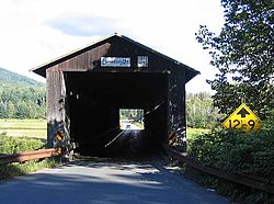
Crosses Connecticut River Locale Lancaster, New Hampshire to Lunenburg, Vermont Maintained by Towns of Lancaster and Lunenburg ID number 29-04-08 (NH #30) Design Howe truss bridge [1] Total length 266.25 ft (81.153 m) Width 20.5 ft (6.25 m) (maximum), 14.42 ft (4.395 m) (roadway) Longest span 127.33 ft (38.810 m) Load limit 6 tons Vertical clearance 12.75 ft (3.886 m) Opened 1911
November 23, 1983Closed July 5, 1983
Mount Orne Covered Bridge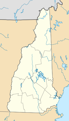

Nearest city: Lancaster, New Hampshire Coordinates: 44°27′36″N 71°39′10″W / 44.46°N 71.65278°WCoordinates: 44°27′36″N 71°39′10″W / 44.46°N 71.65278°W Architect: Berlin Iron Bridge Co. Architectural style: Howe truss covered bridge Governing body: Lancaster, New Hampshire NRHP Reference#: 76000124 Added to NRHP: December 12, 1976[2] The Mount Orne Bridge is a wooden Howe truss bridge over the Connecticut River located between Lancaster, New Hampshire and Lunenburg, Vermont.
Contents
History
The most recent rededication of the bridge took place on November 23, 1983. The Mount Orne Bridge is listed on the National Register of Historic Places.
See also
External links
References
Crossings of the Connecticut River Upstream
US Route 2 bridge

Mount Orne Covered Bridge Downstream
Twin State Railroad bridgeU.S. National Register of Historic Places Topics Lists by states Alabama • Alaska • Arizona • Arkansas • California • Colorado • Connecticut • Delaware • Florida • Georgia • Hawaii • Idaho • Illinois • Indiana • Iowa • Kansas • Kentucky • Louisiana • Maine • Maryland • Massachusetts • Michigan • Minnesota • Mississippi • Missouri • Montana • Nebraska • Nevada • New Hampshire • New Jersey • New Mexico • New York • North Carolina • North Dakota • Ohio • Oklahoma • Oregon • Pennsylvania • Rhode Island • South Carolina • South Dakota • Tennessee • Texas • Utah • Vermont • Virginia • Washington • West Virginia • Wisconsin • WyomingLists by territories Lists by associated states Other  Category:National Register of Historic Places •
  Portal:National Register of Historic PlacesCategories:
- Lancaster, New Hampshire
- Lunenburg, Vermont
- Covered bridges in New Hampshire
- Covered bridges in Vermont
- Bridges over the Connecticut River
- Bridges on the National Register of Historic Places in New Hampshire
- Bridges on the National Register of Historic Places in Vermont
- Bridges completed in 1911
- Wooden bridges in the United States
- Visitor attractions in Coos County, New Hampshire
- Bridges in Coos County, New Hampshire
- Buildings and structures in Essex County, Vermont
- Transportation in Essex County, Vermont
- Visitor attractions in Essex County, Vermont
- Road bridges in New Hampshire
- Road bridges in Vermont
- United States bridge (structure) stubs
- Northeastern United States building and structure stubs
- New Hampshire stubs
- Vermont stubs


Wikimedia Foundation. 2010.