- Near West Side, Chicago
-
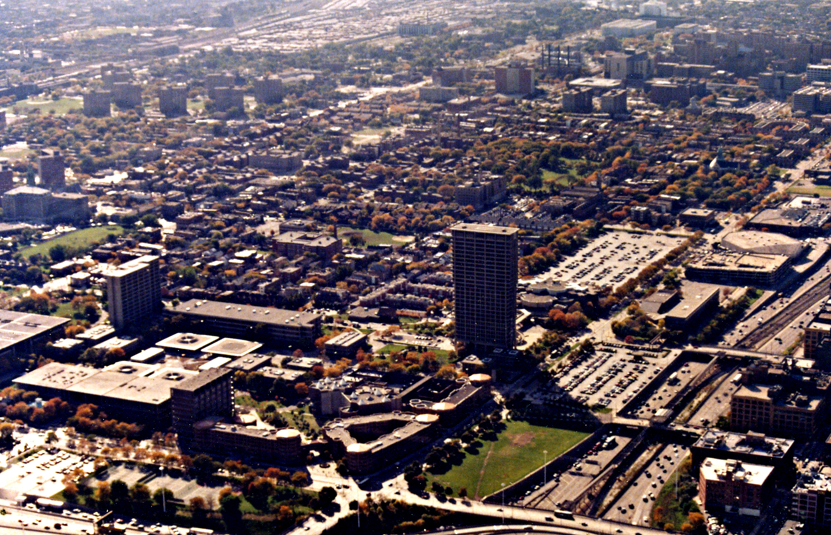
Near West Side — Community area — Community Area 28 - Near West Side University of Illinois at Chicago, 1994 Streetmap
 Location within the city of Chicago
Coordinates: 41°52.2′N 87°40.2′W / 41.87°N 87.67°WCoordinates: 41°52.2′N 87°40.2′W / 41.87°N 87.67°W Country United States State Illinois County Cook City Chicago Neighborhoods Area – Total 5.7 sq mi (14.89 km2) Population (2000) – Total 46,419 – Density 8,074.2/sq mi (3,117.5/km2) population up 0.48% from 1990 Demographics – White 25.3% – Black 52.9% – Hispanic 9.51% – Asian 10.5% – Other 1.87% Time zone CST (UTC-6) – Summer (DST) CDT (UTC-5) ZIP Codes parts of 60606, 60607, 60608, 60610, 60612 and 60661 Median income $29,588 Source: U.S. Census, Record Information Services The Near West Side, one of the 77 defined community areas of Chicago, is located (west of the Chicago River), adjacent to the downtown central business district (the Loop). The rich history of the Near West Side of Chicago has its genesis in the Hull House phenomenon.[1] It was at the turn of the nineteenth century that Jane Addams and Ellen Starr chose the Near West Side slums to found America's first settlement house. The world renowned Nobel Peace Prize winner labeled that immigrant community, "The Hull House Neighborhood."[1][2] Once a bubbling cauldron of European immigrants, its business districts:--(Greek Town, Maxwell Street and Little Italy)--remain as vestiges of the mass migration from southern Europe during the nineteenth and early part of the twentieth century. Only the Italian enclave continues to endure as a vibrant on-going community. Taylor Street Archives
Contents
Neighborhoods
United Center
In the center of the neighborhood is the United Center. The arena opened its doors in 1994, replacing Chicago Stadium. The United Center is the home arena for the Chicago Bulls and the Blackhawks, and also occasionally hosts concerts and other special events. The arena cost $175 million dollars to construct and is 960,000 square feet (89,000 m2) in size. The venue can seat between 20,000 and 25,000 people, depending on the event. Outside the Center is the Michael Jordan Statue.
Little Italy
Main article: Little Italy, ChicagoThe eastern end of Little Italy encompasses about 12 blocks on Taylor Street and the nearby area. The neighborhood lies between the Illinois Medical District and the UIC campus. Many suburban Italians, whose roots trace back to Taylor Street—the port-of-call for the majority of Italians who immigrated to Chicago from the shores of southern Italy—maintain a regular pilgrimage to "the old neighborhood." For many, the lure is attending mass at the Shrine of Our Lady of Pompeii and/or the annual celebrations of Italian food and culture. The memberships of the surviving Social Athletic Clubs (The Old Neighborhood Clubs) are swelled on the week-ends by the men who once resided in the neighborhood.[1] Taylor Street's Little Italy is home to the landmark restaurants Rosebud, Pompei and Francesca's. Those coming for the full Italian-American experience should enjoy a visit to the National Italian American Sports Hall of Fame (and nearby Joe DiMaggio plaza), a frozen lemonade from Mario's Italian Lemonade, a beef at Al's No. 1 Italian Beef, a visit to Conte di Savoia Italian grocer and deli, buy some pasta and cannoli at Scafuri's bakery, and stroll in Arrigo (Peanut) Park to see the statue of Columbus.
University Village
Main article: University Village, ChicagoUniversity Village is a renamed near west Chicago community consisting of newly constructed residential and retail properties. The University Village/Little Italy community cherishes its rich past as one of the first neighborhoods of Chicago. The community is home to mixed-income residents from ethnically diverse socio-economic backgrounds as a result of immigration, urban renewal, gentrification and the growth of the resident student and faculty population of the University of Illinois at Chicago.
University Village, Chicago, consists of major new residential developments over old known Chicago neighborhoods. One such development is the Ivy Hall development, over the area once known as the Maxwell Street neighborhood. This development took one of the poorest neighborhoods in Chicago and made it into a middle- to upper-class income area.
The University Commons development and University Station were created from the defunct South Water Market, historically known as the distribution point for Chicago's produce and agriculture market. The Roosevelt Square development was created over the remains of the now demolished public housing area that was under the auspices of the Chicago Housing Authority called the ABLA homes.
University Village, Chicago also includes the established neighborhood of Little Italy, with a rich history of its own.
University Village surrounds the University of Illinois at Chicago campus to the south and west. The Illinois Medical District borders the area on the west. The BNSF viaduct is the southern border, the Dan Ryan expressway I-94 borders the area on the east.
Tri-Taylor
Tri-Taylor, the western end of Taylor Street's Little Italy consists of the area bordered by Congress Parkway to the North, the diagonal Ogden Avenue to the East, Roosevelt Road on the south and railroad tracks on the west. It is shaped vaguely like a triangle and hence "Tri-Taylor." The neighborhood is traditionally an extension of the Little Italy neighborhood to its east, although it has consistently been one of the most diverse neighborhoods in Chicago as it was situated on the borders of African American, Irish, Hispanic, and Italian areas. Recently it has been composed mostly of students from nearby the University of Illinois at Chicago (UIC). The neighborhood is also home to the Chicago Technology Park research center as well as the West Side Center for Disease Control, the office for the Medical Examiner of Cook County, and the Chicago Hope Academy (a private high school which opened in 2005). This area has a great residential location not far from places like the Illinois Medical District, Downtown Chicago, the Interstate 290, Rush University, and the University of Illinois at Chicago.
Greektown
The Greektown section of Chicago is located roughly between Van Buren and Madison Streets, along Halsted Street, within the Near West Side community area of Chicago. It was popularized in the movie "My Big Fat Greek Wedding," which was actually filmed mostly in Toronto. The neighborhood is known for its plethora of excellent Greek restaurants, including the famous Parthenon, and its 24 hour foodspots.
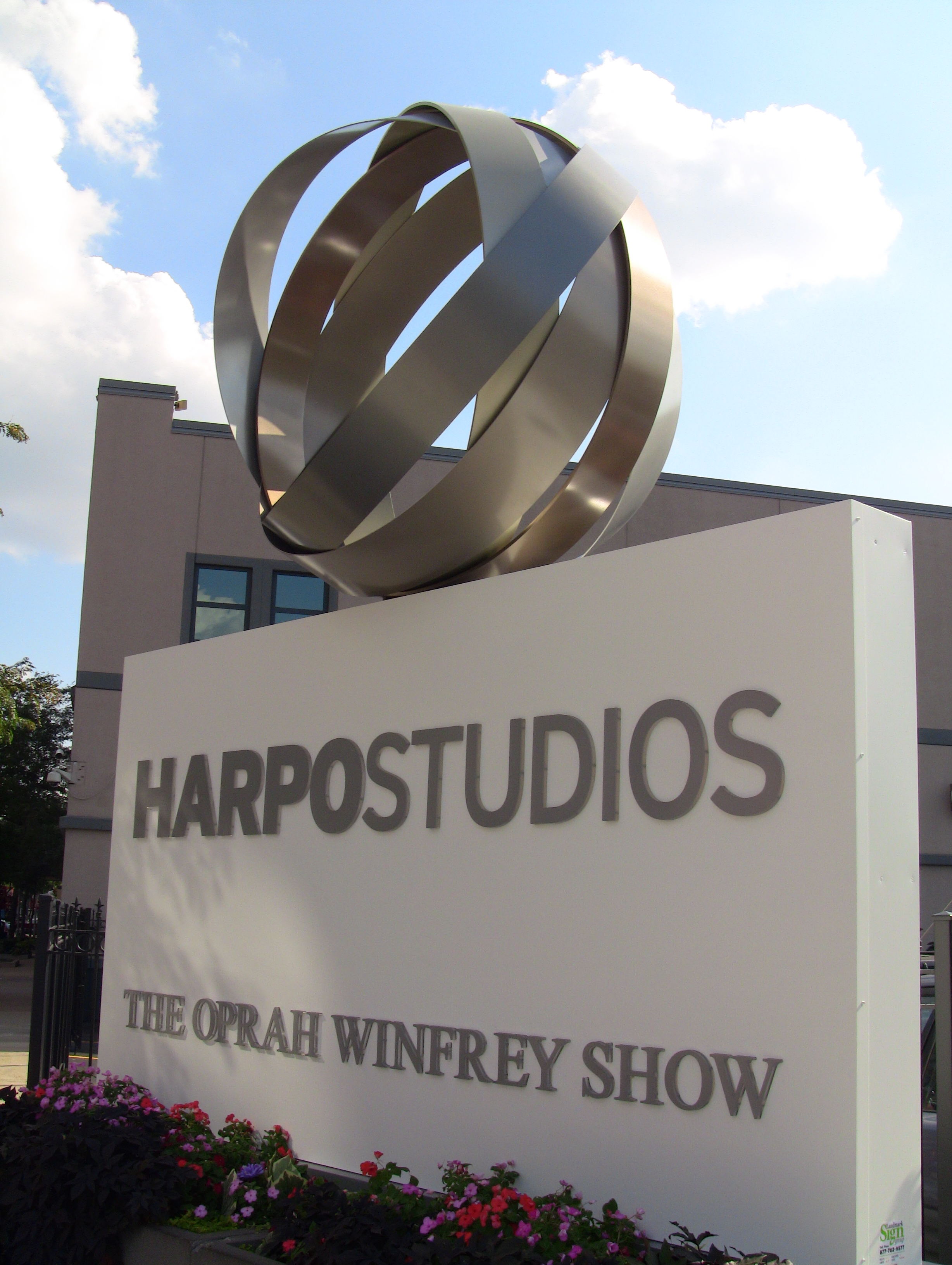
 Oprah Winfrey's Chicago based Harpo Studios
Maxwell Street
Main article: Maxwell StreetThis served as a huge outdoor market frequented by many Chicago residents. In the 1990s it was redeveloped.
West Loop
The West Loop is in the Near West Side community area along the western bank of the Chicago River. It is bounded by Grand Avenue on the north, the Ashland Avenue on the west, the Eisenhower Expressway on the south and the Chicago River on the east.
A former manufacturing corridor turned art-edgy neighborhood, the area consists primarily of warehouses that are still in use or have been converted to loft condominiums (loftominiums), restaurants, night clubs, art galleries, and some retail. It is also the home of Harpo Studios, owned by well known talk show host Oprah Winfrey, and the production site of her syndicated television show.Fulton River District
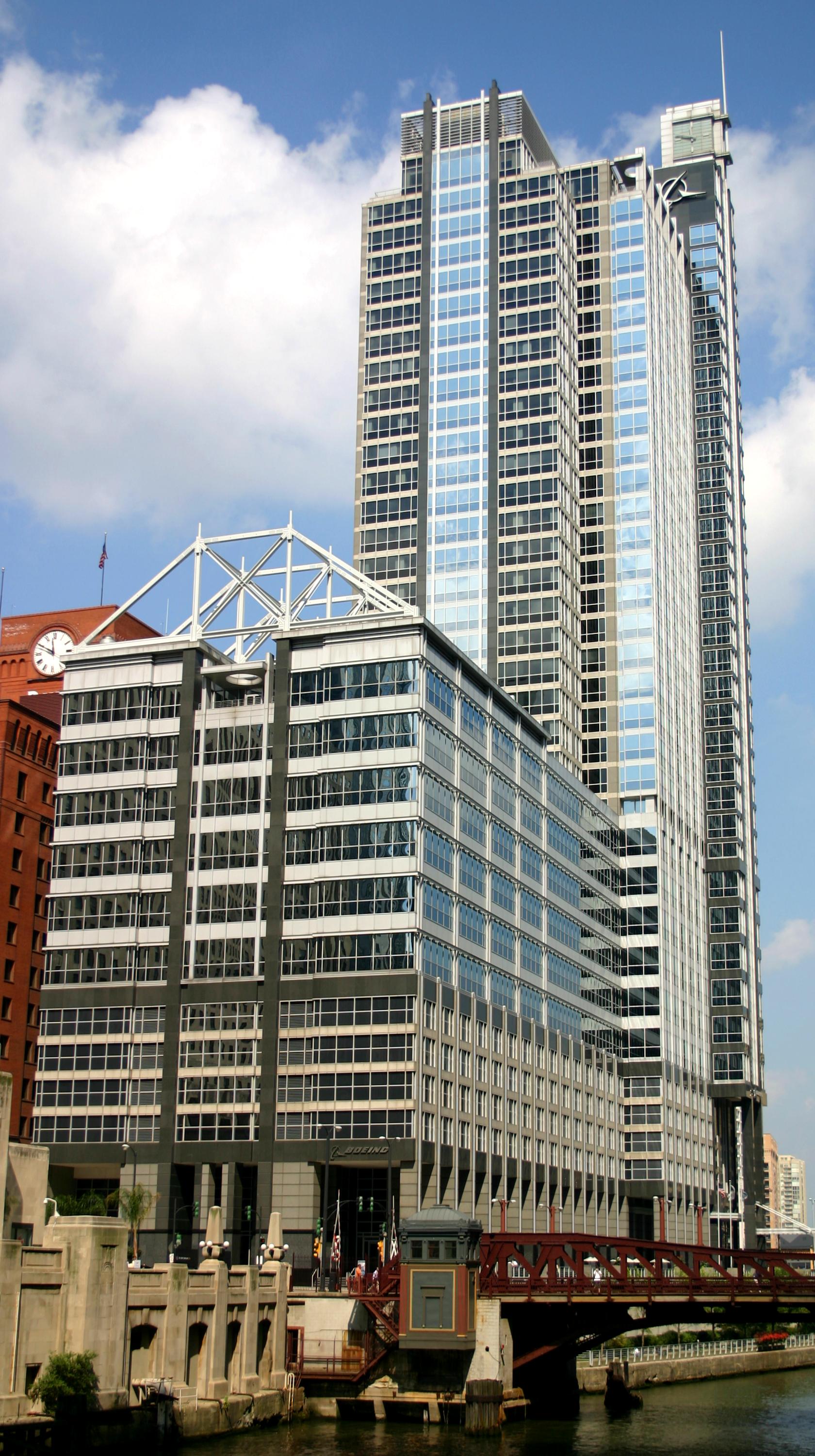
Main article: Fulton River District, ChicagoThe Fulton River District makes up the north east area of the Near West Side, just west of the Loop. It is bordered by the Chicago River to the east, Ohio Street on the north, Madison Street to the south, and the Kennedy Expressway to the west. The Fulton River District is a former manufacturing and current transportation corridor turned residential neighborhood. The neighborhood is made up of warehouses that have been converted to loft condominiums, new construction high rise condominiums and apartments, high rise and mid rise business offices, retail and restaurants. The Fulton River District is also the home of The Boeing Company, and the Ogilvie Transportation Center (formerly Chicago & North Western Station), a major commuter rail terminal. The neighborhood is known for the scent of chocolate emanating from the Blommer Chocolate Company.
Illinois Medical District
Main article: Illinois Medical DistrictThe Illinois Medical District is one of the largest medical district in the United States, formerly the largest. John H. Stroger Jr. Hospital of Cook County (formerly known as Cook County Hospital), one of the largest county-run hospitals in the U.S. and inspiration for the TV shows ER and The Fugitive, is located here. The District had its start in the 1870s when Cook County Hospital, Rush Medical College, and the College of Physicians and Surgeons were established on the Near West Side following the great Chicago fire of 1871. The cornerstone for the Medical Center was the building of Cook County Hospital in 1876. In 1877, Rush Medical College erected a building next to County at Harrison and Wood. Presbyterian Hospital (affiliated with Rush) was built in 1883. The University of Illinois at Chicago's origins in the District can be traced to the College of Physicians and Surgeons, founded in 1881. In 1917, the State acquired the vacated West Side Park located at Polk and Wolcott for the University.
The district is also home to: University of Illinois Medical Center, Rush University Medical Center, Rush University, University of Illinois College of Medicine, UIC Eye & Ear Infirmary, UIC College of Dentistry, UIC College of Pharmacy, Jesse Brown VA, The Neuropsychiatric Institute, Rothstein CORE Center, Chicago Lighthouse for the Blind & Visually Impaired, Illinois Forensic Science Center, West Side CDC, the Chicago Children's Advocacy Center, Chicago Dept. of Public Health and the Cook County Coroner's Office. Recently, the FBI Division Headquarters for Chicago was erected on Roosevelt Road.
Landmarks
Designated Chicago Landmarks in the Near West Side include:
- First Baptist Congregational Church
- Groesbeck House
- Hull House
- Jackson Boulevard District and Extension
- Metropolitan Missionary Baptist Church
- St. Ignatius College Prep Building
- Union Station
- United Center
Government and infrastructure
The United States Postal Service (USPS) operates the main Chicago Post Office at 433 West Harrison Street in the Near West Side.[3][4] The post office is the only 24 hour post office in the United States.[5] USPS also operates the Nancy B. Jefferson Post Office at 116 South Western Avenue.[6] I-290 and I-90 both run through the Near West Side, and their interchange, dubbed Circle Interchange, is too. Also, BNSF owns track in the area, and Metra runs its BNSF service on this track.
Economy
Boeing operates its headquarters at 100 North Riverside.[7] Boeing moved into the facility, formerly the headquarters of Morton Salt, in 2001.[8] Orbitz has its headquarters in the Citigroup Center in the Near West Side.[9]
PepsiCo's Chicago offices are in the Near West Side.[10] Aeroméxico operates the Chicago Downtown Location on the first floor at 954 West Washington Boulevard.[11]
Diplomatic missions
The Consulate-General of Mexico in Chicago is located at 204 South Ashland Avenue.[12]
References
- ^ a b c Taylor Street Archives
- ^ Hull House Museum
- ^ "Major Office Buildings". Chicago City and Neighborhood Guide. http://www.chicagoneighborhoods.cc/chicago-offices.html. Retrieved April 17, 2009.
- ^ "Richard Wright Immortalized on Postage". United States Postal Service. April 8, 2009. http://www.usps.com/communications/newsroom/2009/pr09_037.htm. Retrieved April 17, 2009.
- ^ "New York City's main post office stops 24-hour service". Associated Press. Friday. April 17, 2009. http://www.silive.com/news/index.ssf/2009/04/new_york_citys_main_post_offic.html. Retrieved May 5, 2009.
- ^ "Post Office Location - NANCY B JEFFERSON". United States Postal Service. http://usps.whitepages.com/service/post_office/70350?p=3&s=IL&service_name=post_office&z=Cicero. Retrieved April 17, 2009.
- ^ "Contact Us". Boeing. http://www.boeing.com/contactus.html. Retrieved May 12, 2009.
- ^ "Boeing's First Day in New Era Goes Largely Unnoticed in Seattle, Chicago." The Seattle Times. September 5, 2001. Retrieved on December 23, 2009.
- ^ "Orbitz Worldwide, Inc. (NYSE: OWW)." Forbes. Retrieved on September 27, 2011. "Orbitz Worldwide 500 West Madison Avenue Suite 1000 Chicago, IL 60661 "
- ^ "PepsiCo Contacts." PepsiCo. Retrieved on December 23, 2009.
- ^ "Illinois - Ticket Offices". Aeroméxico. http://www.aeromexico.com/usa/english/pages/contactUs/us/ticketOffices/illinois.html. Retrieved January 28, 2009.[dead link]
- ^ "Home Page". Consulate-General of Mexico in Chicago. http://www.consulmexchicago.com/. Retrieved January 31, 2009.
External links
- Official City of Chicago Near West Side Community Map
- Chicago Arts District
- Chicago Greek Town
- West Loop Neighborhood Social Network
- West Loop
- Fulton River District
- Illinois Medical District
- Rush Medical Center
- University Village
- UIC Eye Center
- Taylor Street Archives; UIC:...Flawed History
City of Chicago Architecture · Beaches · Climate · Colleges and Universities · Community areas · Culture · Demographics · Economy · Flag · Freeways · Geography · Government · History · Landmarks · Literature · Media · Music · Neighborhoods · Parks · Public schools · Skyscrapers · Sports · Theatre · Transportation
 Category ·
  Portal
Community areas in Chicago Far North side Rogers Park · West Ridge · Uptown · Lincoln Square · Edison Park · Norwood Park · Jefferson Park · Forest Glen · North Park · Albany Park · O'Hare · EdgewaterNorth side Northwest side Central, Near North, and Near South side West and Near West side Humboldt Park · West Town · Austin · West Garfield Park · East Garfield Park · Near West Side · North Lawndale · South Lawndale · Lower West SideSouthwest side South side Armour Square · Douglas · Oakland · Fuller Park · Grand Boulevard · Kenwood · Washington Park · Hyde Park · Woodlawn · South Shore · Bridgeport · Greater Grand CrossingFar Southwest side Far Southeast side Chatham · Avalon Park · South Chicago · Burnside · Calumet Heights · Roseland · Pullman · South Deering · East Side · West Pullman · Riverdale · HegewischChicago Blackhawks Franchise Franchise • Original Six • Players • Coaches • GMs • Seasons • Records • Draft picks • Award winnersCulture/Lore Curse of Muldoon • "The Madhouse on Madison" • Here Come the Hawks • Chelsea Dagger • 2009 NHL Winter Classic • Ashland Green Line Station • Wayne Messmer • Jim Cornelison • Harvey Wittenberg • Gene Honda • Pat Foley • Ed Olczyk • HawkvisionArenas Rivalries Detroit Red Wings • St. Louis BluesAffiliates Media Chicago Bulls Founded in 1966 • Based in Chicago, IllinoisThe Franchise Arenas Head Coaches D-League Affiliate NBA Finals Appearances (6) NBA Championships (6) Retired Jerseys Hall of Famers Key Personnel Owner: Jerry Reinsdorf • Vice President of Basketball Operations: John Paxson • General Manager: Gar Forman • Coach: Tom ThibodeauRivals Culture & Lore Hare Jordan and Air Jordan • Disputed Foul Against Scottie Pippen • The Shot • Tommy Edwards • Benny the Bull • "Sirius" • Ray Clay • 72-10 • The Flu Game • Game 6 of the 1998 NBA Finals • The Last Shot • Jerry Krause • The Zen Master • "The Madhouse on Madison" • "The Madhouse on Madison II"/"The House That Jordan Built" • Ashland Green Line Station • Game 6 of the 2009 NBA Playoffs First RoundMedia TVRadioCategories:- Neighborhoods in Chicago, Illinois
- Community areas of Chicago, Illinois


Wikimedia Foundation. 2010.