- Dana Adobe
-
Dana Adobe
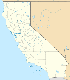

Location: S end of Oak Glen Ave., Nipomo, California Coordinates: 35°1′40″N 120°31′40″W / 35.02778°N 120.52778°WCoordinates: 35°1′40″N 120°31′40″W / 35.02778°N 120.52778°W Built: 1839 Architect: Dana, William G. Architectural style: Adobe Governing body: Private NRHP Reference#: 71000189
[1]Added to NRHP: May 6, 1971 The Dana Adobe or "Casa de Dana" is a historic building in Nipomo, California. It was the home of Boston sea captain William Dana, who in 1837 was granted the 37,888-acre (153.33 km2) Rancho Nipomo on the central coast of California. Captain Dana hosted figures such as Henry Tefft and John C. Fremont in his Nipomo home, which also served as an important exchange point on California's first official mail route between Monterey and Los Angeles.
References
- ^ "National Register Information System". National Register of Historic Places. National Park Service. 2008-04-15. http://nrhp.focus.nps.gov/natreg/docs/All_Data.html.
- Angel, Myron (1983). History of San Luis Obispo County, California, with Illustrations and Biographical Sketches of Its Prominent Men and Pioneers. Friends of the Adobes, San Miguel, CA. ISBN 0-91354-866-9.
External links
U.S. National Register of Historic Places Topics Lists by states Alabama • Alaska • Arizona • Arkansas • California • Colorado • Connecticut • Delaware • Florida • Georgia • Hawaii • Idaho • Illinois • Indiana • Iowa • Kansas • Kentucky • Louisiana • Maine • Maryland • Massachusetts • Michigan • Minnesota • Mississippi • Missouri • Montana • Nebraska • Nevada • New Hampshire • New Jersey • New Mexico • New York • North Carolina • North Dakota • Ohio • Oklahoma • Oregon • Pennsylvania • Rhode Island • South Carolina • South Dakota • Tennessee • Texas • Utah • Vermont • Virginia • Washington • West Virginia • Wisconsin • WyomingLists by territories Lists by associated states Other  Category:National Register of Historic Places •
  Portal:National Register of Historic PlacesCategories:
- History of San Luis Obispo County, California
- Houses on the National Register of Historic Places in California
- California adobes
- Mexican California
- Historic house museums in California
- Museums in San Luis Obispo County, California
- Houses in San Luis Obispo County, California
- California Registered Historic Place stubs

Wikimedia Foundation. 2010.