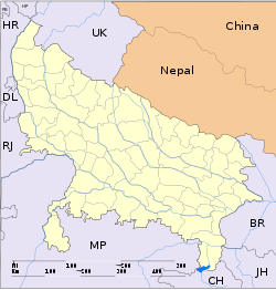
- Nandgaon, Uttar Pradesh
-
For other places with the same name, see Nandgaon (disambiguation).
Nandgaon — city — Coordinates 27°43′N 77°23′E / 27.72°N 77.38°ECoordinates: 27°43′N 77°23′E / 27.72°N 77.38°E Country India State Uttar Pradesh District(s) Mathura Population 9,956 (2001[update]) Time zone IST (UTC+05:30) Area
• 184 metres (604 ft)
Nandgaon is a town and a nagar panchayat in Mathura district in the Indian state of Uttar Pradesh.
Contents
Geography
Nandgaon is located at 27°43′N 77°23′E / 27.72°N 77.38°E.[1] It has an average elevation of 184 metres (603 feet).
Demographics
As of 2001[update] India census,[2] Nandgaon had a population of 9956. Males constitute 54% of the population and females 46%. Nandgaon has an average literacy rate of 45%, lower than the national average of 59.5%: male literacy is 59%, and female literacy is 29%. In Nandgaon, 19% of the population is under 6 years of age.
Culture
Nandgaon is a religious place due to its association with the lord Krishna. It is believed that Krishna spent his childhood here and a few traces of his childhood which are mentioned in the Granthas are found here.
References
- ^ Falling Rain Genomics, Inc - Nandgaon
- ^ "Census of India 2001: Data from the 2001 Census, including cities, villages and towns (Provisional)". Census Commission of India. Archived from the original on 2004-06-16. http://web.archive.org/web/20040616075334/http://www.censusindia.net/results/town.php?stad=A&state5=999. Retrieved 2008-11-01.
 This article incorporates text from a publication now in the public domain: Chisholm, Hugh, ed (1911). Encyclopædia Britannica (11th ed.). Cambridge University Press.Categories:
- Cities and towns in Mathura district
- Agra division geography stubs
Wikimedia Foundation. 2010.


