- Llantwit Fardre
-
Coordinates: 51°33′28″N 3°20′03″W / 51.5578°N 3.3341°W
Llantwit Fardre Welsh: Llanulltud Faerdref 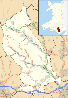
 Llantwit Fardre
Llantwit Fardre shown within Rhondda Cynon TafOS grid reference ST076851 Principal area Rhondda Cynon Taf Ceremonial county Mid Glamorgan Country Wales Sovereign state United Kingdom Post town Church Village, PONTYPRIDD Postcode district CF38 Dialling code 01443 Police South Wales Fire South Wales Ambulance Welsh EU Parliament Wales UK Parliament Pontypridd Welsh Assembly Pontypridd List of places: UK • Wales • Rhondda Cynon Taf Llantwit Fardre (Welsh: Llanilltud Faerdref) is a large village situated on the A473, Pontypridd to Bridgend (Welsh: Penybont ar Ogwr), road near the Welsh towns of Pontypridd and Llantrisant. Confusingly, Llantwit Fardre is also the name of the old parish and the community area that takes in the villages of Llantwit Fardre, Tonteg and Church Village.
The Welsh Assembly Government has constructed a bypass to reduce traffic congestion on the A473 road at Tonteg, Church Village (Welsh: Pentre'r Eglwys) and Llantwit Fardre. The Church Village bypass, as it is known, has been built as a single carriageway, with crawler and overtaking lanes around roundabouts, and was opened for traffic in September 2010.[1][2]
Contents
Etymology
It is believed the name Llantwit Fardre is derived from an old Welsh Language name meaning The Church of St Illtud on the Home Farm of the Prince and relates to the land surrendered to the prince of the District by his subject to provide him with an income. Saint Illtud was a 5th century Celtic priest who built his second church roughly in the area where the present church stands. He was late famed as the Saint of the Five Keys of youth, learning, chivalry, priesthood and knighthood.
History & Amenities
The parish has a fairly well preserved 12th century motte castle with an intact moat[3] called Tomen-Y-Clawdd. Which is located in the parish village of Tonteg. Coach company Edwards Coaches is based in the town, and was established in 1925.
A station called Llantwit Fardre (and formerly Llantwit Dyffryn Red Ash Colliery) served the village on the Llantrisant and Taff Vale Junction Railway.
Employment
Industrialisation began in Llantwit Fardre in the late 17th century with the introduction of stone quarrying and coal mining. With the decline of coal mining the local populace tend to commute to work.
Between 1959 and 1973 Gilbern cars were manufactured in the village.[4]
Sport
Llantwit Fardre has both a rugby union and football (soccer) team. Llantwit Fardre RFC are a rugby union team who play in the WRU Division Three South East league; Llantwit Fardre AFC are a local football club that have a team playing in the South Wales Amateur Football League.
Local government
Llantwit Fardre Parish Council was formed under the 1894 Local Government Act and the first meeting was held on 1 January 1895. It continued in this form until 1974 when, on local government re-organisation, Welsh parish councils were re-titled community councils in deference to the disestablishment of the Church in Wales some 60 years earlier. The council have adopted the motto, carved over the entrance to the Carnegie Hall, “Goreu arf arf ddysg” being translated from the old Welsh to mean “The best tools are the tools for learning”.
On May 2, 2008, Joel James, a British Conservative Party politician became the first Tory councillor to be elected to Rhondda Cynon Taf County Borough Council for the Llantwit Fardre seat.[5]
External links
References
- ^ "'Church Village Bypass - Web Online'". Church Village Bypass website. Rhondda Cynon Taf CBC, Costain and the Welsh Assembly Government. 2009. http://www.churchvillagebypass.com/. Retrieved 2009-04-175.
- ^ "WalesOnline - News - South Wales Valleys - Pontypridd & Llantrisant - Safety worries discounted as bypass work begins". Wayne Nowaczyk, Pontypridd Observer. Media Wales Ltd.. 2008-12-11. http://www.walesonline.co.uk/news/south-wales-news/pontypridd-llantrisant/2008/12/11/safety-worries-discounted-as-bypass-work-begins-91466-22442125/. Retrieved 2009-04-17.
- ^ The Welsh Academy Encyclopaedia of Wales. John Davies, Nigel Jenkins, Menna Baines and Peredur Lynch (2008) pg507 ISBN 978-0-7083-1953-6
- ^ Gilbern owners club
- ^ Ropstad, Mari (May 8, 2008). "Labour hang on to Valleys council". WalesOnline. http://www.walesonline.co.uk/news/politics-news/2008/05/08/labour-hang-on-to-valleys-council-91466-20869794/. Retrieved 2008-07-28.
Categories:- Towns in Rhondda Cynon Taf


Wikimedia Foundation. 2010.