- Cwmparc
-
Coordinates: 51°39′12″N 3°31′09″W / 51.6532°N 3.5193°W
Cwmparc 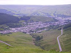
Cwmparc taken from the Bwlch Mountain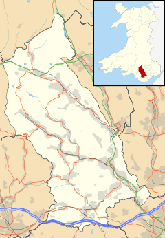
 Cwmparc
Cwmparc shown within Rhondda Cynon TafOS grid reference SS956967 Community Treorchy Principal area Rhondda Cynon Taf Ceremonial county Mid Glamorgan Country Wales Sovereign state United Kingdom Post town Treorchy Postcode district CF42 Dialling code 01443 77 Police South Wales Fire South Wales Ambulance Welsh EU Parliament Wales UK Parliament Rhondda Welsh Assembly Rhondda List of places: UK • Wales • Rhondda Cynon Taf Cwmparc is a village and a district of the community of Treorchy, in the Rhondda Valley, Wales.
Contents
History
Early legends tell of a medieval park, or hunting preserve, in the area called Parc Cwm Brychiniog, which was subsequently made into four farms in Tudor times, one of which was called Parc Uchaf and another Parc Isaf. Thus the area became known as Cwmparc and its stream Nant Cwmparc (Cwm being the Welsh for valley). With the development of the coal mining village in this part of the South Wales Valleys in the 19th century, the village also became known as Cwmparc.
Details of the early history and development of Cwmparc are contained within the booklet, ‘History of Cwmparc. King Coal Invades a Sylvan Valley’ by Mr Gwyn Prosser which was awarded the prize at Treorchy Semi-National Eisteddfod in 1923. The author describes Cwmparc in 1923 as ‘a mining village of considerable pretensions, aspiring almost to the more dignified name of township’ with a population of about five thousand. He describes the Parc [colliery] and, further down the valley, the Dare colliery, and the constant processions of [coal]-laden trucks running down the railway that flanked the Parc River.
Early Cwmparc
The pioneer of Cwmparc’s development was David Davies of Llandinam described as, ‘foremost of Welsh industrial kings and founder of the renowned Ocean Coal Company’, who had in 1862 negotiated with Crawshay Bailey to commence coal mining on the Tremains Estate. Sinking operations were begun in August 1866 and by the end of that year Parc Pit had produced its first output of coal.
The Building of Tallis Street around 1890
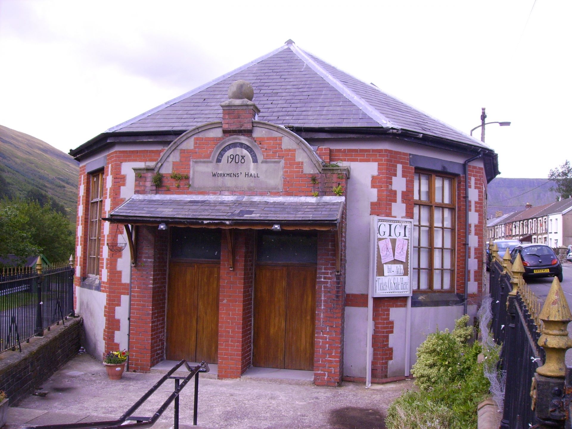
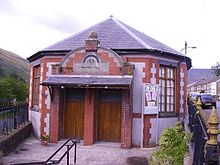 Parc and Dare Workmen's Hall
Gwyn Prosser describes[1] how Railway Terrace was the first of the new streets in Cwmparc to be built near to the railway leading from the pithead. The street was known euphemistically as ‘Tub Row’ because of the habit of the occupants for leaving their tin bath tubs out on the pavements in the evening, ‘thus setting a trap for, and imperilling the life and limbs of unwary strangers on a dark night’. As for the rest of the village he describes how Parc Road, the main street, ‘now more than half a mile long’, contained the more ‘reputable’ buildings, such as the miners' institute, two hotels and three chapels. Mr Prosser details how, with the influx of population, housing in the early days of Cwmparc was a major problem.
In particular he recalls one elderly resident’s recollection of how when she came to Cwmparc her family consisting of a mother, father and four children managed to secure accommodation in a shepherd’s cottage, Parc Bach. The extent of the overcrowding can be seen when you realise that the cottage already accommodated the shepherd, his family and three other lodgers. With such a demand it was not long before builders and property speculators moved into the area, thus in 1867 Cwmdare Street was completed and most of Parc Street the following year. Tallis Street, Barrett Street and Vicarage Terrace were soon to follow erected by a local building club enterprise. Tallis Street was named in honour of Mr A.S. Tallis, manager of Dare Colliery and Barrett Street in honour of a well-respected Scottish doctor in the neighbourhood.
Thirteen years later in 1936 the author provided an additional chapter to update his work. When looking at the then current state of the village there is quite a different tone from that taken thirteen years previously. He describes the industrial history of the village as being ‘overhung with gloom’ and the district as being ‘haunted by the spectre of unemployment’. The village’s main employer, and indeed reason for being, The Parc and The Dare pits had always worked intermittently and had been ‘unable to absorb all the eager claimants for work’. There had been moments of industrial strife, notably the 1926 general strike and the ‘stay in’ strikes of 1935.
In 1954 the National Coal Board merged the two pits, and finally in 1966 after a hundred years of production the Parc and Dare pit closed for the last time, leaving Cwmparc’s ‘sylvan’ valley to revert in some measure back to its original beauty.
WWII Bombing
On the night of April 29th 1941, during the Second World War, Cwmparc was bombed by the German Air Force (Luftwaffe). There were many casualties with some 27 dead, three of whom were evacuees; all members of the same family. The evacuees were all buried in the same grave in Treorchy Cemetery. This event was the biggest loss of life that the Rhondda suffered in a single night of WWII bombing.
Notable people from Cwmparc
- Richie Burnett - former darts world champion
- Robert Thomas - Sculptor
- Rachel Tresize - writer
- Ian Watkins - Pop Singer
- Geraint Williams - Leyton Orient football manager
External links
- Heritage Trail:Cwmparc
- Welsh Coal Mines - research the local pit histories
- www.geograph.co.uk : photos of Cwmparc and surrounding area
Notes
- ^ History of Cwmparc. King Coal Invades a Sylvan Valley, written by Gwyn Prosser, Republished: Free press - Rhondda Leader 1936
Rhondda Fawr Blaencwm • Blaenrhondda • Cwm Clydach • Cwmparc • Cymmer • Dinas Rhondda • Gelli • Glynfach • Llwyncelyn • Llwynypia • Pentre • Penygraig • Pen-yr-englyn • Porth • Ton Pentre • Tonypandy • Trealaw • Trebanog • Trehafod • Treherbert • Treorchy • Tynewydd • Williamstown • Ynyswen • Ystrad Rhondda
Rhondda Fach Blaenllechau • Ferndale • Maerdy • Penrhys • Pontygwaith • Tylorstown • Stanleytown • Wattstown • YnyshirCategories:- Villages in Rhondda Cynon Taf


Wikimedia Foundation. 2010.