- Cymmer, Rhondda Cynon Taf
-
Coordinates: 51°36′54″N 3°23′49″W / 51.61492°N 3.39692°W
Cymmer 
 Cymmer
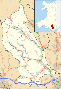
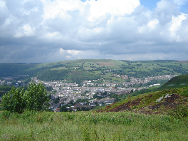
Cymmer shown within Rhondda Cynon TafOS grid reference ST0290 Principal area Rhondda Cynon Taf Ceremonial county Mid Glamorgan Country Wales Sovereign state United Kingdom Post town PORTH Postcode district CF39 Dialling code 01443 Police South Wales Fire South Wales Ambulance Welsh EU Parliament Wales UK Parliament Rhondda Welsh Assembly Rhondda List of places: UK • Wales • Rhondda Cynon Taf Cymmer while today is considered to be a district of the town of Porth, Rhondda Cynon Taf, Wales, prior to the establishment of Porth as the main urban settlement in the area, the position of both communities were largely reversed, Cymmer being so named because of being located at the 'confluence' of the Rhondda Fawr and Rhondda Fach river valleys. Cymmer comprises the sub districts of Glynfach and Britannia. Neighbouring settlements are Trebanog and Llwyncelyn. Cymmer is also the name given for the electoral ward comprising the villages of Cymmer, Trehafod(W), Trebanog, Britannia and Glynfach.
Several collieries were sunk in the vicinity of Cymmer, namely - Cymmer Colliery (Old No. 1 Pit) (1847), Glynfach Colliery (1851), New Cymmer Colliery (1855), Upper Cymmer Colliery (1851) and Ty-Newydd Colliery (1852), not to mention the several other collieries of Porth and Trehafod. It was the site of an 1856 mining accident in which 114 were killed.
Amenities
There are three different schools in Cymmer: Cymmer Infant School, Cymmer Junior School and Ysgol Gyfun Y Cymer. Cymmer offers facilities for young people; there are youth clubs for both Welsh-speaking and English-speaking teenagers. There are 4 pubs: The Colliers, The Rhondda Hotel, the Cymmer Club and the Pioneer Club.
External links
Rhondda Fawr Blaencwm • Blaenrhondda • Cwm Clydach • Cwmparc • Cymmer • Dinas Rhondda • Gelli • Glynfach • Llwyncelyn • Llwynypia • Pentre • Penygraig • Pen-yr-englyn • Porth • Ton Pentre • Tonypandy • Trealaw • Trebanog • Trehafod • Treherbert • Treorchy • Tynewydd • Williamstown • Ynyswen • Ystrad Rhondda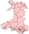
Rhondda Fach Blaenllechau • Ferndale • Maerdy • Penrhys • Pontygwaith • Tylorstown • Stanleytown • Wattstown • YnyshirCategories:- Villages in Rhondda Cynon Taf
- 1856 disasters
- 1856 in Wales
- Coal mining disasters in Wales
- Glamorgan geography stubs


Wikimedia Foundation. 2010.