- Maerdy
-
Coordinates: 51°40′22″N 3°29′00″W / 51.672653°N 3.483313°W
Maerdy Welsh: Maerdy 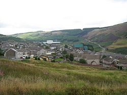
 Maerdy
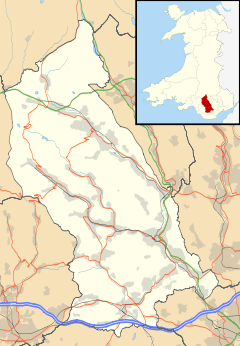
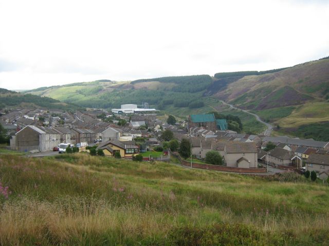
Maerdy shown within Rhondda Cynon TafPopulation 3,441 [1] OS grid reference SS975981 Principal area Rhondda Cynon Taf Ceremonial county Mid Glamorgan Country Wales Sovereign state United Kingdom Post town Ferndale Postcode district CF43 Dialling code 01443 75 Police South Wales Fire South Wales Ambulance Welsh EU Parliament Wales UK Parliament Rhondda Welsh Assembly Rhondda List of places: UK • Wales • Rhondda Cynon Taf Maerdy (Welsh: Y Maerdy) is a village and community in the county borough of Rhondda Cynon Taf, and within the historic county boundaries of Glamorgan, Wales, lying at the head of the Rhondda Fach Valley.
Contents
History
"Maerdy" is a Welsh word meaning "house of the major", and may indicate a medieval origin. The "mayor" was the official also known as the reeve, usually the most affluent farmer in the area.
The area grew from a farming community to town around the coal mining industry and the development of Mardy Colliery in the late 19th century, but its last pit (Mardy Main) shut in 1990. Maerdy was not originally an area of industrial confrontation, with the Cambrian mines of Pentre showing far more socialist ideals. This view would change by the mid to late 20th century when Maerdy became synonymous with working class syndicalism and solidarity. In the mid-twentieth century Maerdy was associated with the Communist Party of Great Britain and radical miners' leaders such as Arthur Horner and was known as Little Moscow. By the time of the Miners' strike in the 1980s, Maerdy was the location of one of the last working mines in the south Wales valleys, and the pictures of the returning miners once the strike was resolved was one of the defining moments of late 20th century Welsh history.
Transport
Between 1849 and 1856, the Taff Vale Railway opened the Maerdy Branch from Porth, including a station at Maerdy. Passenger services were withdrawn in 1964, and the line closed completely and was lifted from June 1986 after coal from Mardy Colliery was raised through Tower Colliery.
In 2005, RCT council constructed the A4223 Porth and Lower Rhondda Fach Relief Road (Porth Bypass) follows the old railway line through Ynyshir, past Wattstown and on to Pontygwaith. The northern section forms a branch to the Taff Trail cycleway.
Community Archives Wales
A group of interested residents takes part in the Maerdy Archive Group which is affiliated with the Community Archives Wales scheme to teach local residents how to upload articles of their community's history. The group has a large collection of photographs and ephemera about the development and expansion of the Maerdy area. In 2002 the village was designated as a Communities First Area and a Partnership formed.
External links
- Welsh Coal Mines - all the pits, all the histories
- www.geograph.co.uk : photos of Maerdy and surrounding area
References
Rhondda Fawr Blaencwm • Blaenrhondda • Cwm Clydach • Cwmparc • Cymmer • Dinas Rhondda • Gelli • Glynfach • Llwyncelyn • Llwynypia • Pentre • Penygraig • Pen-yr-englyn • Porth • Ton Pentre • Tonypandy • Trealaw • Trebanog • Trehafod • Treherbert • Treorchy • Tynewydd • Williamstown • Ynyswen • Ystrad Rhondda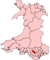
Rhondda Fach Blaenllechau • Ferndale • Maerdy • Penrhys • Pontygwaith • Tylorstown • Stanleytown • Wattstown • YnyshirCategories:- Villages in Rhondda Cynon Taf
- Rhondda Valley


Wikimedia Foundation. 2010.