- Cilfynydd
-
Coordinates: 51°37′30″N 3°19′12″W / 51.625°N 3.32°W
Cilfynydd Welsh: Cilfynydd 

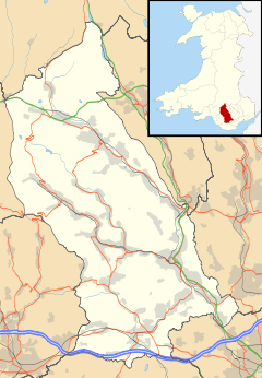
 Cilfynydd shown within Rhondda Cynon Taff
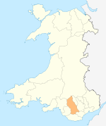
Principal area Rhondda Cynon Taff Ceremonial county Mid Glamorgan Country Wales Sovereign state United Kingdom Police South Wales Fire South Wales Ambulance Welsh EU Parliament Wales UK Parliament Cynon Valley List of places: UK • Wales • Rhondda Cynon Taff Cilfynydd is a village in South Wales a mile from the South Wales Valleys town of Pontypridd, and 13 miles north of the capital city Cardiff.
Contents
History
Siutated on the banks of the River Taff, the village was named after the farm that was situated on the east side of the valley, Cilfynydd Farm farmed by the Lloyd family most recently Gwun and Lewis now both deceased. Cilfynydd was originally a farming hamlet, consisting of some cottages built along the Glamorganshire Canal, surrounded by a few scattered farms. These properties, according to the 1881 census, housed about 100 people, but this all changed over the next two decades.[1]
On 27 October 1913, Cilfynydd was to witness another destructive event. A cyclone swept through the village causing considerable damage and killing one of its inhabitants. In Richard Street, nearly all the shop fronts were blown in and the goods on sale scattered in the street. The corrugated iron roof of the Co-operation Stores was blown clean away and two roofs on houses in Park Place were stripped.
Albion Colliery
Main article: Albion CollieryThe Albion Steam Coal Co. began sinking a coal mine in 1884 at Ynyscaedudwg Farm. The Albion Colliery opened in August 1887, served by the Llancaiach Branch line of the Taff Vale Railway.
Albion was the scene of the second worst disaster in the South Wales Coalfield, after the later disaster at the Universal Colliery at Senghenydd in 1913. At four o'clock on Saturday 23 June 1894, a massive explosion caused by the ignition of coal dust following an explosion of firedamp killed 290 men and boys. Of the 125 horses, only 2 survived. Many of the bodies brought to the surface were so badly mutilated that identification was virtually impossible, and there was several instances of corpses being carried to the wrong houses. Almost everyone in the community lost someone in the disaster, with one family in Howell Street lost 11 members: father, four sons, six lodgers were all killed.[2]
Having been taken over in the 1930s by Powell Duffryn, before being nationalised by National Coal Board in 1947, when at that time there were 991 men employed. The mine closed in 1966,[2] but with the tips threatening a disaster similar to Aberfan, a two-phased scheme to reduce the steep gradient of the spoil began in 1974, completed two years later.[1]
The village
The village was named after the farm that was situated on the east side of the valley, Cilfynydd Farm. The development of the village occurred around and as a result of the development of the Albion Colliery, to provide housing for the workforce.
Typically of the time, the houses were terraced, built along a parallel track to the Cardiff to Merthyr road. It is said that the original terrace streets in Cilfynydd were named after the son's and daughter's of the developer: Howell Street, Ann Street, William Street, Jones Street, Richard Street and Mary Street.
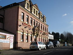
The majority of Cilfynydd's housing and public buildings were built between 1884 and 1910, with this fast development necessary, as by 1891 the population had increased fivefold to over 500. The following decade witnessed an even greater rate of increase, as the 1901 census shows the population totalled 3,500 people.[1] By this point, the village also had: four chapels, three public houses, a school, a church, a post office, and a workman's hall.[1]
Local government
In 2008, Barrie Morgan became the first Labour politician for 9 years to be elected to represent the Cilfynydd ward.[citation needed]
Transport
Originally situated on a drover's trail along the route of the River Taff, it was on the natural route of the Glamorganshire Canal.
Due to the development of the Albion Colliery it became situated on the Llancaiach Branch of the Taff Vale Railway, with through passenger services until 1936 from Pontypridd to Nelson. It continued to receive less regular service until 1953, when the passenger route to Ynysybwl halt ceased.
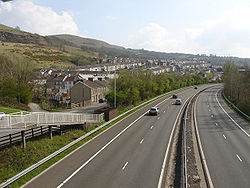
The main road through Cilfynydd was once the main route between Cardiff and Merthyr Tydfil, before the building of the A470 road dual carriageway on the route of the Llancaiach Branch.
A tram service began on 6 March 1905, running from Cilfynydd through Pontypridd to Treforest. It was replaced on 18 September 1930 by trolleybuses, which today are replaced by buses which replicate an almost exact route.[1]
References
- ^ a b c d e "Cilfynydd". rhondda-cynon-taff.gov.uk. http://webapps.rhondda-cynon-taff.gov.uk/heritagetrail/taff/cilfynydd/cilfynydd.htm. Retrieved 2009-03-14.
- ^ a b "Albion Colliery". Welsh Coal Mines. http://www.welshcoalmines.co.uk/GlamEast/Albion.htm. Retrieved 2009-03-14.
External links
- www.geograph.co.uk : photos of Cilfynydd and surrounding area
- "Albion Colliery". http://www.welshcoalmines.co.uk/GlamEast/Albion.htm. Retrieved 2008-07-05.
Categories:- Villages in Rhondda Cynon Taf
Wikimedia Foundation. 2010.


