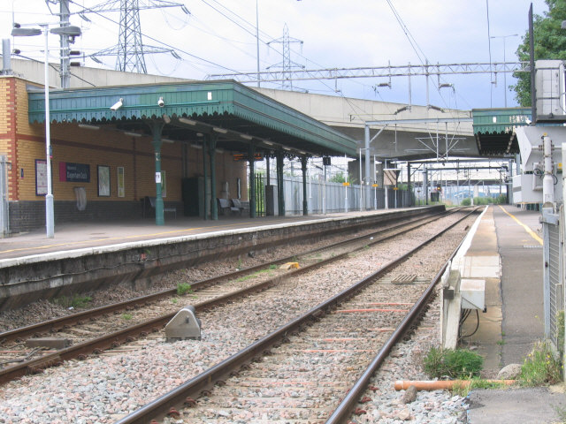
- Dagenham Dock railway station
-
Dagenham Dock 
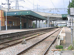
Station platforms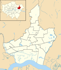
 Dagenham Dock
Location of Dagenham Dock in Barking and DagenhamLocation Dagenham Dock Local authority London Borough of Barking and Dagenham Managed by c2c Owner Network Rail Station code DDK Number of platforms 2 Accessible  [1]
[1]Fare zone 5 National Rail annual entry and exit 2004-05 0.078 million[2] 2005-06 0.091 million[2] 2006-07 0.401 million[2] 2007-08 0.641 million[2] Original company London, Tilbury and Southend Railway Pre-grouping Midland Railway Post-grouping London, Midland and Scottish Railway 1 July 1908 Opened List of stations Underground · National Rail External links Departures • Layout Facilities • Buses Coordinates: 51°31′34″N 0°08′47″E / 51.52611°N 0.14638°E
Dagenham Dock is a railway station located in Dagenham in northeast London, England. The station is managed by c2c and all train services calling at the station are operated by the company. The station is in Zone 5. It is next to the A13 road and the closest station to the local Ford Dagenham plant. Running parallel to the station is the CTRL (High Speed 1).
Contents
History
The station opened on 1 July 1908;[3] it was on the original route of the London, Tilbury and Southend Railway, but was not one of the original stations.
Services
The typical off-peak service frequency is:
- 2 trains per hour to Fenchurch Street
- 2 trains per hour to Grays
At peak times there is an increased service and some trains continue past Grays to Pitsea or Shoeburyness. Some late night and Sunday services towards central London terminate at Barking.
Redevelopment
Although the station is relatively poorly served and located in an industrial area, there are extenive plans to redevelop the area as the London Riverside. Under these plans the station has become the southern terminus of phase one of the East London Transit[4] and it is proposed that an eastern extension of the Docklands Light Railway would terminate here.[5]
References
- ^ "London and South East". Rail Map for People with Reduced Mobility. National Rail. September 2006. http://www.nationalrail.co.uk/system/galleries/download/mobility_maps/LondonSouthEast.pdf. Retrieved 1 January 2010.
- ^ a b c d "Station usage". Rail statistics. Office of Rail Regulation. 30 April 2010. http://www.rail-reg.gov.uk/server/show/nav.1529. Retrieved 17 January 2011. Please note: Some methodology may vary year on year.
- ^ Butt, R.V.J. (1995). The Directory of Railway Stations. Yeovil: Patrick Stephens Ltd. p. 75. ISBN 1 85260 508 1. R508.
- ^ Transport for London - East London Transit route map (PDF)
- ^ Transport for London - DLR takes first steps toward Dagenham. 29 January 2007.
External links
- Train times for Dagenham Dock railway station from National Rail
Preceding station  National Rail
Following station Barking c2c
London, Tilbury & Southend LineRainham Railway stations in the United Kingdom • Railway station categories A B C D E F G H I J K L M N O P Q R S T U V W X Y Z
Categories:- Rail transport stations in London fare zone 5
- Docklands Light Railway stations
- Railway stations in Barking and Dagenham
- Former London, Tilbury and Southend Railway stations
- Railway stations opened in 1908
- Railway stations served by c2c
- DfT Category E stations
- Proposed railway stations in London

Wikimedia Foundation. 2010.