- Tehri
-
Tehri — city — Coordinates 30°23′N 78°29′E / 30.38°N 78.48°ECoordinates: 30°23′N 78°29′E / 30.38°N 78.48°E Country India State Uttarakhand District(s) Tehri Garhwal Population 25,425 (2001[update]) Time zone IST (UTC+05:30) Area
• 1,550 metres (5,090 ft)
Codes-
• Telephone • +01376
FootnotesWebsite 210.212.78.56/50cities/tehri/english/home.asp Tehri (New Tehri) is a city and a municipal board in Tehri Garhwal District in the Indian state of Uttarakhand. It is the administrative seat of Tehri Garhwal District.
Contents
History
The old town of Tehri lies at the confluence of the Bhagirathi and Bhilangna rivers, the site of the Tehri dam. In the eighteenth century the ships of the East India Company would call at the port city of Tehri.[1] The town of Tehri was evacuated to make space for the Tehri dam, and the population has been shifted to the town of New Tehri. The town is famous as the site of protests against the dam by Sundarlal Bahuguna and his followers during the Chipko movement.
Tehri was the capital of the princely state of Tehri Garhwal (Garhwal Kingdom) in British India, which had an area of 4,180 square miles (10,800 km2), and a population of 268,885 in 1901. It adjoined the district of Garhwal, and its topographical features are similar. It contained the sources of both the Ganges and the Yamuna, which are visited by thousands of Hindu pilgrims. The location of Tehri Dam, which is Asia's largest man made lake, has totally submerged the old tehri town and now headquarter of tehri district is known as New Tehri. This lake is 260 metters deep and having potential to produce 2400 MW electricity along with great importance for North India which provide grate volume of water for cultivation and for daily use. this lake is now becoming a great tourist destination in fact view from New Tehri of this lake is spectacular.
Demographics
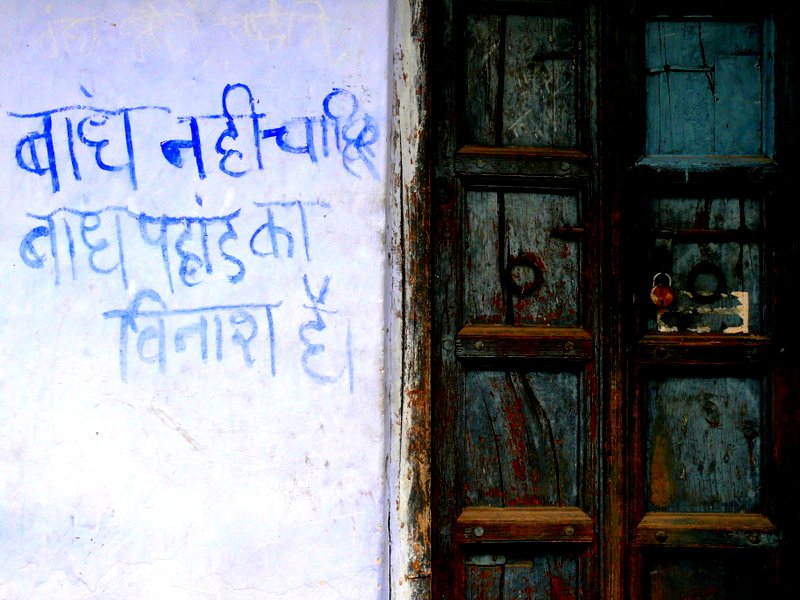
 A protest message against Tehri dam
As of 2001[update] India census,[2] Tehri had a population of 25,425. Males constitute 65% of the population and females 35%. Tehri has an average literacy rate of 78%, higher than the national average of 59.5%: male literacy is 81%, and female literacy is 71%. In Tehri, 10% of the population is under 6 years of age.
Tourist Places
Tehri district has lot of option for tourists to spend their leisure. This division contains lot of options for tourism and has lot of religious places. Most visited places of Tehri are Devi koonjapuri temple and chandrabadni and Tracking route of Mahasar taal , Sehstra taal and Khatling glacier is very much popular amongst foreigner tourists and are being developed. Some areas of tehri are viewable but neglected by Uttrakhand Government such places are Panwali Kantha,Belhbagi Bugyal and Khait parvat ,here no attention is given by government but these places have potential to attract tourists for mountaineering.New district headquarter New Tehri can be looked as a future tourist spot here view of spectacular tehri lake can be viewed.
List Of All Tourist Places Is Given Below.
Tourist Spot Height From Sea Level in Meters Nearby Town Tracking route(Distance from road) Kanatal 2590 Kaddukhal 9 K.M Chandravadni 2756 Devparyag 1.5 K.M Koonjapuri 1645 Narendra Nagar 200 Meters Panwali Kantha 3963 Ghuttu 15 K.M Khatling Glacier 3717 Ghuttu 45 K.M Sehstra Taal 4572 Ghuttu,Reeh 32 K.M Khait Parvat 3030 Ghansali,Ghonti 8.5 K.M Surkanda Devi 2757 Dhanaulti 1.5 K.M Maithiyana Devi 2500 Tilwara,Bhardar 9 K.M References
- ^ "The Ganga". Official Website of district Haridwar, Uttarakhand. National Informatics Centre, Haridwar District Unit. http://haridwar.nic.in/gangaji.htm.
- ^ "Census of India 2001: Data from the 2001 Census, including cities, villages and towns (Provisional)". Census Commission of India. Archived from the original on 2004-06-16. http://web.archive.org/web/20040616075334/http://www.censusindia.net/results/town.php?stad=A&state5=999. Retrieved 2008-11-01.
 This article incorporates text from a publication now in the public domain: Chisholm, Hugh, ed (1911). Encyclopædia Britannica (11th ed.). Cambridge University Press.
External links
·
Cities and towns in Tehri Garhwal Tehri Garhwal Chamba · Devprayag · Dhanaulti · Dhaluwala · Kirtinagar · Muni Ki Reti · Narendra Nagar · Tehri
Cities and towns
in other districtsAlmora · Bageshwar · Chamoli · Champawat · Dehradun · Haridwar · Nainital · Pauri Garhwal · Pithoragarh · Rudraprayag · Udham Singh Nagar · Uttarkashi
Municipalities of Uttarakhand Municipal
CorporationsMunicipalities Almora · Bageshwar · Bajpur · Bhowali · Chamoli Gopeshwar · Dogadda · Gadarpur · Jaspur · Jyotirmath · Kashipur · Khatima · Kichha · Kotdwara · Manglaur · Mussoorie · Nainital · Narendra Nagar · Pauri · Pithoragarh · Ramnagar · Rishikesh · Roorkee · Rudraprayag · Rudrapur · Sitarganj · Srinagar · Tanakpur · Tehri · Uttarkashi · Vikasnagar
Nagar
PanchayatsBadrinathpuri · Barkot · Bhimtal · Chamba · Champawat · Dev Prayag · Dharchula · Didihat · Dineshpur · Doiwala · Dwarahat · Gangotri · Gochar · Herbertpur · Jhabrera · Kaladungi · Karnaprayag · Kedarnath · Kela Khera · Kirtinagar · Laksar · Lalkuan · Landaura · Lohaghat · Mahua Dabra Haripura · Mahua Kheraganj · Muni Ki Reti · Nandprayag · Shaktigarh · Sultanpur
Categories:- Cities and towns in Tehri Garhwal district
- Tehri
- Tehri Garhwal district
- Uttarakhand geography stubs
-


Wikimedia Foundation. 2010.