- Chusovaya River
-
Chusovaya River 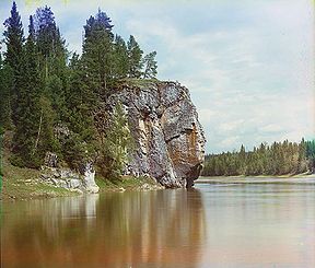
View of the river in the 1910s. Maksimovsky rock.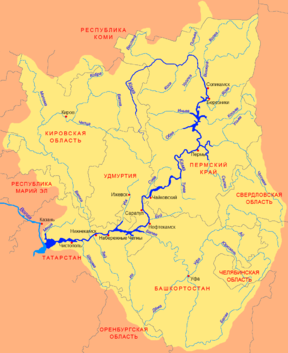
Origin Central Ural Mouth Kamsky Reservoir Basin countries Russia Length 592 km (368 mi) Source elevation 356 m (1,168 ft) Mouth elevation 108.5 m (356 ft) Avg. discharge 222 m³/s Basin area 23,000 km2 (8,900 sq mi) The Chusovaya River (Russian: Чусова́я) is a river flowing in Perm Krai, Sverdlovsk Oblast and Chelyabinsk Oblast of Russia. A tributary of the Kama River, which in turn is a tributary of the Volga River, it discharges into the Chusovskoy Cove of the Kamsky Reservoir. The river is remarkable in that it originates on the eastern slopes of the Ural Mountains in Asia, crosses the mountains, and mostly runs on their western slopes in Europe.[1] The Chusovaya River is widely used as a source of water. In particular, its water is taken from the Volchikhinsky Reservoir (37 km²) to the Verkhneisetsky Reservoir to supply the major city of Yekaterinburg. Fifteen smaller reservoirs are spread over about 150 tributaries of the river.
There are numerous metal and coal mines along the Chusovaya, and the river was intensively used to deliver their production to the western Russia. However, industrial navigation nearly halted with the development of railways in the early 20th century. Chusovoy is the major remaining port on the river.
The Chusovaya River is famous for its hundreds of large rocks located along the shoreline (see infobox image) which are the major tourist attraction of the area. Some rocks posed much danger to boats, especially during the spring thaw. They are generally called boitsy (бойцы, lit. fighters); many of them have individual names and are protected by the state as natural monuments.
Contents
Hydrography
The basin of the Chusovaya River has an area of 23,000 km² and an average elevation of 356 m. The river is 592 km long[2] (777 km according to other sources[1]) and has an average height gradient of 0.4 m/km. It has two sources: Poludennaya Chusovaya and Western (Zapadanaya) Chusovaya. The former originates in a swampy area in the north of Chelyabinsk Oblast and flows to the north. After 45 km, it merges with the Western Chusovaya, which starts at the Ufaley ridge. Then the river flows for about 150 km on the eastern slope of the Ural Mountains; here its width is 10–13 meters. In the upper stream Chusovaya takes many tributaries and shows on its shores outcrops of crystalline shale, which were formed through the interaction of magmatic and sedimentary rocks.[1]
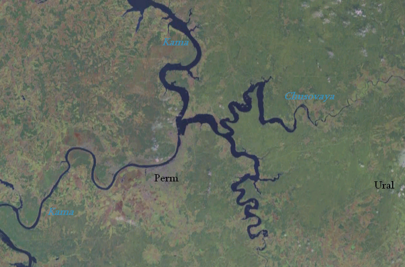
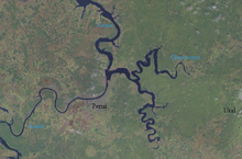 Satellite image of the confluence of the Kama and Chusovaya rivers.
In the middle reaches, the river slopes have canyon-like character. Here the river cuts through several low mountain ranges, which tower above the riverbed as picturesque cliffs called boitsy. There are about 200 of them in the middle reaches and about 50 are protected by the state as natural monuments. Boitsy are of sedimentary origin and are made from limestone and rarely dolomite, anhydrite and shale; they rise 10–115 meters above the water and extend for 30–1500 meters.[1] Limestone is prone to weathering which often creates peculiar shapes. Karst processes created numerous caves and grottoes in this area. The river here has a mountainous character with about 70 rapids, and its elevation here decreases by 120 meters over a length of 280 km. Large boulders sometimes protrude above the water surface. Here the river is 120–140 meters wide and is rather winding, skirting mountain ranges and making numerous loops. One loop near Utkinskoy settlement is 5 kilometers in diameter and is almost a closed loop. [3]
In the lower reaches, after exiting from the Ural Mountains, the river has a plain character. Here it flows through meadows, marshes, deciduous and mixed forests; it slows down and widens in some places up to 300 meters, making occasional broad bends. The river discharges into the Chusovskoy Cove of Kama Reservoir, which is associated with the Kama hydroelectric power station located 693 km from the mouth of the Kama River. Construction of the dam resulted in flooding of the lower reaches of the Chusovaya up to 125 km from the mouth.[4][3] The bottom of the river throughout its length is mainly covered in pebbles.
The water discharge varies between 8.4 and 4570 m³/s with the average of 222 m³/s. The flow is relatively strong – about 10 times that of such rivers as Volga and Kama; it is about 8 km/h on average and may rich 25 km/h in some places. Chusovaya usually freezes in late October-early December and thaws in April. Ice congestions are common for the lower reaches with the increase in the water level of up to 2.8 meters. The river is fed by snow (55%). precipitation (29%) and underground waters (18%). The floods typically occur between mid-April and mid-June. During the early summer, there are 6–7 rain floods with water levels rising up to 4–5 m. In July–August, the river shallows to 7–15 cm in some places.[1][2]
Chusovaya takes more than 150 tributaries with the largest being the river Sylva). Other principal tributaries are Utka, Mezhevaya Utka, Serebryanka, Koyva, Usva, Revda and Lysva. The Kumysh tributary dives underground for about 6 km; the place where it disappears is called нырок in Russian ("dive" in English) by the local people, and the place where it resurfaces is named вынырок ("coming to the surface"). Such behavior is unusual but not unique to Kumysh and is observed for about 15 other rivers of the Urals.[5][6]
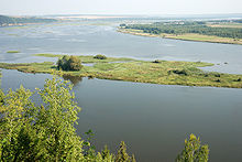 Lower reaches of Chusovaya
Flora and fauna
The upper reaches of the Chusovaya River have abundant marshes and meadows. Forests are rare and are mostly pine forests. The middle reaches are covered by boreal coniferous forests, which are dominated by pine, Siberian Pine, larch and fir. Forests are scarce also in the lower reaches and mostly contain aspen, birch, mountain ash and willow. Fishes include minnow, bass, ruff, roach, pike, ide (Leuciscus idus), chub (Leuciscus cephalus) and bream. There are colonies of crayfish. The tributaries show traces of beavers and the main river hosts muskrats. In the autumn, the river is visited by ducks, geese and other waterfowl.[3] The surrounding forests are inhabited by usual taiga animals such as moose, brown bear, wolf, lynx, fox, hare, squirrel, hazel grouse and black grouse.[1]
History
The river had long been inhabited by people, as evident from numerous Neolithic and Bronze Age settlements found on the river banks. In the Middle Ages, the river basin was mostly populated by Bashkirs, Mansi and Komi-Permyaks. It is assumed that the Battle of Chulmandore, in which Komi-Permyaks defeated Mongols, occurred near the river mouth. The Chusovaya River was first mentioned in 1396 in the Novgorod chronicles.[1][7] Russians started active explorations of the Urals in the early 16th century, and the first Russian settlement Nizhnechusovskie Gorodki appeared on Chusovaya in 1568. From 1579, the garrison of this settlement was headed by the Russian explorer Ermak. The entire river basin was then owned by merchants Stroganov.[1] Stroganovs in particular supplied the expedition of Ermak in the autumn of 1581 up the Chusovaya and beyond the Urals.[8]
Subsequently, the vast lands beyond the Urals, including the upper Chusovaya, were given to Demidov, and the border between the possessions of Stroganov and Demidov was at the river Mezhevaya Utka. Demidov was actively exploring the rich local deposits in his lands and built several iron works, including Polevskoy (1722), Vasilyevo-Shaitansky (1732), Sredneuralskiy (1734) and Seversky (1735).
Before construction of the railway across the Urals, the river served as an important route for transporting metals and fur from the Urals to the western Russia. The first port for this purpose was built in the mouth of the Utka tributary in 1703 by the orders of Peter the Great.[1] Every spring, with the start of the flood, heavily loaded barges were sent from the wharf in the upper Chusovaya to Perm. It was rather difficult to navigate heavy wooden ships through the fast and winding river and many were crashing to the coastal cliffs. About 50 barges had major accidents between 1857 and 1861 on the Chusovaya. In the spring of 1877 alone, 47 barges sank drowning more than 100 men, 23 of those barges crashed at one and the same cliff Brigand (Russian: Разбойник).[9] Massive efforts were spent in the 17–19 centuries to improve the navigation conditions on Chusovaya. The most dangerous shore cliffs were blown up with dynamite, including the Brigand (this was one of the world's first controlled underwater explosions[1]) Smaller boulders protruding at the river center were removed, and hundreds mooring poles had been installed. Logs were set up in the places where the currents tended to wash up boats on the rocks in order to soften the impact. These measures drastically reduced the number of accidents (from 10% to 4% of the total number of shipments in 1890) and the traffic on the river grew from 49,500 tonnes in 1862 to 128,800 tonnes in 1873. It then dropped to 107,200 tonnes and remained at this level through the 1890s.[3]
The barges used on Chusovaya were sturdy wooden boats 35–40 meters long and 6–8 meters wide which could carry up to 200 tonnes. Some barges were reinforced inside with metal stripes and could sustain up to 10 navigation seasons.[1] Barges were equipped with roaped weights, which were thrown overboard to increase the drag thereby reducing the barge speed when needed. The first steamship appeared on Chusovaya in 1841, it was a metal vessel named "Nikita Demidov". First three years, the ship was bringing barges loaded with the production of the Staroutkinsky plant between Suksun and Levshino. In 1844, there was an attempt to run the ship in the middle reaches. After a 24-day trip, she managed to pass only 200 kilometers and then crashed, once again illustrating the difficulty of navigating the river.
The shipment declined after 1878 with the opening of Gornozavodskaya Rails.[3][1] Since the early 20th century, shipment of metals was nearly halted and the barges were only occasionally transporting grain and supplies. The last barge trip occurred in 1920.[10] As a result, many settlements along the river bank had been abandoned. However, the ironworks remained and provided the Soviet Army with metal during World War II.[1]
Commercial use
The Chusovaya River is extensively used for water supply. In particular, water from Volchihinskoe reservoir is supplied to the Upper Iset Pond to serve the needs of Yekaterinburg and its suburbs.[2] In order to improve the water supply, Nyazepetrovsk cascade was built in the mid 1970s. With this hydraulic system, Western Chusovaya was supplied with water from the Nyazepetrovsk reservoir on the Ufa River. There are 15 small reservoirs at the plants on the tributaries of Chusovaya.[11]
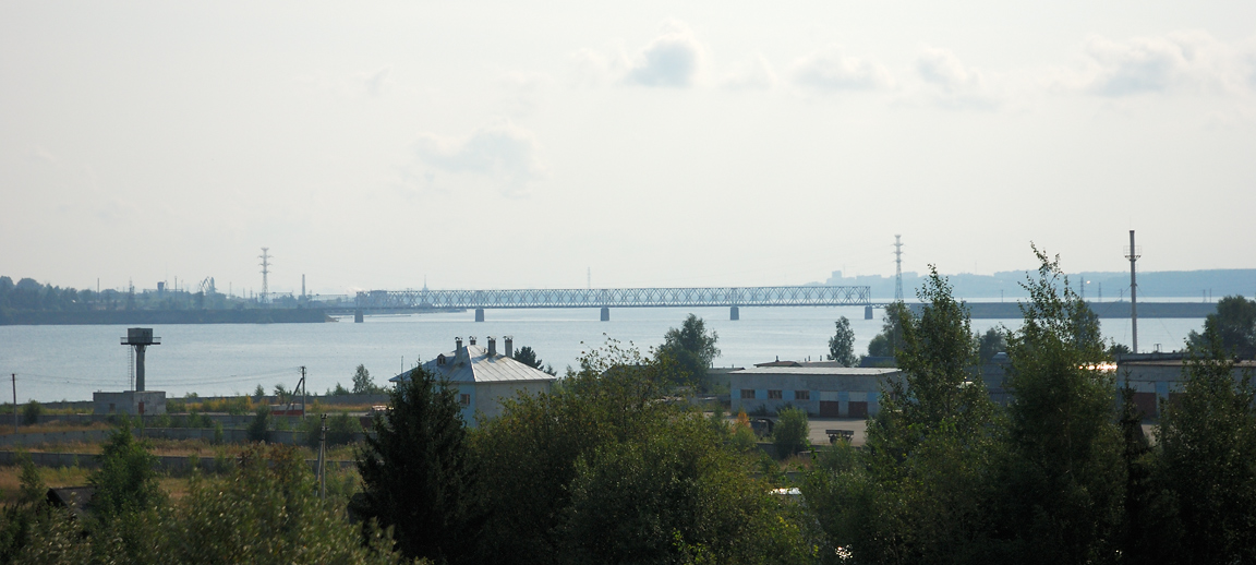
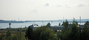 A railway bridge across Chusovaya near its confluence to the Kama Reservoir.
The river basin contains numerous deposits of iron, chromium, platinum, gold, diamond and coal. They were developed since the 17th century, some have been depleted and some are still being mined. Major settlements on the river (from source to the mouth) are Revda, Pervouralsk, Bilimbai, Staroutkinsk, Kyn, Ust-Koiva, Chusovoy and Verhnechusovskie Gorodki.[1]
River is navigable from the city of Chusovoy, but the navigation sees very little commercial use nowadays. The railway bridge at the river mouth limits the height of passing ships to 9.5 meters. Besides, between 1930s and early 1980s, the river basin was intensively used for logging; logs were rafted loose, i.e. neither guided nor bundled, that cluttered the river. The last such rafting was carried out on Chusovaya in 1973,[1][10] and since 1990 it is legally prohibited in Russia.[12]
Ecology
According to the Office for Environmental Protection of Perm Oblast, the water of the river near the town of Chusovoy is contaminated and does not meet the standards for the drinking and sanitary water. In 2006, the content of copper exceeded the maximum permissible concentration (MPC) twice, manganese 8 times, iron 5 times, petroleum 2 times (it was 21 times MPC in 2003) and hexavalent chromium 1.5 times (mostly due to the plant "Chrompic" in Pervouralsk).[13] The biggest polluters of the river are Chusovskoy Steel Works and Chusovskoy Gorvodocanal.[14]
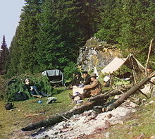 Overnight at a cliff on Chusovaya (1912).
Tourism
Chusovaya has long been famous for its rock formations, many of which have poetic names. They pose no dangers to light vessels and attract lots of tourists. A tourist route was formed here in the 1960s and was visited by about 3,000 people per year.[3] In one summer season of 1980s, several tens of thousands tourists have drafted along the river.[10]
The major objects of attraction are the picturesque river banks, boitsy rocks and their caves and grottoes. Many of these rocks are under state protection as natural monuments.[15] About 200,000 people annually visit the Kungur Cave near Chusovoy. This labyrinth of karst caves was formed as a result of dissolution of gypsum and anhydrites by water at a depth of 60–80 meters and is explored only up to about 6 kilometers.[1]
References
- ^ a b c d e f g h i j k l m n o p Описание Чусовой (Description Chusovaya) (in Russian).
Первоуральский район. История и география.
These sources are largely based on the book E. Postonogov, Yu Postonogov (1980). On Chusovaya. Guide. Sverdlovsk. http://klif.nm.ru/c/p.htm. - ^ a b c Chusovaya River, Great Soviet Encyclopedia (in Russian)
- ^ a b c d e f Rudolph Kashin. Chusovaya: a historical portrait, Bilety Est', No. 6–7, 2006
- ^ Chusovaya, Dictionary of modern geographical names, 2003. ISBN 5-94799-148-9
- ^ V. A. Mezentsev (1988) (in Russian). Энциклопедия чудес. Vol. 1. Обычное в необычном (Encyclopedia of wonders. Usual within unusual). Мoscow: Znanie. http://n-t.ru/ri/mz/on13.htm.
- ^ A. Sheidlin (1936). Chusovaya. Moscow: The publication of the Central Council OPTE. http://www.skitalets.ru/books/chusovaya_sheidlin/index.htm.
- ^ N. Arkhipova (2001). "The mountainous country – from Novaya Zemlya to the southern steppes" (in Russian). Rodina 11. http://www.istrodina.com/rodina_articul.php3?id=186&n=14.
- ^ Development of shipping in Russia
- ^ S.A. Barkov., ed (2002). Tourism in Perm Oblast. Perm: Raritet-Perm. p. 119. ISBN 5-93785-012-2.
- ^ a b c Чусовая в послереволюционное время (Chusovaya after the Great Russian Revolution) (in Russian)
- ^ Three vice-mayor of Yekaterinburg visited Nyazepetrovsk – to view a cascade, 7 June 2008
- ^ Water Code of the Russian Federation 03.06.2006 N 74-FZ
- ^ Proceedings of the annual publication "Status and Environmental Protection, Perm, 2004
- ^ Materials annual compendium on the state and Environmental Protection of Perm Oblast "for 2005
- ^ Ordinance governor of Perm Oblast No 163 from 26.06.2001, the " Refinement of the status, category, borders and protection of specially protected natural areas"
Coordinates: 56°14′49″N 60°34′57″E / 56.24694°N 60.5825°E
Kama River Left tributary of the Volga River Tributaries 
Reservoirs Hydroelectric
stationsCategories:- Kama basin
- Rivers of Chelyabinsk Oblast
- Rivers of Sverdlovsk Oblast
- Rivers of Perm Krai
- ^ a b c d e f g h i j k l m n o p Описание Чусовой (Description Chusovaya) (in Russian).


Wikimedia Foundation. 2010.