- Tōkyū Den-en-toshi Line
-
Tōkyū Den-en-toshi Line
Tokyu 5000 series EMUOverview Type Commuter rail Locale Kantō Region Termini Shibuya
Chūō-RinkanOperation Opened 11 October 1963 Owner Tokyu Corporation Technical Line length 31.5 km Track gauge 1,067 mm (3 ft 6 in) Electrification 1,500 V DC overhead catenary Route diagram Legend

Minami-Kurihashi 

 Tōbu Nikkō Line
Kuki 

 Tōbu Isesaki Line
Oshiage  Tokyo Metro Hanzōmon Line
 Tokyo Metro Ginza LineTokyo Metro Fukutoshin Line


Tōkyū Tōyoko Line 


 Saikyō, Shōnan-Shinjuku lines

0.0 Shibuya Yamanote Line

 Keiō Inokashira Line
 Tamagawa Line (closed tramway)
1.9 Ikejiri-Ōhashi Tamagawa Line (Tramway)
3.3 Sangen-Jaya  Tōkyū Setagaya Line
4.8 Komazawa-Daigaku 6.3 Sakura-Shimmachi 7.6 Yōga 
Tōkyū Ōimachi Line 


9.4 Futako-Tamagawa 


Tama River /Tokyo - Kanagawa 
10.1 Futako-Shinchi 
Ōimachi Line extension in 2009 10.7 Takatsu Nambu Line (Musashi-Mizonokuchi)
11.4 Mizonokuchi 
12.2 Kajigaya 13.7 Miyazakidai 14.7 Miyamaedaira 15.7 Saginuma 
Saginuma depot of Tokyo Metro 17.1 Tama-Plaza Yokohama Subway: Blue Line 18.2 Azamino 19.3 Eda 20.6 Ichigao 22.1 Fujigaoka 23.1 Aobadai 24.5 Tana Yokohama Line25.6 Nagatsuta 
Yokohama Minatomirai Railway: Kodomonokuni Line
Nagatsuta depot 

26.8 Tsukushino 28.0 Suzukakedai 29.2 Minami-Machida 30.3 Tsukimino 
31.5 Chūō-Rinkan Odakyū Enoshima Line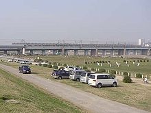 View of riverbank and Futako-Tamagawa Station
The Tōkyū Den-en-toshi Line (東急田園都市線 Tōkyū Den'entoshi-sen) is a major commuter line operated by Tokyu Corporation and connecting south-western suburbs of Tokyo and neighbouring Kanagawa Prefecture, with its western terminus of Chūō-Rinkan, to a major railway junction of western downtown Tokyo, Shibuya. At Shibuya, nearly all the trains continue on the Tokyo Metro Hanzōmon Line.
Contents
History
Prewar predecessors
On March 6, 1907, the Tamagawa Electric Railway (玉川電気鉄道 Tamagawa Denki Tetsudō, Tamaden) opened the first section of the Tamagawa Line (玉川線 Tamagawa sen) tramway (not to be confused with today's Tōkyū Tamagawa Line (東急多摩川線 Tōkyū Tamagawa sen)) between Shibuya and what is now Futako-Tamagawa. Two branch lines opened from the Tamagawa Line: the Kinuta Line (砧線 Kinuta sen) (March 1, 1924) from Futako-Tamagawa to Kinuta, and the Setagaya Line (January 18, 1925) from Sangenjaya.
Tamaden was acquired by the Tokyo Yokohama Electric Railway (東京横浜電気鉄道 Tokyo Yokohama Denki Tetsudō) (now Tokyu) on April 1, 1938. In addition to its principal Tokyo-Yokohama line, TYER also operated the Mizonokuchi Line (溝の口線 Misonokuchi sen) from Futako-Tamagawa (called Futako-Tamagawa-en) to Mizonokuchi from July 15, 1927. The Tamagawa Line provided a further connection past Futako-Tamagawa to Shibuya. On July 1, 1943, this section was integrated with the Ōimachi Line running from Ōimachi in southwest Tokyo to Futako-Tamagawa-en.
Tama Den-En-Toshi Plan
Before 1945, the Tama Hills southwest of Mizonokuchi were largely forested, occupied by small villages along the Ōyama Route (now Route 246) and training bases for the Imperial Japanese Army. After World War II, many farmers migrated to the area.
In 1953, at which time about 20,000 people lived in the area, Tokyu Group president Keita Gotō unveiled a "new town" planning scheme called the South-Western Area Development Plan. He envisioned new railway and freeway infrastructure (the latter being realized as the Tōmei Expressway) and large, clean houses for commuters working in Tokyo. Tokyu started accepting new residents in this Tama Den-En-Toshi ("Garden City") Plan area in 1959.
In accordance with this plan, the Ōimachi Line was renamed the Den-en-toshi Line on October 11, 1963 and officially extended to Nagatsuta on April 1, 1968.
From the 1970s onward, the population of the area increased rapidly. The towns were viewed as cultural and sophisticated, and attracted many new residents. While Tokyu Group's housing construction project is almost complete, other developers still push forward with the construction of apartmants and houses. There are now about 550,000 residences along the line, excluding the section from Shibuya to Mizonokuchi which was already urbanized prior to the plan. This makes the area the largest "new town" developed by the Japanese private sector.
Development of the line
On May 11, 1969, the former Tamagawa Line and Kinuta Line were closed for the construction of a new underground Shin-Tamagawa Line along with the Route 3 of Shuto Expressway. Tokyu provided substitute bus service during the interim. The new line began service on April 7, 1977 between Shibuya and Futako-Tamagawa: through service with the Den-en-toshi Line began on November 16, 1977.
On August 12, 1979, the section from Ōimachi to Futako-Tamagawa was separated and named the Ōimachi Line again, thus restoring its original name and route. This coincided with the inauguration of through services from the Den-en-toshi Line via the Hanzōmon Line of the then Teito Rapid Transit Authority (帝都高速度交通営団 Teito Kōsokudo Kōtsū Eidan, Eidan or TRTA) and the Shin-Tamagawa Line.
The line was completed in its present form on April 9, 1984, when sections between Tsukimino and Chūō-Rinkan were opened. The Shin-Tamagawa Line officially became part of the Den-en-toshi Line on August 6, 2000.
Through service was extended beyond Suitengūmae to Oshiage on March 19, 2003, allowing through service with the Isesaki Line and Nikkō Line of Tōbu Railway.
Tōkyū plans to expand the line to four tracks from Futako-Tamagawa to Mizonokuchi. Almost all trains of the Ōimachi line are planned to run through this section to Mizonokuchi. The corporation has already announced that it will begin this service on June 2009, postponed from fiscal 2007. Ōimachi line express trains, which are 6-car sets, will then run between Ōimachi and Mizonokuchi.[1]
Operation
Nearly all trains on the Den-en-toshi Line are operated through to/from the Tokyo Metro Hanzōmon Line using Tōkyū, Tokyo Metro, and Tōbu Railway 10-car EMUs. Around half of them continue beyond Oshiage, the terminus of the Hanzōmon Line, to the Tōbu Isesaki Line (Kuki Station) and Tōbu Nikkō Line (Minami-Kurihashi Station).
Rapid service
Tōkyū operates two types of rapid services as well as Locals.
- Local (普通 Futsū) (L)
- Stop at all stations. Eight service per hour per direction in day time.
- Semi-Express (準急 Junkyū) (SE)
- Only upward trains in weekday morning, to reduce congestion of passenges around Shibuya of rapid trains and to reduce delays with equalizing the speed of the trains.
- Express (急行 Kyūkō) (Ex)
- Four trains per hour per direction in day time.
Through trains to Ōimachi Line
A few trains are operated through to/from the Tōkyū Ōimachi Line to utilize forwardings to/from Saginuma depot, up to Ōimachi in the mornings, and down to Saginuma in the late evenings. These formations are 5-car sets, unlike the 10-car trains normally used on the line. A few express trains in holidays also serve from Chūō-Rinkan in the mornings, down in the evenings.
Stations
Name in Japanese km L SE Ex Connections Location Trains continue to ○Tokyo Metro Hanzōmon Line Shibuya 渋谷 0.0 S S S - Tōkyū Tōyoko Line
- Yamanote Line
- Saikyō Line
- Shōnan-Shinjuku Line
- Keiō Inokashira Line
- ○Tokyo Metro Hanzōmon Line (Z-01, run through)
- ○Tokyo Metro Ginza Line (G-01, see below)
- ○Tokyo Metro Fukutoshin Line
(F-16)
Shibuya Tokyo Ikejiri-Ōhashi 池尻大橋 1.9 S S Meguro, Setagaya Sangen-Jaya 三軒茶屋 3.3 S S S Tōkyū Setagaya Line Setagaya Komazawa-Daigaku 駒沢大学 4.8 S S Sakura-Shimmachi 桜新町 6.3 S S Yōga 用賀 7.6 S S Futako-Tamagawa 二子玉川 9.4 S S S Tōkyū Ōimachi Line Futako-Shinchi 二子新地 10.1 S Takatsu-ku, Kawasaki Kanagawa Takatsu 高津 10.7 S Mizonokuchi 溝の口 11.4 S S S Nambu Line (Musashi-Mizonokuchi) Kajigaya 梶が谷 12.2 S Miyazakidai 宮崎台 13.7 S Miyamae-ku, Kawasaki Miyamaedaira 宮前平 14.7 S Saginuma 鷺沼 15.7 S S S Tama-Plaza たまプラーザ 17.1 S S S Aoba-ku, Yokohama Azamino あざみ野 18.2 S S S Yokohama Municipal Subway Blue Line Eda 江田 19.3 S Ichigao 市が尾 20.6 S Fujigaoka 藤が丘 22.1 S Aobadai 青葉台 23.1 S S S Tana 田奈 24.5 S Nagatsuta 長津田 25.6 S S S - Kodomonokuni Line
- Yokohama Line
Midori-ku, Yokohama Tsukushino つくし野 26.8 S Machida Tokyo Suzukakedai すずかけ台 28.0 S Minami-Machida 南町田 29.2 S S1 Tsukimino つきみ野 30.3 S Yamato Kanagawa Chūō-Rinkan 中央林間 31.5 S S S Odakyū Enoshima Line Note:
- Shibuya (Ginza Line): Tokyu and Tokyo Metro recommend to transfer at Omotesandō Station on Hanzōmon Line.
- S1: Minami-Machida is served by express trains on Saturdays and public holidays.
Rolling stock
Type Image Top speed
(km/h)Tokyo Metro 08 series 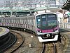
120 Tokyo Metro 8000 series 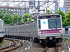
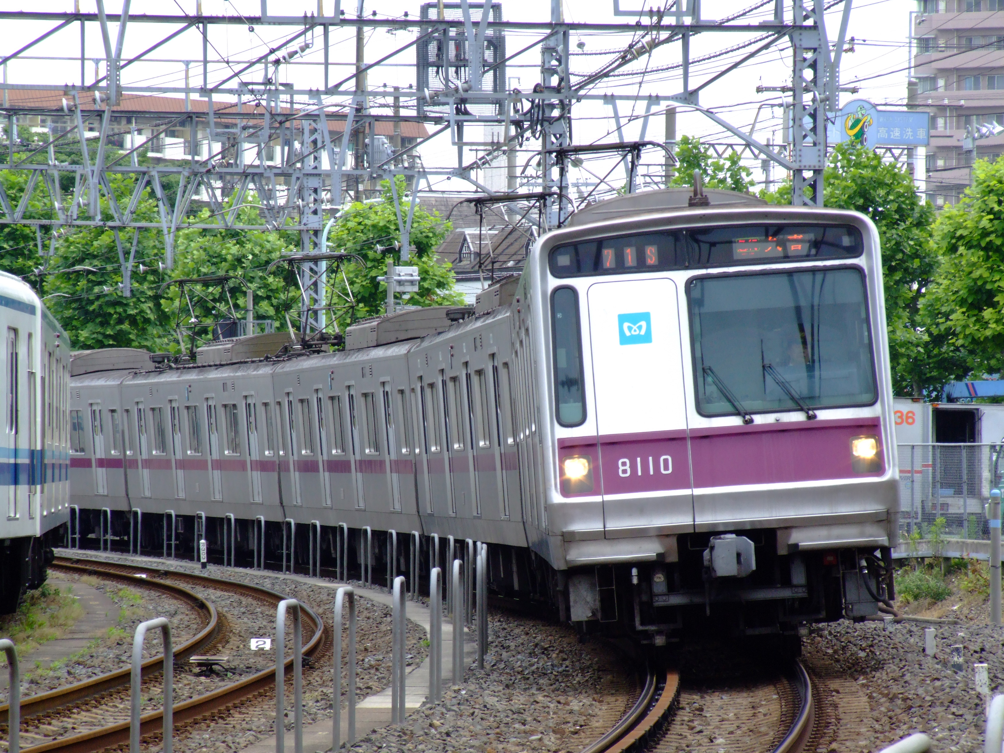
100 Tokyu 2000 series 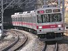
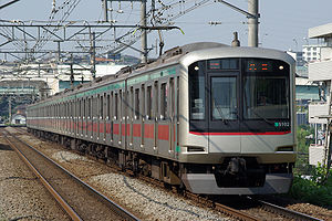
120 Tokyu 5000 series 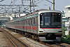
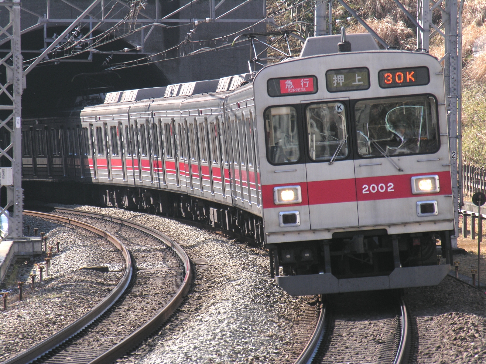
120 Tokyu 8500 series 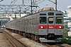
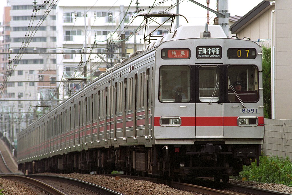
120 Tokyu 8590 series 
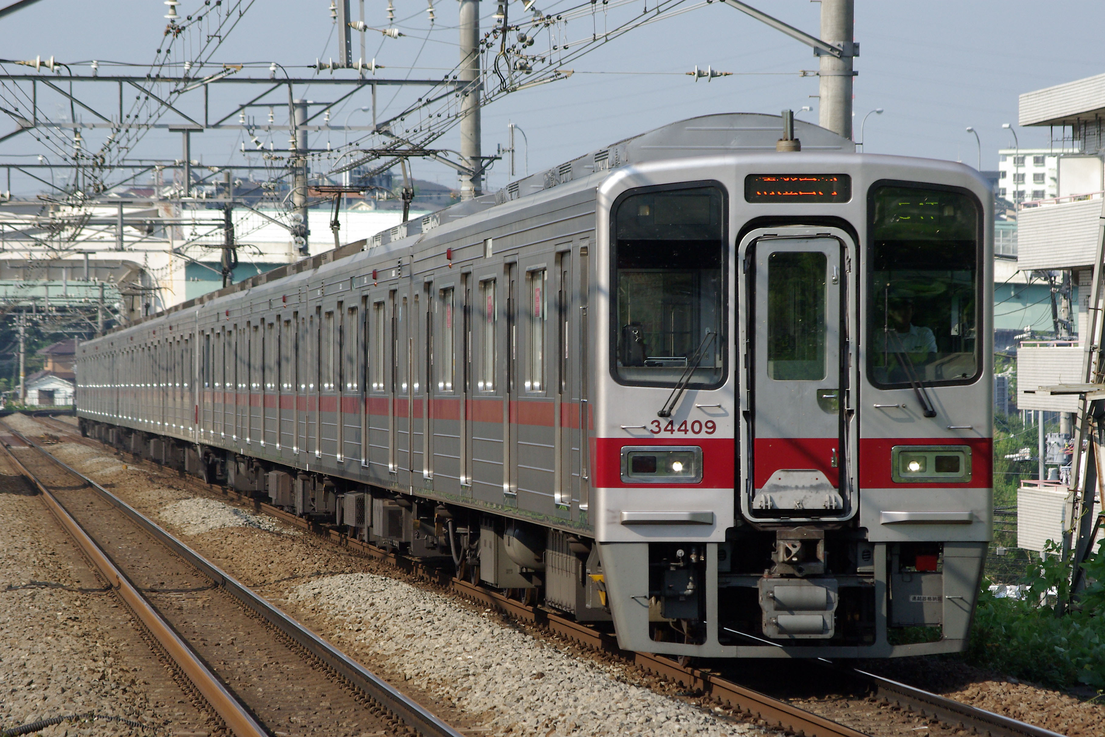
120 Tōbu 30000 series 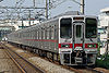
120 Tōbu 50050 series 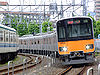
120 References
Coordinates: 35°31′55″N 139°29′40″E / 35.53194°N 139.49444°E
Categories:- Lines of Tokyu Corporation
- Rail transport in Tokyo
- Rail transport in Kanagawa Prefecture
- 1067 mm gauge railways in Japan


Wikimedia Foundation. 2010.