- Chief Joseph Pass
-
Chief Joseph Pass 
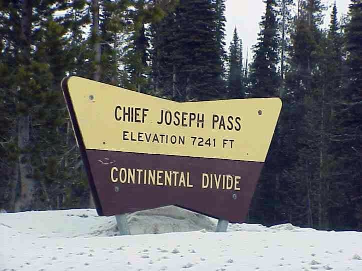
US Forestry sign at Chief Joseph PassElevation 7,264 ft (2,214 m) Traversed by =  MT 43
MT 43Location Location Lemhi County, Idaho / Beaverhead County, Montana,
 United States
Range Bitterroot Mountains,
Bitterroot Range,
Rocky MountainsCoordinates 45°41.0′N 113°56.0′W / 45.683°N 113.933°W 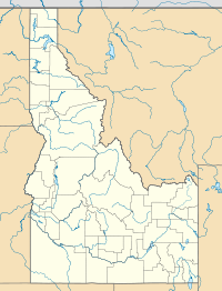
 Chief Joseph Passlocation of Chief Joseph Pass
Chief Joseph Pass is a mountain pass on the continental divide of the Rocky Mountains in the northwestern United States, between the states of Idaho and Montana. At an elevation of 7264 feet (2214 m) above sea level in the Bitterroot Mountains, it is traversed by Montana State Highway 43.
West of the pass, the highway quickly connects with US-93 at Lost Trail Pass, about a half-mile (1 km) west of the Divide. Between the passes the Montana highway is actually in Idaho, for about a mile (1.6 km).
This is the final pass on the continental divide between Idaho & Montana. Less than a mile north, the Continental Divide heads eastward into Montana, following the Ravalli-Beaverhead county line towards Butte. East of Chief Joseph Pass, Highway 43 descends to Wisdom, 26 miles (42 km) away; just over halfway is the historic Big Hole National Battlefield of 1877.
- Chief Joseph Pass is named after Chief Joseph of the Wallowa band of the Nez Perce tribe.
- Lewis and Clark traveled in this vicinity in early September 1805, then descended north into the Bitterroot Valley of present-day Ravalli County, Montana. They later re-entered Idaho at Lolo Pass, in a very early snowstorm of mid-September.
- The Lost Trail Powder Mountain ski area is about a mile (1.6 km) west, at Lost Trail Pass on US-93.
See also
- Mountain passes in Montana
External links
- Idaho Transportation Dept. - webcam of nearby Lost Trail Pass - US-93
- Lost Trail.com - Lost Trail Powder Mountain ski area - official site
 State of Montana
Helena (capital) Topics Index · History · Governors · People · Geography · State Government · Delegations · Visitor Attractions
Society Crime · Demographics · Economy · Education · Politics
Regions The Flathead · Glacier National Park · Regional designations of Montana · Western Montana · Yellowstone
Largest cities Counties Beaverhead · Big Horn · Blaine · Broadwater · Carbon · Carter · Cascade · Chouteau · Custer · Daniels · Dawson · Deer Lodge · Fallon · Fergus · Flathead · Gallatin · Garfield · Glacier · Golden Valley · Granite · Hill · Jefferson · Judith Basin · Lake · Lewis and Clark · Liberty · Lincoln · Madison · McCone · Meagher · Mineral · Missoula · Musselshell · Park · Petroleum · Phillips · Pondera · Powder River · Powell · Prairie · Ravalli · Richland · Roosevelt · Rosebud · Sanders · Sheridan · Silver Bow · Stillwater · Sweet Grass · Teton · Toole · Treasure · Valley · Wheatland · Wibaux · Yellowstone
Categories:- Mountain passes of Idaho
- Mountain passes of Montana
- Landforms of Lemhi County, Idaho
- Landforms of Beaverhead County, Montana
- Transportation in Lemhi County, Idaho
- Transportation in Beaverhead County, Montana
- Idaho geography stubs
- Montana geography stubs

Wikimedia Foundation. 2010.