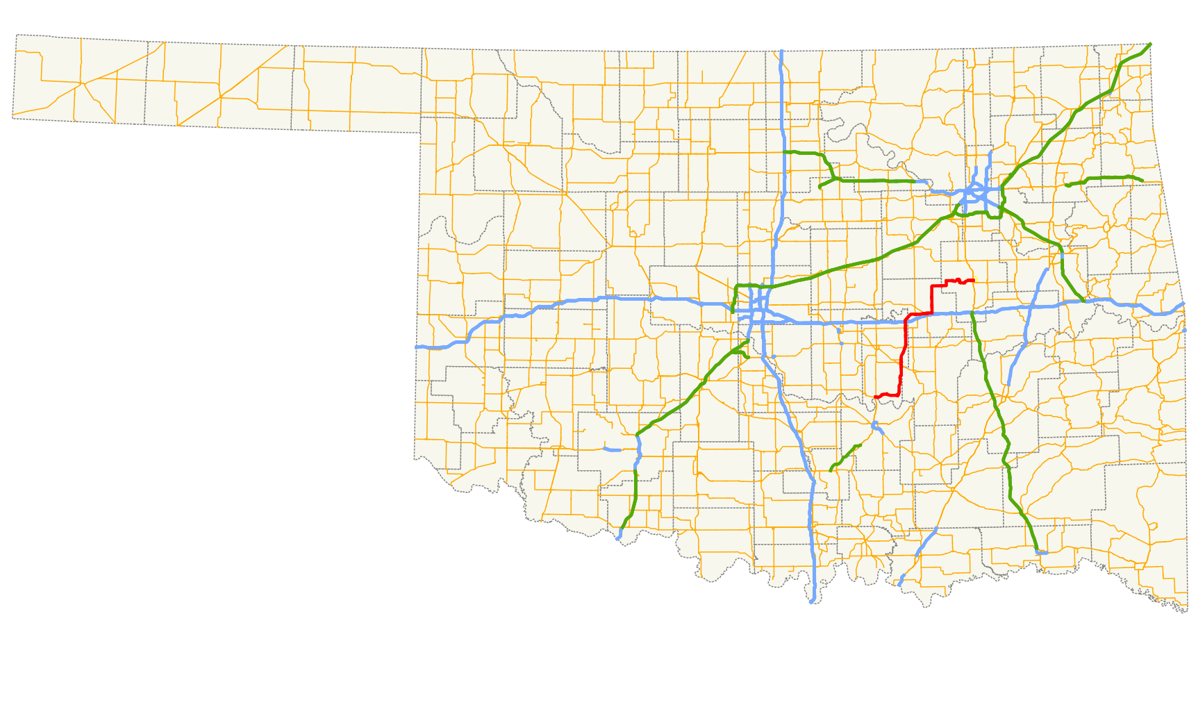
- Oklahoma State Highway 56
-
State Highway 56
Seminole Nation Highway 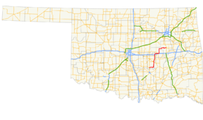
Route information Maintained by ODOT Length: 86.7 mi[2] (139.5 km) Existed: August 28, 1929[1] – present Major junctions West end: 


 US-377/SH-3E/SH-39/SH-99 east of Konawa
East end:  US-75 in Okmulgee
Highway system Oklahoma State Highways
Oklahoma turnpike system←  US-56
US-56SH-58  →
→State Highway 56 (abbreviated SH-56 or OK-56) is a state highway in the U.S. state of Oklahoma. The road serves Seminole County, Okfuskee County, and Okmulgee Counties in central and east-central Oklahoma. In Seminole County, it is also designated as the Seminole Nation Highway in honor of the contributions the Seminole Nation has made to the state of Oklahoma.[1]
SH-56 begins at an intersection with US-377 four miles (6 km) east of Konawa,[3] and extends to US-75 in Okmulgee. The highway's total length is 86.7 miles (139.5 km).[2]
SH-56 was first added to the state highway system in 1929. It was gradually extended to its present length between then and 1942.[1]
Contents
Route description
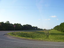 Northbound SH-56 as seen from the SH-9 junction
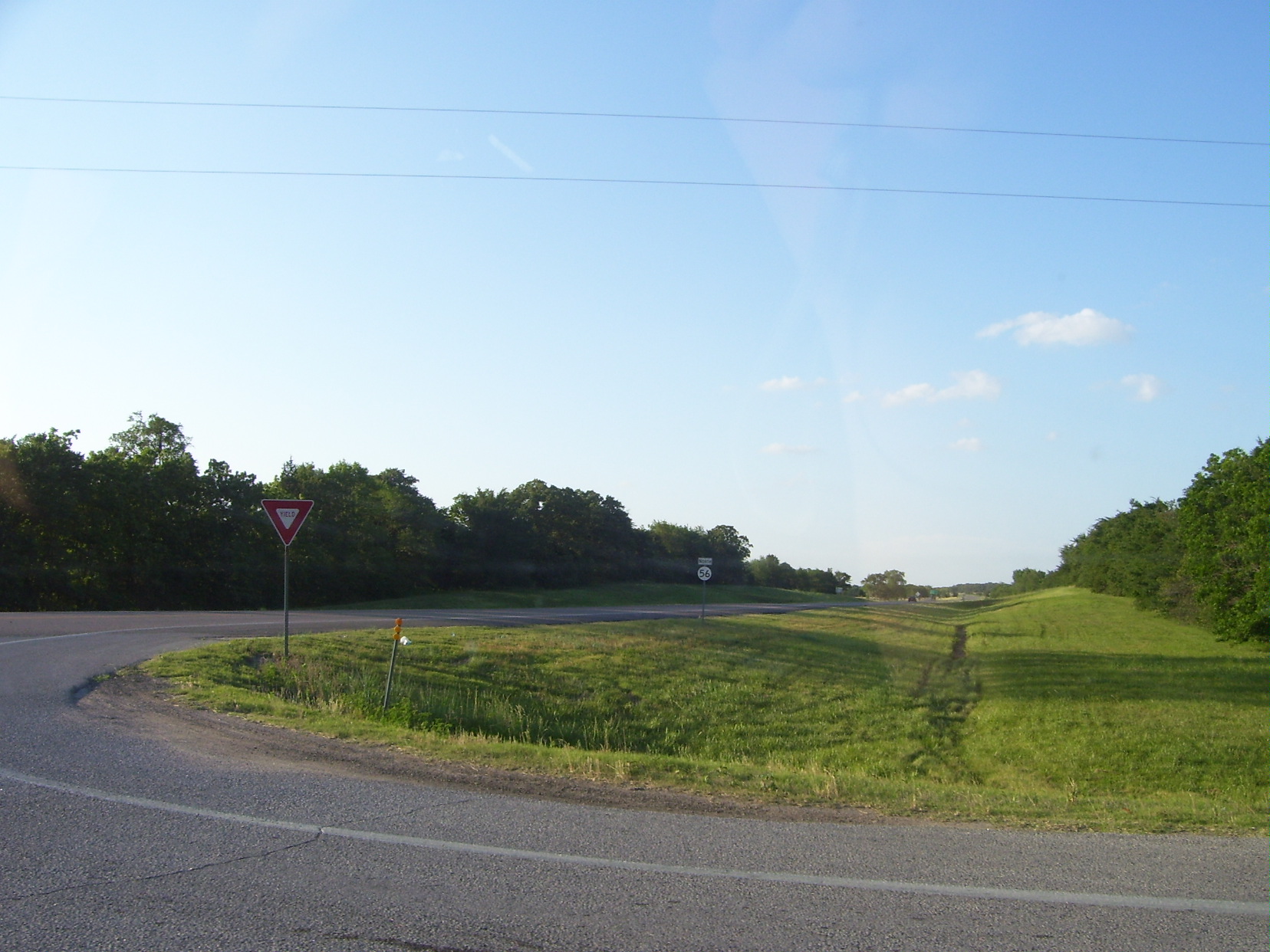
SH-56 begins at the junction of SH-39 and US-377/SH-3E/SH-99 four miles (6 km) east of Konawa. From here, the highway and heads east, curving through the hilly terrain of southeastern Seminole County.[4] The highway passes through the town of Sasakwa 10 miles (16 km) east of US-377.[3] At Sasakwa, the road turns north, crossing the Little River northeast of town and generally paralleling the Seminole–Hughes County county line. The highway then bisects the town of Wewoka, intersecting US-270 and concurring with its business loop. SH-56 also serves as the eastern terminus of SH-59 in Wewoka. North of the town, SH-56 intersects with SH-9. The highway continues north, intersecting SH-99A near Cromwell and interchanging with I-40 near the unincorporated community of Schoolton. After crossing I-40, SH-56 makes a long arc to the east, bringing it into Okfuskee County.[3]
Just east of the county line, SH-56 bridges the North Canadian River. South of Castle, the road intersects with SH-48. SH-56 then proceeds east into Okemah, the county seat, where it has a short concurrency with both US-62 and SH-27. The highway continues east from town, then turns north, before turning back to the east to pass through the unincorporated settlement of Okfuskee. East of Okfuskee, the highway enters Okmulgee County.
In Okmulgee County, SH-56 skirts the northern edge of Okmulgee Lake and serves Dripping Springs State Park. East of the lake, it passes through Okmulgee Wildlife Refuge and Deep Fork National Wildlife Refuge.[4] It then enters the city of Okmulgee. There, SH-56 comes to an end at US-75.
History
State Highway 56 traces its origins to August 28, 1929, its original date of commissioning. At that time, the highway only consisted of the portion of the route extending from the SH-99 junction (then SH-48) east to Sasakwa, thence north to end at SH-3 south of Wewoka.[1][5] The highway underwent its first extension just under two years later, on June 15, 1931, when it was extended to end at US-62 in Okemah.[1][6] The highway was extended to Okmulgee on April 13, 1942, bringing it to its current extent.[1][7] Other than minor realignments, the highway has undergone no further changes since 1942.
Junction list
County Location Mile[2] Destinations Notes Seminole 0.0 US-377 / SH-3E / SH-39 / SH-99Western terminus, eastern terminus of SH-39 Wewoka 23.1 


 US-270 / US-270 Bus.
Eastern terminus of US-270 Bus., southern end of US-270 Bus. concurrency 24.2  SH-59
SH-59Eastern terminus of SH-59 25.1
US-270 Bus.Northern end of US-270 Bus. concurrency 30.5  SH-9
SH-9Cromwell 38.6  SH-99A
Schoolton 41.2  I-40
I-40I-40 exit 212 Okfuskee 47.2  SH-48
SH-48Okemah 51.8 
 US-62 / SH-27
Western end of US-62/SH-27 concurrency 52.1 US-62 / SH-27Eastern end of US-62/SH-27 concurrency Okmulgee Okmulgee US-75Eastern terminus 1.000 mi = 1.609 km; 1.000 km = 0.621 mi
Concurrency terminus • Closed/Former • Incomplete access • UnopenedLoop route
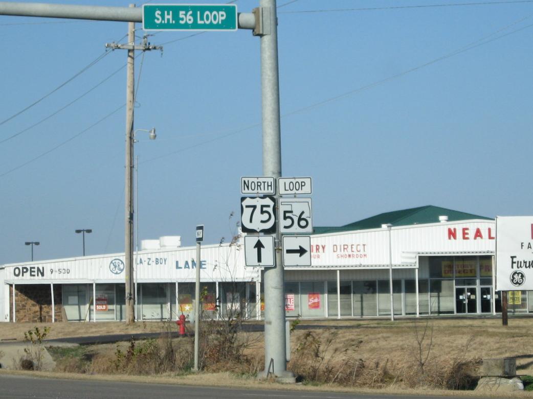
 Loop 56 at its intersection with US-75
- SH-56 Loop is a bypass route around the northeast quadrant of Okmulgee, running from US-75 east and south to US-62. in Okmulgee from US-75 , east and south to US-62. Although it shares its number with SH-56, it does not intersect its parent route. The highway provides access to OSU-Okmulgee. SH-56 Loop is 3.7 miles (6.0 km) long.[8] It was established on May 7, 1962.[1]
References
- ^ a b c d e f g Oklahoma Department of Transportation. "Memorial Dedication and Revision History, SH 56". http://www.okladot.state.ok.us/memorial/legal/sh56.htm. Retrieved 2010-05-01.
- ^ a b c Stuve, Eric. "OK-56". OKHighways. http://www.okhighways.com/ok56.html. Retrieved 2010-04-30.
- ^ a b c Oklahoma Department of Transportation. Official State Map (Map) (2009–10 ed.). http://www.odot.org/hqdiv/p-r-div/maps/state-maps/2009state/pdfs/state-map.pdf. Retrieved 2010-04-30.
- ^ a b DeLorme (2006). Oklahoma Atlas and Gazetteer (Map). 1:200,000.
- ^ Oklahoma State Highway Department. Map Showing Condition of Improvement of the State Highway System (Map) (March 1, 1930 ed.). http://www.okladot.state.ok.us/hqdiv/p-r-div/maps/state-maps/pdfs/1930.pdf. Retrieved 2010-05-01.
- ^ Oklahoma Department of Highways. Map Showing Condition of Improvement of the State Highway System (Map) (June 1932 ed.). http://www.odot.org/hqdiv/p-r-div/maps/state-maps/pdfs/1932.pdf. Retrieved 2010-05-01.
- ^ Oklahoma Department of Highways. Map Showing Condition of Improvement of the State Highway System (Map) (June 1944 ed.). http://www.odot.org/hqdiv/p-r-div/maps/state-maps/pdfs/1944.pdf. Retrieved 2010-05-01.
- ^ Oklahoma Department of Transportation. 2008 Control Section Maps – Okmulgee County (Map). http://www.odot.org/hqdiv/p-r-div/maps/control-maps/okmulgee.pdf. Retrieved 2010-04-30.
External links
Categories:- State highways in Oklahoma

Wikimedia Foundation. 2010.