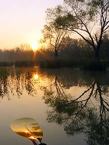
- Deep Fork National Wildlife Refuge
-
Coordinates: 35°35′00″N 95°58′00″W / 35.5833333°N 95.9666667°W
The Deep Fork National Wildlife Refuge is part of the United States system of National Wildlife Refuges. It is located in Eastern Oklahoma, near the city of Okmulgee and the Deep Fork River where the park gets its name.
The refuge was established in 1993 and contains over 9,000 acres (36 km²) of protected land. The park is subject to annual flooding which provides excellent habitat for waterfowl and other animals.
External links
Federal National Forests:National Wildlife Refuges:Deep Fork • Little River • Optima • Ozark Plateau • Salt Plains • Sequoyah • Tishomingo • Washita • Wichita MountainsState Adair • Alabaster Caverns • Arrowhead • Beaver Dunes • Beavers Bend Resort Park • Bernice • Black Mesa • Boggy Depot • Boiling Springs • Boswell Lake • Brushy Lake • Cherokee • Cherokee Landing • Clayton Lake • Crowder Lake • Disney/Little Blue • Dripping Springs • Fort Cobb • Foss • Gloss Mountain • Great Plains • Great Salt Plains • Greenleaf • Heavener Runestone • Hochatown • Honey Creek • Hugo Lake • Keystone • Lake Eucha • Lake Eufaula • Lake Murray • Lake Texoma • Lake Wister • Lake Thunderbird • Little Sahara • McGee Creek • Natural Falls • Okmulgee • Osage Hills • Quartz Mountain • Raymond Gary • Red Rock Canyon • Robbers Cave • Roman Nose • Sequoyah Bay • Sequoyah/Western Hills • Snowdale • Spavinaw • Talimena • Tenkiller • Twin Bridges • Wah-Sha-She • Walnut CreekCategories:- National Wildlife Refuges in Oklahoma
- Protected areas of Okmulgee County, Oklahoma
- Protected areas established in 1993
- Oklahoma geography stubs
- Southern United States protected area stubs
Wikimedia Foundation. 2010.

