- Knapton
-
Coordinates: 52°51′N 1°25′E / 52.85°N 1.42°E
Knapton 
Knapton Parish Church
 Knapton
Knapton shown within NorfolkArea 5.80 km2 (2.24 sq mi) Population 362 (2001 census) - Density 62 /km2 (160 /sq mi) OS grid reference TG305340 - London 134 miles (216 km) Parish Knapton District North Norfolk Shire county Norfolk Region East Country England Sovereign state United Kingdom Post town NORTH WALSHAM Postcode district NR28 Dialling code 01263 Police Norfolk Fire Norfolk Ambulance East of England EU Parliament East of England UK Parliament North Norfolk List of places: UK • England • Norfolk Knapton is a village and a civil parish in the English county of Norfolk.[1] The village is 8.9 miles (14.3 km) south-east of Cromer, 19.4 miles (31.2 km) north-east of Norwich and 134 miles (216 km) north-east of London. The village lies 3.5 miles (5.6 km) north-east of the A149 between Kings Lynn and Great Yarmouth. The nearest railway station is at North Walsham for the Bittern Line which runs between Sheringham, Cromer and Norwich. The nearest airport is Norwich International Airport.
Contents
History
Knapton is mentioned in the Domesday Book of 1086 where it is listed under the name ‘Kanapatone’.[2] The tenant in chief was William de Warenne[3] who was a Norman aristocrat who fought at the Battle of Hastings and became great landowners in England.
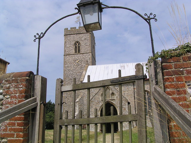
Saint Peter and Saint Paul Parish Church
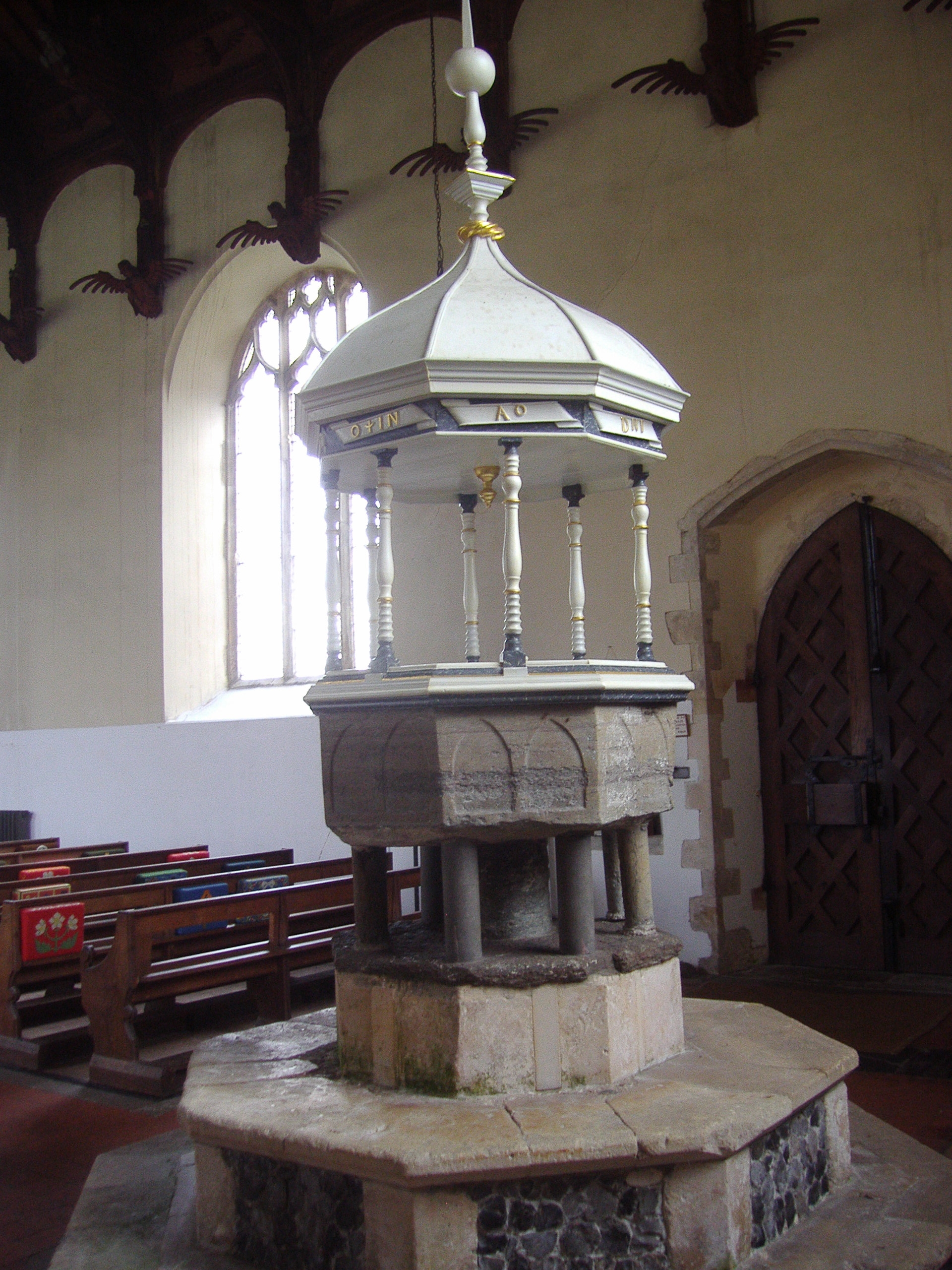
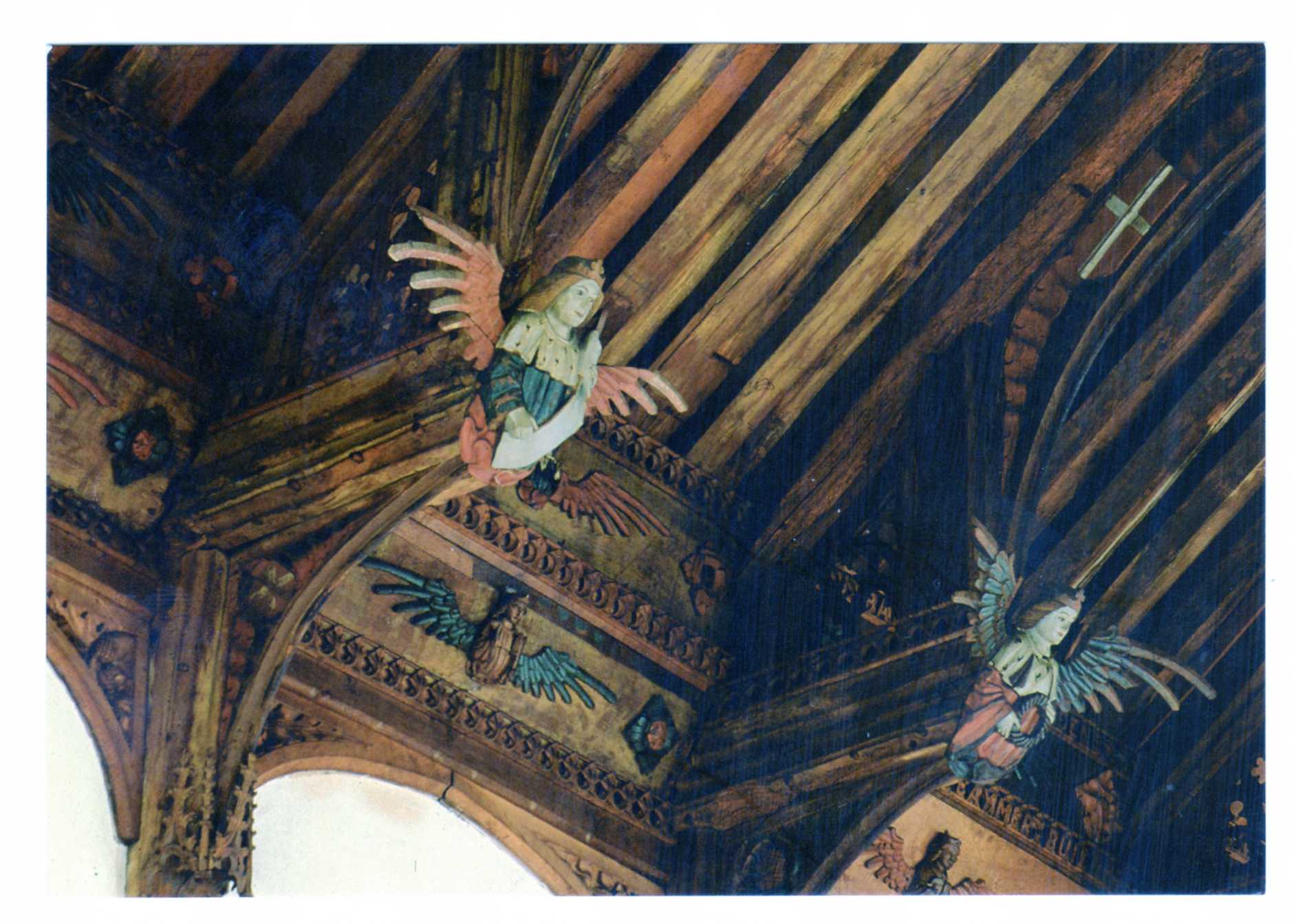
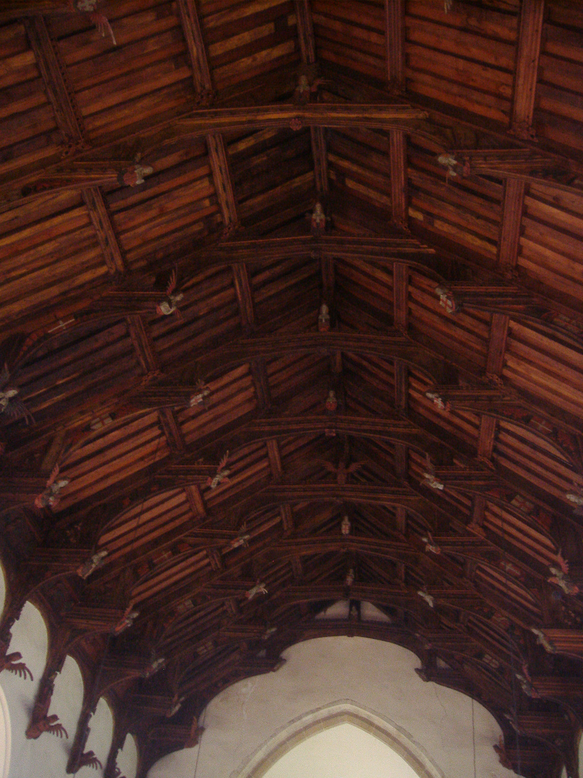
The present church dates from mainly the 14th century.[4] The tower is set into the north west corner of the building. The porch is on the southern elevation. Atop of the church there is a weathervane designed by J.S. Cotman[5] an artist famed as a member of the Norwich school. Inside there is a 13th-century font on three high steps which has a Purbeck marble bowl and a cover over which dates from 1704. The inscription which is in Greek reads “wash my sins and not my face only”[5] The inscription is a palindrome, reading the same backwards as forwards.. At the back of the church behind the font there are some coffin-lids[5] from the earlier church set into the flags of the floor. The most prominent feature of this church is the roof. The roof was given to the church by a John Smithe in 1504. It is of a double hammerbeam[4] construction and still retains its original colour. The beams and spandrels are richly carved with three tiers of angels which have outspread wings. More angels are carved on the kingposts and on the wall plate. In niches below the wall supports there are figures with scrolls, shields, symbols or playing musical instruments. The church is a Grade I listed building [1].
Church Gallery
-
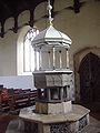
The covered Font
-
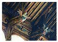
Some of the carved angels
-

The double hammerbeam roof
References
- ^ Ordnance Survey, Explorer Sheet 252, Norfolk Coast East, ISBN 9780319467268
- ^ The Domesday Book, Englands Heritage, Then and Now, Editor: Thomas Hinde,Norfolk page 191 ISBN 1858334403
- ^ William the Conqueror by David C Douglas, 1964, ISBN 0300078846
- ^ a b Norfolk 1: Norwich and North-East, By Nikolaus Pevsner and Bill Wilson, Knapton entry. ISBN 0-300-09607-0
- ^ a b c The King’s England, Norfolk, by Arthur Mee, Page 152 ISBN 0 340 15061 0
Links
External links
 Media related to Knapton at Wikimedia CommonsCategories:
- Villages in Norfolk
- Civil parishes in Norfolk
-

Wikimedia Foundation. 2010.