- Corpusty
-
Coordinates: 52°49′00″N 1°01′00″E / 52.8167°N 1.0167°E
Corpusty 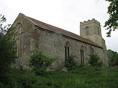
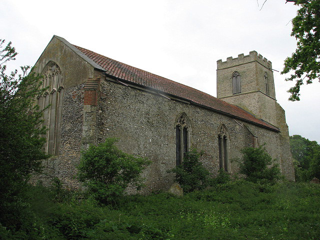
St Peter's Church, Corpusty
 Corpusty
Corpusty shown within NorfolkArea 12.73 km2 (4.92 sq mi) Population 637 (2001 census[1]) - Density 50 /km2 (130 /sq mi) OS grid reference TG114293 Parish Corpusty District North Norfolk Shire county Norfolk Region East Country England Sovereign state United Kingdom Post town NORWICH Postcode district NR11 Police Norfolk Fire Norfolk Ambulance East of England EU Parliament East of England List of places: UK • England • Norfolk Corpusty is a village and civil parish in North Norfolk, Norfolk in eastern England. Corpusty and its twin village Saxthorpe are situated either side of the river Bure which starts at Melton Constable and flows on to Yarmouth. Corpusty is about sixteen miles from Norwich and six miles (10 km) from Holt, Aylsham, and Reepham. According to Ekwall's place names, Corpusty given as Korpr's stye ( Korpr meaning raven, stye meaning way).
Corpusty's small church (Church of Saint Peter) stands alone on the outskirts of the village and can be seen for miles around. There are different views as to why the church is so far out of the village, some argue it is due to the black death in 1349 which killed so many people. The church is no longer open for worship and is now in the care of Friends of Friendless Churches [1]. The church has a page, with pictures, on Simon Knott's site. [2]
Corpusty County Primary School is highly thought after in 2006 it enrolled 88 pupils achieving 101.0 value added with the national at 99.8
Corpusty once had four pubs: The Wheatsheaf, The Horse shoes, The Castle and The Dukes Head the last pub still open. It overlooks the village green and has recently been refurbished.
Corpusty and Saxthopre Bonfire is held every year at Bonfire Night. A life size guy is made and pulled around the village with a procession on a cart. As the guy is taken to the bonfire it is followed by people dressed up carrying flaming torches. The guy is lifted on to top of the bonfire when the guy is alight the fireworks display begins. The event is very popular and although it is free, donations collected go towards next year's event and local charities such as coal for pensioners.
The village has a watermill and used to also have three post windmills. The first known record of a windmill in Corpusty was in a deed dated 1671, where a windmill was referred to as being in Saxthorpe. A watermill here is mentioned in the Domesday Book, recording that there was one here already at the time of the Norman invasion. Information on all the mills can be found on the Norfolk Mills website - www.norfolkmills.co.uk.
More on the history of Corpusty and Saxthorpe can be found in the book The Heritage of Corpusty And Saxthorpe by Janet Wilson
Notes
- ^ Census population and household counts for unparished urban areas and all parishes. Office for National Statistics & Norfolk County Council (2001). Retrieved 20 June 2009.
External links
 Media related to Corpusty at Wikimedia CommonsCategories:
- Villages in Norfolk
- Civil parishes in Norfolk
- Norfolk geography stubs

Wikimedia Foundation. 2010.