- Norwich International Airport
-
This article is about the civil airport. For the military base, see RAF Horsham St Faith.
Norwich International Airport 
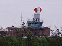
The control tower at Norwich International Airport IATA: NWI – ICAO: EGSH Summary Airport type Public Owner Omniport (80.1%)
Norfolk County Council
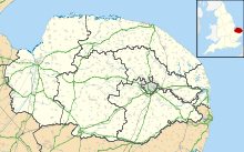
Norwich City CouncilOperator Norwich Airport Limited Serves Norwich Location Norwich, Norfolk Elevation AMSL 117 ft / 36 m Coordinates 52°40′33″N 001°16′58″E / 52.67583°N 1.28278°ECoordinates: 52°40′33″N 001°16′58″E / 52.67583°N 1.28278°E Website Map Location in Norfolk Runways Direction Length Surface m ft 09/27 1,841 6,040 Asphalt/concrete Statistics Passengers 2008/2009 430,594  26.1%
26.1%Passengers 2009/2010 425,821  1.1%
1.1%Sources: UK AIP at NATS[1]
Statistics from the UK Civil Aviation Authority[2]Norwich International Airport (IATA: NWI, ICAO: EGSH), also known as Norwich Airport, is an airport in the City of Norwich within Norfolk, England 2.8 NM (5.2 km; 3.2 mi) north of the city centre and on the edge of the city's suburbs.
Along with a long history of flights to Amsterdam Airport Schiphol via KLM Cityhopper (formerly KLM UK), it offers flights to various destinations in the United Kingdom and Europe. Besides the commercial flights, charter operators also operate out of Norwich. Bristow Helicopters flies crews to North Sea gas rigs and Skydrift Air Charter, Sterling Helicopters and SaxonAir Charter operate executive, private aircraft and helicopter charter flights. Aerial photography company Sky-Art.co.uk also operates from Norwich.
Norwich Airport has a CAA Public Use Aerodrome Licence (Number P723) that allows flights for the public transport of passengers or for flying instruction.
Contents
Ground services
Bus
Norse Operates a Park and Ride service a 2 minute walk from the airport direct to Norwich city centre on Monday – Saturday every 10 – 15 minutes.
On Sunday and public holidays First Buses operate service 27 directly outside the terminal building to Norwich city centre via Anglia square. Although airport Park and Ride bus services run nearby the airport they do not stop directly outside the airport, but are in easy walking distance of the airport.
Road
Norwich airport is situated on the A140, which travels from Ipswich via Norwich to the seaside town of Cromer; this also provides easy road access to Norwich city centre.
Future Road Links: There are plans for the Norwich Northern Distributor road to link the airport to the A47, stopping people using the congested ring road, and providing faster and better connections to other parts of the county and country.
Rail
Norwich airport does not have a railway station; the nearest railway station is Norwich Railway Station on the other side of the city.
Taxi
Taxis are available directly outside the terminal building
Facilities
The airport has one runway (designated 09/27), 1,841 m (6,040 ft) in length. A smaller 1,285 m (4,216 ft) runway (designated 04/22) was closed in 2006, and is now used as a taxiway. The airport has nine parking stands for commercial aircraft.
Airlines and destinations
Airlines Destinations Air Malta Seasonal: Malta BH Air Seasonal: Bourgas BMI Regional Aberdeen Eastern Airways Aberdeen Flybe Edinburgh, Manchester
Seasonal: Guernsey, JerseyKLM operated by KLM Cityhopper Amsterdam Thomas Cook Airlines Seasonal: Antalya, Dalaman, Enfidha, Monastir, Palma de Mallorca Thomson Airways Seasonal: Alicante, Corfu, Ibiza, Palma de Mallorca, Tenerife-South[3] Based operators
- Bond Helicopters[4]
- Bristow Helicopters[5]
- Centerline Aerospace[6]
- CHC Helicopters[7]
- KLM[8]
- Eastern Airways
- Flybe
- NHV[9]
- SaxonAir Charter & SaxonAir Flight Support
- East Anglian Air Ambulance[10]
- Norfolk Constabulary Air Operations Unit[11]
- Skydrift Air Charter
Statistics
10 Busiest Routes to and from Norwich Airport (2009) Rank Airport Passengers handled % Change
2008 / 09Airlines 1  Netherlands – Amsterdam
120,914  13
13KLM Cityhopper 2  United Kingdom – Aberdeen
60,852  7
7BMI Regional, Eastern Airways 3  United Kingdom – Edinburgh
50,365  14
14Flybe 4  United Kingdom – Manchester
34,438  20
20Flybe 5  Spain – Palma de Mallorca
14,102  45
45Thomas Cook, Thomson 6  Greece – Corfu
10,976  21
21Thomson 7  United Kingdom – Exeter
8,992  17
178  Spain – Mahon
8,679  4
4Thomson 9  Turkey – Dalaman
8,267  18
18Thomas Cook, Thomson 10  Malta – Malta
7,777  30%
30%Air Malta Source: UK Civil Aviation Authority [5] As of 2010 Norwich airport is 28th busiest airport in the UK.[2]
History
The first Norwich airport was set up on a former First World War aerodrome on Mousehold Heath under what is now the Heartsease housing estate. This fell into disuse in the early part of the Second World War.
RAF Horsham St Faith
Main article: RAF Horsham St FaithThe current site, formerly known as Royal Air Force Station Horsham St Faith, or more commonly RAF Horsham St Faith, was first developed in 1939 and officially opened on 1 June 1940 as a bomber station.
In September 1942 Horsham St. Faith was made available to the United States Army Air Forces for use by the Eighth Air Force. The USAAF designated the airfield as Station 123 (HF).
The airfield was transferred to RAF Fighter Command on 10 July 1945 when it was occupied by four Gloster Meteor Squadrons. RAF Horsham St. Faith was a front-line RAF station for many years, and its squadrons participated in many post-war exercises. The station was deactivated on 1 August 1963.
Civil airport
The Royal Air Force left Horsham on 24 March 1967. Over the following two years the major part of the airfield and buildings were sold to Norwich City and Norfolk County Council, a small part being retained by the Ministry of Defence (MoD). Norwich Airport Ltd under ownership of the County and City Councils developed the modern day Norwich International Airport.
Most of the World War II buildings used by the United States Army Air Force remain, although converted for a variety of purposes. Three of the five large pre-war hangars are still being used for aircraft maintenance. Two have been converted for commercial use. The control tower still exists although the top has been restored and a new tower has been built adjacent to the present main runway. Other wartime buildings now form part of the airport industrial estate (owned by the County and City Councils) and are intermingled with many newer structures.
The former RAF accommodation blocks situated towards Old Catton were until 1993 used by the University of East Anglia as accommodation for students, known to students as "Fifers Lane" halls these have since been demolished and the site redeveloped as housing. The remaining MoD property, formerly enlisted men's quarters, has become married quarters for nearby RAF stations.
Whilst most runways and taxi-tracks from the military airfield remain, only one runway is primarily used, east–west runway 09/27, which was extended eastwards by the RAF in 1956, to avoid takeoffs and landings over built-up areas. The old 04/22 runway is no longer used for takeoffs or landings, but is used for parking and taxiing of larger aircraft.
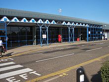
Adjacent to the airport terminal building opened in 1988 there is a memorial display relating to the USAAF, consisting of photographs, paintings, and a plaque commemorating the American use of the airfield.
In March 2004, the City and County Councils sold 80.1% of Norwich Airport Ltd to Omniport[12] whilst retaining the further 19.9%. Omniport has also acquired 100% of Norwich Airport Travel Ltd. Since the sale to Omniport the airport has become one of the UK hubs for budget carrier Flybe and the number of flights and destinations served have rapidly increased. In 2005 a £3.5M terminal expansion programme began.
It was announced in April 2008 that Flybe was to reduce routes and frequencies from Norwich Airport. Glasgow was axed by May and Paris-Charles de Gaulle was being merged into a Norwich-Jersey-Charles de Gaulle service, making it an indirect service. Guernsey is having its frequency dropped to one Saturday flight.
On 5 July 2008, LTE International Airways started scheduled flights to Alicante, Barcelona and Palma de Mallorca for the summer 2008 season and in addition to these routes from winter 2008/2009 they had announced new routes to Malaga, Tenerife and Gran Canaria, however due to financial difficulties with the airline, LTE services (including all from Norwich) are suspended until further notice.
During filming of the BBC show Top Gear, operations from the airport appeared disrupted when a caravan, adapted into an airship and flown by James May, drifted overhead the airport, infringing its controlled airspace. In reality, the event occurred after much pre-planning with the airport authorities and the BBC, and scenes showing the airship in the airfield boundary were actually filmed after the blimp had lifted from the airfield to satisfy the requirements of the film crew.[13]
Controversy
Advertising for 'fake' passengers
During 2008 Flybe advertised for actors to fly for free to Dublin from the airport to avoid a £280,000 fine. It was projected to be 172 passengers short of the required minimum 15,000 passengers and advertised 200 free flights to make up the numbers. They said they would carbon offset the flights.[14] Plane Stupid asked why airports require minimum passenger levels in the first place.[15]
Notes
- ^ Norwich – EGSH
- ^ a b UK Airport Statistics: 2009 – annual
- ^ http://flights.firstchoice.co.uk/firstchoice/en-GB/timetable/findbyroute?departure=TFS&destination=NWI
- ^ [1]
- ^ Bristow Helicopters
- ^ [2]
- ^ [3]
- ^ KLM Royal Dutch Airlines
- ^ [4]
- ^ East Anglian Air Ambulance
- ^ Norfolk Constabulary Air Operations Unit
- ^ Omniport Website
- ^ http://www.edp24.co.uk/content/edp24/news/video/story.aspx?brand=EDPOnline&category=Video&itemid=NOED05%20Oct%202009%2015%3A02%3A41%3A300&tBrand=EDPOnline&tCategory=Video
- ^ "Airline sought actors for flights". BBC News. 30 March 2008. http://news.bbc.co.uk/1/hi/england/norfolk/7321306.stm. Retrieved 2009-07-19.
- ^ "Flybe, Norwich City Council and the tale of the fake passengers". Plane Stupid. http://www.planestupid.com/blogs/2008/03/31/flybe-norwich-city-council-and-tale-fake-passengers. Retrieved 2009-07-19.
References
- Freeman, Roger A. (1978) Airfields of the Eighth: Then and Now. After the Battle ISBN 0-900913-09-6
- Maurer, Maurer (1983). Air Force Combat Units Of World War II. Maxwell AFB, Alabama: Office of Air Force History. ISBN 0-89201-092-4.
- USAAS-USAAC-USAAF-USAF Aircraft Serial Numbers—1908 to present
- www.controltowers.co.uk Horsham St Faith
External links
- Official website
- RAF Bomber Command History of Horsham St Faith
- 458th Bombardment Group website
- City of Norwich Aviation Museum website
 Airports in the United Kingdom and the Crown Dependencies
England Birmingham · Blackpool · Bournemouth · Bristol · Doncaster-Sheffield · Durham Tees Valley · East Midlands · Exeter · Humberside · Leeds-Bradford · Liverpool · London City · London-Gatwick · London Heathrow · London Luton · London Southend · London Stansted · Manchester · Newcastle · Newquay · Norwich · Plymouth · Southampton
Biggin Hill • Cambridge • Gloucestershire • Kent • Land's End • Oxford • Lydd • Penzance • St Mary's • TrescoScotland Aberdeen · Edinburgh · Glasgow International · Glasgow Prestwick · Inverness
Barra • Benbecula • Campbeltown • Dundee • Eday • Fair Isle • Islay • Kirkwall • Lerwick • North Ronaldsay • Oban • Papa Westray • Sanday • Scatsta • Stornoway • Stronsay • Sumburgh • Tiree • Westray • WickWales Northern Ireland Crown Dependencies Alderney · Guernsey · Isle of Man · Jersey
Smaller font-size indicates airports handling domestic, charter or private services only. Categories:- Airports in the East of England
- Airports established in 1940
- Norwich
- Transport in Norfolk
Wikimedia Foundation. 2010.


