- Hel Peninsula
-
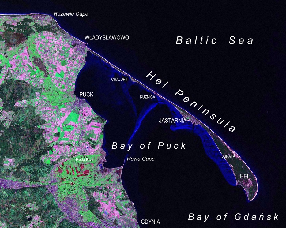
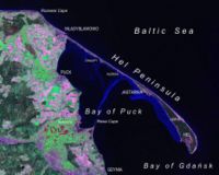 Hel Peninsula as seen from Landsat satellite in 2000.
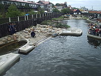
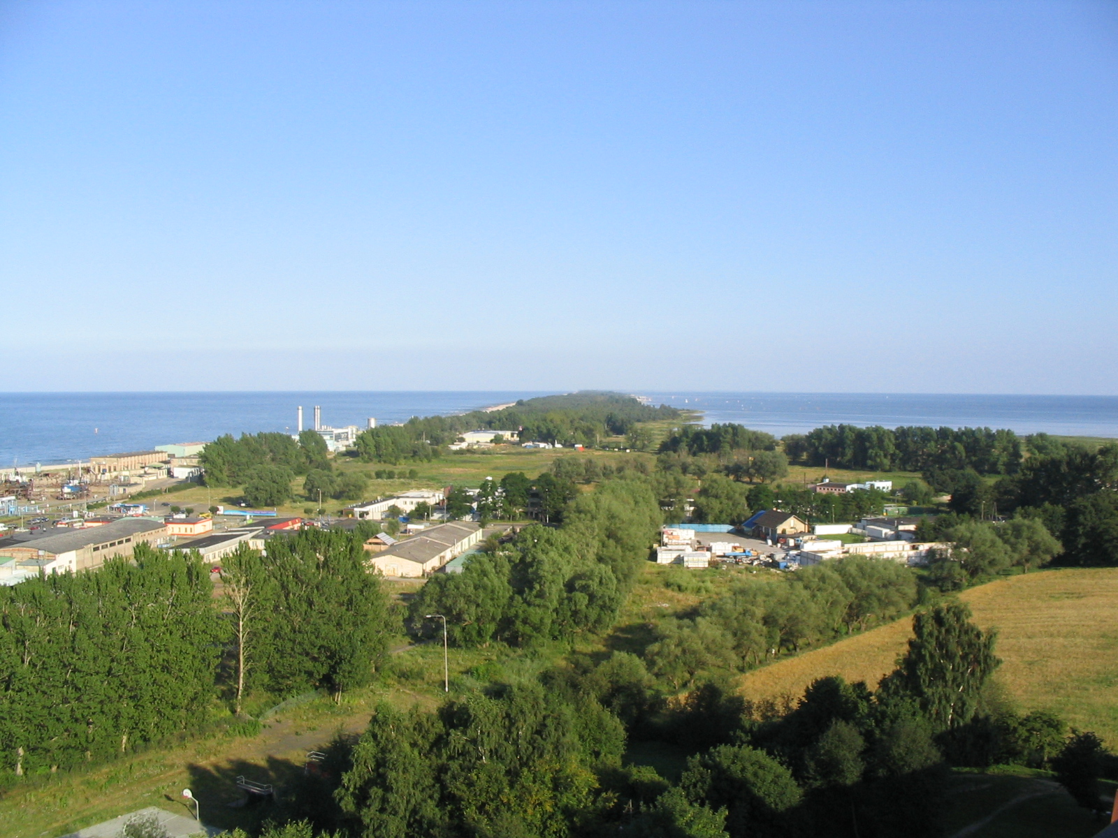
 Hel Peninsula as seen from the tallest building in Władysławowo
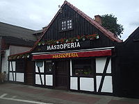 Wooden house from circa 1850, now a restaurant
Hel Peninsula (
 listen (help·info); Polish: Mierzeja Helska, Półwysep Helski; Kashubian: Hélskô Sztremlëzna; German: Halbinsel Hela or Putziger Nehrung) is a 35-km-long sand bar peninsula in northern Poland separating the Bay of Puck from the open Baltic Sea. It is located in Puck County of the Pomeranian Voivodeship.
Contents
Geography
The width of the peninsula varies from approximately 300 m. near Jurata, through 100 m in the most narrow part to over 3 km at the tip. Since the peninsula was formed entirely of sand, it is frequently turned into an island by winter storms. Until the 17th century the peninsula was a chain of islands that formed a strip of land only during the summer.
A road and a railroad run along the peninsula from the mainland to the town located at the furthest point, Hel, a popular tourist destination. Other towns, ports, and tourist resorts are Jurata, Jastarnia, Kuźnica, Chałupy, and Władysławowo.
Military importance
After the peninsula became part of the Second Polish Republic after World War I, it acquired considerable military significance, and was turned into a fortified region, with a garrison of about 3,000. In the course of the Battle of Hel in 1939, Polish forces dynamited the peninsula at one point, turning it into an island.
During the years of German occupation (1939–1945), Hel's defenses were further expanded, and a battery of three 40.6 cm SK C/34 gun was constructed, though the guns were soon moved to the Atlantic Wall in occupied France. The peninsula remained in German hands until the end of World War II, when the defending forces surrendered on May 10, 1945.
After the war Hel continued to have military significance, with much of its area reserved for military use. Additional gun batteries were built during the 1940s and 1950s. Today many of the fortifications and batteries are open to tourists, though some areas of the peninsula still belong to the Polish Armed Forces.
Cultural references
During an episode of the cartoon Metalocalypse, members of the band Dethklok perform a concert near the Hel Peninsula, the episode states they play the concert "near Danzig."
See also
- Hel Fortified Area
- Westerplatte
- Hel lighthouse
- German guns on the Peninsula Hel
References
Coordinates: 54°38′30″N 18°46′53″E / 54.64167°N 18.78139°E
Geography of Pomerania Regions CurrentVorpommern (Western or Hither Pomerania) · Zachodniopomorskie · Pomerelia (Kashubia) · Pomerania euroregionAdministration Towns ListsList of towns in Vorpommern · List of towns in Farther Pomerania · Pomeranian cities, towns and villages · List of placenames in the Province of Pomerania (A-H · I-P · Q-Z)Largest>100,000>50,000Islands Peninsulae Rivers Lakes Bays, lagoons National parks Places on the Baltic coast of Poland Świnoujście • Uznam • Międzyzdroje • Wolin • Wolin National Park • Grodno • Międzywodzie • Dziwnów • Dziwnówek • Łukęcin • Pobierowo • Pustkowo • Trzęsacz • Rewal • Niechorze • Pogorzelica • Mrzeżyno • Rogowo • Dźwirzyno • Grzybowo • Kołobrzeg • Sianożęty • Ustronie Morskie • Pleśna • Gąski • Sarbinowo • Chłopy • Mielno • Unieście • Łazy • Dąbkowice • Dąbki • Bobolin • Żukowo Morskie • Darłowo • Darłówko • Wicie • Jarosławiec • Wicko Morskie • Modlinek • Ustka • Orzechowo • Poddąbie • Dębina • Rowy • Rówek • Czołpino • Słowiński National Park • Łeba • Osetnik • Lubiatowo • Białogóra • Dębki • Władysławowo (includes Karwia, Ostrowo, Jastrzębia Góra, Cape Rozewie, Cetniewo, Chłapowo, Chałupy) • Jastarnia (includes Kuźnica, Jurata) • Hel • Hel Peninsula • Coastal Landscape Park • Swarzewo • Puck • Bay of Puck • Błądzikowo • Rzucewo • Osłonino • Rewa • Mechelinki • Gdynia • Sopot • Gdańsk • Bay of Gdańsk • Mikoszewo • Jantar • Stegna • Sztutowo • Kąty Rybackie • Skowronki • Krynica Morska • Vistula Spit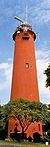 Categories:
- Landforms of Poland
- Peninsulas of Poland
- Baltic Sea
- Spits


Wikimedia Foundation. 2010.