- Świnoujście
Infobox Settlement
name = Świnoujście

imagesize = 250px
image_caption = Night view

image_shield = POL Świnoujście COA 1.svg
pushpin_
pushpin_label_position = bottom
subdivision_type = Country
subdivision_name = POL
subdivision_type1 = Voivodeship
subdivision_name1 = West Pomeranian
subdivision_type2 = County
subdivision_name2 = "city county"
leader_title = Mayor
leader_name = Janusz Żmurkiewicz
established_title = Established
established_date =12th century
established_title3 = Town rights
established_date3 = 1765
area_total_km2 = 197.23
population_as_of = 2006
population_total = 40899
population_density_km2 = auto
timezone = CET
utc_offset = +1
timezone_DST = CEST
utc_offset_DST = +2
latd = 53 | latm = 55 | lats = | latNS = N | longd = 14 | longm = 15 | longs = | longEW = E
elevation_m = 5
postal_code_type = Postal code
postal_code = 72-600 to 72-612
area_code = +48 091
blank_name = Car plates
blank_info = ZSW
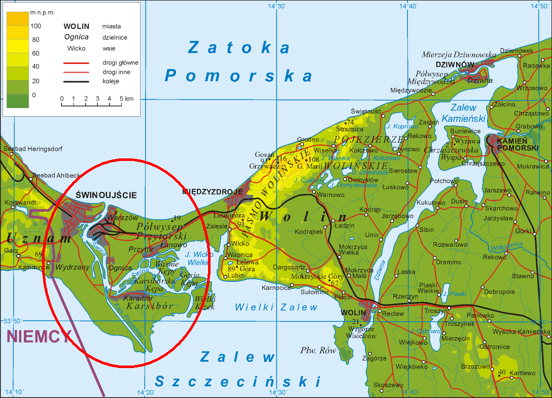
website = http://www.swinoujscie.pl/ Świnoujście Audio-IPA-pl|Pl-Świnoujście.ogg|ś|f|i|n|o|'|u|j|ś|ć|e ( _de. Swinemünde) is acity and seaport on theBaltic Sea andSzczecin Lagoon , located in the extreme north-west ofPoland . It is situated mainly on the islands ofUsedom andWolin , but also occupies smaller islands, of which the largest is Karsibór island, once part of Usedom, now separated by acanal dug in the late 19th century to facilitate ship access toStettin (Szczecin ).Since 1999 Świnoujście has been a city with the administrative rights of a county (
powiat ) ( _pl. miasto na prawach powiatu), withinWest Pomeranian Voivodeship . It was previously part ofSzczecin Voivodeship (1975–1998). The city lies in the geographic region ofPomerania and had a population of 41,100 in 2006.History
The river
Świna ( _de. Swine) was formerly flanked by the fishing villages of Westswine and Ostswine. Towards the beginning of the 17th century it was made navigable for large ships, and Swinemünde, which was founded on the site of Westswine in 1748, was fortified and receivedtown privileges from KingFrederick II of Prussia in 1765. It served as the outer port of Stettin (Szczecin) and was administered within theProvince of Pomerania . Swinemünde became part of theGerman Empire after theKingdom of Prussia completed theunification of Germany in 1871.The town had broad unpaved streets and one-story houses built in the Dutch style, which gave it an almost rustic appearance, although its industries, beyond some fishing, were entirely connected with its shipping. The river mouth, which was the entrance to the harbor, and which was regarded as the best on the Prussian Baltic coast, was then protected by two curving long breakwaters, and was strongly fortified. On the island of Wollin, on the other side of the narrow Swine, a great lighthouse was erected. In 1897 the canal of the Kaiserfahrt was opened to navigation, and this waterway between the Stettin harbour and the Baltic Sea was deepened between 1900–01. From then on Stettin could be reached directly by ships, and Swinemünde's importance diminished somewhat.
On
March 12 ,1945 duringWorld War II , Swinemünde suffered heavy destruction by USAAF bombing. At least 23,000 civilians died, mainly refugees fleeing from East Prussia and from surrounding areas. The uncomplete German aircraft carrier Graf Zeppelin was scuttled in the harbor to save it from the advancing Russians. The city was placed under Polish administration in 1945 after the war ended and officially renamed Świnoujście. Its German population was expelled and replaced withPoles , themselves refugees fromPolish areas annexed by the Soviet Union . In Winter 1945 former victims of German concentration camps and repressions during the war, now members of Polish Security Forces, acted in revenge against local Germans and killed 40 Civilians. They were later sentenced for robbery by a Polish court [http://www.gazetawyborcza.pl/1,86871,4849528.html] TheRed Army occupied part of the city until 1957 and the navy harbour until c. 1990.Population
* 1900: 10,300
* 1925: 18,200
* 1938: 30,100
* 1947: 5,800
* 1960: 17,000
* 1970: 28,100
* 1975: 42,400
* 1980: 47,100
* 1990: 43,300
* 1995: 43,361
* 2003: 41,188
* 2004: 41,098
* 2005: 40,993
* 2006: 41,100Source:
*1900, 1925, 1938, 1947: Fact|date=July 2007
*1960, 1970, 1975, 1980: ["Rocznik Statystyczny 1981", Główny Urząd Statystyczny, Warszawa 1981.]
*1990: Fact|date=July 2007
*1995, 2003, 2004, 2005: [Official website of Świnoujście: "O mieście" -> "Świnoujście w liczbach", [http://www.swinoujscie.pl/122/] pl icon]
*2006: Polish Wikipedia,Infrastructure
Transport
The town is located on both banks of the river Świna, and since there is no road connection across it, transport is provided by regular ferries. Under current plans, a tunnel will be built under the river some time before 2013.
Świnoujście has the largest and most modern
ferry terminal in Poland, with regular connections toDenmark andSweden . The city lies at the northern terminus of Polish National Route 3 (DK3, in the future express road S3), which is in turn part of theEuropean route E65 running across Europe from Sweden toGreece . Świnoujście has four railway stations on the eastern bank of the river Świna, on Wolin island, with regular regional connections to Szczecin and long-distance connections to other cities in Poland.Land border controls were abolished
21 December 2007 , and free automobile traffic to and from Germany was allowed for the first time since1945 , as Poland implemented theSchengen Agreement . As from September 20th 2008 the city will gain a railway connection to its western portion as well, when the railway line to Ahlbeck is extended eastward to Świnoujście, ("Swinemünde Central") giving it a direct link to the German railway network. The nearest airport at Heringsdorf in Germany, 13 km west of Świnoujście, will likely become more important for travelling to the city, if it ever acquires year-round scheduled passenger connections; it currently has a number of summer connections to German cities only. The nearest airport with year-round traffic is theSzczecin-Goleniów "Solidarność" Airport , 80 km southeast in Poland.Tourist attractions
* The former
town hall houses the Museum of Deep Sea Fishing. Exhibits include the history of sea fishing, sea animals, the town and its region, and old navigation equipment.
* The Angel's Fort, built from 1845-1858, is a replica ofHadrian 's Mausoleum (Castel Sant'Angelo inRome ).
* Concerts and art exhibitions are held at the Western Fort. Built between 1843-1863, it has been modernized a few times in the past. From afterWorld War II until 1962 it was a headquarters of theRed Army .
* The 18th Christ the King Church in the centre of the town was erected on the site of a Gothic temple. A wooden ship replica is in the mainnave . Organ concerts are presented during the summer.
* The neo-Gothic church of the Holy Mother "Stella Maris" has stained glass windows of great artistic value. It was erected at the end of 19th century.
* The "well" is a preserved tower of a Protestant church damaged during World War II and demolished afterwards.
* A shelter built in 1942 has the exposition "The town yesterday and now", presenting pictures of the town's history and other exhibits.
* The "stawa Młyny" is a navigation beacon built in the form of awindmill on the 19th century breakwater.
* Thelighthouse , built in 1858, is at 68 m the highest lighthouse on theBaltic sea .
* The Eastern Fort, or Gerhard's Fort, is one of three preserved forts from the 19th century. An exhibition inside the building presents the history of the town's forts, as well as objects found there.
* The district ofKarsibór contains an Evangelicalcemetery established in the first half of 19th century.
* The Gothic church from the 15th century contains an altar from the 15th century and a pulpit from the 17th century.
* A monument honours the memory ofRoyal Air Force pilots shot down while raiding harbour targets in April 1945.
*Karsiborska Kępa , an island near the town, contains abird sanctuary with approximately 140 species.Districts of Świnoujście
*
Przytór
* Karsibór
*Wydrzany
*Łunowo
*Ognica Professional teams:
* Flota Swinoujscie - plays in the second division of the Polish football league,
Polish First League Notable residents
*
Alfred Ploetz (1860–1940)
*Elsa von Freytag-Loringhoven (1874–1927), artist
*Hans-Werner Grosse (* 1922), pilotCities and towns near Świnoujście
*
Szczecin (Poland )
*Międzyzdroje (Poland )
*Kamień Pomorski (Poland )
*Nowe Warpno (Poland )
*Ueckermünde (Germany )
*Ahlbeck (Germany )ee also
*
Dreikaiserbäder (Ahlbeck , Heringsdorf, andBansin )
*Ports of the Baltic Sea References
External links
* [http://www.swinoujscie.pl/?lang=en Official website of Świnoujście] en icon pl icon de icon
* [http://erwin-rosenthal.de/swinemuende1/ Swinemünde - Baltic Coastal Resort and Port on the Island of Usedom] en icon pl icon de icon
* [http://www.oldstratforduponavon.com/swinoujscie A Few Views of Swinoujscie in Old Postcards]


Wikimedia Foundation. 2010.