- North Cronulla Beach
-
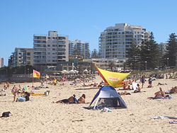
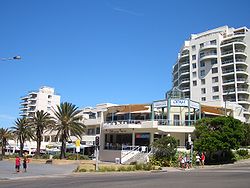
North Cronulla Beach or North Cronulla is a patrolled beach on Bate Bay, in Cronulla, New South Wales, Australia. [1] The Wall is the local name given to the area between North Cronulla Beach and Eleoura. The Alley is the local name given to the area between North Cronulla Beach and Cronulla Beach.
Contents
North Cronulla Surf Life Saving Club
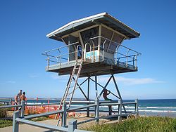
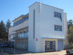
The North Cronulla Surf Life Saving Club [2] was established by a group of local residents who were concerned about the safety of visitors to the beach. The first patrol of the beach was in 1925, using the reel, line and belt as their only form of rescue equipment. The first clubhouse, which opened in 1926, was a small weatherboard building on the beach, at the end of The Kingsway.
Wave action forced club members to move the clubhouse from the beach into Dunningham Park in 1932. The rock pools between Cronulla and North Cronulla were built and opened the same year. A new, three storey cement rendered clubhouse was opened in 1937, said to be the finest in Australia. The Army’s beach fortifications during World War II affected the seawall foundations and the clubhouse had to be demolished after heavy seas in 1946.
In 1950, North Cronulla lost one of its greatest swimming champions, Club Captain Major James 'Jim' Peryman who was attempting to rescue a 16 year old woman from the surf when he was pulled under by the weight of seaweed on his rescue line. The woman was pulled the safety by another club member but Peryman, who was reeled to shore, could not be revived. A new clubhouse opened later that year and a pool later added to the surf club complex was named after Peryman.
In 75 years, North Cronulla members conducted more than 11,000 rescues. Today, North Cronulla has approximately 500 senior and 250 junior members.
History
Cronulla is derived from an Aboriginal word kurranulla, meaning 'place of pink seashells'.
North Cronulla Gallery
See also
References
Beaches of the Cronulla region Boat Harbour · Wanda Beach · Elouera Beach · North Cronulla Beach · Cronulla Beach · Blackwoods Beach · Shelly Beach · Oak ParkSuburbs and localities within the Sutherland Shire · Southern Sydney · Sydney Suburbs Alfords Point · Bangor · Barden Ridge · Bundeena · Bonnet Bay · Burraneer · Caringbah · Caringbah South · Como · Cronulla · Dolans Bay · Engadine · Grays Point · Gymea · Gymea Bay · Heathcote · Illawong · Jannali · Kangaroo Point · Kareela · Kirrawee · Kurnell · Lilli Pilli · Loftus · Lucas Heights · Maianbar · Menai · Miranda · Oyster Bay · Port Hacking · Sandy Point · Sutherland · Sylvania · Sylvania Waters · Taren Point · Waterfall · Woolooware · Woronora · Woronora Heights · Yarrawarrah · Yowie BayLocalities Audley · Bate Bay · Caravan Head · Como West · Cronulla Beach · Cronulla sand dunes · Elouera Beach · Garie Beach · Gundamaian · Gunnamatta Bay · North Cronulla Beach · North Engadine · Royal National Park · Shelly Beach · Sylvania Heights · Towra Point · Wanda Beach · Warumbul · Wattamolla
Coordinates: 34°03′04″S 151°09′23″E / 34.0510°S 151.1564°E
Categories:- Geography of Sydney
- Beaches of New South Wales
- Surfing locations in New South Wales
- Sydney geography stubs
Wikimedia Foundation. 2010.


