- Dolans Bay, New South Wales
-
Dolans Bay
Sydney, New South Wales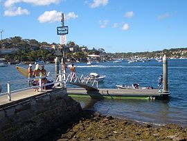
Wally’s Wharf, Dolans BayPopulation: 560 Postcode: 2229 Location: 26 km (16 mi) south of Sydney CBD LGA: Sutherland Shire State District: Cronulla Federal Division: Cook Suburbs around Dolans Bay: Caringbah Caringbah Woolooware Lilli Pilli Dolans Bay Burraneer Port Hacking Maianbar Bundeena Dolans Bay is a suburb in southern Sydney, in the state of New South Wales, Australia. Dolans Bay is located 26 kilometres south of the Sydney central business district, in the local government area of the Sutherland Shire.
Dolans Bay sits on the north shore of the Port Hacking estuary. The suburb is named after the small bay on the edge of Burraneer Bay. Houses overlook the bay and some line the water's edge together with boatsheds. Boats are moored in the bay, which provides protection from the southerly wind. Burraneer Bay features a private marina and slipway with full repair facilities.
Dolans Bay is surrounded by the suburbs of Caringbah, Lilli Pilli and Port Hacking. The suburb of Burraneer is located across Burraneer Bay. The villages of Maianbar and Bundeena are located on the opposite bank of Port Hacking.
Contents
History
Dolans Bay was named after a land owner in the area called Dominick Dolan. In 1858 Mary and Andrew Webster paid 108 pounds and 15 shillings plus a yearly peppercorn quit rent for their land in this area. The Websters sold their land to Dominick Dolan in 1863. [1]
Transport
The suburb can be accessed by Port Hacking Road or Saunders Bay Road, both of which lead to Lilli Pilli Point and Wally's Wharf.
References
- ^ The Book of Sydney Suburbs, Compiled by Frances Pollon, Angus & Robertson Publishers, 1990, Published in Australia ISBN 0-207-14495-8, page 51
External links
- Dolans Bay, New South Wales is at coordinates 34°03′45″S 151°07′35″E / 34.06259°S 151.12641°ECoordinates: 34°03′45″S 151°07′35″E / 34.06259°S 151.12641°E
Suburbs and localities within the Sutherland Shire · Southern Sydney · Sydney Suburbs Alfords Point · Bangor · Barden Ridge · Bundeena · Bonnet Bay · Burraneer · Caringbah · Caringbah South · Como · Cronulla · Dolans Bay · Engadine · Grays Point · Gymea · Gymea Bay · Heathcote · Illawong · Jannali · Kangaroo Point · Kareela · Kirrawee · Kurnell · Lilli Pilli · Loftus · Lucas Heights · Maianbar · Menai · Miranda · Oyster Bay · Port Hacking · Sandy Point · Sutherland · Sylvania · Sylvania Waters · Taren Point · Waterfall · Woolooware · Woronora · Woronora Heights · Yarrawarrah · Yowie BayLocalities Categories:- Suburbs of Sydney
- Bays of New South Wales

Wikimedia Foundation. 2010.