- Loftus, New South Wales
Infobox Australian Place | type = suburb
name = Loftus
city = Sydney
state = nsw
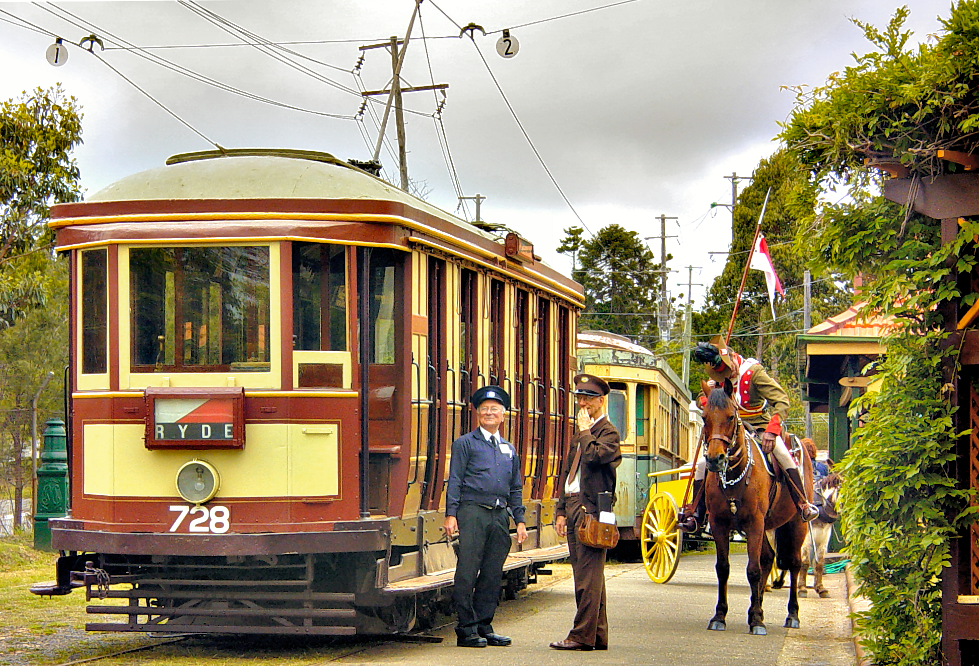
caption = Sydney Tramway Museum
lga =Sutherland Shire
postcode = 2232
pop =
area =
propval =
est =
stategov = Heathcote
fedgov = Hughes
near-nw = Woronora Heights
near-n = Woronora
near-ne = Sutherland
near-w = Lucas Heights
near-e = Kirrawee
near-sw = Engadine
near-s = Yarrawarrah
near-se = "The Royal National Park "
dist1 = 29
dir1 = south
location1=Sydney CBD Loftus is a suburb, in southern
Sydney , in the state ofNew South Wales ,Australia . Loftus is located 29kilometres south of theSydney central business district , in the local government area of theSutherland Shire .Loftus is a residential suburb with a bushland atmosphere, adjacent to the
Royal National Park that flanks Sydney's south eastern boundary. The western border is formed by Loftus and Fahy Creeks. Prince Edward Park and Woronora Cemetery form the northern border.History
Loftus was named after Lord Augustus William Frederick Spencer Loftus, governor of New South Wales between 1878 and 1885. The Illawarra railway line to Sutherland was completed in 1885. The next station south was Loftus Junction, which opened on the 9th March 1886. The name was changed to Loftus ten years later and in 1979 the station moved to the present site.
The Tramway Museum at Loftus was created in 1950, in a large tram yard shed beside the rail tracks that ran across the Princess Highway into the Royal National Park. During the latter years of
World War II this had been an army camp site, with the national park used as a training ground. The public school opened in January 1953. The official post office opened in July 1953 but closed in 1980. [ "The Book of Sydney Suburbs", Compiled by Frances Pollen, Angus & Robertson Publishers, 1990, Published in Australia ISBN 0-207-14495-8 ]Transport
The
Princes Highway runs along the eastern border. Loftus railway station is on theCity Rail Illawarra line . Loftus is also home to theSydney Tramway Museum and a tram line runs from the museum to the Royal National Park. The tram line was originally a train branch line to Audley station withinRoyal National Park .chools
Loftus Primary School is located in National Avenue. The Southern Sydney Institute of
TAFE , Loftus Campus and the University of Wollongong, Loftus Campus are located next to the railway station. Camp Wonawong is a youth camp located beside Loftus Creek.port and Recreation
Loftus has various social and sporting clubs which include:- Loftus Yarrawarrah Rovers Football Club- Loftus Zircons Netball Club- 1st Loftus Scouts- Loftus Underground Organisation (LUGOS)- The Loftus Lorikeet and Lyrebird Guide Groups
References
External links
Wikimedia Foundation. 2010.