- Bundeena, New South Wales
Infobox Australian Place | type = suburb
name = Bundeena
city = Sydney
state = nsw
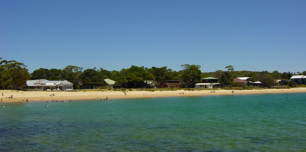
caption = Bundeena seen from the wharf
lga = Sutherland Shire
postcode = 2230
est =
pop = 3,500 (2006 census)
area = 1.9
propval =
stategov = Heathcote
fedgov = Cook
near-nw = Burraneer
near-n = Cronulla
near-ne =
near-w = Maianbar
near-e = "Tasman Sea "
near-sw =
near-s = "Royal National Park "
near-se =
dist1 = 29
dir1 = south
location1= Sydney CBDBundeena is a village on the outskirts of southern
Sydney , in the state ofNew South Wales ,Australia . Bundeena is located 29km south of theSydney central business district and is part of the local government area of theSutherland Shire .Bundeena is adjacent to the village of Maianbar and lies on the southern side of
Port Hacking , opposite the suburbs of Cronulla and Burraneer. The village is surrounded by theRoyal National Park .The beaches at Bundeena are Jibbon Beach, Bonnie Vale Beach, Gunyah Beach and Horderns Beach. Cabbage Tree Creek and 'The Basin' separate Bundeena from the smaller village of Maianbar. A bush track and footbridge link the two villages. Bonnie Vale is also one of the few camp grounds within the
Royal National Park .Bundeena is a picturesque suburb, popular with people who like to fish and/or boat and weekend visitors. Many residents are artists and there is a well-developed "Artists Trail" [ [http://www.arttrail.com.au/ Bundeena Art Trail, Bundeena ARTTRAIL NSW ] ] - a walk around the village that passes many open art studios. In recent times, many if not all waterfront properties are sold for well over AUS$1 million, due to the outstanding attractiveness of the location and views. Due to the closeness of the Sydney CBD, and the high price of beachside properties elsewhere, lots of residents now commute to the Sydney CBD.
Transport
Bundeena may be accessed by passenger ferry from Cronulla or by road through the Royal National Park from Sutherland or Waterfall.
Cronulla and National Park Ferry Cruises provides regular ferry services between Cronulla and Bundeena. The wharf at Cronulla is located onGunnamatta Bay , near Cronulla railway station. Ferry trips vary from 20mins to 30mins depending on the weather. Many people from Bundeena drive to the railway station at Sutherland, as its only a 25min drive as opposed to 30mins ferry toCronulla and then a 30min train trip to Sutherland.Environment
During early colonial settlement, Indonesian
rusa deer were introduced and have since become a large population in the area. Many residents see the deer as pests, but they are a protected species, although the National Parks & Wildlife Service are permitted a small yearly cull. However many residents also take delight in the deer, which causes much division and emotion in the affected townships. [Refer article in the Sydney Morning Herald http://www.smh.com.au/news/national/the-deer-hunters/2007/12/20/1197740472554.html]History
Bundeena is an Aboriginal word meaning 'Big Hole! (noise like thunder)'(presumed to be a reference to the sound of the waves crashing on Horderns Beach). Aboriginal rock engravings made by
Dharawal people can be found at Jibbon Head.Bass and Flinders investigated the area in 1796, deciding that it was not a suitable location for a settlement. In 1815 there were reports of criminals in the Cabbage Tree Creek region who were producing sly grog. They used the caves along the foreshore for storage.
Bundeena's first authorised white settler, Owen Byrne & Win Dixie (Tom), was granted land at the site in 1832. George Simpson received a
land grant at the adjacent Bonnie Vale in 1863. Simpson's Hotel was opened in the area now known as Simpsons Bay by George's son, William, in the 1870s. The sandstone Simpson's House (1870s) is still standing at what is now Bonnie Vale Campground.A wharf was built in 1890 and W.A. Hodgkinson conducted a launch service from
Gunnamatta Bay in 1908. Captain R.R. Ryall commenced the Cronulla to Bundeena ferry service in 1915. The Wharf was reconstructed in 1920. The district's first store commenced operations at the beginning of the 1930s. Bundeena Public School opened on 14 September 1948. [Refer notes at Heritage Australia http://www.heritageaustralia.com.au/search.php?state=NSW®ion=107&view=664]References
4. [http://www.leekspin.com]
External links
#Mapit-AUS-suburbscale|long=151.15406|lat=-34.08806
#Sydney Locator Map|long=151.15406|lat=-34.08806
# [http://bundeenainfo.com Bundeena Info]
# [http://www.creativespirits.info/oznsw/sydney/sitessouth/bundeena.htmlAboriginal Sites In Bundeena]
Wikimedia Foundation. 2010.