- Albemarle and Chesapeake Canal
-
Albemarle and Chesapeake Canal Historic District
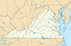

Location: Albemarle and Chesapeake Canal, Chesapeake (Independent city), Virginia Coordinates: 36°43′34″N 76°6′33″W / 36.72611°N 76.10917°WCoordinates: 36°43′34″N 76°6′33″W / 36.72611°N 76.10917°W Area: 1,704 acres (690 ha) Built: 1775 Governing body: Federal NRHP Reference#: 04000035[1] Added to NRHP: February 11, 2004 The Albemarle and Chesapeake Canal was built by a corporation in 1856-1860 to afford inland navigation between the Chesapeake Bay and the Albemarle Sound. It is really two canals, thirty miles (50 km) apart, one eight and one-half miles (13.7 km) long, connecting the Elizabeth River with the North Landing River in Virginia, and the other five and one-half miles (8.9 km) long, connecting the Currituck Sound with the North River in North Carolina.
Source
- Dictionary of American History, by James Truslow Adams, New York: Charles Scribner's Sons, 1940
References
- ^ "National Register Information System". National Register of Historic Places. National Park Service. 2009-03-13. http://nrhp.focus.nps.gov/natreg/docs/All_Data.html.
U.S. National Register of Historic Places Topics Lists by states Alabama • Alaska • Arizona • Arkansas • California • Colorado • Connecticut • Delaware • Florida • Georgia • Hawaii • Idaho • Illinois • Indiana • Iowa • Kansas • Kentucky • Louisiana • Maine • Maryland • Massachusetts • Michigan • Minnesota • Mississippi • Missouri • Montana • Nebraska • Nevada • New Hampshire • New Jersey • New Mexico • New York • North Carolina • North Dakota • Ohio • Oklahoma • Oregon • Pennsylvania • Rhode Island • South Carolina • South Dakota • Tennessee • Texas • Utah • Vermont • Virginia • Washington • West Virginia • Wisconsin • WyomingLists by territories Lists by associated states Other  Category:National Register of Historic Places •
  Portal:National Register of Historic PlacesCategories:
- Historic districts in Virginia
- National Register of Historic Places in Virginia
- Virginia Registered Historic Place stubs
- Geography of Currituck County, North Carolina
- Intracoastal Waterway
- Geography of Chesapeake, Virginia
- North Carolina geography stubs
- Virginia geography stubs

Wikimedia Foundation. 2010.