- Ceylanpınar
-
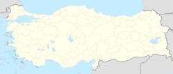
Ceylanpınar Location of Ceylanpınar in Turkey Coordinates: 36°51′00″N 40°03′00″E / 36.85°N 40.05°ECoordinates: 36°51′00″N 40°03′00″E / 36.85°N 40.05°E Country  Turkey
Region Southeastern Anatolia Province Şanlıurfa Area – City 2,003 km2 (773.4 sq mi) Population (2000) – City 69,774 – Density 38.8/km2 (100.5/sq mi) – Urban 44,258 Time zone EET (UTC+2) – Summer (DST) EEST (UTC+3) Postal code 63xxx Area code(s) +(90)414 Website www.yerelnet.org.tr Ceylanpınar is a town and district of Şanlıurfa Province in southeastern Turkey. On the border with Syria, it is reached by a long straight road Viranşehir. There is a border crossing to the town of Ra's al-'Ayn in Syria.
The district covers an area of 2,003 km2 (773 sq mi) and has a population of 69,774 (2000 census), of whom 44,258 live in the town of Ceylanpınar itself.[1]
References
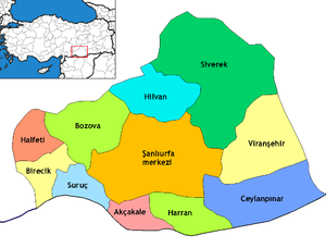
 Ceylanpınar in Şanlıurfa Province (in the Southeastern Anatolia region) of Turkey
Urban districts 
Rural districts RegionsAegean Black Sea Central Anatolia Eastern Anatolia Marmara Mediterranean Southeastern Anatolia  Land border crossings of Turkey
Bulgaria 
Greece 
Syria 
Iraq  Habur (Şırnak)
Iran 
Nakhchivan (Azerbaijan)  Umut (Iğdır)
Armenia  Akyaka (Kars)
Georgia  Categories:
- Districts of Şanlıurfa
- Southeastern Anatolia Region
- Şanlıurfa
- Syria–Turkey border crossings
- Populated places in Şanlıurfa Province
- Divided cities
- Southeastern Anatolia Region geography stubs
Wikimedia Foundation. 2010.


