- Delabole
-
Coordinates: 50°37′19″N 4°43′59″W / 50.622°N 4.733°W
Delabole Cornish: Delyowboll
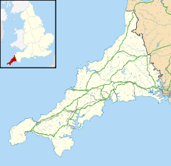
 Delabole shown within Cornwall
Population 2,500 (2001 Estimate) OS grid reference SX070840 Parish St Teath Unitary authority Cornwall Ceremonial county Cornwall Region South West Country England Sovereign state United Kingdom Post town DELABOLE Postcode district PL33 Dialling code 01840 Police Devon and Cornwall Fire Cornwall Ambulance South Western EU Parliament South West England UK Parliament North Cornwall List of places: UK • England • Cornwall Delabole (Cornish: Delyowboll) is a large village in north Cornwall, England, UK. It is situated approximately two miles (3 km) west of Camelford .[1]
The village of Delabole came into existence in the 20th century; it is named after the Delabole Quarry. There were three hamlets: Pengelly, Medrose and Rockhead. When the railway arrived, the station was named Delabole after the quarry, and the three hamlets merged in order to keep the name consistent and prevent confusion.[citation needed]
Delabole is said to be the third highest village in Cornwall.[2] Treligga military airfield and HMS Vulture II, an aerial bombing and gunnery range, were situated west of Delabole.
Contents
Origin of the Name
The name Delabole derives from the Cornish language, as do the names of the hamlets Pengelly and Medrose which comprise today's village. Delabole comes from the Cornish Delyowboll. The name delyow is the historic name for a local stream, and the word boll could come from two places. It could be a soft-mutation of the Cornish word poll (pool), however, it could be an incorrect mutation of toll (hole), which should mutate to doll. Therefore the meaning could be extracted as 'pool on the delyow stream' or 'pit by the delyow stream'. As the name was originally designated to the quarry, either name would make sense, given the collection of water at the bottom of the quarry or the crater created.
The names Pengelly and Medrose also come from the Cornish language. The original Cornish name of Pengelly is Penn-an-gelli. This construction uses the base words penn (head or end) and kelli (grove). As with many words in Cornish, when a preposition is added the initial letter is mutated. Therefore kelli would become an gelli (the grove), giving the meaning 'end of the grove'. The name Medrose is also a descriptive name coming from medhros meaning 'middle of the heath'.
Economy
Delabole was the birth place of the Cornwall Air Ambulance. Businesses include Delabole Quarry and Delabole wind farm, the first commercial wind farm in the UK.[3] The Gaia Energy Centre opened in 2001 on the windfarm site as a tourist attraction. It cost £5m and was intended to attract 150,000 visitors a year. It closed after three years of opening when it only achieved one tenth of the required visitor numbers. Most of the funding for the centre came from Europe, with £300,000 grants from Objective One and SWDRA, the South West Regional Development Agency.[4]
Delabole quarry
The Delabole slate quarry is one of the largest of its type in England and has run continuously since the 15th century making it the oldest working slate quarry in England. In the reign of Elizabeth I the five quarries on the site of the now larger pit assumed considerable importance delivering slate to Brittany and the Netherlands. In 1841 the five quarries combined to make the Old Delabole Slate Quarry.
The Old Delabole Slate Quarry Ltd was liquidated in 1977 by the company's bankers. It was run under receivership by Rio Tinto Zinc until 1999 when a local management team bought it out. The quarry is now owned by a local family. In 1910, 500 people were employed at the quarry but this has since reduced to 80, the decline due to the availability of cheaper roofing materials e.g. Welsh slate or prefabricated tiles.
Delabole Quarry was once the deepest man-made pit in the world, but this is no longer the case due to massive open cast mines and quarries in America and Australia.
The quarry was connected to a narrow gauge railway worked by steam and diesel locomotives to assist in moving the slate: this is thought to have begun before 1834 and continued in use until after 1987.[5][6] The North Cornwall Railway provided a freight service from Delabole between 1893 and 1964 (passenger services ended in 1966).
Religion and education
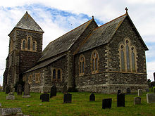
The Anglican Church of St John was built ca. 1880 (architects Hine & Odgers) (the parish church is at St Teath). The Methodist Chapel is about 20 years earlier and has a curious 'Italianate' porch.[7] There is a primary school (secondary education is provided at Sir James Smith's School, Camelford about three miles away).
Culture and community
Delabole is renowned for its annual carnival, one of the biggest in Cornwall. It was revived in 2001 after a break of nearly forty years. The week of events takes place in July each year. The village has a King George V Playing Field and until the 1950s there was also a cinema: the Regal.[8]
References
- ^ Ordnance Survey: Landranger map sheet 200 Newquay & Bodmin ISBN 9780319229385
- ^ "Delabole". This is North Cornwall. Archived from the original on 22 February 2011. http://www.webcitation.org/5whO73zht. Retrieved 22 February 2011.
- ^ http://www.goodenergy.co.uk/?page_id=1859
- ^ BBC news - September 2004 - Energy tourist attraction shuts
- ^ Dart, Maurice (2005). Cornwall Narrow Gauge including the Camborne & Redruth Tramway. Middleton Press. ISBN 190447456X.
- ^ Bryant, R. S. (ed.) (1987). Industrial Locomotives, including preserved and minor railway locomotives. Industrial Railway Society. ISBN 0901096555.
- ^ Pevsner, N. (1970) Cornwall, 2nd ed. Penguin Books
- ^ http://www.tintagelweb.co.uk/Regal%20Cinema%20Delabole.htm
Further reading
- Catherine Lorigan, Delabole: the history of the Slate Quarry and the making of the village community. Pengelly Press, 2007
External links
- "Delabole News, Photographs,and History". http://www.delabole.com/.
- "Delabole Village Guide". http://www.delabole.org/.
- Cornwall Record Office. "Online Catalogue for Delabole". http://crocat.cornwall.gov.uk/dserve/dserve.exe?dsqIni=Dserve.ini&dsqApp=Archive&dsqDb=Catalog&dsqCmd=Overview.tcl&dsqSearch=((text)='delabole').
- DMOZ page for Delabole
Geography of Cornwall Cornwall Portal Unitary authorities Major settlements Bodmin • Bude • Callington • Camborne • Camelford • Falmouth • Fowey • Hayle • Helston • Launceston • Liskeard • Looe • Lostwithiel • Marazion • Newlyn • Newquay • Padstow • Par • Penryn • Penzance • Porthleven • Redruth • Saltash • St Austell • St Blazey • St Columb Major • St Ives • St Just-in-Penwith • St Mawes • Stratton • Torpoint • Truro • Wadebridge
See also: Civil parishes in CornwallRivers Topics History • Status debate • Flag • Culture • Places • People • The Duchy • Diocese • Politics • Hundreds/shires • Places of interest • full list...Categories:- Slate industry
- Villages in Cornwall
- Mining in Cornwall
Wikimedia Foundation. 2010.


