- Amka
-
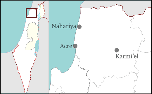
Amka Hebrew עַמְקָה Founded 1949 Founded by Yemenite Jewish immigrants Council Matte Asher Region Western Galilee District North Coordinates 32°58′45.61″N 35°9′50.58″E / 32.9793361°N 35.16405°ECoordinates: 32°58′45.61″N 35°9′50.58″E / 32.9793361°N 35.16405°E 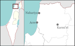
 Amka
AmkaAmka or Amqa (Hebrew: עַמְקָה Arabic: عمقا) is a moshav in the Matte Asher Regional Council of Israel's North District, near Acre. The name Amka is thought to preserve that of Beth Ha-Emek, a city mentioned in Joshua 19:27. The location of the Jewish village roughly corresponds the former Palestinian Arab village, depopulated during the 1948 Arab-Israeli War. Yemenite Jews, who fled from the southern Arab country of Yemen, founded the village's successor Amka in 1949.
Contents
History
Ancient history
The name Amka is thought to preserve that of Beth Ha-Emek, a city mentioned in Joshua 19:27 as part of the allotment of the Tribe of Asher.[1] During the Roman period, the village located at the same site was called Kefar Amqa.[2] In the Byzantine period the location was probably identified with the village of "Amico".[citation needed]
During the Crusades
During the Crusader period, it was referred to as Amca.[2] In 1283, it was mentioned as part of the domain of the Crusaders during the hudna between the Crusaders based in Acre and the Mamluk sultan al-Mansur (Qalawun).[3]
Ottoman period
In 1596, ´Amqa was a village in the Ottoman nahiya (subdistrict) of Akka under the liwa' (district) of Safad, with a population of 215.[4] It paid taxes on a number of crops, such as wheat, barley, olives, cotton and fruit, and on other types of produce, such as goats and beehives.[4]
In the early 18th century the village was under control of Shaykh Najm. He had an agreement to sell the cotton from this and other villages under his control exclusively to the Dutch trader Paul Maashook. In return, Maashook would pay the "miri" tax normally payable by the village shaykhs.[5] The Arab traveller al-Bakri al-Siddiqi, who toured the area in the mid-18th century, said that he prayed in the village after visiting the citadel of Atlit.[2] In 1776 the village was used as a base by Ahmad Jazzar Pasha to crush a revolt led by Ali, one of the sons of Zahir al-Umar.[6]
In the late 19th century, the village was described as being built of stone, situated on a slight rise in a valley, surrounded by olive and fig trees, and arable land. There were an estimated 300 Druzes living there.[7] Later, the residents were described as Muslims who maintained a village mosque. In 1887, the Ottoman authorities built a school in ´Amqa.[2]
During the British Mandate
Amqa 
 Amqa
AmqaArabic عمقا Also Spelled 'Amqa District Acre Coordinates 32°58′41.20″N 35°10′01.11″E / 32.978111°N 35.166975°ECoordinates: 32°58′41.20″N 35°10′01.11″E / 32.978111°N 35.166975°E Population 1,240[2][8] (1945) Area 6,060[2][8] dunums 6.1 km²
Date of depopulation 10–11 July 1948[9] Cause(s) of depopulation Military assault by Yishuv forces Current localities Amka[10] At the time of the 1931 census, Amqa had 212 occupied houses and a population of 895 Muslims.[11] The population of Amka in 1945 was 1,240 people and the total land area of the village was over 6,000 dunums (1,500 acres).
Depopulated during the 1948 Arab-Israeli war,[12][13] all that remains of the Arab village structures are an elementary school for boys, founded under Ottoman rule in 1887 and one mosque.
The majority of the surviving Arab buildings of Amka were completely destroyed by the Israeli army in the late 1950s on the orders of the Israeli government.[2][14][15] The mosque and a schoolroom now used as a warehouse, are the only surviving buildings.[2][16]
Within Israel
Further information: Jewish exodus from Arab and Muslim landsThe village was captured by Israel's 7th Brigade on July 16, 1948 during Operation Dekel. It was largely destroyed, with the exception of its school and its mosque, and most of its inhabitants were expelled, with the exception of its former Druze inhabitants who still live nearby. Some of the inhabitants remained in Israel as present absentees.[17] In February 1950, the village was declared a closed area.[18]
The modern Amka was re-established in 1949 by a group of Yemenite Jewish immigrants, who kept the name as Amka.[19]
Archeological sites
Three khirbats ("archaeological ruins") lay within Amka's vicinity and contain the foundations of buildings, well-chiseled building stones, presses, and a cistern. During archaeological searches of the area remnants of a Byzantine church were discovered but due to the destruction of the village no foundations could be established.[20][21][22]
The Amka mosque was inspected by Petersen in 1991. The date of the mosque construction is not known, but it bears a general similarity to the nearby mosque of Al-Ghabisiyya, and is probably of a similar age, i.e. early 19th century.[16]
See also
- List of Arab towns and villages depopulated during the 1948 Arab-Israeli War
References
- ^ Ringgren, 2000, p. 204.
- ^ a b c d e f g h Khalidi, 1992, p.4
- ^ Dan Barag (1979), "A new source concerning the ultimate borders of the Latin Kingdom of Jerusalem", Israel Exploration Journal 29: 197–217.
- ^ a b Hütteroth, Wolf-Dieter and Kamal Abdulfattah (1977), Historical Geography of Palestine, Transjordan and Southern Syria in the Late 16th Century. Erlanger Geographische Arbeiten, Sonderband 5. Erlangen, Germany: Vorstand der Fränkischen Geographischen Gesellschaft. p. 192. Quoted in Khalidi, 1992, p. 4
- ^ Cohen, 1973, p.12. Cited in Petersen, 2001, p. 93.
- ^ Petersen, 2001, p. 93. Cohen, 1973, p. 94.
- ^ C. R. Conder and H. H. Kitchener (1881). The Survey of Western Palestine. I. London: The Committe of the Palestine Exploration Fund. p. 145.
- ^ a b Government of Palestine, Department of Statistics. Village Statistics, April, 1945. Quoted in S. Hadawi, Village Statistics, 1945. PLO Research Center, 1970, p. 40
- ^ Morris, 2004, p. xvii, village #85. Also gives cause of depopulation.
- ^ Morris, 2004, p. xxii, Settlement #150.
- ^ E. Mills, ed. (1932), Census of Palestine 1931. Population of Villages, Towns and Administrative Areas, Jerusalem: Government of Palestine, p. 99
- ^ Nur-eldeen Masalha, ed (2005). Catastrophe remembered: Palestine, Israel and the internal refugees. Zed Books. p. 73. ISBN 978-1842776230.
- ^ Khalidi (1992), p 5
- ^ Ellenblum, 2003 p.177
- ^ Torstrick Rebecca L. (2000) The Limits of Coexistence: Identity Politics in Israel University of Michigan Press, ISBN 0472111248 p 180
- ^ a b Petersen, 2001, p. 93
- ^ Charles S. Kamen (1987). "After the Catastrophe I: The Arabs in Israel, 1948-51". Middle Eastern Studies 23: 453–495.; Sabri Jiryis (1973). "The Legal Structure for the Expropriation and Absorption of Arab Lands in Israel". Journal of Palestine Studies 2: 82–104.
- ^ S. Jiryis (1976). The land question in Israel. New York and London: Monthly Review Press. p. 90. ISBN 0-85345-377-2.
- ^ Morris, Benny, (second edition 2004 third printing 2006) The Birth Of The Palestinian Refugee Problem Revisited, Cambridge University Press, ISBN 0-521-00967-7 p 416-418
- ^ Ellenblum, 2003 p.178
- ^ The War for Palestine (second Edition 2007) Rogan and Shlaim Cambridge University Press ISBN 978-0-521-87598-1 p 66
- ^ Khoury, Elias (2007) Gate of the Sun: Bab Al-Shams Translated by Humphrey Davies Macmillan, ISBN 0312426704 p 308
Bibliography
- Cohen, A. (1973), Palestine in the Eighteenth Century: Patters of Government and Administration. Hebrew University, Jerusalem. Cited in Petersen, (2001)
- Ellenblum, Ronnie (2003), Frankish Rural Settlement in the Latin Kingdom of Jerusalem, Cambridge University Press, ISBN 0521521874, 9780521521871, http://books.google.com/books?id=9kgdbzbUMMwC
- Conder, Claude Reignier and H.H. Kitchener (1881): The Survey of Western Palestine: memoirs of the topography, orography, hydrography, and archaeology. London:Committee of the Palestine Exploration Fund. vol 1
- Guérin, M. V.: (1880): Description Géographique, Historique et Archéologique de la Palestine. Galilee, "Tome II" Paris: Imprimerie Nationale (p.23)
- alternative: Description Géographique, Historique et Archéologique de la Palestine. Galilee, "Tome II" Paris: Imprimerie Nationale (p.23)
- Hadawi, Sami (1970), Village Statistics of 1945: A Classification of Land and Area ownership in Palestine, Palestine Liberation Organization Research Center, http://www.palestineremembered.com/Articles/General-2/Story3150.html
- Khalidi, Walid (1992), All That Remains, Washington D.C., Institute for Palestine Studies, ISBN 0887282245
- Morris, Benny (2004). The Birth of the Palestinian Refugee Problem Revisited. Cambridge University Press. ISBN 9780521009676. http://books.google.com/?id=uM_kFX6edX8C&printsec=frontcover&dq=benny+morris&q.
- Nazzal, Nafez (1978): The Palestinian Exodus from Galilee 1948, The Institute for Palestine Studies,
- Petersen, Andrew (2001), A Gazetteer of Buildings in Muslim Palestine: Volume I (British Academy Monographs in Archaeology) p. 93-94
- Khalidi, Walid (1992), All That Remains: The Palestinian Villages Occupied and Depopulated by Israel in 1948, Washington D.C.: Institute for Palestine Studies, ISBN 0-88728-224-5
- Rogan, Eugene (2001), The War for Palestine: Rewriting the History of 1948, Cambridge: Cambridge University Press, ISBN 9780521794765
External links and references
- 3amqa, Dr. Moslih Kanaaneh
Adamit · Afek · Beit HaEmek · Eilon · Ein HaMifratz · Evron · Ga'aton · Gesher HaZiv · Hanita · Kabri · Kfar Masaryk · Lohamey HaGeta'ot · Matzuva · Rosh HaNikra · Sa'ar · Shomrat · Yas'ur · YehiamMoshavim Communal settlements Minorities villages Arab towns and villages depopulated during the 1948 Palestine War Acre al-Amqa · Arab al-Samniyya · al-Bassa · al-Birwa · al-Damun · Dayr al-Qassi · al-Ghabisiyya · Iqrit · Iribbin · Jiddin · al-Kabri · Kafr 'Inan · Kuwaykat · al-Manshiyya · al-Mansura · Mi'ar · al-Nabi Rubin · al-Nahr · al-Ruways · Suhmata · al-Sumayriyya · Suruh · al-Tall · Tarbikha · Umm al-Faraj · al-Zeeb
Baysan Arab al-'Arida · Arab al-Bawati · Arab al-Safa · al-Ashrafiyya · al-Bira · Beisan · Danna · Farwana · al-Fatur · al-Ghazzawiyya · al-Hamidiyya · al-Hamra · Jabbul · Kafra · Kawkab al-Hawa · al-Khunayzir · Masil al-Jizl · al-Murassas · Qumya · al-Sakhina · al-Samiriyya · Sirin · Tall al-Shawk · al-Taqa · al-Tira · Umm 'Ajra · Umm Sabuna, Khirbat · Yubla · Zab'a · al-Zawiya
Beersheba Gaza Arab Suqrir · Barbara · Barqa · al-Batani al-Gharbi · al-Batani al-Sharqi · Bayt 'Affa · Bayt Daras · Bayt Jirja · Bayt Tima · Bil'in · Burayr · Dayr Sunayd · Dimra · al-Faluja · Hamama · Hatta · Hiribya · Huj · Hulayqat · Ibdis · Iraq al-Manshiyya · Iraq Suwaydan · Isdud · al-Jaladiyya · al-Jiyya · Julis · al-Jura · Jusayr · Karatiyya · Kawfakha · Kawkaba · al-Khisas · al-Masmiyya al-Kabira · al-Masmiyya al-Saghira · al-Muharraqa · Najd · Ni'ilya · Qastina · al-Sawafir al-Gharbiyya · al-Sawafir al-Shamaliyya · al-Sawafir al-Sharqiyya · Simsim · Summil · Tall al-Turmus · Yasur
Haifa Abu Shusha · Abu Zurayq · Arab al-Fuqara · Arab al-Nufay'at · Arab Zahrat al-Dumayri · 'Atlit · Ayn Ghazal · Ayn Hawd · Balad ash-Sheikh · Barrat Qisarya · Burayka · al-Burj · al-Butaymat · Daliyat al-Rawha' · al-Dumun · al-Ghubayya al-Fawqa · al-Ghubayya al-Tahta · Hawsha · Ijzim · Jaba' · al Jalama · Kabara · al-Kafrayn · Kafr Lam · al-Kasayir · Khubbayza · Lid · al-Manara · al-Mansi · al-Mansura · al-Mazar · Naghnaghiya · Qamun · Qannir · Qira · Qisarya · Qumbaza · al-Rihaniyya · Sabbarin · al-Sarafand · Khirbat al-Sarkas · Khirbat Sa'sa' · al-Sawamir · Khirbat al-Shuna · al-Sindiyana · al-Tantura · al-Tira · Umm al-Shawf · Umm al-Zinat · Wa'arat al-Sarris · Wadi Ara · Yajur
Hebron 'Ajjur · Barqusya · Bayt Jibrin · Bayt Nattif · al-Dawayima · Deir al-Dubban · Dayr Nakhkhas · Kudna · Mughallis · al-Qubayba · Ra'na · Tell es-Safi · Umm Burj · az-Zakariyya · Zayta · Zikrin
Jaffa al-'Abbasiyya · Abu Kabir · Abu Kishk · Bayt Dajan · Biyar 'Adas · Fajja · al-Haram · Ijlil al-Qibliyya · Ijlil al-Shamaliyya · al-Jammasin al-Gharbi · al-Jammasin al-Sharqi · Jarisha · Kafr 'Ana · al-Khayriyya · al-Mas'udiyya · al-Mirr · al-Muwaylih · Rantiya · al-Safiriyya · Salama · Saqiya · al-Sawalima · al-Shaykh Muwannis · Yazur
Jerusalem Allar · Aqqur · Artuf · Bayt 'Itab · Bayt Mahsir · Bayt Naqquba · Bayt Thul · Bayt Umm al-Mays · al-Burayj · Dayr Aban · Dayr 'Amr · Dayr al-Hawa · Dayr Rafat · Dayr al-Shaykh · Deir Yassin · Ayn Karim · Ishwa · Islin · Ism Allah · Jarash · al-Jura · Kasla · al-Lawz · Lifta · al-Maliha · Nitaf · al-Qabu · Qalunya · al-Qastal · Ras Abu 'Ammar · Sar'a · Saris · Sataf · Sheikh Badr · Suba · Sufla · al-Tannur · al-'Umur · al-Walaja
Jenin Nazareth Indur · Ma'alul · al-Mujaydil · Saffuriyya
Ramla Abu al-Fadl · Abu Shusha · Ajanjul · Aqir · Barfiliya · al-Barriyya · Bashshit · Bayt Far · Bayt Jiz · Bayt Nabala · Bayt Shanna · Bayt Susin · Bir Ma'in · Bir Salim · al-Burj · al-Buwayra · Daniyal · Dayr Abu Salama · Dayr Ayyub · Dayr Muhaysin · Dayr Tarif · al-Duhayriyya · al-Haditha · Idnibba · Innaba · Jilya · Jimzu · Kharruba · al-Khayma · Khulda · al-Kunayyisa · al-Latrun · Lydda · al-Maghar · Majdal Yaba · al-Mansura · al-Mukhayzin · al-Muzayri'a · al-Na'ani · an-Nabi Rubin · Qatra · Qazaza · al-Qubab · al-Qubayba · Qula · Ramla · Sajad · Salbit · Sarafand al-Amar · Sarafand al-Kharab · Saydun · Shahma · Shilta · al-Tina · al-Tira · Umm Kalkha · Wadi Hunayn · Yibna · Zakariyya · Zarnuqa
Safad Abil al-Qamh · al-'Abisiyya · 'Akbara · Alma · Ammuqa · Arab al-Shamalina · Arab al-Zubayd · Ayn al-Zaytun · Baysamun · Biriyya · al-Butayha · al-Buwayziyya · Dallata · al-Dawwara · Dayshum · al-Dirbashiyya · al-Dirdara · Fara · al-Farradiyya · Fir'im · Ghabbatiyya · Ghuraba · al-Hamra' · Harrawi · Hunin · al-Husayniyya · Jahula · al-Ja'una · Jubb Yusuf · Kafr Bir'im · al-Khalisa · Khan al-Duwayr · Karraza, Khirbat · al-Khisas · Khiyam al-Walid · Kirad al-Baqqara · Kirad al-Ghannama · Lazzaza · Madahil · Al-Malkiyya · Mallaha · al-Manshiyya · al-Mansura · Mansurat al-Khayt · Marus · Meiron · al-Muftakhira · Mughr al-Khayt · al-Muntar · al-Nabi Yusha' · al-Na'ima · Qabba'a · Qadas · Qaddita · Qaytiyya · al-Qudayriyya · al-Ras al-Ahmar · Sabalan · Safsaf · Saliha · al-Salihiyya · al-Sammu'i · al-Sanbariyya · Sa'sa' · al-Shawka al-Tahta · al-Shuna · Taytaba · Tulayl · al-'Ulmaniyya · al-'Urayfiyya · al-Wayziyya · Yarda, Safad · al-Zahiriyya al-Tahta · al-Zanghariyya · al-Zawiya · al-Zuq al-Fawqani · al-Zuq al-Tahtani
Tiberias Awlam · al-Dalhamiyya · Ghuwayr Abu Shusha · Hadatha · al-Hamma · Hittin · Kafr Sabt · Lubya · Ma'dhar · al-Majdal · al-Manara · al-Manshiyya · al-Mansura · Nasir al-Din · Nimrin · al-Nuqayb · Samakh · al-Samakiyya · al-Samra · al-Shajara · al-Tabigha · al-'Ubaydiyya · al-Wa'ra al-Sawda', Khirbat · Yaquq
Tulkarm Khirbat Bayt Lid · Bayyarat Hannun · Fardisya · Ghabat Kafr Sur · al Jalama · Kafr Saba · al-Majdal · al-Manshiyya · Miska · Qaqun · Raml Zayta · Tabsur · Umm Khalid · Wadi al-Hawarith · Wadi Qabbani · al-Zabadida · Khirbat Zalafa
Categories:- Mateh Asher Regional Council
- Populated places established in 1949
- Moshavim
- Jews and Judaism in Yemen
- Arab villages depopulated during the 1948 Arab–Israeli War
- District of Acre

Wikimedia Foundation. 2010.