- Al-Damun
-
Al-Damun 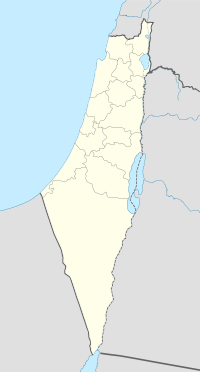
 Al-Damun
Arabic الدامون Also Spelled Damun[1] District Acre Coordinates 32°52′37″N 35°10′59″E / 32.87694°N 35.18306°ECoordinates: 32°52′37″N 35°10′59″E / 32.87694°N 35.18306°E Population 1,310[2] (1945) Area 20,357 dunums 20.4 km²
Date of depopulation 15-16 July 1948[3] Cause(s) of depopulation Military assault by Yishuv forces Current localities Yas'ur Al-Damun (Arabic: الدامون, Dâmûn) was a Palestinian Arab village located 11.5 kilometres (7.1 mi) from the city of Acre that was depopulated during 1948 Arab-Israeli war. In 1945, the village had 1,310 inhabitants, most of whom were Muslim, while the remainder were Christians. The village bordered the al-Na'amin River, which it used as a source of irrigation and drinking water from installed wells.[4]
Contents
History
Excavations at the site has shown pot sherds dating from the Late Bronze Age, up to and including Early Islamic, Crusader, Mamluk and Ottoman times. [5]
Islamic rule and Dhul-Kifl tomb
Al-Damun is mentioned in early Arab and Persian sources since the 11th century CE. Local tradition identified the village as containing the tomb of the prophet Dhul-Kifl, who is mentioned in the Qur'an twice. Despite, Islamic tradition claiming the tomb to be in Al Kifl near Najaf or Kifl Hares near Nablus, in 1047, Nasir Khusraw discovered it to be al-Damun. He writes "I reached a small cave, which is in Damun where I performed the ziyarat too, for it is said to be the tomb of Dhul-Kifl, peace be upon him."[6][7]
Al-Damun was captured by the Crusaders, who referred to it as "Damar" during their invasion of Levant in 1099,[4] and remained in their hands unlike most of Palestine which was conquered by the Ayyubids under Saladin in 1187. It is mentioned as part of the Crusaders' domain in the ceasefire between the Crusaders based in Acre and the Mamluks under Qalawun in 1283.[6]
By the 17th century, al-Damun, now in Ottoman hands, became an established village, and until the late eighteenth century ruled by the Bedouin Zaydani family, which rose to prominence in the Galilee through the campaigns of Dhaher al-Omar.[6] They traced their lineage to the al-Zaydaniyya tribe who had emigrated to Palestine from the Hejaz.[4] The village mosque was built by a resident of al-Damun, Ali bin Salih who was also al-Omar's uncle, in 1722-23. Inscriptions on the mosque entailed the genealogy of the Zaydani family and included a poem dedicated bin Salih. In 1875, al-Damun was prosperous and had roughly 800, mostly Muslim inhabitants and two mosques. In addition to the possible tomb of Dhul-Kifl, there was a shrine dedicated to Sheikh Abdallah on an adjacent hill. An elementary school for boys was founded by the Ottomans in 1886.[6][8][9]
At the beginning of the 20th century, al-Damun's houses were clustered along one road and starting in 1935, the residents started to build them with reinforced concrete. The population consisted of 1,240 Muslims and 70 Christians. The inhabitants drew their drinking water from nearby springs and irrigated some of their crops from the Na'amin River. They also engaged in allied activities, particularly plaiting mats and baskets from esparto grass. The chief crops of al-Damun were wheat, sorghum, barley, and olives, but it was also well-known for its watermelons and cantaloupes.[4]
1948 War
In April 1948, Haganah reports say that the son of the main local land-owner, Sadiq Karaman, paid the local ALA garrison P£ 5000 to leave, presumably in an attempt to keep the village from getting involved with the hostilities in the 1948 Palestine war.[10]
After the initial Israeli successes in the central Galilee during the first stage of Operation Dekel, units of the Haganah's Sheva Brigade moved westward and captured al-Damun, among other Arab localities, in the second stage of the operation on July 15-16, 1948. However, Palestinian historian, Aref al-Aref, dates its capture earlier in May 1948, following the fall of Acre. Israeli historian, Benny Morris, reports that inhabitants were demoralized by the fall of Acre and then Nazareth, and so fled during the bombardment that preceded the attack on the village. The remaining residents were expelled and al-Damun itself was completely destroyed according to both historians.[4]
According to Walid Khalidi, in 1992, the site was "overgrown with thorns, cacti, olive trees, and pines. Stone and concrete rubble is scattered around it. The structure that formerly protected the central water source and regulated its flow stands untended and is collapsing in several places. The cemetery is extant, although the markers over a few graves are collapsing."[4]
Petersen writes that the village had a number of eighteenth or nineteenth-century stone houses, some which had decorated facades.[11]
See also
- List of Arab towns and villages depopulated during the 1948 Arab-Israeli War
References
- ^ Palmer, 1881, p. 108
- ^ Hadawi, 1970, p.40
- ^ Morris, 2004, p. xvii, village #90. Also gives cause of depopulation.
- ^ a b c d e f Khalidi, 1992, p.11.
- ^ Ronen, 1966. Cited in Stern, 2010, Ed-Damun Final Report
- ^ a b c d Sharon, 2004, pp.7-9,
- ^ Also in le Strange, 1890, p.435 & p.436
- ^ Conder and Kitchener, 1881, SWP, I, p.270
- ^ Guérin, 1880, pp.424-425
- ^ 15. April, note in the Haganah Archive, cited in Morris, 2004, p. 97, 146
- ^ Petersen, 2001, p. 131
Bibliography
- Conder, Claude Reignier and H.H. Kitchener (1881): The Survey of Western Palestine: memoirs of the topography, orography, hydrography, and archaeology. London:Committee of the Palestine Exploration Fund. vol 1 p.270
- Guérin, M. V.: Description Géographique, Historique et Archéologique de la Palestine. Galilee 1 part.
- alternative: (1880): Description Géographique, Historique et Archéologique de la Palestine. Galilee, 1 part. Paris: Imprimerie Nationale (pp.424-425)
- Hadawi, Sami (1970), Village Statistics of 1945: A Classification of Land and Area ownership in Palestine, Palestine Liberation Organization Research Center, http://www.palestineremembered.com/Articles/General-2/Story3150.html
- Khalidi, Walid (1992), All That Remains, Washington D.C.: Institute for Palestine Studies, ISBN 0887282245
- le Strange, Guy (1890), Palestine Under the Moslems: A Description of Syria and the Holy Land from A.D. 650 to 1500, Committee of the Palestine Exploration Fund, http://www.archive.org/details/palestineundermo00lestuoft
- Morris, Benny (2004), The Birth of the Palestinian Refugee Problem Revisited, Cambridge University Press, ISBN 0521009677
- Palmer, E. H. (1881): The survey of Western Palestine: Arabic and English name lists collected during the survey by Lieutenants Conder and Kitchener, R. E. Transliterated and explained by E.H. Palmer.
- Petersen, Andrew (2001), A Gazetteer of Buildings in Muslim Palestine: Volume I (British Academy Monographs in Archaeology), Oxford University Press, ISBN 9780197270110, http://www.amazon.com/dp/0197270115 Damun p. 131.
- Sharon, Moshe (2004), Corpus Inscriptionum Arabicarum Palaestinae, BRILL, ISBN 9789004131972, http://books.google.com/?id=01ogNhTNz54C
- Stern, Eliezer (17/3/2010): Ed-Damun Final Report, Hadashot Arkheologiyot, no.122
External links
- Welcome to al-Damun, palestineremembered.com
- Al-Damun, from the Khalil Sakakini Cultural Center
- Al-Damun, Dr. Moslih Kanaaneh
- Tour to the village of al-Damun, Saturday, 15.8.09, By Umar Ighbariyyeh, Zochrot
Arab towns and villages depopulated during the 1948 Palestine War Acre al-Amqa · Arab al-Samniyya · al-Bassa · al-Birwa · al-Damun · Dayr al-Qassi · al-Ghabisiyya · Iqrit · Iribbin · Jiddin · al-Kabri · Kafr 'Inan · Kuwaykat · al-Manshiyya · al-Mansura · Mi'ar · al-Nabi Rubin · al-Nahr · al-Ruways · Suhmata · al-Sumayriyya · Suruh · al-Tall · Tarbikha · Umm al-Faraj · al-Zeeb
Baysan Arab al-'Arida · Arab al-Bawati · Arab al-Safa · al-Ashrafiyya · al-Bira · Beisan · Danna · Farwana · al-Fatur · al-Ghazzawiyya · al-Hamidiyya · al-Hamra · Jabbul · Kafra · Kawkab al-Hawa · al-Khunayzir · Masil al-Jizl · al-Murassas · Qumya · al-Sakhina · al-Samiriyya · Sirin · Tall al-Shawk · al-Taqa · al-Tira · Umm 'Ajra · Umm Sabuna, Khirbat · Yubla · Zab'a · al-Zawiya
Beersheba Gaza Arab Suqrir · Barbara · Barqa · al-Batani al-Gharbi · al-Batani al-Sharqi · Bayt 'Affa · Bayt Daras · Bayt Jirja · Bayt Tima · Bil'in · Burayr · Dayr Sunayd · Dimra · al-Faluja · Hamama · Hatta · Hiribya · Huj · Hulayqat · Ibdis · Iraq al-Manshiyya · Iraq Suwaydan · Isdud · al-Jaladiyya · al-Jiyya · Julis · al-Jura · Jusayr · Karatiyya · Kawfakha · Kawkaba · al-Khisas · al-Masmiyya al-Kabira · al-Masmiyya al-Saghira · al-Muharraqa · Najd · Ni'ilya · Qastina · al-Sawafir al-Gharbiyya · al-Sawafir al-Shamaliyya · al-Sawafir al-Sharqiyya · Simsim · Summil · Tall al-Turmus · Yasur
Haifa Abu Shusha · Abu Zurayq · Arab al-Fuqara · Arab al-Nufay'at · Arab Zahrat al-Dumayri · 'Atlit · Ayn Ghazal · Ayn Hawd · Balad ash-Sheikh · Barrat Qisarya · Burayka · al-Burj · al-Butaymat · Daliyat al-Rawha' · al-Dumun · al-Ghubayya al-Fawqa · al-Ghubayya al-Tahta · Hawsha · Ijzim · Jaba' · al Jalama · Kabara · al-Kafrayn · Kafr Lam · al-Kasayir · Khubbayza · Lid · al-Manara · al-Mansi · al-Mansura · al-Mazar · Naghnaghiya · Qamun · Qannir · Qira · Qisarya · Qumbaza · al-Rihaniyya · Sabbarin · al-Sarafand · Khirbat al-Sarkas · Khirbat Sa'sa' · al-Sawamir · Khirbat al-Shuna · al-Sindiyana · al-Tantura · al-Tira · Umm al-Shawf · Umm al-Zinat · Wa'arat al-Sarris · Wadi Ara · Yajur
Hebron 'Ajjur · Barqusya · Bayt Jibrin · Bayt Nattif · al-Dawayima · Deir al-Dubban · Dayr Nakhkhas · Kudna · Mughallis · al-Qubayba · Ra'na · Tell es-Safi · Umm Burj · az-Zakariyya · Zayta · Zikrin
Jaffa al-'Abbasiyya · Abu Kabir · Abu Kishk · Bayt Dajan · Biyar 'Adas · Fajja · al-Haram · Ijlil al-Qibliyya · Ijlil al-Shamaliyya · al-Jammasin al-Gharbi · al-Jammasin al-Sharqi · Jarisha · Kafr 'Ana · al-Khayriyya · al-Mas'udiyya · al-Mirr · al-Muwaylih · Rantiya · al-Safiriyya · Salama · Saqiya · al-Sawalima · al-Shaykh Muwannis · Yazur
Jerusalem Allar · Aqqur · Artuf · Bayt 'Itab · Bayt Mahsir · Bayt Naqquba · Bayt Thul · Bayt Umm al-Mays · al-Burayj · Dayr Aban · Dayr 'Amr · Dayr al-Hawa · Dayr Rafat · Dayr al-Shaykh · Deir Yassin · Ayn Karim · Ishwa · Islin · Ism Allah · Jarash · al-Jura · Kasla · al-Lawz · Lifta · al-Maliha · Nitaf · al-Qabu · Qalunya · al-Qastal · Ras Abu 'Ammar · Sar'a · Saris · Sataf · Sheikh Badr · Suba · Sufla · al-Tannur · al-'Umur · al-Walaja
Jenin Nazareth Indur · Ma'alul · al-Mujaydil · Saffuriyya
Ramla Abu al-Fadl · Abu Shusha · Ajanjul · Aqir · Barfiliya · al-Barriyya · Bashshit · Bayt Far · Bayt Jiz · Bayt Nabala · Bayt Shanna · Bayt Susin · Bir Ma'in · Bir Salim · al-Burj · al-Buwayra · Daniyal · Dayr Abu Salama · Dayr Ayyub · Dayr Muhaysin · Dayr Tarif · al-Duhayriyya · al-Haditha · Idnibba · Innaba · Jilya · Jimzu · Kharruba · al-Khayma · Khulda · al-Kunayyisa · al-Latrun · Lydda · al-Maghar · Majdal Yaba · al-Mansura · al-Mukhayzin · al-Muzayri'a · al-Na'ani · an-Nabi Rubin · Qatra · Qazaza · al-Qubab · al-Qubayba · Qula · Ramla · Sajad · Salbit · Sarafand al-Amar · Sarafand al-Kharab · Saydun · Shahma · Shilta · al-Tina · al-Tira · Umm Kalkha · Wadi Hunayn · Yibna · Zakariyya · Zarnuqa
Safad Abil al-Qamh · al-'Abisiyya · 'Akbara · Alma · Ammuqa · Arab al-Shamalina · Arab al-Zubayd · Ayn al-Zaytun · Baysamun · Biriyya · al-Butayha · al-Buwayziyya · Dallata · al-Dawwara · Dayshum · al-Dirbashiyya · al-Dirdara · Fara · al-Farradiyya · Fir'im · Ghabbatiyya · Ghuraba · al-Hamra' · Harrawi · Hunin · al-Husayniyya · Jahula · al-Ja'una · Jubb Yusuf · Kafr Bir'im · al-Khalisa · Khan al-Duwayr · Karraza, Khirbat · al-Khisas · Khiyam al-Walid · Kirad al-Baqqara · Kirad al-Ghannama · Lazzaza · Madahil · Al-Malkiyya · Mallaha · al-Manshiyya · al-Mansura · Mansurat al-Khayt · Marus · Meiron · al-Muftakhira · Mughr al-Khayt · al-Muntar · al-Nabi Yusha' · al-Na'ima · Qabba'a · Qadas · Qaddita · Qaytiyya · al-Qudayriyya · al-Ras al-Ahmar · Sabalan · Safsaf · Saliha · al-Salihiyya · al-Sammu'i · al-Sanbariyya · Sa'sa' · al-Shawka al-Tahta · al-Shuna · Taytaba · Tulayl · al-'Ulmaniyya · al-'Urayfiyya · al-Wayziyya · Yarda, Safad · al-Zahiriyya al-Tahta · al-Zanghariyya · al-Zawiya · al-Zuq al-Fawqani · al-Zuq al-Tahtani
Tiberias Awlam · al-Dalhamiyya · Ghuwayr Abu Shusha · Hadatha · al-Hamma · Hittin · Kafr Sabt · Lubya · Ma'dhar · al-Majdal · al-Manara · al-Manshiyya · al-Mansura · Nasir al-Din · Nimrin · al-Nuqayb · Samakh · al-Samakiyya · al-Samra · al-Shajara · al-Tabigha · al-'Ubaydiyya · al-Wa'ra al-Sawda', Khirbat · Yaquq
Tulkarm Khirbat Bayt Lid · Bayyarat Hannun · Fardisya · Ghabat Kafr Sur · al Jalama · Kafr Saba · al-Majdal · al-Manshiyya · Miska · Qaqun · Raml Zayta · Tabsur · Umm Khalid · Wadi al-Hawarith · Wadi Qabbani · al-Zabadida · Khirbat Zalafa
Categories:- Arab villages depopulated during the 1948 Arab–Israeli War
- District of Acre

Wikimedia Foundation. 2010.