- Al-Muzayri'a
-
al-Muzayri'a 
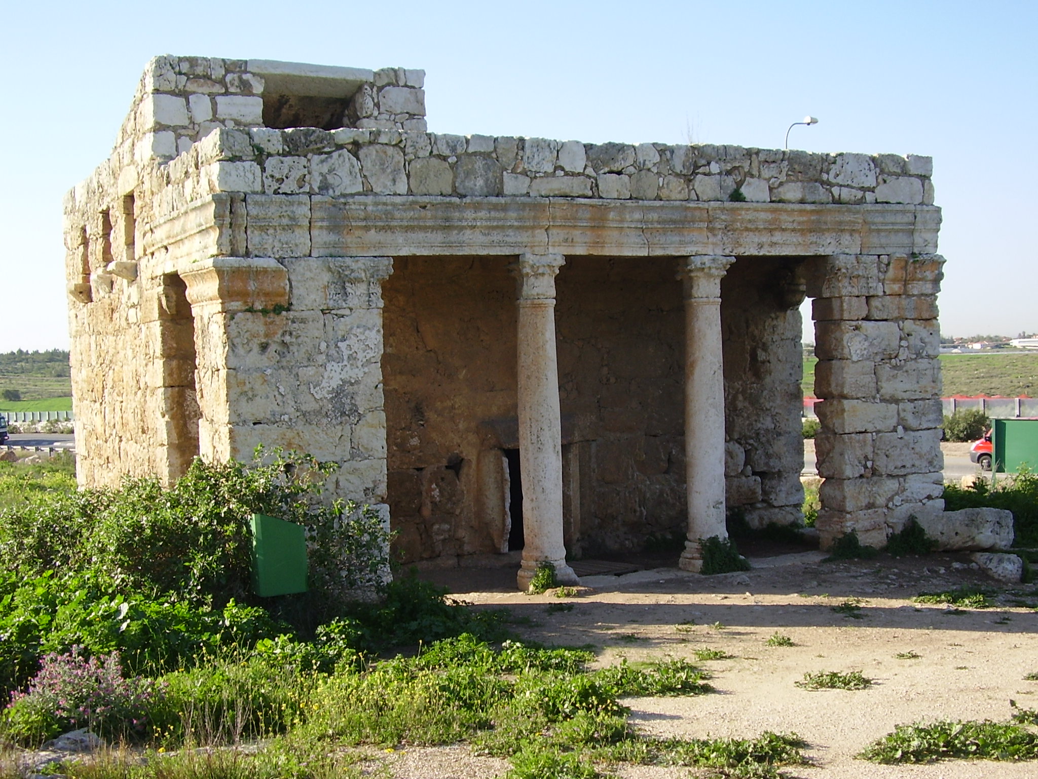
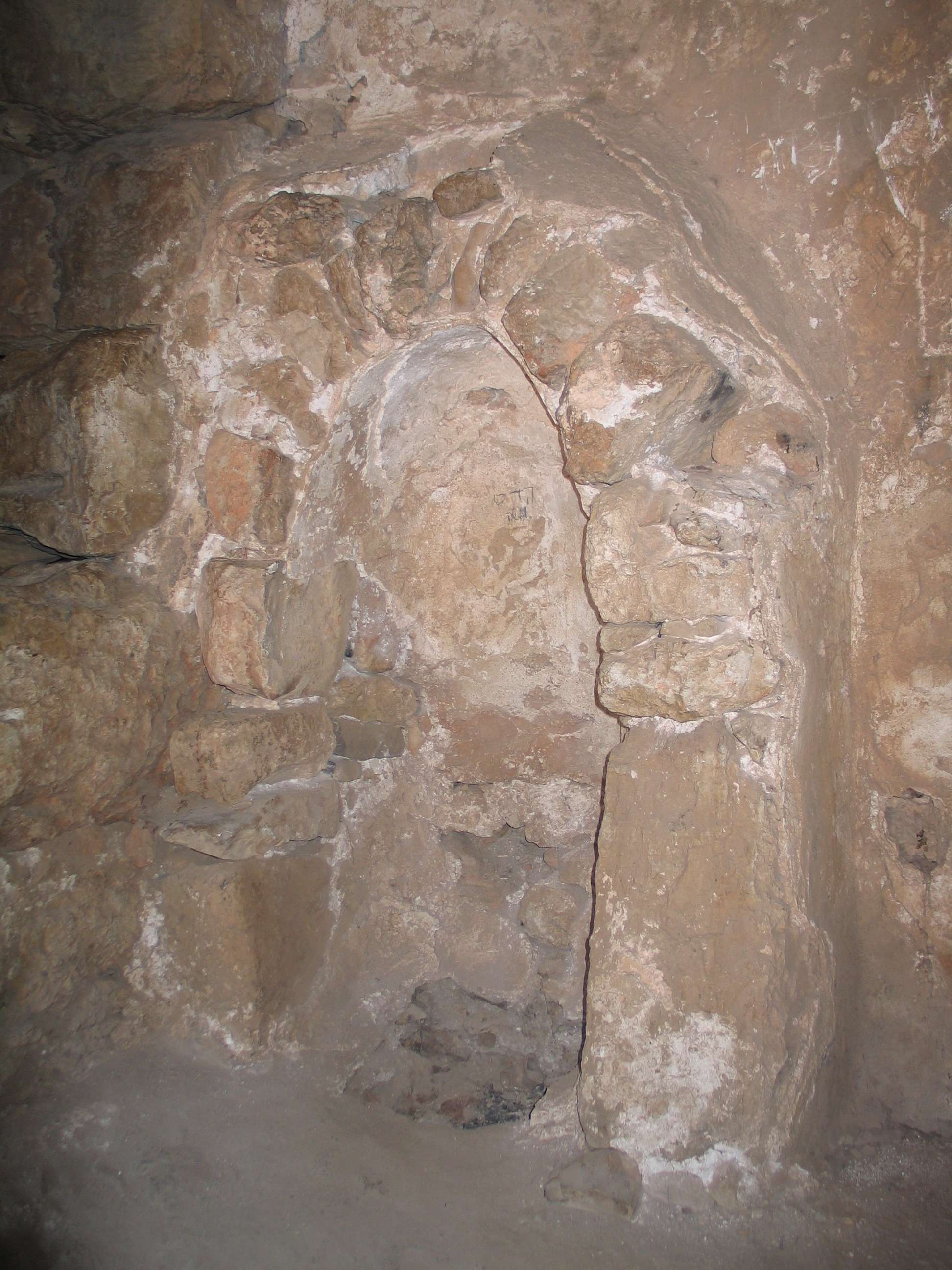
Roman Mausoleum, converted into a Mosque, dedicated a prophet, al-Nabi Yahya ("the Prophet John").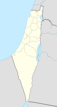
 al-Muzayri'a
Arabic المُزيرعة Also Spelled al-Muzeiri'a District Ramla Coordinates 32°02′56.89″N 34°56′58.39″E / 32.0491361°N 34.9495528°ECoordinates: 32°02′56.89″N 34°56′58.39″E / 32.0491361°N 34.9495528°E Population 1,160[1] (1945) Area 10,822[1] dunums Date of depopulation 12 July 1948[2] Cause(s) of depopulation Military assault by Yishuv forces Current localities Mazor[3][4] Nechalim[4] Al-Muzayri'a (Arabic: المُزيرعة) was a Palestinian village in the district of Ramla, depopulated in 1948.
Contents
Location
Al-Muzayri'a was located 15 kilometers (9.3 mi) north-northeast of al-Ramla, on limestone hill, overlooking the coastal plain. A wadi ran along its southern part, and separated it from the village of Qula. The village was about 1 km east of the al-Ramla-Haifa railway line. It was also located to the east of the al-Ramla-Jaffa highway.[4]
History
The location has a long history of habitation. A Roman mausoleum, still standing, (about 1 km south of the village site) was converted into a mosque dedicated to a prophet, al-Nabi Yahya ("the Prophet John").[when?] About 1 km northeast of the village was Khirbat Zikhrin, a Roman-Byzantine site that was inhabited during Mamluk and Ottoman periods. The place has been excavated since 1982.[4]
In 1596, Al-Muzayri'a was part of the Ottoman Empire, nahiya (subdistrict) of Jabel Qubal under the liwa' (district) of Nablus with a population of thirty-nine. It paid taxes on a number of crops, including wheat, barley, and olives, as well as goats, and beehives.[5]
The village was possibly abandoned during the seventeenth century, only to be reoccupied in the eighteenth century by a family from Dayr Ghassana, named al-Rumayh.[4] A. Mansell mentioned passing the village in the early 1860s.[6]
In 1919, a school for boys was founded in the village. By 1945 it had become a full-fledged elementary school, with 207 students, including children of the neighboring villages. 35 dunums of land was attached to the school. A school for girls was founded in 1945, and had an initial enrollment of 78 students.[4]
In 1944/45 the village had a population of 1,160. A total of 953 dunums of village land was used for citrus and bananas, 5,895 dunums were used for cereals, and 35 dunums were irrigated or used for orchards.[4][7]
1948, and aftermath

Al-Muzayri'a was located in the territory allotted to the Arab state under the 1947 UN Partition Plan.[8]
The Israeli settlement of Nechalim was founded in 1949 on the northwestern part of village land. The settlement of Mazor was founded the same year on the western part of village land.[4]
The Palestinian historian Walid Khalidi, described the place in 1992: "The site is largely forested. While a few houses remain, most have been reduced to rubble. Cacti and stone terraces are visible on the site."[4]
See also
- List of Arab towns and villages depopulated during the 1948 Arab-Israeli War
- Palestinian cultural club
- Mazor Mausoleum
Footnotes
- ^ a b Hadawi, 1970, p. 67
- ^ Morris, Benny, (second edition 2004 third printing 2006) The Birth Of The Palestinian Refugee Problem Revisited, Cambridge University Press, ISBN 0-521-00967-7 p xvi village 210
- ^ Morris, Benny, (second edition 2004 third printing 2006) The Birth Of The Palestinian Refugee Problem Revisited, Cambridge University Press, ISBN 0-521-00967-7 p xx village 98
- ^ a b c d e f g h i Khalidi, 1992, p. 399
- ^ Hütteroth, Wolf-Dieter and Kamal Abdulfattah (1977), Historical Geography of Palestine, Transjordan and Southern Syria in the Late 16th Century. Erlanger Geographische Arbeiten, Sonderband 5. Erlangen, Germany: Vorstand der Fränkischen Geographischen Gesellschaft. p. 136. Quoted in Khalidi, 1992, p. 399
- ^ Mansell, 1863, p.39. Cited in Khalidi, 1992, p.399
- ^ Hadawi, 1970, p.116
- ^ "Map of UN Partition Plan". United Nations. http://domino.un.org/maps/m0103_1b.gif. Retrieved 2009-08-06.
Bibliography
- Guérin, M. V. (1875): Description Géographique, Historique et Archéologique de la Palestine. Samarie, 2 pt. ("Seconde partie -Samarie")("Tome II") p. 390
- Hadawi, Sami (1970), Village Statistics of 1945: A Classification of Land and Area ownership in Palestine, Palestine Liberation Organization Research Center, http://www.palestineremembered.com/Articles/General-2/Story3150.html
- Morris, Benny (2004). The Birth of the Palestinian Refugee Problem Revisited. Cambridge University Press. ISBN 9780521009676. http://books.google.com/?id=uM_kFX6edX8C&printsec=frontcover&dq=benny+morris&q.
- Khalidi, Walid (1992), All That Remains: The Palestinian Villages Occupied and Depopulated by Israel in 1948, Washington D.C.: Institute for Palestine Studies, ISBN 0-88728-224-5
- Mansell, A. L. (1863): "A Surveying Trip through the Holy Land." The Nautical Magazine and Naval Chronicle. January Issue:36-40. Cited in Khalidi, 1992.
- Yehuda Dagan (2006): Mazor (East) Final Report, Hadashot Arkheologiyot – Excavations and Surveys in Israel, No. 118.
- Alla Nagorsky (2006): Mazor Final Report, Hadashot Arkheologiyot – Excavations and Surveys in Israel, No. 118.
- Itamar Taxel (2006): Mazor (El‘ad), Hadashot Arkheologiyot – Excavations and Surveys in Israel, No. 118.
- Ianir Milevski (2007): Mazor (West), Hadashot Arkheologiyot – Excavations and Surveys in Israel, No. 119. "c. 180 m west of the mausoleum and east of the hill where a Muslim cemetery is located"
- Tzach Kanias (2008): Mazor, East Final Report, Hadashot Arkheologiyot – Excavations and Surveys in Israel, No. 120.
- Uzi ‘Ad (2008): El‘ad (Mazor) Final Report, Hadashot Arkheologiyot – Excavations and Surveys in Israel, No. 120.
- Gili Hillel (2008): Mazor (El‘ad) Final Report, Hadashot Arkheologiyot – Excavations and Surveys in Israel, No. 120.
External links
- Welcome To al-Muzayri'a
- al-Muzayri'a from the Khalil Sakakini Cultural Center
- Al-Muzer3a from Dr. Moslih Kanaaneh
Arab towns and villages depopulated during the 1948 Palestine War Acre al-Amqa · Arab al-Samniyya · al-Bassa · al-Birwa · al-Damun · Dayr al-Qassi · al-Ghabisiyya · Iqrit · Iribbin · Jiddin · al-Kabri · Kafr 'Inan · Kuwaykat · al-Manshiyya · al-Mansura · Mi'ar · al-Nabi Rubin · al-Nahr · al-Ruways · Suhmata · al-Sumayriyya · Suruh · al-Tall · Tarbikha · Umm al-Faraj · al-Zeeb
Baysan Arab al-'Arida · Arab al-Bawati · Arab al-Safa · al-Ashrafiyya · al-Bira · Beisan · Danna · Farwana · al-Fatur · al-Ghazzawiyya · al-Hamidiyya · al-Hamra · Jabbul · Kafra · Kawkab al-Hawa · al-Khunayzir · Masil al-Jizl · al-Murassas · Qumya · al-Sakhina · al-Samiriyya · Sirin · Tall al-Shawk · al-Taqa · al-Tira · Umm 'Ajra · Umm Sabuna, Khirbat · Yubla · Zab'a · al-Zawiya
Beersheba Gaza Arab Suqrir · Barbara · Barqa · al-Batani al-Gharbi · al-Batani al-Sharqi · Bayt 'Affa · Bayt Daras · Bayt Jirja · Bayt Tima · Bil'in · Burayr · Dayr Sunayd · Dimra · al-Faluja · Hamama · Hatta · Hiribya · Huj · Hulayqat · Ibdis · Iraq al-Manshiyya · Iraq Suwaydan · Isdud · al-Jaladiyya · al-Jiyya · Julis · al-Jura · Jusayr · Karatiyya · Kawfakha · Kawkaba · al-Khisas · al-Masmiyya al-Kabira · al-Masmiyya al-Saghira · al-Muharraqa · Najd · Ni'ilya · Qastina · al-Sawafir al-Gharbiyya · al-Sawafir al-Shamaliyya · al-Sawafir al-Sharqiyya · Simsim · Summil · Tall al-Turmus · Yasur
Haifa Abu Shusha · Abu Zurayq · Arab al-Fuqara · Arab al-Nufay'at · Arab Zahrat al-Dumayri · 'Atlit · Ayn Ghazal · Ayn Hawd · Balad ash-Sheikh · Barrat Qisarya · Burayka · al-Burj · al-Butaymat · Daliyat al-Rawha' · al-Dumun · al-Ghubayya al-Fawqa · al-Ghubayya al-Tahta · Hawsha · Ijzim · Jaba' · al Jalama · Kabara · al-Kafrayn · Kafr Lam · al-Kasayir · Khubbayza · Lid · al-Manara · al-Mansi · al-Mansura · al-Mazar · Naghnaghiya · Qamun · Qannir · Qira · Qisarya · Qumbaza · al-Rihaniyya · Sabbarin · al-Sarafand · Khirbat al-Sarkas · Khirbat Sa'sa' · al-Sawamir · Khirbat al-Shuna · al-Sindiyana · al-Tantura · al-Tira · Umm al-Shawf · Umm al-Zinat · Wa'arat al-Sarris · Wadi Ara · Yajur
Hebron 'Ajjur · Barqusya · Bayt Jibrin · Bayt Nattif · al-Dawayima · Deir al-Dubban · Dayr Nakhkhas · Kudna · Mughallis · al-Qubayba · Ra'na · Tell es-Safi · Umm Burj · az-Zakariyya · Zayta · Zikrin
Jaffa al-'Abbasiyya · Abu Kabir · Abu Kishk · Bayt Dajan · Biyar 'Adas · Fajja · al-Haram · Ijlil al-Qibliyya · Ijlil al-Shamaliyya · al-Jammasin al-Gharbi · al-Jammasin al-Sharqi · Jarisha · Kafr 'Ana · al-Khayriyya · al-Mas'udiyya · al-Mirr · al-Muwaylih · Rantiya · al-Safiriyya · Salama · Saqiya · al-Sawalima · al-Shaykh Muwannis · Yazur
Jerusalem Allar · Aqqur · Artuf · Bayt 'Itab · Bayt Mahsir · Bayt Naqquba · Bayt Thul · Bayt Umm al-Mays · al-Burayj · Dayr Aban · Dayr 'Amr · Dayr al-Hawa · Dayr Rafat · Dayr al-Shaykh · Deir Yassin · Ayn Karim · Ishwa · Islin · Ism Allah · Jarash · al-Jura · Kasla · al-Lawz · Lifta · al-Maliha · Nitaf · al-Qabu · Qalunya · al-Qastal · Ras Abu 'Ammar · Sar'a · Saris · Sataf · Sheikh Badr · Suba · Sufla · al-Tannur · al-'Umur · al-Walaja
Jenin Nazareth Indur · Ma'alul · al-Mujaydil · Saffuriyya
Ramla Abu al-Fadl · Abu Shusha · Ajanjul · Aqir · Barfiliya · al-Barriyya · Bashshit · Bayt Far · Bayt Jiz · Bayt Nabala · Bayt Shanna · Bayt Susin · Bir Ma'in · Bir Salim · al-Burj · al-Buwayra · Daniyal · Dayr Abu Salama · Dayr Ayyub · Dayr Muhaysin · Dayr Tarif · al-Duhayriyya · al-Haditha · Idnibba · Innaba · Jilya · Jimzu · Kharruba · al-Khayma · Khulda · al-Kunayyisa · al-Latrun · Lydda · al-Maghar · Majdal Yaba · al-Mansura · al-Mukhayzin · al-Muzayri'a · al-Na'ani · an-Nabi Rubin · Qatra · Qazaza · al-Qubab · al-Qubayba · Qula · Ramla · Sajad · Salbit · Sarafand al-Amar · Sarafand al-Kharab · Saydun · Shahma · Shilta · al-Tina · al-Tira · Umm Kalkha · Wadi Hunayn · Yibna · Zakariyya · Zarnuqa
Safad Abil al-Qamh · al-'Abisiyya · 'Akbara · Alma · Ammuqa · Arab al-Shamalina · Arab al-Zubayd · Ayn al-Zaytun · Baysamun · Biriyya · al-Butayha · al-Buwayziyya · Dallata · al-Dawwara · Dayshum · al-Dirbashiyya · al-Dirdara · Fara · al-Farradiyya · Fir'im · Ghabbatiyya · Ghuraba · al-Hamra' · Harrawi · Hunin · al-Husayniyya · Jahula · al-Ja'una · Jubb Yusuf · Kafr Bir'im · al-Khalisa · Khan al-Duwayr · Karraza, Khirbat · al-Khisas · Khiyam al-Walid · Kirad al-Baqqara · Kirad al-Ghannama · Lazzaza · Madahil · Al-Malkiyya · Mallaha · al-Manshiyya · al-Mansura · Mansurat al-Khayt · Marus · Meiron · al-Muftakhira · Mughr al-Khayt · al-Muntar · al-Nabi Yusha' · al-Na'ima · Qabba'a · Qadas · Qaddita · Qaytiyya · al-Qudayriyya · al-Ras al-Ahmar · Sabalan · Safsaf · Saliha · al-Salihiyya · al-Sammu'i · al-Sanbariyya · Sa'sa' · al-Shawka al-Tahta · al-Shuna · Taytaba · Tulayl · al-'Ulmaniyya · al-'Urayfiyya · al-Wayziyya · Yarda, Safad · al-Zahiriyya al-Tahta · al-Zanghariyya · al-Zawiya · al-Zuq al-Fawqani · al-Zuq al-Tahtani
Tiberias Awlam · al-Dalhamiyya · Ghuwayr Abu Shusha · Hadatha · al-Hamma · Hittin · Kafr Sabt · Lubya · Ma'dhar · al-Majdal · al-Manara · al-Manshiyya · al-Mansura · Nasir al-Din · Nimrin · al-Nuqayb · Samakh · al-Samakiyya · al-Samra · al-Shajara · al-Tabigha · al-'Ubaydiyya · al-Wa'ra al-Sawda', Khirbat · Yaquq
Tulkarm Khirbat Bayt Lid · Bayyarat Hannun · Fardisya · Ghabat Kafr Sur · al Jalama · Kafr Saba · al-Majdal · al-Manshiyya · Miska · Qaqun · Raml Zayta · Tabsur · Umm Khalid · Wadi al-Hawarith · Wadi Qabbani · al-Zabadida · Khirbat Zalafa
Categories:- Arab villages depopulated during the 1948 Arab–Israeli War
- Philistines
- District of Ramla

Wikimedia Foundation. 2010.