- Artuf
-
Artuf 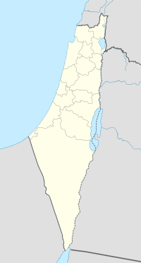
 Artuf
ArtufArabic عرتوف District Jerusalem Coordinates 31°46′02.38″N 35°00′05.17″E / 31.7673278°N 35.0014361°ECoordinates: 31°46′02.38″N 35°00′05.17″E / 31.7673278°N 35.0014361°E Population (1948) Area 403 dunums Date of depopulation 18 July 1948[1] Cause(s) of depopulation Military assault by Yishuv forces Current localities Naham Artuf (Arabic: عرتوف ) was a Palestinian village in the Jerusalem foothills depopulated in 1948. It was situated 21.5 kilometers (13.4 mi) west of Jerusalem on a high plateau, surrounded by plains on the south, east, and west. The village was on a secondary road that linked it to the main road to Jerusalem.[2]
Contents
History
Under the Ottoman Empire, in 1596, Artuf was a village in a nahiya ("subdistrict") of Ramla, part of Liwa of Gaza with a population of 110. The villagers paid taxes on a number of crops, including wheat, barley and fruit, as well as on goats, beehives and vineyards.[3] It was built on the ruins of an earlier settlement. In the late nineteenth century, Artuf was described as a small village built on a low hill overlooking a valley.[4]
Most houses were built of stone and mud; a few were built of stone and cement and had domed roofs. The villagers, who were all Muslims, worshipped in a mosque called the al-Umari Mosque, perhaps in reference to the second Muslim caliph, Umar ibn al-Khattab. The tomb of a local Muslim sage named Shaykh ´Ali al-Ghimadi stood on the outskirts of the village.[2] About half of the villagers worked in agriculture, while the rest worked in the nearby Bab al-Wad station, on the Jaffa–Jerusalem railway. The agricultural land extended west of the village, where fruit trees and almond trees were planted. In 1944/45, the village had a population of 350 people. A total of 279 dunums was used for cereals, 61 dunums were irrigated or used for orchards, of which 20 dunums were planted with olive trees.[2]
Establishment of Hartuv
Main article: HartuvIn 1883, a group of English missionaries purchased land in Artuf to establish an agricultural colony for Jews whom they hoped to convert to Christianity. When the settlers refused to convert, the project was abandoned.[5] It was resettled in 1895,[5] but destroyed in the 1929 riots.[6]
In 1917, Artuf served as the base camp for the 10th Light Horse Brigade that fought in the battle for Jerusalem.[7]
After 1948
After the establishment of the State of Israel, a ma'abara transit camp was established on the site for Jewish immigrants, and a cement factory was opened to provide employment.[5] In 1950, Moshav Naham was built on Hartuv's land.
According to the Palestinian historian Walid Khalidi, the village remaining structures in 1992 were: "One stone house, located outside the Jewish settlement of Nacham, has been expanded, and is now inhabited by a Jewish family. In the middle of the Jewish settlement is a small stone house that is used as a warehouse; it stands by the site of the former mosque. On the western slopes of the site is a circular structure with no roof that was formerly used as a lime kiln (kabbara). The village cemetery, to the west, has been levelled; only one or two graves remain on its eastern edge. Part of the British police headquarters is still standing. Elsewhere, the village site is covered with scattered stone rubble. Olive, fig, and cypress trees grow on the village site, especially in the west and north."[8]
Archaeology
Two archaeological sites nearby are Khirbat Marmita, about 1 km east of the village, and al-Burj, on the site of Hartuv to the southwest. Excavations have been carried out on Khirbat al-Burj by the Hebrew University since 1985.[2] Excavations in Hartuv revealed an architectural complex dating to the Early Bronze 1 period. The site includes a central courtyard surrounded by rooms on at least three sides. One of the rooms, a rectangular hall with pillar bases along its long axis, may have been a sanctuary with a line of standing stones (massebot). Another hall has a monumental entrance flanked by two monolithic door jambs. The complex appears to have had both religious and secular functions.[9]
See also
- List of Arab towns and villages depopulated during the 1948 Arab-Israeli War
References
- ^ Morris, 2004, p xx village 334. Also gives cause of depopulation
- ^ a b c d Khalidi, 1992, p.268
- ^ Hütteroth, Wolf-Dieter and Kamal Abdulfattah (1977), Historical Geography of Palestine, Transjordan and Southern Syria in the Late 16th Century. Erlanger Geographische Arbeiten, Sonderband 5. Erlangen, Germany: Vorstand der Fränkischen Geographischen Gesellschaft. p. 152. Quoted in Khalidi (1992), p. 268
- ^ Conder and Kitchener, 1881, III:22. Quoted in Khalidi, 1992, p.268
- ^ a b c "Remembering Har-Tuv," Avraham B. Rivlin, Special to the Jerusalem Post 1976
- ^ Jerusalem-Tel Aviv railway line dedication
- ^ Light Horse Brigade in Artuf
- ^ Khalidi, 1992, p.269
- ^ . JSTOR 1357126.
Bibliography
- Conder, Claude Reignier and H.H. Kitchener (1881): The Survey of Western Palestine: memoirs of the topography, orography, hydrography, and archaeology. London:Committee of the Palestine Exploration Fund. vol 3
- Hadawi, Sami (1970), Village Statistics of 1945: A Classification of Land and Area ownership in Palestine, Palestine Liberation Organization Research Center, http://www.palestineremembered.com/Articles/General-2/Story3150.html
- Khalidi, Walid (1992), All That Remains: The Palestinian Villages Occupied and Depopulated by Israel in 1948, Washington D.C.: Institute for Palestine Studies, ISBN 0-88728-224-5
- Morris, Benny (2004). The Birth of the Palestinian Refugee Problem Revisited. Cambridge University Press. ISBN 9780521009676. http://books.google.com/?id=uM_kFX6edX8C&printsec=frontcover&dq=benny+morris&q.
External links
- Palestine Remembered
- Reflections of the '48 Generation, Tikva Honig-Parnass, 16 May 2002
Arab towns and villages depopulated during the 1948 Palestine War Acre al-Amqa · Arab al-Samniyya · al-Bassa · al-Birwa · al-Damun · Dayr al-Qassi · al-Ghabisiyya · Iqrit · Iribbin · Jiddin · al-Kabri · Kafr 'Inan · Kuwaykat · al-Manshiyya · al-Mansura · Mi'ar · al-Nabi Rubin · al-Nahr · al-Ruways · Suhmata · al-Sumayriyya · Suruh · al-Tall · Tarbikha · Umm al-Faraj · al-Zeeb
Baysan Arab al-'Arida · Arab al-Bawati · Arab al-Safa · al-Ashrafiyya · al-Bira · Beisan · Danna · Farwana · al-Fatur · al-Ghazzawiyya · al-Hamidiyya · al-Hamra · Jabbul · Kafra · Kawkab al-Hawa · al-Khunayzir · Masil al-Jizl · al-Murassas · Qumya · al-Sakhina · al-Samiriyya · Sirin · Tall al-Shawk · al-Taqa · al-Tira · Umm 'Ajra · Umm Sabuna, Khirbat · Yubla · Zab'a · al-Zawiya
Beersheba Gaza Arab Suqrir · Barbara · Barqa · al-Batani al-Gharbi · al-Batani al-Sharqi · Bayt 'Affa · Bayt Daras · Bayt Jirja · Bayt Tima · Bil'in · Burayr · Dayr Sunayd · Dimra · al-Faluja · Hamama · Hatta · Hiribya · Huj · Hulayqat · Ibdis · Iraq al-Manshiyya · Iraq Suwaydan · Isdud · al-Jaladiyya · al-Jiyya · Julis · al-Jura · Jusayr · Karatiyya · Kawfakha · Kawkaba · al-Khisas · al-Masmiyya al-Kabira · al-Masmiyya al-Saghira · al-Muharraqa · Najd · Ni'ilya · Qastina · al-Sawafir al-Gharbiyya · al-Sawafir al-Shamaliyya · al-Sawafir al-Sharqiyya · Simsim · Summil · Tall al-Turmus · Yasur
Haifa Abu Shusha · Abu Zurayq · Arab al-Fuqara · Arab al-Nufay'at · Arab Zahrat al-Dumayri · 'Atlit · Ayn Ghazal · Ayn Hawd · Balad ash-Sheikh · Barrat Qisarya · Burayka · al-Burj · al-Butaymat · Daliyat al-Rawha' · al-Dumun · al-Ghubayya al-Fawqa · al-Ghubayya al-Tahta · Hawsha · Ijzim · Jaba' · al Jalama · Kabara · al-Kafrayn · Kafr Lam · al-Kasayir · Khubbayza · Lid · al-Manara · al-Mansi · al-Mansura · al-Mazar · Naghnaghiya · Qamun · Qannir · Qira · Qisarya · Qumbaza · al-Rihaniyya · Sabbarin · al-Sarafand · Khirbat al-Sarkas · Khirbat Sa'sa' · al-Sawamir · Khirbat al-Shuna · al-Sindiyana · al-Tantura · al-Tira · Umm al-Shawf · Umm al-Zinat · Wa'arat al-Sarris · Wadi Ara · Yajur
Hebron 'Ajjur · Barqusya · Bayt Jibrin · Bayt Nattif · al-Dawayima · Deir al-Dubban · Dayr Nakhkhas · Kudna · Mughallis · al-Qubayba · Ra'na · Tell es-Safi · Umm Burj · az-Zakariyya · Zayta · Zikrin
Jaffa al-'Abbasiyya · Abu Kabir · Abu Kishk · Bayt Dajan · Biyar 'Adas · Fajja · al-Haram · Ijlil al-Qibliyya · Ijlil al-Shamaliyya · al-Jammasin al-Gharbi · al-Jammasin al-Sharqi · Jarisha · Kafr 'Ana · al-Khayriyya · al-Mas'udiyya · al-Mirr · al-Muwaylih · Rantiya · al-Safiriyya · Salama · Saqiya · al-Sawalima · al-Shaykh Muwannis · Yazur
Jerusalem Allar · Aqqur · Artuf · Bayt 'Itab · Bayt Mahsir · Bayt Naqquba · Bayt Thul · Bayt Umm al-Mays · al-Burayj · Dayr Aban · Dayr 'Amr · Dayr al-Hawa · Dayr Rafat · Dayr al-Shaykh · Deir Yassin · Ayn Karim · Ishwa · Islin · Ism Allah · Jarash · al-Jura · Kasla · al-Lawz · Lifta · al-Maliha · Nitaf · al-Qabu · Qalunya · al-Qastal · Ras Abu 'Ammar · Sar'a · Saris · Sataf · Sheikh Badr · Suba · Sufla · al-Tannur · al-'Umur · al-Walaja
Jenin Nazareth Indur · Ma'alul · al-Mujaydil · Saffuriyya
Ramla Abu al-Fadl · Abu Shusha · Ajanjul · Aqir · Barfiliya · al-Barriyya · Bashshit · Bayt Far · Bayt Jiz · Bayt Nabala · Bayt Shanna · Bayt Susin · Bir Ma'in · Bir Salim · al-Burj · al-Buwayra · Daniyal · Dayr Abu Salama · Dayr Ayyub · Dayr Muhaysin · Dayr Tarif · al-Duhayriyya · al-Haditha · Idnibba · Innaba · Jilya · Jimzu · Kharruba · al-Khayma · Khulda · al-Kunayyisa · al-Latrun · Lydda · al-Maghar · Majdal Yaba · al-Mansura · al-Mukhayzin · al-Muzayri'a · al-Na'ani · an-Nabi Rubin · Qatra · Qazaza · al-Qubab · al-Qubayba · Qula · Ramla · Sajad · Salbit · Sarafand al-Amar · Sarafand al-Kharab · Saydun · Shahma · Shilta · al-Tina · al-Tira · Umm Kalkha · Wadi Hunayn · Yibna · Zakariyya · Zarnuqa
Safad Abil al-Qamh · al-'Abisiyya · 'Akbara · Alma · Ammuqa · Arab al-Shamalina · Arab al-Zubayd · Ayn al-Zaytun · Baysamun · Biriyya · al-Butayha · al-Buwayziyya · Dallata · al-Dawwara · Dayshum · al-Dirbashiyya · al-Dirdara · Fara · al-Farradiyya · Fir'im · Ghabbatiyya · Ghuraba · al-Hamra' · Harrawi · Hunin · al-Husayniyya · Jahula · al-Ja'una · Jubb Yusuf · Kafr Bir'im · al-Khalisa · Khan al-Duwayr · Karraza, Khirbat · al-Khisas · Khiyam al-Walid · Kirad al-Baqqara · Kirad al-Ghannama · Lazzaza · Madahil · Al-Malkiyya · Mallaha · al-Manshiyya · al-Mansura · Mansurat al-Khayt · Marus · Meiron · al-Muftakhira · Mughr al-Khayt · al-Muntar · al-Nabi Yusha' · al-Na'ima · Qabba'a · Qadas · Qaddita · Qaytiyya · al-Qudayriyya · al-Ras al-Ahmar · Sabalan · Safsaf · Saliha · al-Salihiyya · al-Sammu'i · al-Sanbariyya · Sa'sa' · al-Shawka al-Tahta · al-Shuna · Taytaba · Tulayl · al-'Ulmaniyya · al-'Urayfiyya · al-Wayziyya · Yarda, Safad · al-Zahiriyya al-Tahta · al-Zanghariyya · al-Zawiya · al-Zuq al-Fawqani · al-Zuq al-Tahtani
Tiberias Awlam · al-Dalhamiyya · Ghuwayr Abu Shusha · Hadatha · al-Hamma · Hittin · Kafr Sabt · Lubya · Ma'dhar · al-Majdal · al-Manara · al-Manshiyya · al-Mansura · Nasir al-Din · Nimrin · al-Nuqayb · Samakh · al-Samakiyya · al-Samra · al-Shajara · al-Tabigha · al-'Ubaydiyya · al-Wa'ra al-Sawda', Khirbat · Yaquq
Tulkarm Khirbat Bayt Lid · Bayyarat Hannun · Fardisya · Ghabat Kafr Sur · al Jalama · Kafr Saba · al-Majdal · al-Manshiyya · Miska · Qaqun · Raml Zayta · Tabsur · Umm Khalid · Wadi al-Hawarith · Wadi Qabbani · al-Zabadida · Khirbat Zalafa
Categories:- 1929 Palestine riots
- Arab villages depopulated during the 1948 Arab–Israeli War
- District of Jerusalem

Wikimedia Foundation. 2010.