- Central Expressway (Dallas)
-
"NCX" redirects here. For other uses, see NCX (disambiguation).
 Central Expressway at Fitzhugh Avenue
Central Expressway is a north–south highway in Dallas, Texas (USA) and surrounding areas.
Contents
North Central Expressway
The best-known section is the North Central Expressway, a name for a freeway section of U.S. Highway 75 between downtown Dallas and McKinney, Texas. The southern terminus is at an intersection with "hidden" Interstate 345 (signed as Interstate 45) and Woodall Rodgers Expressway.[1]
South of US 75's terminus, North Central Expressway briefly continues south in the median of I-345, then becomes a surface street through the eastern side of downtown Dallas. The surface street section south of Pearl Street was renamed for César Chávez in April, 2010[2].
The North Central Expressway is near high-income neighborhoods and enclave cities such as Highland Park and University Park. The freeway is also adjacent to popular districts including Uptown, Cityplace, Lower Greenville, NorthPark Center, and the Telecom Corridor. Near the intersection of Central Expressway and Mockingbird Lane is Southern Methodist University, and Mockingbird Station.
The Dallas Area Rapid Transit light rail system has a tunnel underneath the North Central Expressway between downtown Dallas and Mockingbird Station.
History
The Central project was first proposed by Dallas City Planner George E. Kessler in 1911, who suggested that the city buy the right of way of the Houston and Texas Central Railroad (H&TC) to remove the railway tracks and construct a Central Boulevard (later renamed the Central Expressway project) in their place. The Central project became a real project in the 1920's (with first mention in The Dallas Morning News in December 1924), but resistance from the Southern Pacific railroad company proved to be a serious obstacle that delayed the project for decades. Southern Pacific opposed the use of their railroad's right of way to construct the Central Expressway, and it was this opposition and lobbying of political forces that caused the significant delays in the construction to the early 1950s.[3]
Parts of the North Central Expressway were opened in 1950. The route from Downtown to Mockingbird Lane was fully functional by the end of 1952, and the whole route to Campbell Road in Richardson was opened for traffic in August 1956. By the time the Central Expressway opened for traffic, North Dallas and Richardson had already expanded beyond expectations, and the new highway was already hopelessly inadequate by the 1960s. The Expressway did not reach the city of Anna and the northern Collin County line until late 1969 or early 1970.
Reconstruction
Prior to reconstruction, the North Central Expressway was considered to be one of the most poorly designed freeways in the nation.[4][5] Though initially an engineering marvel as Dallas's first freeway when it opened to traffic in 1950, the explosive growth that soon hit north Dallas and the nearby suburbs quickly overwhelmed its design and capacity. By the 1980s, the four-lane freeway had acquired a reputation for severe rush-hour traffic jams.
In the early 1980s, the TxDOT floated plans to build an elevated structure above the existing freeway[citation needed]. After considerable study and debate, elevated structures were eliminated. Construction started in 1992 and was finally completed in November 1999. Total reconstruction cost was around $600 million.
Current state
The facility has 8 continuous general-purpose lanes from downtown Dallas to Legacy Drive in Plano except for a six-lane segment where it passes under Interstate 635 (two additional lanes are present but are only entrance ramps/exit ramps for Forest Lane and Midpark Road). For the six miles (10 km) north of downtown Dallas, the freeway lies more than 30 feet (9.1 m) below adjacent and partially cantilevered frontage roads.
Aesthetic treatment
The freeway's architecturally distinctive design distinguishes it as one of the nation's most attractive urban freeways. Every structure and element along the highway right-of-way was given aesthetic attention during the design phase. Support columns for overpasses and bridges have been designed to be as visually appealing as possible. The beige concrete columns which form the support structure for the retaining walls contrast with the brown, textured infill panels of the walls to create a multicolored and articulated edge to the freeway. Two million square feet[citation needed] of these walls along the nine mile (14 km)-long project distinguishes the freeway.
Freedman's Cemetery
Central Expressway's 1940s construction methods would come to represent inadequacies of both civil engineering and social engineering. The southern end of North Central Expressway passed through a historic African-American neighborhood, displacing 1,500 black residents. But the full scale of the injustice was not revealed until preparations began for the 1990s expansion of the route. The living weren't the only ones displaced; a quarter of the 4-acre (16,000 m2) Freedman's Cemetery, with graves dating back to Emancipation, had been paved over. Archeological excavations uncovered the remains of over 1,100 men, women, and children under existing and proposed roadways. After their reburial, the site was turned into a memorial to the working-class black residents of the area, which after the expressways were built, became the upscale Uptown Dallas neighborhood.[6]
South Central Expressway
From south of Main Street and its crossing under the Interstate 45 overhead in downtown Dallas, Central Expressway became the South Central Expressway. The road met Interstate 30 at a three-level interchange and continued south as a surface road down to I-45. This section was renamed in honor of César Chávez in April, 2010[7]. Upon crossing under I-45, it becomes U.S. Highway 175 and is signed both as South Central Expressway and S.M. Wright Freeway (named for a local minister). Where US 175 turns off to the east, the road continues south as State Highway 310; the S.M. Wright Freeway name ends at Loop 12, past the end of freeway standards. The South Central Expressway continues past a partial interchange with Interstate 20 to end at a merge with I-45 north of Hutchins. This section through and south of downtown mainly serves local traffic. I-45 was built roughly parallel to it. However, the parallel section of I-45 north of the Trinity River is completely elevated, and is often difficult to traverse when ice storms hit Dallas (about once per year); thus, South Central often takes over some of the traffic during this time.
Future changes
The US 175 section is due to be rerouted in the future, off South Central/S.M. Wright onto a new alignment, further extending C.F. Hawn Freeway west to I-45; it has not been reported whether or not the State Highway 310 numbering would replace US 175's when it is rerouted. Meanwhile, TxDOT is preparing to redesign the portion of South Central/S.M. Wright (between I-45 and US 175's current east turn) into a surface-street boulevard, and has held meetings with local residents about the project. Many have differences of opinion; some want a 4-lane arrangement, others want 6 lanes. Some even think TxDOT is to blame for dividing the surrounding neighborhood. Unfortunately, there is not current funding for the project, and even if there were, it would be 2015 at the earliest before US 175's rerouting could be finished [8][9][10].
Exit list
South Central Expressway
County Location Destinations Notes Dallas Dallas Lamar Street northbound exit and southbound entrance Municipal Avenue; Lamar Street northbound exit and entrance Haven Street southbound exit and entrance  U.S. Highway 175 east - Kaufman
no southbound entrance Hatcher Street no northbound exit Pine Street Metropolitan Avenue Pennsylvania Avenue northbound exit and southbound entrance Martin Luther King Jr. Boulevard northbound exit only  Interstate Highway 45 to U.S. Highway 75 - McKinney
northbound exit and southbound entrance Good-Latimer Expressway northbound exit and southbound entrance At this point South Central Expressway becomes a surface road through Downtown Dallas.
North Central Expressway
North Central Expressway is the only highway in Texas to use a consecutive-numbering system as opposed to a mile marker system. The numbering system south of I-635 changed drastically when several exits were consolidated; north of I-635 the system remained the same. When US 75 was rerouted west of Sherman and Denison, additional exits took the next available numbers.
North of McKinney, US 75 is not referred to as Central Expressway, giving way to other names such as Collins Freeway (Howe) and Sam Rayburn Freeway (Sherman).
County Location # Destinations Notes Dallas Dallas Old Bryan Street; Good-Latimer Expressway southbound exit and northbound entrance  Interstate Highway 45 south - Houston (Interstate Highway 345 south)
southbound exit and northbound entrance 285 Ross Avenue southbound exit only; exit no. corresponds to I-45 1A  to Interstate Highway 35E - Denton; Waco (Spur 366 west)
southbound exit and northbound entrance; northbound where I-45 becomes US 75, exit 286; no. corresponds to I-45 north 1 (Hall Street) 2 (Lemmon Avenue) 3 1B Haskell Avenue; Blackburn Street; Fitzhugh Avenue; Lemmon Avenue 4 (Fitzhugh Avenue) 5 2 Knox Street; Henderson Avenue; Monticello Avenue; Fitzhugh Avenue 6 (Monticello Avenue) 7 (McCommas Boulevard) 8 3 Mockingbird Lane; University Boulevard; Monticello Avenue 9 (Yale Boulevard) 10 (University Boulevard) 11 4A Lovers Lane; Southwestern Boulevard; University Boulevard exit 4 southbound 12 (Southwestern Boulevard) 13 4B Caruth Haven Lane southbound exit is combined with 5A 14-15 5A  Loop 12 - Caruth Haven Lane
16 5B Northpark Boulevard; Park Lane 17 6 Walnut Hill Lane; Meadow Road 18 (Meadow Road) 19 7 Royal Lane; Meadow Road 20A 8A Forest Lane exit 20-20A southbound 20B 8B Coit Road northbound exit and southbound entrance 20B Frontage Road northbound exit only 21  Interstate Highway 635
20A Churchill Way southbound exit and northbound entrance 22 Midpark Road Richardson 23 Spring Valley Road 24 Belt Line Road; Main Street 25 Arapaho Road 26 Campbell Road northbound exit and southbound entrance 27A Galatyn Parkway; Renner Road; Campbell Road exit 26 southbound Collin 27 Renner Road southbound exit and northbound entrance 28A Plano Parkway 28B President George Bush Turnpike Plano 29 15th Street (former FM 544) northbound exit and southbound entrance 29A Park Boulevard; 15th Street 30 Parker Road 30A Frontage Road southbound exit only 31 Spring Creek Parkway 32 Legacy Drive 32A Frontage Road northbound exit and southbound exit Allen 33 Bethany Drive 34 McDermott Drive (former FM 2170) 35 Allen Drive northbound exit and southbound entrance 36 Exchange Parkway 37  Farm to Market Road 2786 - Stacy Road
38 Ridgeview Drive 38A 
 State Highway 121 south; to State Highway 5 - Fort Worth (Spur 399; former Farm to Market Road 720)
SH 121 joins northbound and leaves southbound McKinney 39 Eldorado Parkway 40A 
 Farm to Market Road 3038; Spur 359 - Louisiana Street; Virginia Parkway
40B White Avenue northbound exit and southbound entrance 41  U.S. Highway 380 - Greenville; Denton
42 Wilmeth Road 43  Farm to Market Road 543 - Weston Road
44 Telephone Road; Davis Road 45 State Highway 121 north - BonhamSH 121 joins southbound and leaves northbound Melissa 46 Melissa Road 47 Throckmorton Road; Foster Crossing Road Anna 48  Farm to Market Road 455 - Anna-Weston Road
49 Mantua Road 50 County Line Road Grayson Van Alstyne 51  Farm to Market Road 121 - Van Alstyne
due to confusion between this exit and State Highway 121 (a few miles to the south, which leads to DFW Airport), southbound highway signs are marked "DFW TRAFFIC DO NOT EXIT" 52 Farmington Road Howe 53  Spur 381 - Howe
54 
 Farm to Market Road 902; State Highway 5
Sherman 55A Frontage Road southbound exit and entrance 55 Frontage Road 56  Farm to Market Road 1417
56A South Travis Street northbound exit and southbound entrance 56B Frontage Road northbound exit only 57 Park Street; Center Street 58  State Highway 56 - Lamar Street; Houston Street
Lamar Street is one way eastbound; Houston Street is one way westbound 59 Washington Street no southbound entrance 60  Farm to Market Road 131 - Travis Street; Taylor Street
61  State Highway 91 north — Texoma Parkway
no southbound exit 62 Lamberth Road northbound exit and southbound entrance 63  U.S. Highway 82 - Bonham; Gainesville
64 Loy Lake Road; Fallon Drive 65  Farm to Market Road 691 - Grayson County Airport; Grayson County Junior College
Denison 66  Spur 503 - Denison
67 Loy Lake Road 68 Crawford Street Road 69  Farm to Market Road 120 - Pottsboro; Lake Texoma
70  Farm to Market Road 84
71 Randell Lake Road 72 State Highway 9173  U.S. Highway 69 south - Greenville; Denison
US 69 joins northbound and leaves southbound 74 Texas Travel Info Center Images of Central Expressway
-

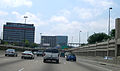
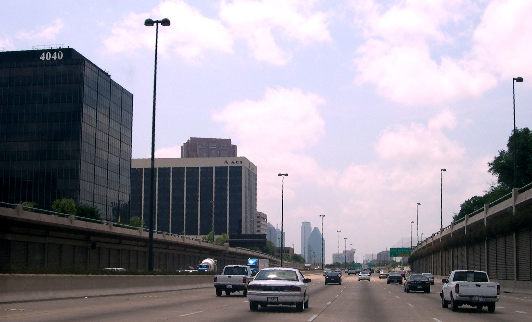
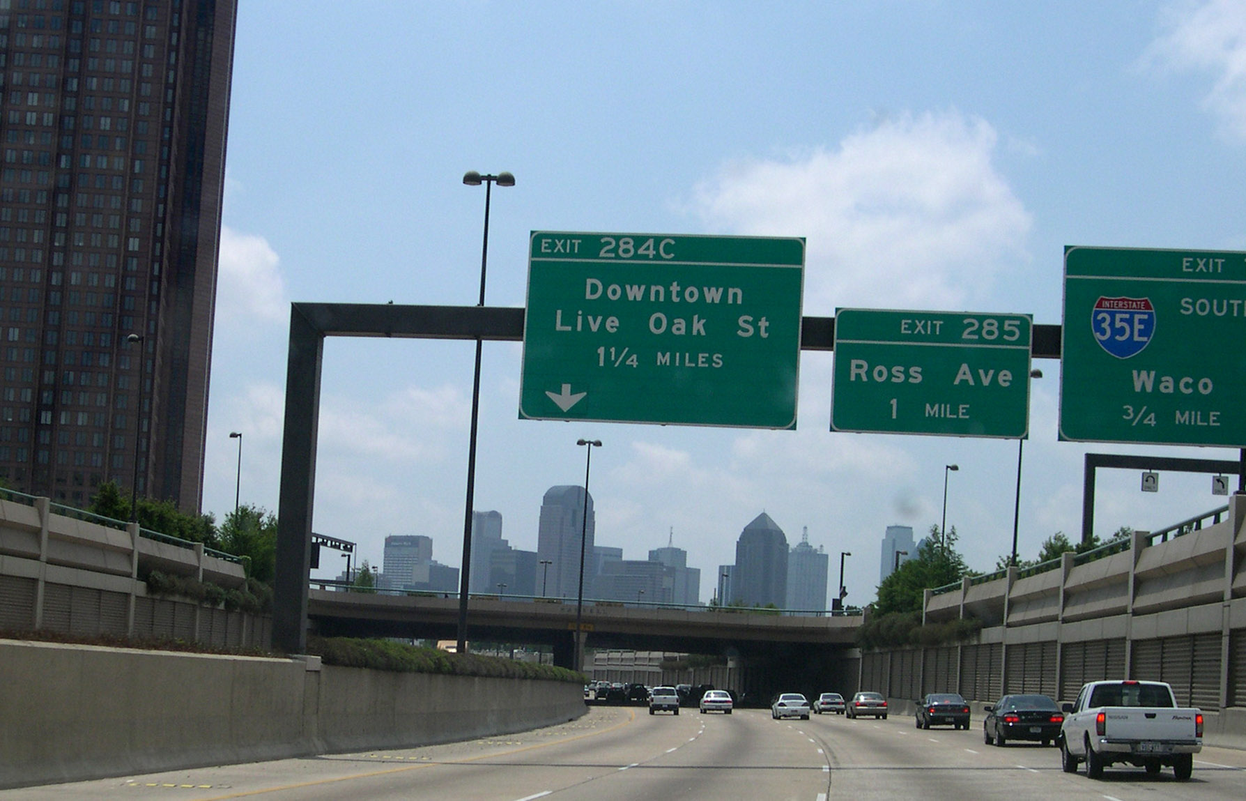
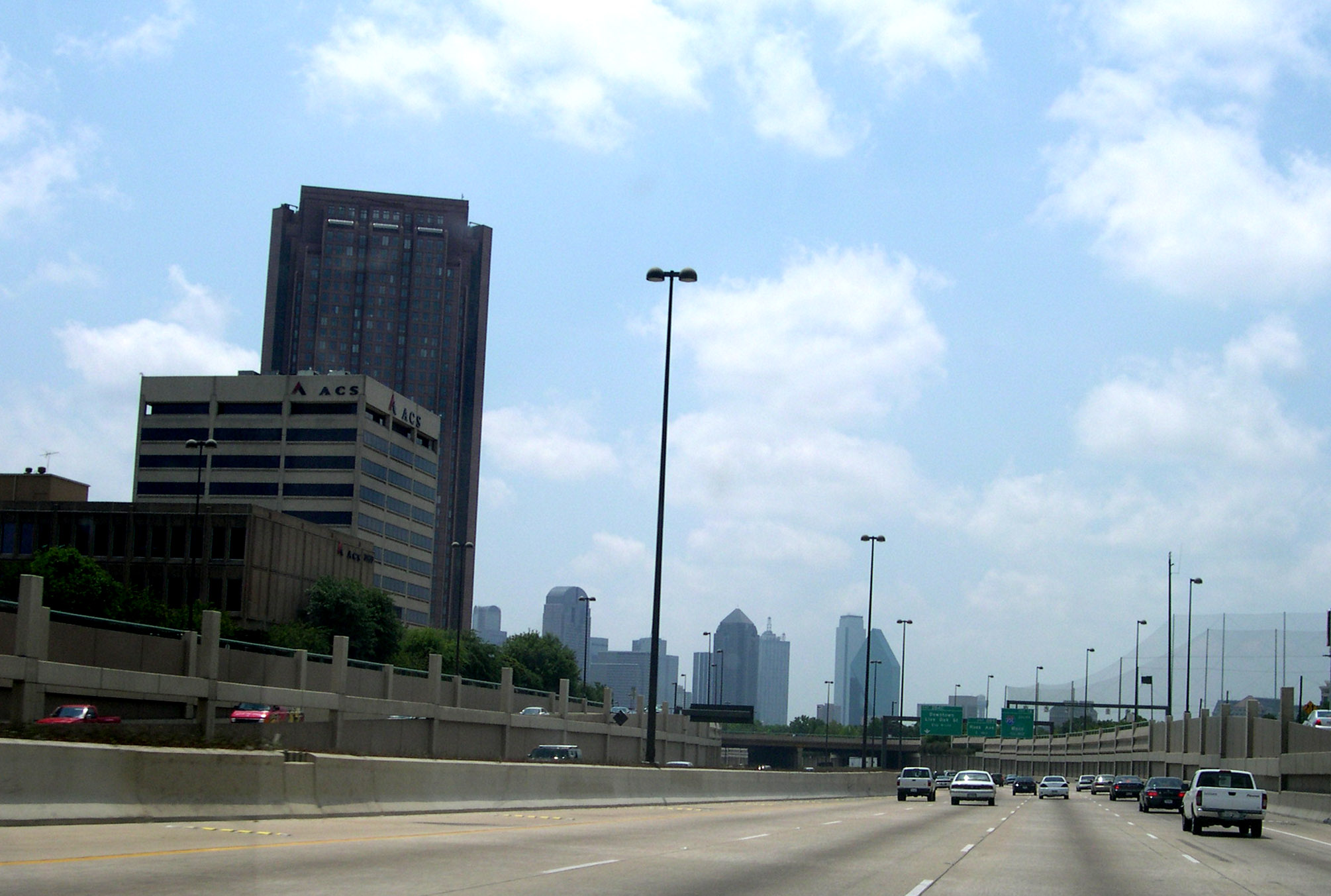
Central Expressway heading southbound, towards Downtown Dallas
-
Central Expressway near NorthPark Center
-
Central Expressway near Southern Methodist University and Mockingbird Lane
-

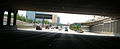
Central Expressway at Haskell Ave
References
- ^ www.interstate-guide.com
- ^ Cesar Chavez Street Signs Debuted Today At City Hall, Along Cesar Chavez Blvd., Unfair Park blog, Dallas Observer, Patrick Michels--writer, April 9, 2010. Retrieved 2010-04-10.
- ^ VickeryPlace.com: archive of newspaper clippings on the History of Central Expressway
- ^ Texasfreeway.com - Photos from after renovation
- ^ Texasfreeway.com - Historic photos
- ^ http://www.projectpast.org/jcbrandon/papers/dallas2004.asp
- ^ Cesar Chavez Street Signs Debuted Today At City Hall, Along Cesar Chavez Blvd., Unfair Park blog, Dallas Observer, Patrick Michels--writer, April 9, 2010. Retrieved 2010-04-10.
- ^ TxDOT Dazzles Southern Dallas With Plans to Straighten Out "Statistically Dangerous Curve" on S.M. Wright, Dallas Observer "Unfair Park" Blog, Daniel Rodrigue--writer, March 31, 2010. Retrieved 2010-05-22.
- ^ SMWrightProject.org, Halff Associates, Inc. Retrieved 2010-05-22
- ^ Some say fix for S.M. Wright Freeway isn't enough, Dallas Morning News, Michael A. Lindenburger--writer, May 16, 2010. Retrieved 2010-05-22.
Categories:- Transportation in the Dallas – Fort Worth Metroplex
- Highways in Dallas, Texas
- U.S. Route 75
-


Wikimedia Foundation. 2010.