- Texas State Highway 289
Infobox TX State Highway
type=State
route=289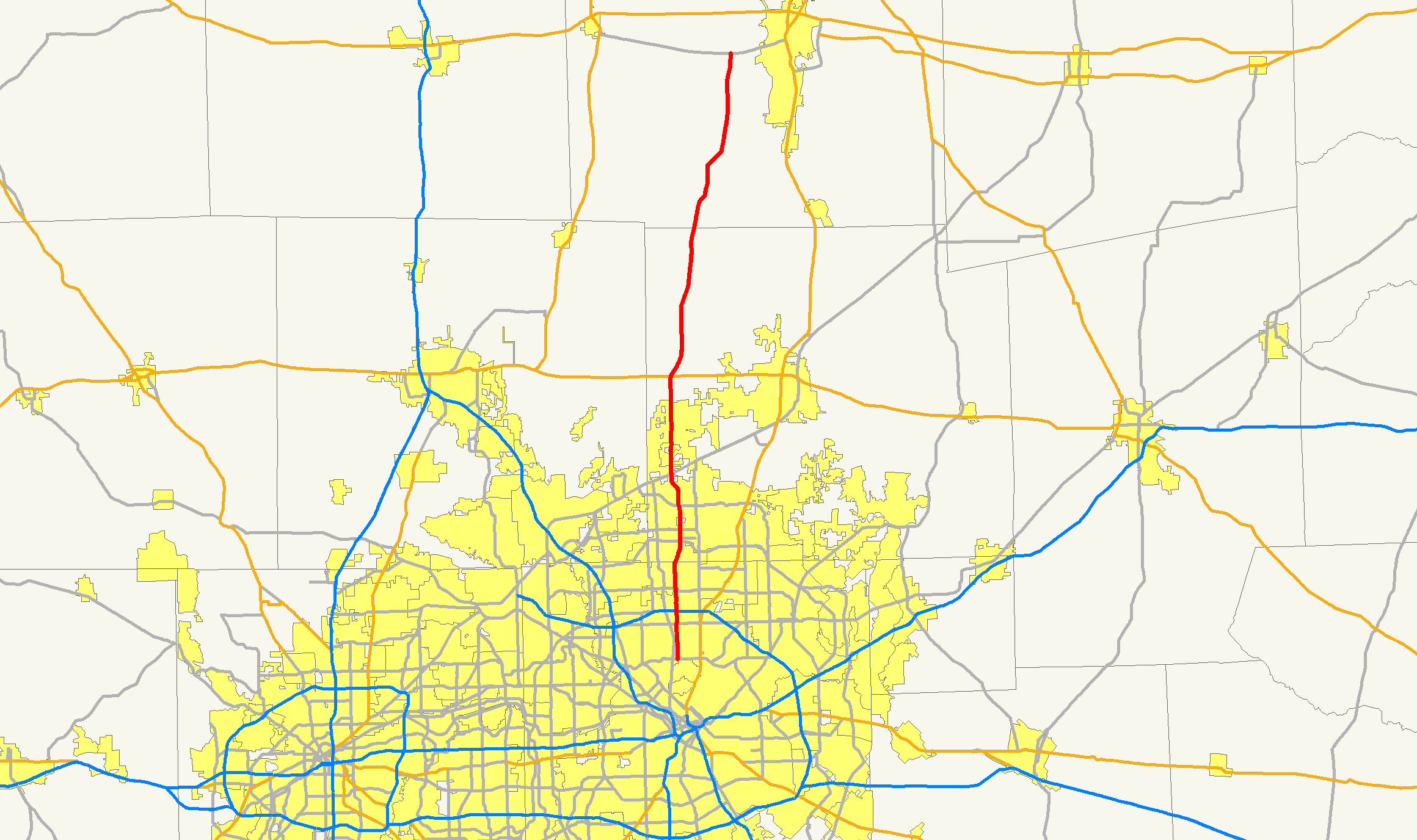
length_mi=53.703Texas Department of Transportation , [http://www.dot.state.tx.us/tpp/hwy/sh/sh0289.htm] ]
length_km=86.42
formed=1939
dir1=North
dir2=South
from=
junction=
PGBT
to=| previous_type=State
previous_route=288
next_type=State
next_route=290State Highway 289, known for most of its length as Preston Road, is a north-south
Texas state highway. It begins at the intersection of Preston Road and Loop 12/Northwest Highway.Prior to 1989, it began north of downtown Dallas,
Texas (USA) in the Oak Lawn neighborhood at an intersection with Pearl Street. From there, the highway designation followed Cedar Springs Road northeast for less than a block, and upon an intersection with Maple Avenue, ran northwest up that street. Less than a mile later at an intersection with Oak Lawn Avenue, the highway designation turned northeast up Oak Lawn, which it followed into Highland Park. There it was known as Oak Lawn Avenue until an intersection with Armstrong Parkway, where it became Preston Road.The road is known as Preston all the way north through the remainder of the
Dallas-Fort Worth Metroplex to a junction with State Highway 56 west of Sherman,Texas , near theOklahoma border (except for the portion through Gunter which is designated as 8th Street).The Preston Road designation comes from the fact that the highway generally follows the course of an older road known as the
Preston Trail , which ran to the town of Preston Bend. Preston Bend is now completely submerged byLake Texoma .Preston Road passes through many of the fast-growing northern Dallas suburbs, including Frisco and Plano, as well as Prosper and Celina, which have started seeing new housing developments along Preston.
Preston Road is one of the most congested highways in the
Dallas/Fort Worth Metroplex ; however, due to urban growth along the highway there is minimal room to add additional lanes, and no means to upgrade the road to freeway status without incurring significant cost to demolish businesses along the path. Instead, the nearbyDallas North Tollway generally parallels Preston Road.Future improvements/extension
Construction is underway to extend SH 289 north to connect with Farm to Market Road 120 near
Pottsboro, Texas , another segment of the oldPreston Trail which ends on the south shore ofLake Texoma . This will provide another access route toNorth Texas Regional Airport , which has been proposed as a third airport for the DFW area.Approximately US$63 million in bonds has been sold by
Grayson County, Texas (where the extended road would be built). TheTexas Department of Transportation has promised US$85 million in reimbursements for the bonds sold by the county.References
*"Bonds sold for new SH 289 project",
The Herald Democrat , January 21, 2007.
Wikimedia Foundation. 2010.