- Texas State Highway 114
Infobox TX State Highway
type=State
route=114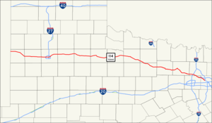
length_mi=194.452
length_ref=TxDOT|SH|114|accessdate=2008-03-15]
length_round=3
formed=by 1933
dir1=West
dir2=East
from=jct|state=NM|NM|114
junction=jct|state=TX|US|385
jct|state=TX|US|62|US|82
jct|state=TX|US|84
jct|state=TX|I|27|US|87
jct|state=TX|US|83
jct|state=TX|US|183|US|277|US|283
jct|state=TX|US|281
jct|state=TX|US|380
jct|state=TX|US|81|US|287
jct|state=TX|I|35W
jct|state=TX|US|377
to=jct|state=TX|SH|183 in Irving
previous_type=State
previous_route=113
next_type=State
next_route=115
browse=tx browse
previous_type=state
previous_route=115
route=SH 116
next_type=state
next_route=117State Highway 114 or SH 114 is a
state highway that runs from theDallas-Fort Worth Metroplex westward across the state to the state border withNew Mexico , where it becomesNew Mexico State Road 114 , which eventually ends atElida, New Mexico at US 70/NM 330 .History
The route was originally planned by 1933 as connector between Dallas and Bridgeport. By 1939, this section was completed, with an extension northward from Chico to Sunset. This route remained little changed until 1973, when it was extended northward from Sunset to Bowie. Major rerouting was made in 1976, when the route was redirected west over U.S. Highway 380, U.S. Highway 281, former SH 199, and U.S. Highway 82 from Bridgeport to Lubbock, with the stretch from Bridgeport to Bowie transferred to SH 101. In 1977, the route was extended to the New Mexico border, connecting to it sister
New Mexico State Highway 114 , replacing State Highway 116.Route desription
The highway's eastern terminus is at the intersection with SH 183 at
Texas Stadium in Irving. It continues northwest as the "John W. Carpenter Freeway" (a name shared with SH 183) along theDallas-Fort Worth International Airport , eventually crossing the airport's northern entrance, proceeding west into Grapevine. At Grapevine, it continues northwest through Southlake and Westlake, eventually intersecting Interstate 35W atTexas Motor Speedway . Except for the western end, most of this route is freeway; the SH 114 Business road in the Roanoke area (the original routing of the highway) is named for the late golferByron Nelson , who lived in that area.From there, it continues on a mostly northwesterly course as a rural highway, passing through many towns: Rhome, Boyd and Bridgeport, where it joins U.S. Highway 380 through Jacksboro. It continues through rural Texas, passing through Olney, Megargel, Seymour (where it joins U.S. Highway 82), Benjamin, Guthrie, Dickens, Crosbyton, Ralls, Lorenzo (where it also joins U.S. Highway 62) and Idalou before eventually turning southwest into Lubbock.
In Lubbock, Highway 114 follows Idalou Road where it separates from US 82, then bears west along 19th Street, eventually forming the southern boundary of
Texas Tech University , where it then separates from US 62. It passes Loop 289 and exits Lubbock continuing towards the west along 19th Street and then Levelland Highway. As it continues west, it passes through Smyer, Levelland, Whiteface and Morton before crossing into New Mexico.Junction list
References

Wikimedia Foundation. 2010.