Texas State Highway Loop 12 — State Highway Loop 12 Route information … Wikipedia
Texas State Highway 158 — Infobox TX State Highway type=State route=158 length mi=170.2Texas Department of Transportation, [http://www.dot.state.tx.us/tpp/hwy/sh/sh0158.htm] ] length km=272.3 formed=1992 dir1=West dir2=East from= junction= |to= previous type=State… … Wikipedia
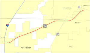
Texas State Highway 12 — Infobox TX State Highway type=State route=12 length mi=19.6Texas Department of Transportation, [http://www.dot.state.tx.us/tpp/hwy/sh/sh0012.htm] ] length km=31.5 formed=1959 dir1=West dir2=East from= to= previous type=State previous route=11… … Wikipedia
Texas State Highway 99 — Infobox TX State Highway type=State route=99 shields= length mi=31.675 length ref=TxDOT|SH|99|accessdate=2008 03 11] length round=1 formed=1984 dir1=South dir2=North from=jct|state=TX|US|59|FM|2759 in Sugar Land, jct|state=TX|FM|1405 near Baytown … Wikipedia
Texas State Highway 171 — Infobox TX State Highway type=State route=171 length mi=110.845 length ref=TxDOT|SH|171|accessdate=2008 03 13] length round=3 formed=by 1933 dir1=West dir2=East from=jct|state=TX|US|180 at Weatherford junction=jct|state=TX|I|20… … Wikipedia
Texas State Highway 146 — Infobox TX State Highway type=State route=146 length mi=105.97Texas Department of Transportation, [http://www.dot.state.tx.us/tpp/hwy/sh/sh0146.htm] ] length km=170.54 formed=before 1933 dir1=North dir2=South from= junction= |to= previous… … Wikipedia
Texas State Highway 33 — Infobox TX State Highway type=State route=33 length mi=22.7Texas Department of Transportation, [http://www.dot.state.tx.us/tpp/hwy/sh/sh0033.htm] ] length km=36.5 formed=1955 dir1=West dir2=East from= junction= to= previous type=SH previous route … Wikipedia
Texas State Highway Spur 69 — Infobox TX State Highway type=Spur route=69 shields= length mi=1.26 length km=2.03 length ref= formed=orig. 1939 curr. 1969 dir1=West dir2=East from=jct|state=TX|RM|2222 at Lamar Boulevard to=jct|state=TX|US|290 at jct|state=TX|I|35 previous type … Wikipedia
List of Texas State Highways — Interstate HighwaysPrimary Interstate RoutesRoutes from Interstate 35 Routes from U.S. Highway 75 Routes from U.S. Highway 81 Routes from U.S. Highway 90 =State Highways= tate Highways 1 99* * * * * * * * * * * * * * * * * * * * * * * * * *Texas… … Wikipedia
Oklahoma State Highway 51 — State Highway 51 Route information … Wikipedia