- Norwood Green
-
- For Norwood Green, in West Yorkshire, see Norwood Green, West Yorkshire
Coordinates: 51°29′38″N 0°21′51″W / 51.4939°N 0.3641°W
Norwood Green 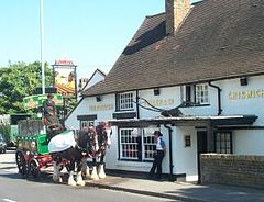
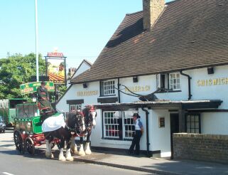
The Plough
 Norwood Green
Norwood Green shown within Greater LondonOS grid reference TQ135785 - Charing Cross 10.7 mi (17.2 km) E London borough Ealing Ceremonial county Greater London Region London Country England Sovereign state United Kingdom Post town SOUTHALL Postcode district UB2 Dialling code 020 Police Metropolitan Fire London Ambulance London EU Parliament London UK Parliament Ealing Southall London Assembly Ealing and Hillingdon List of places: UK • England • London Norwood Green is a place in the London Borough of Ealing in London, England. It is a suburban development situated 10.7 miles (17.2 km) west of Charing Cross and 4 miles (6.4 km) northeast of Heathrow Airport. It lends its name to a much larger electoral ward within Ealing, which has a population of 12,500.[1]
Contents
History
Norwood Green is the modern name for the old hamlet called Norwood in the manor of Norwood, this name in turn derives from the Saxon settlement name of Northuuda.[2]
The manor of Norwood was in the parish of Hounslow until 1859 when the church of St Mary became the parish church for a new parish that also took the name Norwood. This new parish encompassed also the hamlets of Southall and Northcotte.[3][4]
In 1894, under the Local Government Act 1894, Norwood Green formed part of the Southall Norwood Urban District of Middlesex. The urban district gained further status as a municipal borough in 1936 and was renamed Southall. When the municipal borough was abolished in 1965, under the London Government Act 1963, the area became part of the London Borough of Ealing.[5]
Geography
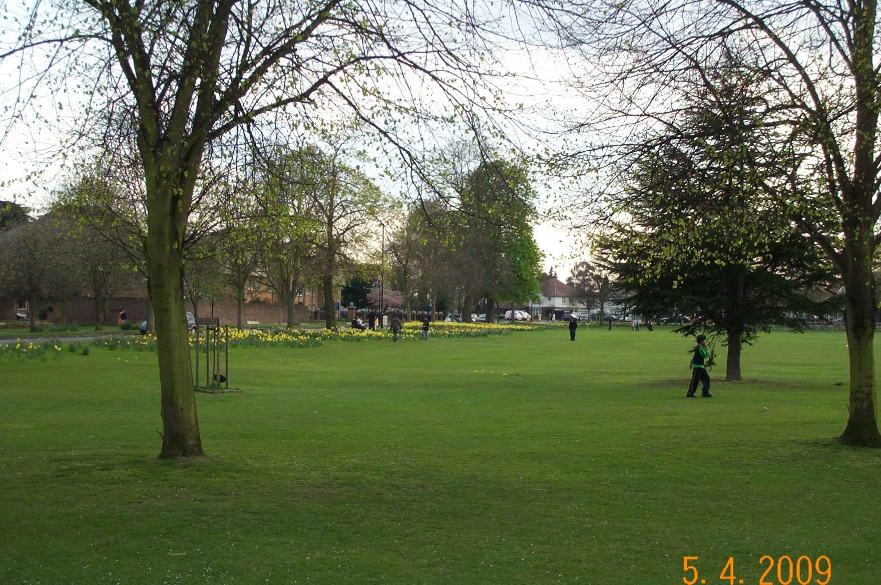
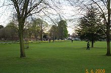 Norwood Green's green (springtime, SW corner )
The area of this settlement is bounded by the Grand Union Canal to the north, Osterley Lane to the south, Windmill Lane to the east and Norwood Road to the west. The village retains its green, church and local pub but the local metropolitan police station and Post Office closed in 2008. There is a primary school in Norwood Green. The roadsides are lined with trees and there are several open spaces and wooded areas. Residential property consists of a mix of bungalows, large and small detached, semi-detached and terraced houses.
The parish church, St Mary The Virgin, has a bell-tower and is a Grade II* listed building. One local pub, The Plough, has an old stable block and both are grade II listed building. The Plough serves hand-drawn Fullers beers and featured in the Good Beer Guide published by CAMRA. The pubs to the north of the Green, The Wolf, and further on, by the canal, The Lamb both closed in 2009, however The Lamb reopened in November 2009 under new management. The second Saturday of June is when the residents' Association hold Village Day on the green - a local fete - and the church is dressed and opened to visitors.
Transport
Three Bridges (a transport intersection, designed and built by the Victorian Engineer, Isambard Kingdom Brunel) in the north-east corner, is claimed as an ancient monument. It is located where north-south running Windmill Lane goes over the Grand Union Canal as it "flows" West-East towards the Thames at Brentford and where the canal goes over the single track, freight only, railway line running from the main GWR line to its end just north of the A4 trunk road. There are in fact just "two" bridges at "Three Bridges" (the road over the canal bridge and the canal over the railway bridge) but they are stacked one above another with the road on top of the canal which is on top of the railway which is in a deep cutting at this point. There are weight and width restrictions on the road bridge.
Osterley tube station on the Piccadilly line, is 30–40 minutes walk using footpaths across the fields or down Osterley Lane and then through Osterley Park. Southwards from Norwood Green, lies the Hounslow (London Underground Piccadilly Line stations (Hounslow East, Hounslow Central or Hounslow West) to Heathrow 20 minutes and Central London 40 minutes). London Buses provide the 120 bus service along Norwood Road with a stop at The Green. Buses run every 10–12 minutes during the day and every 20 minutes or so during the evening. The H32 bus service runs through the Western edge of Norwood Green ward (Hounslow to Southall). Northwards it is a mile and half to Southall railway station ( First Great Western to Ealing Broadway and Paddington (15–20 minutes); Slough; Reading and Oxford plus Heathrow Connect trains serving Heathrow Airport and local stations to Paddington).
The M4 motorway is accessed at Junction 2 for Central London and Junction 3 for Heathrow and Bristol. The A40 "Western Avenue" to the north and the A4 to the south are the nearest east-west trunk roads.
Nearest places

Hayes Southall Heston 
Hanwell  Norwood Green

Heston Heston, Hounslow Osterley, Brentford Politics
As stated above, Norwood Green also gives its name to the local electoral ward which is part of the parliamentary constituency of Ealing Southall, represented since 2007 by Labour Member of Parliament Virendra Sharma. The Norwood Green ward for local council elections elects councillors to Ealing Council. Norwood Green ward has three Labour councillors. Ealing Council is currently run by a Labour administration.
Norwood Green ward is in the London Assembly constituency of Ealing and Hillingdon which has one assembly member: Richard Barnes (Conservative), who was re-elected in May 2008. The Norwood Green Ward Forum (formerly the Area committee) is held in the main hall of St Mary's Church, Norwood Green.[6]
Demographics
According to the 2001 census, the population of the Norwood Green ward stood at 12,650.[7] 67% of ward are in ethnic groups other than British. Indian/Pakistani is the largest ethnic group, making up 49.8% of the population of the Norwood Green ward.[8][9]
References
- ^ Simpson, Ludi (November 2005). Measuring residential segregation: regional and city profiles: Ealing; page 2. The Cathie Marsh centre for census and survey research. The University of Manchester. Accessed 2008-10-09.
- ^ The Place-names of Middlesex Apart from the City of London:By John Eric Bruce Gover, Allen Mawer, Frank Merry Stenton, Sidney Joseph Madge, English Place-Name Society. Published by The University press, 1942
- ^ A History of the County of Middlesex: Volume 4: Harmondsworth, Hayes, Norwood with Southall, Hillingdon with Uxbridge, Ickenham, Northolt, Perivale, Ruislip, Edgware, Harrow with Pinner (1971),Norwood, including Southall: Introduction, pp. 40-43. Date accessed: 09 October 2008.
- ^ A History of the County of Middlesex: Volume 4: Harmondsworth, Hayes, Norwood with Southall, Hillingdon with Uxbridge, Ickenham, Northolt, Perivale, Ruislip, Edgware, Harrow with Pinner (1971).'Norwood, including Southall: Manors', , pp. 43-45. Date accessed: 09 October 2008.
- ^ http://www.visionofbritain.org.uk/relationships.jsp?u_id=10153256&c_id=10001043 visionofbritain.org.uk
- ^ Ealing Council. Norwood Green Ward Forum. Accessed 2008-10-26
- ^ http://www.ccsr.ac.uk/research/migseg/Ealing.doc ccsr.ac.uk
- ^ http://www.ccsr.ac.uk/research/migseg/Ealing.doc ccsr.ac.uk
- ^ http://www.london.gov.uk/archive/gla/publications/factsandfigures/dmag-briefing-2005-38.rtf london.gov.uk
External links
- Ealing Council. Map of the Norwood Green Ward. Accessed 2008-10-09
- A History of Norwood Green at British History Online
- This Links to a Canal Museum article on The Grand Union
- Osterley Park at the National Trust
- Osterley Park
- 120 bus timetable
- Contact details for Norwood Green local councillors
Categories:- Districts of London
- Districts of Ealing


Wikimedia Foundation. 2010.