- Sør-Varanger
-
Sør-Varanger kommune — Municipality — 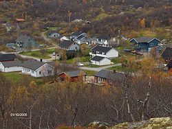

Coat of arms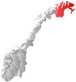
Finnmark within
NorwaySør-Varanger within Finnmark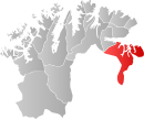
Coordinates: 69°39′53″N 29°44′58″E / 69.66472°N 29.74944°ECoordinates: 69°39′53″N 29°44′58″E / 69.66472°N 29.74944°E Country Norway County Finnmark Administrative centre Kirkenes Government – Mayor (2007) Linda Beate Randal (Ap) Area – Total 3,968 km2 (1,532.1 sq mi) – Land 3,468 km2 (1,339 sq mi) Area rank 6 in Norway Population (2007) – Total 9,490 – Rank 106 in Norway – Density 3/km2 (7.8/sq mi) – Change (10 years) -3.7 % Demonym Varangværing[1] Time zone CET (UTC+1) – Summer (DST) CEST (UTC+2) ISO 3166 code NO-2030 Official language form Bokmål Website www.sor-varanger.kommune.no Data from Statistics Norway Sør-Varanger (Northern Sami: Máttá-Várjjat, Kven: Etelä-Varenki, Finnish: Etelä-Varanki) is a municipality in Finnmark county, Norway. The administrative centre of the municipality is the town of Kirkenes. Sør-Varanger was separated from the municipality of Vadsø on 1 July 1858.
Contents
General information
Name
The meaning of the name Sør-Varanger is originally the name of a fjord, (Old Norse: Ver(j)angr). The first part is ver meaning "fishing village" and the last part is angr which means "fjord". It was first probably used for the narrow fjord on the inside of Angsnes which now is called "Meskfjorden" and leads in to Varangerbotn. Sør means "south". Prior to 1918, the name was spelled Sydvaranger. Until 1964 there also was a municipality named Nord-Varanger.
Coat-of-arms
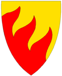
The coat-of-arms is from modern times. They were granted on 16 April 1982. The arms show three flames in gold/orange. The division of the shield symbolizes the importance of the number three: The three main sources of income are agriculture, mining, and fishing; the municipality has three rivers (Neiden, Pasvikelva and Jakobselva) that form the borders of Norway, Russia, and Finland; and there are three cultures in the municipality: Norwegians, Finns, and Sami.[2]
Geography
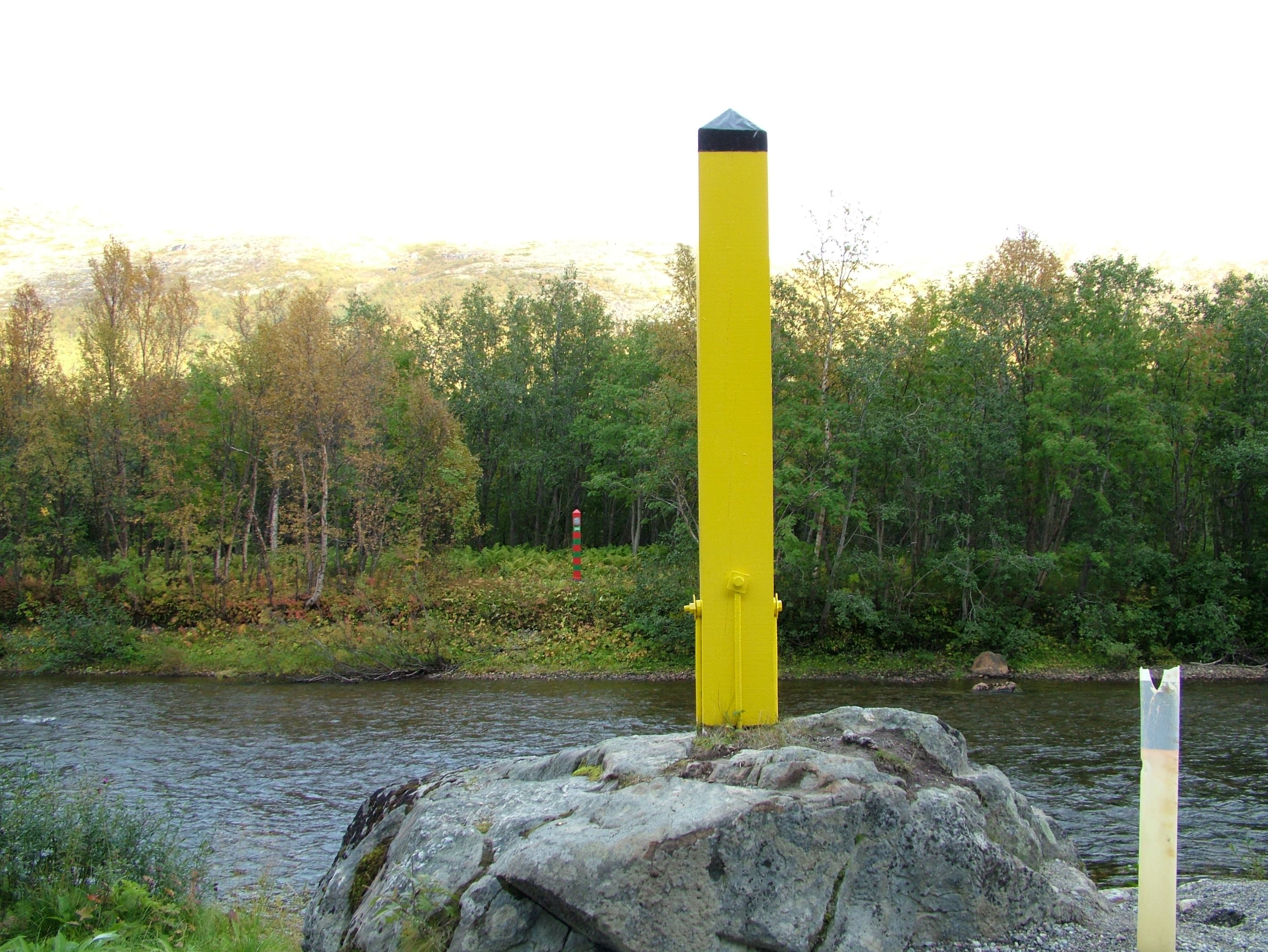
 The border with Russia follows the Grense Jakobselv in the northeast near the Barents Sea, while Pasvikelva forms the border further south along the Pasvik Valley.
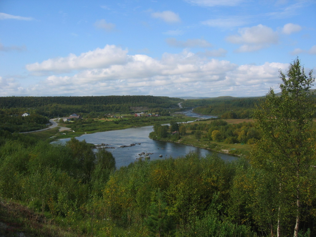
 Neiden, Sør-Varanger. The river yields a large catch of salmon, which the Skoltesami here traditionally catch with an unusual technique (throwing small nets in the river).
Sør-Varanger is a vast area of some 3,700 square kilometres (1,429 sq mi), situated between Finland and Russia. Most of the area is low-lying forest of pine and birch, with barren sections facing the Barents Sea.
The centre of Sør-Varanger is the town of Kirkenes. Other settlements include Bugøynes, Neiden, and little hamlets along the river of Pasvikelva. The local airport is called Høybuktmoen which is also a military camp. Garnisonen i Sør-Varanger (GSV) is based at Høybuktmoen.
The flora of the area is a part of the Russian and Siberian taiga, including a few hundred spruce trees of the Russian variety. Bears also inhabit the upper valley, notably in the Øvre Pasvik National Park.
History
The original inhabitants of the area are the Skolt Sami. This Sami group migrated between coast and inland in present Norwegian, Finnish, and Russian territory long before any borders existed. In the 16th century, they were converted to the Russian Orthodox faith, and still today the chapel of Saint George at Neiden, dating from 1565, is a reminder of eastern influence. In 1826, the previously disputed areas were divided between Norway and Russia, causing great difficulties for the Sami. The Norwegian state also invited Norwegian settlers to come to the area, building Lutheran churches to counterbalance the Orthodox heritage. During the 19th century Finnish settlers (Kven) arrived to the valleys, and from 1906 Norwegians came in numbers because of the iron mining starting up in Kirkenes. After the Treaty of Tartu the area of Petsamo was ceded to Finland, and Sør-Varanger (and Norway) no longer bordered Russia, until Finland had to cede it back to the Soviet Union in 1944.
In 1906, Sydvaranger opened the Bjørnevatn Mine at Bjørnevatn and four years later the mine was connected to the port in Kirkenes by Kirkenes-Bjørnevatnbanen, the world's most northery railway. The mine was closed in 1996.
Attractions
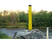
The attractions in the area include the Orthodox chapel of Saint George in Neiden, the chapel of King Oscar II in Grense Jakobselv on the Russian border (built in 1869 to mark the border) and prehistoric labyrinth constructions in the area, probably used for religious purposes.
Popular leisure activities include salmon fishing in one of the numerous rivers, hunting for elk and grouse, and snowmobile driving. Many inhabitants also own and frequently use a cabin located in more remote parts of the municipality.
References
- ^ "Personnemningar til stadnamn i Noreg" (in Norwegian). Språkrådet. http://www.sprakrad.no/nb-no/Sprakhjelp/Rettskrivning_Ordboeker/Innbyggjarnamn/.
- ^ Norske Kommunevåpen (1990). "Nye kommunevåbener i Norden". http://www.ngw.nl/int/nor/s/sorvaran.htm. Retrieved 2008-12-11.
External links
 Media related to Sør-Varanger at Wikimedia Commons
- Sør-Varanger climate statistics from met.no (Norwegian)
- KirkenesGateway: Little known facts about Sør-Varanger
Municipalities of Finnmark  Categories:
- Municipalities of Finnmark
- Sør-Varanger
- Populated places of Arctic Norway


Wikimedia Foundation. 2010.