- Nesseby
-
Nesseby kommune
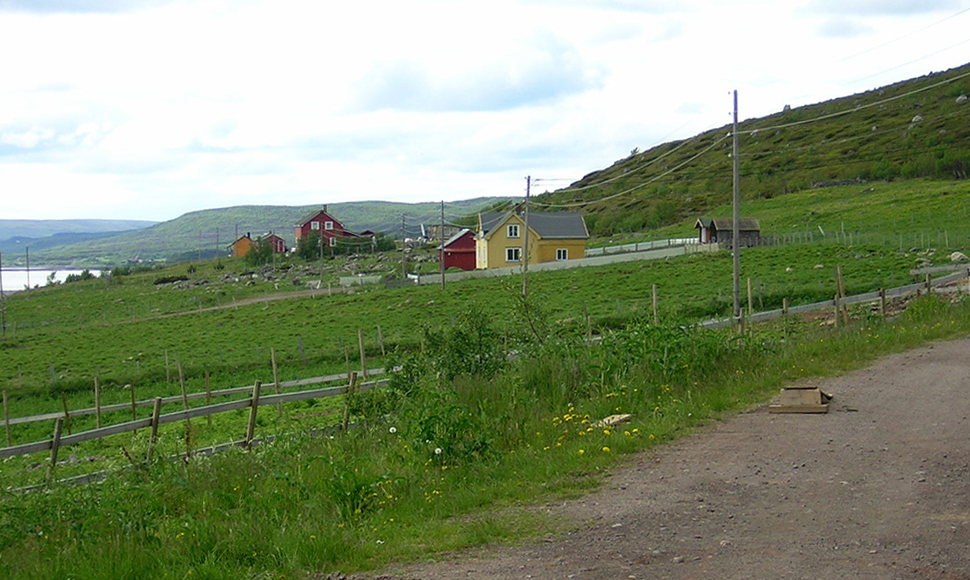
Unjárgga gielda— Municipality — Abelsborg in Nesseby municipality

Coat of arms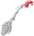
Finnmark within
NorwayNesseby within Finnmark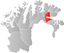
Coordinates: 70°8′29″N 28°36′30″E / 70.14139°N 28.60833°ECoordinates: 70°8′29″N 28°36′30″E / 70.14139°N 28.60833°E Country Norway County Finnmark District Varanger Administrative centre Varangerbotn Government - Mayor (2007-) Inger Katrine Juuso (Cross-political common list (Tverrpolitisk liste)) Area - Total 1,436 km2 (554.4 sq mi) - Land 1,367 km2 (527.8 sq mi) Area rank 57 in Norway Population (2008) - Total 856 - Rank 415-416 in Norway - Density 1/km2 (2.6/sq mi) - Change (10 years) -13.5 % Demonym Nessebyværing[1] Time zone CET (UTC+1) - Summer (DST) CEST (UTC+2) ISO 3166 code NO-2027 Official language form Bokmål and Sami Website nesseby.kommune.no Data from Statistics Norway 
Unjárga (Northern Sami) or Nesseby (Norwegian) (also Uuniemi in Kven/Finnish) is a municipality in Finnmark county, Norway. The administrative centre of the municipality is the village of Varangerbotn.
On 1 January 1846, the municipality of Nesseby was created by merging the Nesseby area of Vadsø together with the areas of Berlevåg, Polmak, and Tana from Lebesby. Tana and Berlevåg were separated from Nesseby on 1 January 1864 to form the new municipality of Tana. Polmak was separated from Nesseby on 1 January 1903.
Contents
General information
Name
The official name of the municipality was Nesseby before 1989 when it was changed to Unjárga-Nesseby.[2] It was the second municipality in Norway to get a Sami name. In 2005, the name was again changed, such that either Unjárga or Nesseby can be used.[3]
The municipality (originally the parish) is named after the old Nesseby farm, since the first church was built there (in 1858). The first element is nes which means "headland" and the last element is by which means "town".
The meaning of the first element (u-) in the Sami name is unknown and the last element is njárga which means "headland".
Coat-of-arms
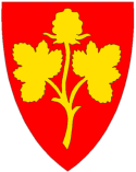
The coat-of-arms is from modern times. They were granted on 27 June 1986. The arms show a cloudberry plant (Rubus chamaemorus), since these plants are commonly found in the municipality and the region. The berries were historically exported to other parts of Norway by the barrel.[4][5]
History
Wild reindeer used to cross the isthmus in prehistoric times until the year 1900, causing extensive human activity throughout the millennia. Therefore, the area is full of archeological finds from different periods.
Sami culture
Most inhabitants are of Sami origin, and today Sami is being taught as the first language in schools. The municipality has its own Sami costume.
The Norwegian Sami Parliament's department of culture and environment is located in Unjárga-Nesseby. The Várjjat Sámi Museum is located in the municipality. The museum is about the sea-sami culture. Unjárga-Nesseby is also the birthplace of Isak Saba the first Sami to be elected into the Norwegian Parliament.
The popular teen-age pop-band The Blacksheeps come from Nesseby.
Geography
The municipality is situated on the isthmus between the Varangerfjord and the Tana River. People live in small settlements along the fjord.
Birdlife
The municipality of Unjárga-Nesseby is known for its interesting birding localities and is mentioned in several birding guide books. Other than the Varangerford, the main habitat is tundra with areas of bog and marsh. One species that can usually be seen on small ponds during the summer months is the Red-necked Phalarope.
References
- ^ "Personnemningar til stadnamn i Noreg" (in Norwegian). Språkrådet. http://www.sprakrad.no/nb-no/Sprakhjelp/Rettskrivning_Ordboeker/Innbyggjarnamn/.
- ^ "Ot.prp. nr. 111 (2001-2002)". Regjeringen.no. http://www.regjeringen.no/nb/dep/fad/dok/regpubl/otprp/20012002/Otprp-nr-111-2001-2002-.html?id=125740. (Norwegian)
- ^ "Endring av skrivemåten for tospråklige kommuner. Endring av skrivemåten for tospråklige kommunenavn, Unjárga-Nesseby". http://www.lovdata.no/cgi-wift/wiztldles?doc=/usr/www/lovdata/for/lf/ov/ov-20041210-1636.html. (Norwegian)
- ^ Norske Kommunevåpen (1990). "Nye kommunevåbener i Norden". http://www.ngw.nl/int/nor/n/nesseby.htm. Retrieved 2008-12-11.
- ^ "Kommunevåpen". Flags of the World. 28 June 2002. http://fotw.us/flags/no-20-27.html. Retrieved 2008-12-11.
External links
- http://www.nesseby.kommune.no/ Official homepage (Norwegian)
- http://www.varjjat.org/ Várjjat Sámi Museum (Sami)
- http://www.isaksaba.no/ Isak Saba center (Sami)
Municipalities of Finnmark Alta · Båtsfjord · Berlevåg · Deatnu - Tana · Gamvik · Hammerfest · Hasvik · Karasjok · Kautokeino · Kvalsund · Lebesby · Loppa · Måsøy · Nesseby · Nordkapp · Porsanger · Sør-Varanger · Vadsø · Vardø Categories:
- Municipalities of Finnmark
- Sami language municipalities
- Populated places of Arctic Norway


Wikimedia Foundation. 2010.