- Old Christ Church (Laurel, Delaware)
-
Old Christ Church
 Christ Church in 1960
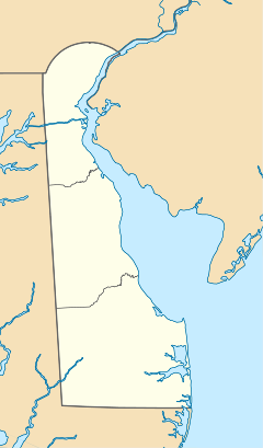

Nearest city: Laurel, Delaware Coordinates: 38°33′40″N 75°32′16″W / 38.56111°N 75.53778°WCoordinates: 38°33′40″N 75°32′16″W / 38.56111°N 75.53778°W Built: 1772 Architectural style: Georgian Governing body: Private NRHP Reference#: 72000297 Added to NRHP: April 13, 1972[1] Old Christ Church, also known as Old Lightwood, is a historic church near Laurel, Delaware. The 1772 church resembles its parent church, Green Hill Church of Stepney Parish in Green Hill, Maryland, except that while Stepney was built in brick, Christ Church is of wood construction. Its weathered, never-painted appearance has given rise to the name "Old Lightwood."
The church was built by Robert Houston in 1772 and given by him to Stepney Parish. Originally called Broad Creek Chapel,[2] Christ Church was termed a "chapel of ease" for the northern part of the large Stepney Parish of the Church of England. At the time of the church's construction the area was claimed by the colony of Maryland. After clarification of the boundary via the Mason-Dixon Line, four Delaware governors have been members: Nathaniel Mitchell, who is buried there, William B. Cooper, William H. H. Ross, and Elbert N. Carvel.[3]
The 40-foot (12 m) by 60-foot (18 m) church is located at the edge of Chipman's Millpond. On both the interior and exterior, only the window sashes are painted. On the interior the pulpit stands on the middle of the north wall, with an altar at the east end. A slave gallery remains at the west end, reached by stairs. Pews are high, with doors to each family section. The ceiling is a flattened barrel vault.[3]
See also
- Chipman's Mill, across the pond from the church
- National Register of Historic Places listings in Sussex County, Delaware
References
- ^ "National Register Information System". National Register of Historic Places. National Park Service. 2009-03-13. http://nrhp.focus.nps.gov/natreg/docs/All_Data.html.
- ^ Maynard, W. Barksdale (2008). "Western Sussex County". Buildings of Delaware. Charlottesville: University of Virginia Press. p. 296. ISBN 978-0-8139-2702-2.
- ^ a b Wilkie, Rea (1971). "National Register of Historic Places Inventory Nomination: Old Christ Church". National Park Service. http://pdfhost.focus.nps.gov/docs/NRHP/Text/72000297.pdf. Retrieved 2009-05-14.
U.S. National Register of Historic Places Topics Lists by states Alabama • Alaska • Arizona • Arkansas • California • Colorado • Connecticut • Delaware • Florida • Georgia • Hawaii • Idaho • Illinois • Indiana • Iowa • Kansas • Kentucky • Louisiana • Maine • Maryland • Massachusetts • Michigan • Minnesota • Mississippi • Missouri • Montana • Nebraska • Nevada • New Hampshire • New Jersey • New Mexico • New York • North Carolina • North Dakota • Ohio • Oklahoma • Oregon • Pennsylvania • Rhode Island • South Carolina • South Dakota • Tennessee • Texas • Utah • Vermont • Virginia • Washington • West Virginia • Wisconsin • WyomingLists by territories Lists by associated states Other Categories:- Properties of religious function on the National Register of Historic Places in Delaware
- Georgian architecture in Delaware
- 1772 architecture
- Episcopal churches in Delaware
- Churches in Sussex County, Delaware
- Delaware Registered Historic Place stubs


Wikimedia Foundation. 2010.