| [1] |
Landmark name |
Image |
Date listed |
Location |
City or town |
Summary |
| 1 |
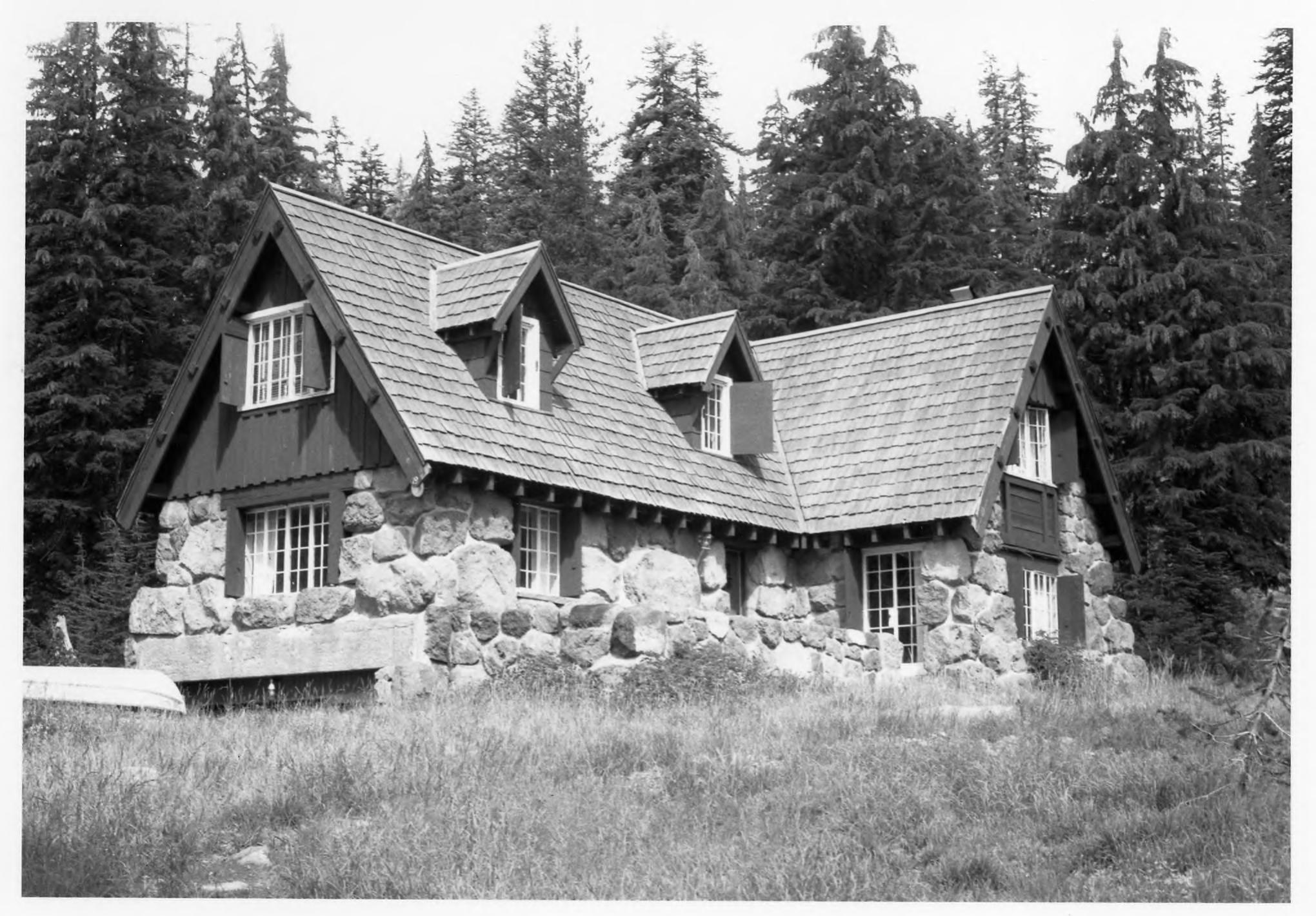
Baldwin Hotel |
|
01973-10-02October 2, 1973 |
31 Main St.
42°13′14″N 121°47′12″W / 42.220556°N 121.786667°W / 42.220556; -121.786667 (Baldwin Hotel) |
Klamath Falls |
|
| 2 |
Judge Henry L. Benson House |
|
01981-12-02December 2, 1981 |
137 High St.
42°13′25″N 121°47′07″W / 42.223611°N 121.785278°W / 42.223611; -121.785278 (Judge Henry L. Benson House) |
Klamath Falls |
|
| 3 |
Bisbee Hotel |
|
02006-10-12October 12, 2006 |
229 S. 6th St.
42°13′27″N 121°46′47″W / 42.224167°N 121.779722°W / 42.224167; -121.779722 (Bisbee Hotel) |
Klamath Falls |
|
| 4 |
Blackburn Sanitarium |
|
01996-09-27September 27, 1996 |
1842 Esplanade
42°13′59″N 121°46′20″W / 42.233056°N 121.772222°W / 42.233056; -121.772222 (Blackburn Sanitarium) |
Klamath Falls |
|
| 5 |
Bly Ranger Station |
|
01981-03-11March 11, 1981 |
OR 140
42°24′03″N 121°02′41″W / 42.400833°N 121.044722°W / 42.400833; -121.044722 (Bly Ranger Station) |
Bly |
|
| 6 |
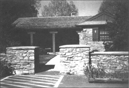
Comfort Station No. 68 |
|
01988-12-01December 1, 1988 |
Rim Dr., near Rim Village Campground
42°54′42″N 122°08′44″W / 42.911667°N 122.145556°W / 42.911667; -122.145556 (Comfort Station No. 68) |
Crater Lake National Park |
|
| 7 |
Comfort Station No. 72 |
|
01988-12-01December 1, 1988 |
Rim Dr., in Rim Village Campground
42°54′41″N 122°08′50″W / 42.911389°N 122.147222°W / 42.911389; -122.147222 (Comfort Station No. 72) |
Crater Lake National Park |
|
| 8 |
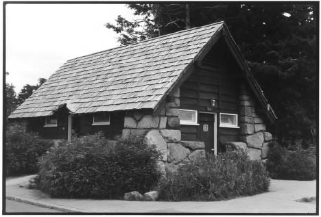
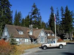
Crater Lake Lodge |
|
01981-05-05May 5, 1981 |
Crater Lake National Park
42°54′36″N 122°08′22″W / 42.91°N 122.139444°W / 42.91; -122.139444 (Crater Lake Lodge) |
Crater Lake National Park |
|
| 9 |
Crater Lake Superintendent's Residence |
|
01987-05-28May 28, 1987 |
Munson Valley
42°54′03″N 122°08′12″W / 42.900833°N 122.136667°W / 42.900833; -122.136667 (Crater Lake Superintendent's Residence) |
Crater Lake National Park |
|
| 10 |
Fort Klamath Site |
|
01971-10-07October 7, 1971 |
SE of Fort Klamath
42°41′31″N 121°58′20″W / 42.691944°N 121.972222°W / 42.691944; -121.972222 (Fort Klamath Site) |
Fort Klamath |
|
| 11 |
Fred Goeller House |
|
01998-06-03June 3, 1998 |
234 Riverside Dr.
42°13′03″N 121°47′24″W / 42.2175°N 121.79°W / 42.2175; -121.79 (Fred Goeller House) |
Klamath Falls |
|
| 12 |
Honeymoon Creek Snow-Survey Cabin |
|
02000-12-29December 29, 2000 |
Sky Lakes Wilderness
42°40′05″N 122°11′50″W / 42.668056°N 122.197222°W / 42.668056; -122.197222 (Honeymoon Creek Snow-Survey Cabin) |
Ashland |
|
| 13 |
Jacksonville-to-Fort Klamath Military Wagon Road |
|
01979-05-16May 16, 1979 |
S of Butte Falls
42°28′46″N 122°26′57″W / 42.479444°N 122.449167°W / 42.479444; -122.449167 (Jacksonville-to-Fort Klamath Military Wagon Road) |
Butte Falls[2] |
|
| 14 |
Klamath County Armory & Auditorium |
|
02011-05-18May 18, 2011 |
1451 Main St.
42°13′42″N 121°46′29″W / 42.228333°N 121.774722°W / 42.228333; -121.774722 (Klamath County Armory & Auditorium) |
Klamath Falls |
|
| 15 |
Klamath Falls City Hall |
|
01989-10-30October 30, 1989 |
226 S. 5th St.
42°13′24″N 121°46′51″W / 42.223333°N 121.780833°W / 42.223333; -121.780833 (Klamath Falls City Hall) |
Klamath Falls |
|
| 16 |
Old Klamath Falls City Library |
|
01989-10-30October 30, 1989 |
500 Klamath Ave.
42°13′25″N 121°46′51″W / 42.223611°N 121.780833°W / 42.223611; -121.780833 (Old Klamath Falls City Library) |
Klamath Falls |
|
| 17 |
Lake of the Woods Ranger Station-Work Center |
|
01986-04-08April 8, 1986 |
Winema National Forest
42°23′09″N 122°13′34″W / 42.385833°N 122.226111°W / 42.385833; -122.226111 (Lake of the Woods Ranger Station-Work Center) |
Klamath Falls |
|
| 18 |
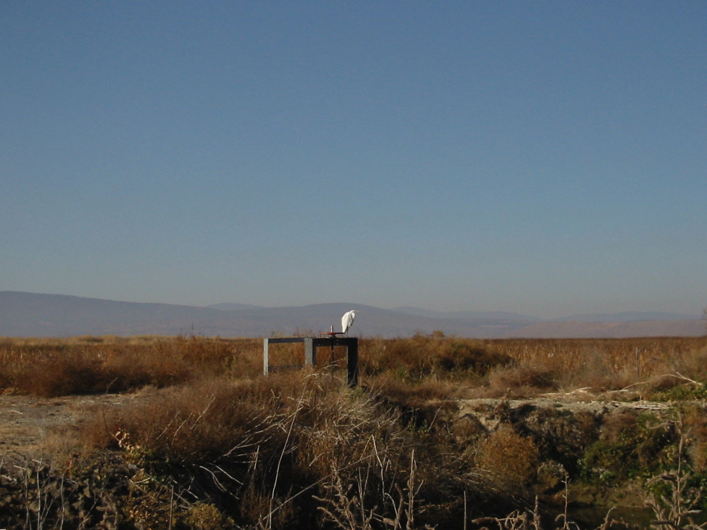
Lower Klamath National Wildlife Refuge |
|
01966-10-15October 15, 1966 |
Lower Klamath Lake, E of Dorris
41°56′48″N 121°39′53″W / 41.946667°N 121.664722°W / 41.946667; -121.664722 (Lower Klamath National Wildlife Refuge) |
Worden |
|
| 19 |
Warren Mills House |
|
01993-02-11February 11, 1993 |
123 High St.
42°13′22″N 121°47′12″W / 42.222778°N 121.786667°W / 42.222778; -121.786667 (Warren Mills House) |
Klamath Falls |
|
| 20 |
Munson Valley Historic District |
|
01988-12-01December 1, 1988 |
Jct. of Crater Lake Hwy. and Rim Dr.
42°53′52″N 122°08′04″W / 42.897778°N 122.134444°W / 42.897778; -122.134444 (Munson Valley Historic District) |
Crater Lake National Park |
|
| 21 |
Oregon Bank Building |
|
01987-09-10September 10, 1987 |
905 Main St.
42°13′38″N 121°46′45″W / 42.227222°N 121.779167°W / 42.227222; -121.779167 (Oregon Bank Building) |
Klamath Falls |
|
| 22 |
Point Comfort Lodge |
|
01979-12-31December 31, 1979 |
27505 Rocky Point Rd.
42°28′19″N 122°05′22″W / 42.471944°N 122.089444°W / 42.471944; -122.089444 (Point Comfort Lodge) |
Rocky Point |
|
| 23 |
Richardson-Ulrich House |
|
01988-08-11August 11, 1988 |
636 Conger Ave.
42°13′24″N 121°47′33″W / 42.223333°N 121.7925°W / 42.223333; -121.7925 (Richardson-Ulrich House) |
Klamath Falls |
|
| 24 |
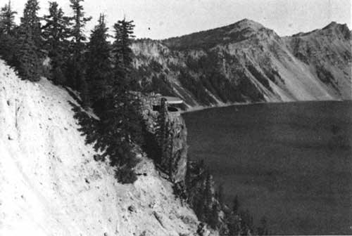
Rim Drive Historic District |
|
02008-01-30January 30, 2008 |
Rim Drive along edge of caldera surrounding Crater Lake; Crater Lake National Park
|
Crater Lake National Park |
|
| 25 |
Rim Village Historic District |
|
01997-09-18September 18, 1997 |
Jct. of Rim Village Rd. and an access rd.
42°54′37″N 122°08′33″W / 42.910278°N 122.1425°W / 42.910278; -122.1425 (Rim Village Historic District) |
Crater Lake National Park |
|
| 26 |
Sinnott Memorial Building No. 67 |
|
01988-12-01December 1, 1988 |
Rim Dr., near Rim Village Campground
42°54′42″N 122°08′33″W / 42.911667°N 122.1425°W / 42.911667; -122.1425 (Sinnott Memorial Building No. 67) |
Crater Lake National Park |
|
| 27 |
Valley Hospital |
|
01988-09-08September 8, 1988 |
405 Pine St.
42°13′27″N 121°47′01″W / 42.224167°N 121.783611°W / 42.224167; -121.783611 (Valley Hospital) |
Klamath Falls |
|
| 28 |
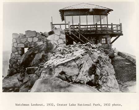
Watchman Lookout Station No. 68 |
|
01988-12-01December 1, 1988 |
Off Rim Dr. on The Watchman
42°54′41″N 122°08′50″W / 42.911389°N 122.147222°W / 42.911389; -122.147222 (Watchman Lookout Station No. 68) |
Crater Lake National Park |
|
| 29 |
Winthrow-Melhase Block |
|
01982-06-14June 14, 1982 |
4th and Main Sts.
42°13′26″N 121°46′59″W / 42.223889°N 121.783056°W / 42.223889; -121.783056 (Winthrow-Melhase Block) |
Klamath Falls |
|