- Butte Falls, Oregon
Infobox Settlement
official_name = Butte Falls, Oregon
settlement_type =Town
nickname =
motto =
imagesize =
image_caption =
image_
imagesize =
image_caption =
image_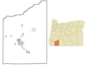
mapsize = 250x200px
map_caption = Location inOregon
mapsize1 =
map_caption1 =
subdivision_type = Country
subdivision_name =United States
subdivision_type1 = State
subdivision_name1 =Oregon
subdivision_type2 = County
subdivision_name2 = Jackson
government_type =
leader_title =Mayor
leader_name = Ron Ormond
established_title = Incorporated
established_date = 1911
area_magnitude =
area_total_sq_mi = 0.4
area_total_km2 = 1.0
area_land_sq_mi = 0.4
area_land_km2 = 1.0
area_water_sq_mi = 0
area_water_km2 = 0
area_urban_sq_mi =
area_urban_km2 =
area_metro_sq_mi =
area_metro_km2 =
population_as_of = 2000
population_note =
population_total = 439
population_metro =
population_urban =
population_density_km2 = 423.7
population_density_sq_mi = 1100.2
timezone = Pacific
utc_offset = -8
timezone_DST = Pacific
utc_offset_DST = -7
latd = 42 |latm = 32 |lats = 33 |latNS = N
longd = 122 |longm = 34 |longs = 3 |longEW = W
elevation_m = 772.97
elevation_ft = 2536
website =
postal_code_type =ZIP code
postal_code = 97522
area_code = 541
blank_name = FIPS code
blank_info = 41-10050GR|2
blank1_name = GNIS feature ID
blank1_info = 1139061GR|3
footnotes =Butte Falls is a city in Jackson County,
Oregon ,United States . The population was 439 persons as of the 2000 US Federal census.History
Butte Falls was incorporated as a city in 1911.
Geography
The city is located at coor dms|42|32|33|N|122|34|3|W|city (42.542379, -122.567509)GR|1.
According to the
United States Census Bureau , the city has a total area of 0.4square mile s (1.0km² ), all of it land.Demographics
As of the US Federal
census GR|2 of 2000, there were 439 people, 160 households, and 112 families residing in the city. Thepopulation density was 1,100.2 people per square mile (423.7/km²). There were 170 housing units at an average density of 426.0/sq mi (164.1/km²). The racial makeup of the city was 93.85% White, 2.73% Native American, 0.23% Asian, 0.91% from other races, and 2.28% from two or more races. Hispanic or Latino of any race were 2.51% of the population.There were 160 households out of which 41.3% had children under the age of 18 living with them, 50.6% were married couples living together, 11.3% had a female householder with no husband present, and 29.4% were non-families. 23.1% of all households were made up of individuals and 10.0% had someone living alone who was 65 years of age or older. The average household size was 2.74 and the average family size was 3.20.
In the city the population was spread out with 31.9% under the age of 18, 6.8% from 18 to 24, 28.5% from 25 to 44, 21.0% from 45 to 64, and 11.8% who were 65 years of age or older. The median age was 33 years. For every 100 females there were 104.2 males. For every 100 females age 18 and over, there were 99.3 males.
The median income for a household in the city was $23,750, and the median income for a family was $30,132. Males had a median income of $27,188 versus $14,875 for females. The
per capita income for the city was $11,511. About 15.1% of families and 22.1% of the population were below thepoverty line , including 25.2% of those under age 18 and 28.6% of those age 65 or over.References
External links
* [http://bluebook.state.or.us/local/cities/ad/buttefalls.htm Oregon Blue Book listing for Butte Falls]
* [http://www.buttefallsschools.org Butte Falls School District website]
Wikimedia Foundation. 2010.