- Mystic Bridge Historic District
-
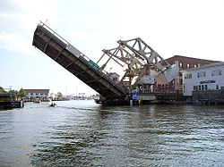
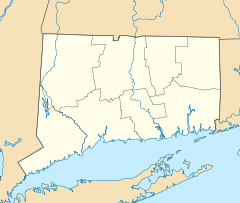
Mystic Bridge Historic District

Location: U.S. 1 and CT 27, Mystic, Connecticut Coordinates: 41°21′25″N 71°57′51″W / 41.35694°N 71.96417°WCoordinates: 41°21′25″N 71°57′51″W / 41.35694°N 71.96417°W Area: 155 acres (63 ha) Built: 1840 Architect: Clift,Amos,III; Multiple Architectural style: Greek Revival, Italianate, Queen Anne Governing body: State NRHP Reference#: 79002671[1] Added to NRHP: August 31, 1979 Mystic Bridge Historic District (also known as Lower Mystic or Mistick) is a historic district on U.S. 1 and CT 27 in the Stonington side of the village of Mystic, Connecticut. The district represents the core of the early settlement of that name on the east bank of the Mystic River.
The district features Queen Anne and Italianate architecture. The district was added to the National Register of Historic Places in 1979.[1]
See also
References
- ^ a b "National Register Information System". National Register of Historic Places. National Park Service. 2009-03-13. http://nrhp.focus.nps.gov/natreg/docs/All_Data.html.
See also
- Mystic Seaport, which comprises part of the district
- James M. Hyde, metallurgist, born here
U.S. National Register of Historic Places Topics Lists by states Alabama • Alaska • Arizona • Arkansas • California • Colorado • Connecticut • Delaware • Florida • Georgia • Hawaii • Idaho • Illinois • Indiana • Iowa • Kansas • Kentucky • Louisiana • Maine • Maryland • Massachusetts • Michigan • Minnesota • Mississippi • Missouri • Montana • Nebraska • Nevada • New Hampshire • New Jersey • New Mexico • New York • North Carolina • North Dakota • Ohio • Oklahoma • Oregon • Pennsylvania • Rhode Island • South Carolina • South Dakota • Tennessee • Texas • Utah • Vermont • Virginia • Washington • West Virginia • Wisconsin • WyomingLists by territories Lists by associated states Other Categories:- Historic districts in Connecticut
- Queen Anne architecture in Connecticut
- Italianate architecture in Connecticut
- Mystic, Connecticut
- Historic districts in New London County, Connecticut
- Connecticut Registered Historic Place stubs
Wikimedia Foundation. 2010.

