- Stonington, Connecticut
Infobox Settlement
name = Stonington, Connecticut
established_title = Named
established_date = 1666
subdivision_type2 =
subdivision_name2 =
government_type = Selectman-town meeting
settlement_type = Town
imagesize =
image_caption =
mapsize =
map_caption =
mapsize1 =
map_caption1 =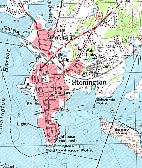
mapsize = 250x200px
map_caption = Current map of Stonington Borough
subdivision_type =NECTA
subdivision_name = Norwich-New London
subdivision_type1 = Region
subdivision_name1 = Southeastern Connecticut
leader_title = First selectman
leader_name = Edward Haberek Jr.
area_magnitude =
area_total_km2 = 129.5
area_water_km2 = 29.4
area_total_sq_mi = 50.0
area_land_km2 = 100.2
area_land_sq_mi = 38.7
population_as_of = 2007
population_total = 18343
population_density_km2 = 183
population_density_sq_mi = 474
timezone = Eastern
utc_offset = -5
timezone_DST = Eastern
utc_offset_DST = -4
area_water_sq_mi = 11.3
elevation_m = 23
elevation_ft = 75
latd = 41 |latm = 21 |lats = 54 |latNS = N
longd = 71 |longm = 54 |longs = 24 |longEW = W
region =
postal_code_type = ZIP code
postal_code = 06355, 06378, 06379
area_code = 860
blank_name = FIPS code
blank_info = 09-73770
blank1_name = GNIS feature ID
blank1_info = 0213513
footnotes =
website = http://www.stonington-ct.gov/The Town of Stonington is in New London County,Connecticut in the southeastern corner of thatU.S. state . It includes the borough of Stonington, the villages of Pawcatuck, Quiambaug, Lords Point, Wequetequock, the eastern half of the village of Mystic (the other half being in the town of Groton), andOld Mystic . The population was 17,906 at the 2000 census.Known as "The Borough" to the locals, the densely-built Borough of Stonington occupies a point of land that projects into
Little Narragansett Bay . It has two main streets that link two squares, Cannon Square and Wadawanuck Square, named for the former Wadawanuck Hotel that brought fashionable visitors in the post-Civil War era. The lack of through traffic or modern industry, together with the borough's role as a fashionable summer residence, have preserved its colonial, Federal, and outstandingGreek revival domestic architecture, while the activity of Connecticut's last remainingfishing and lobstering fleet keep it from being simply a quaint, historic village. There is a large community of Portuguese descent.Geography
According to the
United States Census Bureau , the town has a total area of 50.0square mile s (129.6km² ), of which, 38.7 square miles (100.2 km²) of it is land and 11.4 square miles (29.4 km²) of it (22.68%) is water.In the waters off Stonington, the states of
New York ,Connecticut andRhode Island come together at a single point.Demographics
USCensusPop
1990= 16919
2000= 17906
estimate=18343
estyear=2007
footnote=Population 1990 - 2007 [ [http://factfinder.census.gov/servlet/SAFFPopulation?_event=ChangeGeoContext&geo_id=06000US0901173770&_geoContext=01000US%7C04000US34%7C16000US3465280&_street=&_county=stonington&_cityTown=stonington&_state=04000US09&_zip=&_lang=en&_sse=on&ActiveGeoDiv=geoSelect&_useEV=&pctxt=fph&pgsl=010&_submenuId=population_0&ds_name=null&_ci_nbr=null&qr_name=null®=null%3Anull&_keyword=&_industry=] ,U.S. Census Bureau . AccessedAugust 25 ,2008 .] As of thecensus GR|2 of 2000, there were 17,906 people, 7,665 households, and 4,897 families residing in the town. Thepopulation density was 462.8 people per square mile (178.7/km²). There were 8,591 housing units at an average density of 222.1/sq mi (85.7/km²). The racial makeup of the town was 95.81% White, 0.63% Black or African American, 0.37% Native American, 1.26% Asian, 0.05% Pacific Islander, 0.46% from other races, and 1.42% from two or more races. Hispanic or Latino of any race were 1.30% of the population.There were 7,665 households out of which 26.2% had children under the age of 18 living with them, 51.9% were married couples living together, 8.9% had a female householder with no husband present, and 36.1% were non-families. 30.0% of all households were made up of individuals and 11.9% had someone living alone who was 65 years of age or older. The average household size was 2.31 and the average family size was 2.88.
In the town the population was spread out with 21.7% under the age of 18, 5.4% from 18 to 24, 28.5% from 25 to 44, 27.0% from 45 to 64, and 17.5% who were 65 years of age or older. The median age was 42 years. For every 100 females there were 94.5 males. For every 100 females age 18 and over, there were 92.1 males.
The median income for a household in the town was $52,437, and the median income for a family was $63,431. Males had a median income of $45,596 versus $32,069 for females. The
per capita income for the town was $29,653. About 2.9% of families and 5.0% of the population were below thepoverty line , including 5.4% of those under age 18 and 5.7% of those age 65 or over.History
The first European colonists came to the town in 1649, on lands that had belonged to the
Pequot s who referred to the areas making up Stonington as "Pawcatuck" and "Mistack." It was named "Souther Towne" or Southertown, byMassachusetts in 1658, and was renamed as Stonington when Connecticut established its claim over the territory in 1665.Thomas Miner and Walter Palmer were among the founders. The town of North Stonington was set off as aparish from Stonington in 1724 and incorporated as atown in 1807.Stonington first gained wealth in the 1790s when its harbor was home to a fleet engaged in the profitable sealing trade in which the skins of seals clubbed on islands off the Chilean and Patagonian coasts were sold as fur in China. [Diana Muir, "Reflections in Bullough's Pond: Economy and Ecosystem in New England", 2000:80.]
Stonington repulsed two British naval bombardments. One, during the
American Revolution , was a desultory bombardment bySir James Wallace in the frigate "Rose" onAugust 30 ,1775 . The other was a more damaging three-day affair between August 9 and 12, 1814. During theWar of 1812 , four British vessels, HMS "Ramillies", HMS "Pactolus", HMS "Dispatch", and HMS "Terror", under the command of Sir Thomas Hardy, appeared offshore on August 9, 1814. The British demanded immediate surrender, but Stonington’s citizens replied with a note that stated, "We shall defend the place to the last extremity; should it be destroyed, we shall perish in its ruins." For three days the Royal Navy pounded the town, but the only fatality was that of an elderly woman who was mortally ill. The British, after suffering many dead and wounded, sailed off on12 August . The American poetPhilip Freneau wrote (in part)::"The bombardiers with bomb and ball
"::"Soon made a farmer's barrack fall,
":"And did a cow-house badly maul
"::"That stood a mile from Stonington.":"They kill'd a goose, they kill'd a hen
"::"Three hogs they wounded in a pen—
":"They dashed away and pray what then?
"::"This was not taking Stonington.":"But some assert, on certain grounds,
"::"(Beside the damage and the wounds),
":"It cost the king ten thousand pounds
"::"To have a dash at Stonington."The
Stonington Harbor Light , a low stone building, was the first lighthouse established by the U.S. Federal Government, in 1823. In the 19th century Stonington supported a small fishing, whaling and sealing fleet, with some direct trade with the West Indies, enough in volume for it to be made a Port of Entry in 1842; the small granite Customs House faces Main Street just north of Cannon Square.The New London and Stonington Railroad Company was incorporated on July 29, 1852.
In recent decades, Stonington has experienced a large influx of new home owners using historic Borough houses as second homes. The town has undergone a widespread reconditioning of these homes since the mid 1990's, when an altercation over redevelopment rights attracted substantial news coverage about Stonington's revitalization. [cite web |url=http://query.nytimes.com/gst/fullpage.html?res=9F0CE4DE103DF930A35751C1A9669C8B63&sec=&spon=&partner=permalink&exprod=permalink |publisher=The New York Times |title= DEVELOPMENT; There Goes The Neighborhood |format=hmtl | publish date=December 3, 2000 ]
Buildings on the National Register of Historic Places
*
Capt. Nathaniel B. Palmer House — 40 Palmer St. (addedJuly 19 ,1996 )
* Mechanic Street Historic District — Roughly bounded by West Broad Street, Pawcatuck River, Cedar Street, and Courtland Street. (addedJuly 7 ,1988 )
*Stanton-Davis Homestead Museum also known as the Robert Stanton House — Green Haven Road (addedJuly 4 ,1979 )
*Stonington Harbor Light house — 7 Water St. (addedFebruary 1 ,1976 )
* Stonington High School — Church Street (addedSeptember 17 ,1978 )
* Whitehall Mansion — Off state Route 27 (addedMay 12 ,1979 )Notable people, past and present
The very young
Nathaniel Palmer , in charge of the sloop "Hero", was seal hunting in theSouth Shetland Islands in the Antarctic summer season of 1820-1821. Sent southwards in November to investigate a volcanic eruption on the horizon, he sighted Antarctica.Palmer Land on the Antarctic Peninsula is named after him, andStonington Island , near Antarctica, is named after the town. Palmer also helped develop the clipper ship, the fastest sailing ship of the nineteenth century.Other famous residents have included the explorer
Edmund Fanning , who discoveredPalmyra Island south ofHawai'i ; Revolutionary War heroNathaniel Fanning ; the Beaux-Arts architect Edward P. York, ofYork and Sawyer ; the poetStephen Vincent Benét , and the garden essayistEleanor Perenyì . Pulitzer Prize-winning poetJames Merrill , whose 'Water Street' evokes Stonington, moved to town in 1955. Ruth Buzzi of television's "Laugh In" was born and brought up where Buzzi Memorials sits on Stonington Road. Harpsichord makerDavid Jacques Way 's workshop was in Stonington.Peter Benchley , the author of Jaws, also had a summer house located in the Borough. Since 1999, Stonington has been the home of 2004World Series of Poker champion Greg "Fossilman" Raymer.Stonington has also been a destination for many famous persons, such as
Viggo Mortensen , who rented a home in the area, and his "The Lord of the Rings " costarElijah Wood ; television hostConan O'Brien , whose sister lives in the Borough; and others, such as George Hamilton,Jimmy Fallon ,Trey Anastasio of Phish andDick Vitale of ESPN. Stonington has been the home to several on-location movie shoots, includingSteven Spielberg 's "Amistad" and theJulia Roberts breakthrough movie, "Mystic Pizza ".Footnotes
References
Henry Robinson Palmer, "Stonington by the Sea," 1957
External links
* [http://www.stonington-ct.gov/Pages/index Town government Web site]
* [http://www.tourism.state.ct.us/tourism_regions/default.asp?region=mysticcountry Mystic Country: The Eastern Regional Tourism District]
* [http://www.stonington.org/ Stonington Public Schools]
* [http://www.stoningtonboroughct.com/ Stonington Borough Merchants Association]
* [http://www.mysticaquarium.org/ Mystic Aquarium & Institute for Exploration]
* [http://www.mysticseaport.org/ Mystic Seaport]
Wikimedia Foundation. 2010.