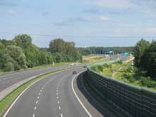
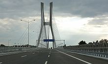
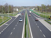
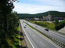
- Highways in Poland
-
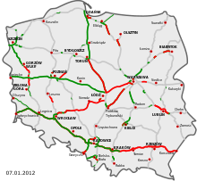
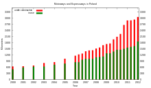
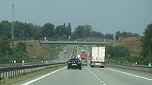
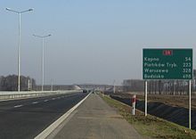
The highways in Poland are divided into motorways and expressways. As of November 2011, there are 926 kilometres (580 mi) of motorways[1] (autostrady, singular - autostrada) and 718 km (450 mi) of expressways[1] (drogi ekspresowe, singular - droga ekspresowa).
Currently, three major motorways (A1, A2 and A4) spanning the entire country are being built. Many sections are under construction (contracts signed, construction in progress) and almost all remaining parts are contracted to be finished by mid-2012 (before Euro 2012). The only exception is the Warsaw-Belarus connection which is scheduled to be built later. By the end of 2012, 8 of the 10 largest Polish cities (Gdańsk, Poznań, Wrocław, Łódź, Warsaw, Kraków, Katowice, Szczecin) will have a motorway connecting them with the motorway network of Western Europe.
Contents
List of polish motorways and expressways
 Motorways in Poland are identified by the letter A, followed by a number (e.g. A1). Under current plans, by 2015 three motorways will span the country, two along the East-West axis (A2, A4) and one along the North-South axis (A1). In addition, three shorter motorway stretches (A6, A8, A18) are planned. All of them are currently under construction, in various stages of completion.
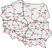
 Expressways in Poland are limited-access roads which can be dual or single carriageways. As of January 20, 2011 there are 718 km (450 mi) of expressways in Poland. There are about 570 km (350 mi) of expressways in various stages of construction.[1] The start of an expressway in Poland is marked with sign of white car on blue background, while number sign for an expressway is of red background and white letters, with the letter S preceding a number.
On May 15, 2004 the Regulation of the Council of Ministers (on the network of motorways and express roads) referred to a network of motorways and expressways in Poland totalling about 7,200 km (4,470 mi) (including about 2,000 km (1,240 mi) of motorways).[2] Regulation from February 2007 added roads S2 and S79 to the list.[3] Regulation from October 2009 supplemented plans with road S61.[4] The following table summarizes the planned expressways in accordance with government regulations. Please note the lengths are approximate and are only indicative. As of end of January 2011 there are over 700 km (430 mi) of both single and dual-carriageway expressways in Poland.[1] There are about 570 km (350 mi) of expressways in various stages of construction.[1]
Motorways Sign Course Total length Existing Under construction Tender Enviromental decision (DŚU) 
Gdańsk (S6) - Gorzyczki (border) 565,1 km 205,4 km 36,35% 235,9 km 123,8 km 
Świecko (border) – Kukuryki (border) 610 km * 253,9 km ~41,6% 218,6 km 
Jędrzychowice (border) – Korczowa (border) 670 km 446,5 km 66,64% 223,5 km 
Kołbaskowo (border) – Rzęśnica (S3) 28,7 km 21,7 km 75,61% 2,2 km 4,8 km 
Bielany Wrocławskie (S8) – Wrocław (S8) 22,3 km 22,3 km 100% 
Olszyna (border) – Krzyżowa (A4) 78,5 km 7,6 km;
70,9 km (north carriageway)54,84% 70,9 km
(south carriageway)In total 1974,6 km 992,85 km 50,28% 659,4 km 164,05 km Expressways Sign Course Total length Existing Under construction Tender Enviromental decision (DŚU) 
Pyrzowice (A1) – Cieszyn (border) 122,1 km * 62,6 km 51,27% 1,9 km 4,8 km 
Konotopa (A2) – Nowy Konik (A2) 35,6 km 15 km 20,6 km 
Świnoujście – Lubawka (border) 478,2 km * 154,15 km 32,24% 90,55 km 201,35 km 
Grudziądz (A1) – Wrocław (A8) 367,7 km * 41,15 km 11,12% 64,3 km 262,25 km 
Goleniów (S3) – Gdańsk (A1) 318,7 km * 46,15 km 14,48% 9,4 km 180 km 
Gdańsk (A1) – Rabka-Zdrój 726,2 km * 166,45 km 22,92% 108,15 km 80,7 km 241,6 km 
Wrocław (A8) – Białystok (S19) 590,5 km * 94,4 km 15,99% 236,2 km 117,2 km 110,8 km 
Szczecin (A6) – Płońsk (S7) 459,8 km * 43,55 km 9,47% 4,85 km 24 km 
Koszalin (S6) – Pyrzowice (A1) 554,2 km * 33,65 km 6,07% 22,1 km 5,3 km 111,7 km 
Piotrków Trybunalski (A1) – Dorohusk-Jagodzin (border) 319 km * 12,55 km 3,93% 43,7 km 22,4 km 12,1 km 
Łódź (A2) – (S8) 40,1 km 12,9 km 27,2 km 
Warszawa (S8) – Hrebenne-Rawa Ruska (border) 321,6 km * 18 km 5,6% 43,7 km 22,4 km 113,2 km 
Kuźnica Białostocka-Bruzgi (border) – Barwinek (border) 595,2 km * 3,3 km 0,55% 26,15 km 10,7 km 31,5 km 
Elbląg – Grzechotki (border) 50,2 km[5] 50,2 km 100% 
Olsztyn – Olsztynek (S7) 21 km 6 km 15 km 
Ostrów Mazowiecka (S8) – Budzisko (border) 247,5 km * 14 km 19,25 km 
Bielsko-Biała – Zwardoń (border) 49,8 km 25,7 km 51,6% 15,6 km 8,5 km 
Sulejów (S12) – Nisko (S19) 192,2 km * 6,8 km 9,7 km 
Warszawa-Lotnisko (S2) – Warszawa-Marynarska 4,3 km 4,3 km In total 5493,9 km 751,85 km 13,69% 725,6 km 258,7 km 1393,55 km History
First ideas of creation of motorways in Poland were conceived in the interbellum period. The main promoter of this concept was Professor Melchior Wladyslaw Nestorowicz of the Warsaw University of Technology, who organized three Road Congresses, during which a group of specialists discussed creation of Polish motorway network. On March 5, 1939, in a professional magazine Drogowiec, Professor Nestorowicz published an article, in which he proposed a very ambitious plan of construction of almost 5000 kilometres of motorways, I and II category. According to Nestorowicz, a nationwide programme of motorways, based on similar programmes in Germany and Italy, should be started in Poland.[6] Professor sketched a map of future motorways of the Second Polish Republic.
First class roads consisted of the following motorways:
- Warsaw - Łódź - 100 km
- Warsaw – Poznań - Polish-German border - 350 km
- Warsaw beltway - 130 km
- Poznań beltway - 80 km
- Gdynia – Bydgoszcz – Łódź – 500 km
- Łódź beltway - 90 km
- Bytow - Free City of Danzig border - 50 km
- Katowice – Kraków – Lwów - 375 km
- Warsaw – Lublin – Polish-Ukrainian border - Lwów – Sniatyn - Ukrainian-Romanian border - 550 km
- Puławy – Sandomierz – Przemyśl - 175 km
A total of 2,400 km (1,500 mi)
Second class roads consisted of the following motorways:
- Piotrków Trybunalski - Kielce - Sandomierz - 180 km
- Warsaw – Kielce – Kraków - 180 km
- Łódź - Kalisz - Polish-German border north of Wrocław - 130 km
- Warsaw – Grodno – Wilno – Polish - Lithuania - Latvian border near Daugavpils - 575 km
- Grodno - Nowogrodek - Polish-Soviet border near Minsk - 190 km
- Bydgoszcz – Poznań – Częstochowa - 350 km
- Katowice – Cieszyn – Polish-Czechoslovak border - 60 km
- Ostrołęka - Polish-East Prussian border - 50 km
- Grodno - Polish-Lithuanian border - 40 km
- Grodno - Brzesc nad Bugiem - Krasnystaw - 300 km
- Warsaw – Brzesc nad Bugiem - 170 km
A total of 2,295 km (1,430 mi)
Current motorway and expressway network plans are enclosed with regulation of Council of Ministers of October 2009. Currently planned network consist of 6 motorways (A1, A2, A4, A6, A8, A18) and 19 express roads.[7]
See also
References
- ^ a b c d e Polish motorways and expressways stats on skyscrapercity(Polish)
- ^ Dz.U. 2004 nr 128 poz. 1334(Polish)
- ^ Dz.U. 2007 nr 35 poz. 220(Polish)
- ^ Dz.U. 2009 nr 187 poz. 1446(Polish)
- ^ w 2005 w NPR na lata 2007–2013 planowano wydłużenie drogi do Gorzowa Wielkopolskiego (o ok. 320 km.) - Harmonogram budowy autostrad i dróg ekspresowych na lata 2007-2013; wydłużenie to nie zostało jednak wprowadzone w żadnej aktualizacji Rozporządzenia Rady Ministrów
- ^ Prof. M. W. Nestorowicz, Problem budowy dróg samochodowych (autostrad) w Polsce
- ^ Dz.U. 2009 nr 187 poz. 1446(Polish)
External links
- General Directorate for National Roads and Motorways (in Polish, some information also in English)
National roads, motorways and expressways in Poland National roads 1 · 2 · 3 · 4 · 5 · 6 · 7 · 8 · 9 · 10 · 11 · 12 · 13 · 14 · 15 · 16 · 17 · 18 · 19 · 20 · 21 · 22 · 23 · 24 · 25 · 26 · 27 · 28 · 29 · 30 · 31 · 32 · 33 · 34 · 35 · 36 · 37 · 38 · 39 · 40 · 41 · 42 · 43 · 44 · 45 · 46 · 47 · 48 · 49 · 50 · 51 · 52 · 53 · 54 · 55 · 56 · 57 · 58 · 59 · 60 · 61 · 62 · 63 · 64 · 65 · 66 · 67 · 68 · 69 · 70 · 71 · 72 · 73 · 74 · 75 · 76 · 77 · 78 · 79 · 80 · 81 · 82 · 83 · 84 · 85 · 86 · 87 · 88 · 90 · 91 · 92 · 93 · 94 · 98Motorways 
Expressways 
Roads in Europe Sovereign
states- Albania
- Andorra
- Armenia
- Austria
- Azerbaijan
- Belarus
- Belgium
- Bosnia and Herzegovina
- Bulgaria
- Croatia
- Cyprus
- Czech Republic
- Denmark
- Estonia
- Finland
- France
- Georgia
- Germany
- Greece
- Hungary
- Iceland
- Ireland
- Italy
- Kazakhstan
- Latvia
- Liechtenstein
- Lithuania
- Luxembourg
- Macedonia
- Malta
- Moldova
- Monaco
- Montenegro
- Netherlands
- Norway
- Poland
- Portugal
- Romania
- Russia
- San Marino
- Serbia
- Slovakia
- Slovenia
- Spain
- Sweden
- Switzerland
- Turkey
- Ukraine
- United Kingdom
States with limited
recognition- Abkhazia
- Kosovo
- Nagorno-Karabakh
- Northern Cyprus
- South Ossetia
- Transnistria
Dependencies
and other territories- Åland
- Faroe Islands
- Gibraltar
- Guernsey
- Jan Mayen
- Jersey
- Isle of Man
- Svalbard
Other entities Categories:- Roads in Poland
- Lists of roads
- Poland-related lists
Wikimedia Foundation. 2010.

