- Roads in Serbia
-
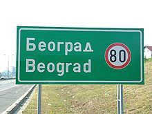 City sign at entrance to Belgrade on E75
The following European routes pass through the country:
 E65: Rožaje, Montenegro - Tutin - Kosovska Mitrovica - Priština - Đeneral Janković - Skopje, Macedonia.
 E70: Slavonski Brod, Croatia - Šid - Belgrade - Vršac - Timişoara, Romania.
- section between Slavonski Brod and Belgrade is built to motorway standards.
 E75: Szeged, Hungary - Subotica - Novi Sad - Beška Bridge - Belgrade - Niš - Leskovac - Grdelica - Vranje - Preševo - Kumanovo, Macedonia.
- section between Beška Bridge and Grdelica is built to motorway standards.
 E80: Rožaje, Montenegro - Peć - Priština - Prokuplje - Niš - Niška Banja - Pirot - Dimitrovgrad - Sofia, Bulgaria.
- section between Niš and Niška Banja is built to motorway standards.
 E662: Subotica - Sombor - Bezdan - Osijek, Croatia.
 E761: Sarajevo, Bosnia and Herzegovina - Užice - Čačak - Kraljevo - Kruševac - Pojate - Paraćin - Zaječar.
 E763: Belgrade - Čačak - Nova Varoš - Bijelo Polje, Montenegro.
 E771: Drobeta-Turnu Severin, Romania - Zaječar - Niš.
 E851: Kukës, Albania - Prizren - Priština.
total: 37,937 km (2002)
paved: 23,937 km (2002) (including 560 km of expressways)
unpaved: 13,950 km (2002)Contents
Serbian motorways
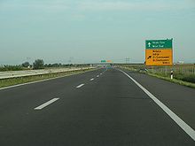 Motorway E75 in Serbia
The motorways in Serbia (Serbian: Аутопут / Autoput) are the backbone of the road system in Serbia and important transit roads in Europe.
Expansion
Since 1991, motorsways have been under constant expansion in Serbia. Current themes of expansion include European Corridor 10, and what is expected to be Corridor 11.
Yearly expansion figures:[1]
- 2004 - 33 km
- 2005 - 22,5 km
- 2006 - 33,22 km
- 2008 - 7,7 km
- 2009 - 40,55 km
- 2010 - 110 km [2]
- 2011 - 180 km
As of October 2011 the northern part of Corridor 10 (Belgrade to Horgos) is finished. The following sections are as such (km from Hungarian border):[3]
- 0km to 28 km - Horgoš to Bikovo - opened on 17 July, 2011
- 28km to 38km - Bikovo to Žednik - opened in 2009
- 38km to 50km - Žednik to Bačka Topola - opened 20 July, 2011
- 50km to 71km - Bačka Topola to Feketić - opened on 10 August, 2011
- 71km to 80km - Feketić to ? - opened on 20 August, 2011
- 80km to 85km - ? to Srbobran - opened on 30 August, 2011
- 85km to 98km - Srbobran - Sirig - opened on 1 August, 2011
- 98km to 108km - Sirig - Novi Sad - opened in 2009
The Beska dual-carriage bridge has also been finished, with the reconstruction of the old old bridge currently underway. Rapid construction progress is also underway in the southern part of Corridor 10 (from Nis to Bulgarian border), as well as from Vranje to Macedonian border. Serbian government estimates that the Corridor 10 will be completed by end of 2013.
In the meantime, construction continues on the unofficial "Corridor 11". Currently, a 12 km stretch between Ub and Lajkovac is under construction, and the plans for the construction by Sava river have been approved on October 5, 2011.
List of the motorways
Though the Serbian word for motorway is "autoput", the "A1", "A2" or "A3" road designations don't seem to be in use in the country. E-numeration is used instead.
Name Road sign Route Е65 
Kosovska Mitrovica - Pristina Е70 
Croatia - Batrovci - Sremska Mitrovica - Dobanovci (Belgrade bypass) - Zemun (Е70) - Belgrade E75 
Novi Sad - Beška
Beška - Batajnica
Zemun (Е70) - Belgrade - Bubanj Potok (Belgrade bypass) - Jagodina - Niš (Е80) - LeskovacЕ80 
Niš (Е70) - Niška Banja References
- ^ http://www.blic.rs/Vesti/Ekonomija/248352/Koridor-10-moze-biti-gotov-najranije-2014-godine
- ^ http://www.emportal.rs/vesti/srbija/138187.html
- ^ http://www.rts.rs/page/stories/sr/story/13/Ekonomija/924964/Nova+deonica+na+Koridoru+10.html
Roads in Europe Sovereign
states- Albania
- Andorra
- Armenia
- Austria
- Azerbaijan
- Belarus
- Belgium
- Bosnia and Herzegovina
- Bulgaria
- Croatia
- Cyprus
- Czech Republic
- Denmark
- Estonia
- Finland
- France
- Georgia
- Germany
- Greece
- Hungary
- Iceland
- Ireland
- Italy
- Kazakhstan
- Latvia
- Liechtenstein
- Lithuania
- Luxembourg
- Macedonia
- Malta
- Moldova
- Monaco
- Montenegro
- Netherlands
- Norway
- Poland
- Portugal
- Romania
- Russia
- San Marino
- Serbia
- Slovakia
- Slovenia
- Spain
- Sweden
- Switzerland
- Turkey
- Ukraine
- United Kingdom
States with limited
recognition- Abkhazia
- Kosovo
- Nagorno-Karabakh
- Northern Cyprus
- South Ossetia
- Transnistria
Dependencies
and other territories- Åland
- Faroe Islands
- Gibraltar
- Guernsey
- Jan Mayen
- Jersey
- Isle of Man
- Svalbard
Other entities Categories:


Wikimedia Foundation. 2010.