- Slavonski Brod
-
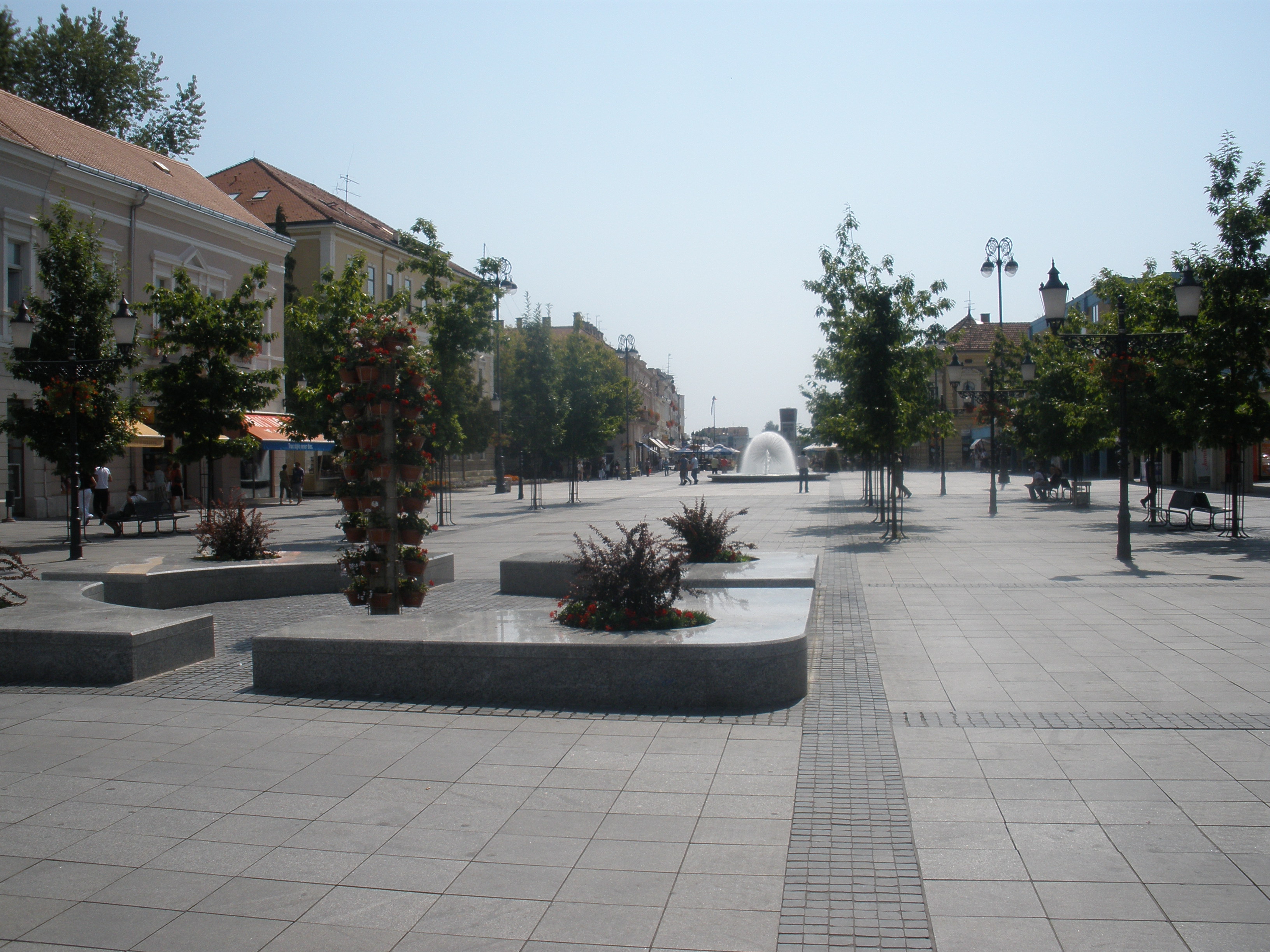
Slavonski Brod The main square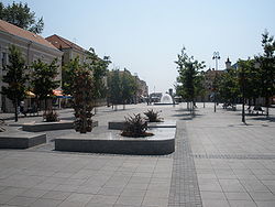

Coat of armsLocation of Slavonski Brod in Croatia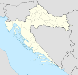
 Slavonski Brod
Coordinates: 45°10′N 18°01′E / 45.167°N 18.017°ECoordinates: 45°10′N 18°01′E / 45.167°N 18.017°E Country Croatia County Brod-Posavina Government - Mayor Dr. Mirko Duspara (CPR) Area - Total 50.27 km2 (19.4 sq mi) Population (2011)[1] - Total 59,507 Time zone CET (UTC+1) - Summer (DST) CEST (UTC+2) Slavonski Brod (Croatian pronunciation: [slǎv̞ɔ̝ːnskiː brɔ̝̂ːd]) is a city in Croatia, with a population of 59,507 in 2011.[1] The city was known as Marsonia in the Roman Empire, and as Brod na Savi 1244–1934. It is the sixth largest city in Croatia, after Zagreb, Split, Rijeka, Osijek and Zadar. Located in the region of Slavonia, it is the centre of Brod-Posavina County, and a river port on the Sava river. It is 197 km southeast of Zagreb and at an elevation of 96 m. Although 'brod' is the word 'ship' in modern Croatian, the city's name bears witness to an older meaning - 'water crossing', 'ford'. In 2009, the city was awarded "The most beautiful city in Croatia" award, given annually by the Croatian National Tourist Board.[2] Across the Sava lies the city of Brod, Bosnia and Herzegovina, also known as Bosanski Brod.
Contents
Geography
The city developed at the strategically important crossing over the Sava river towards Brod in Bosnia and Herzegovina. It is an important intersection of the Posavina part of the highway and a railway junction, since it is located on the highway linking Zagreb–Lipovac–Belgrade (E70, A3) and the Zagreb–Vinkovci–Belgrade railway. The ship port 'Brod' on the Sava river is under construction.
There is also new modern highway under construction, on the Pan-European Corridor Vc, which will connect Northern Europe and Hungary with Croatia (region of Slavonia), Bosnia and Herzegovina and again Croatia (coastal region of Dalmatia). Alignment of this highway is some 19 km far away from the center of the town. With completion of this route, the area of the town Slavonski Brod will become one of the major highway intersections in this part of the Europe connecting directions west-east and north-south.
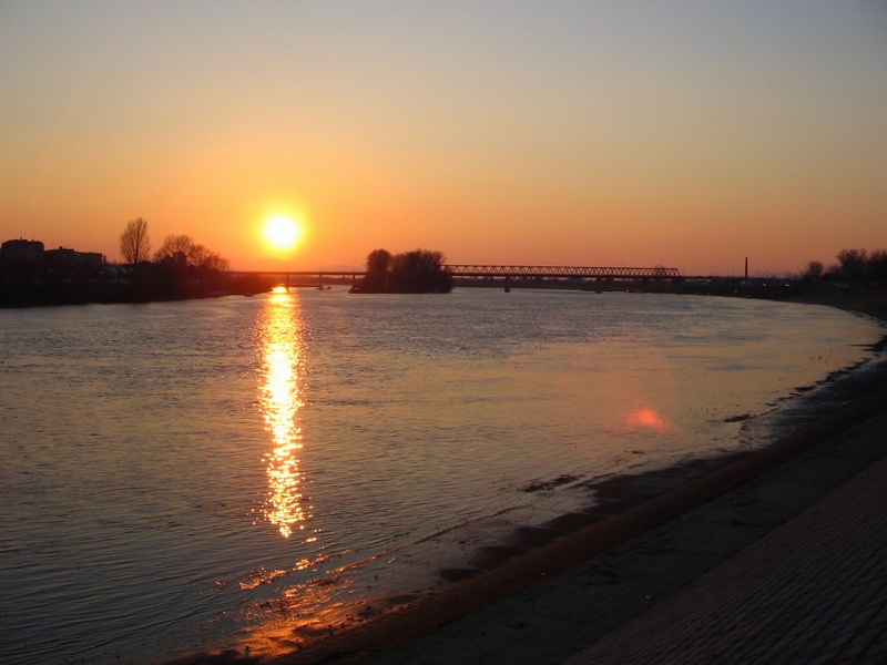
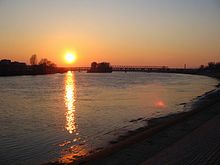 The bridge over the river Sava
The following settlements comprise the administrative area of Slavonski Brod:[1]
- Brodski Varoš, population 2,013
- Podvinje, population 3,536
- Slavonski Brod, population 53,473
History
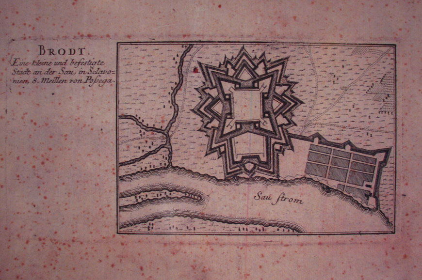
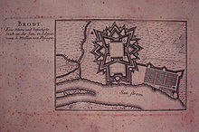 The Plan of the Brod Fortress, dating from 18th century.
A favorable geographical location, pleasant continental climate, fertile soil and vicinity of the river Sava have all resulted with the city being inhabited since a prehistoric age. The city was given the name "Brod", historically first signifying the place where the river could be crossed, and only later the actual vessel to cross the river with.
The northeastern part of the city, at Galovo, recently revealed a rich deposit of the Starčevo culture, dating in the Early Stone Age. Besides the fact that this is the largest architectural finding in Northern Croatia, it confirms that the locality of Brod has been inhabited for at least 8,000 years.
The first historical settlement in Brod dates from Roman times, the settlement being known as Marsonia.It is still disputed whether Marsonia was a postal station, lodging for the night or an actual settlement.
The famous Peutinger map refers to Marsonia as Marsonie, while the work "Notitia dignitatum" has Marsonia under the name of "Auxilia Ascaria Tauruno sive Marsonia". The issue of Marsonia becoming a city has been tackled by the publishers of Ptolemy's geography, dating from the 16th century. The first geographer who located the position of Marsonia at the locality of Brod was Abraham Ortelius, who, in his atlas Theatrum orbis terrarum (Antwerpen 1590) published a map, the objective of which was to reconstruct and connect the antic names of Panonian and Illyric settlements with the towns of that time. It was he who placed Marsonia at the today's locality of Brod.
The aforementioned Peutinger's table clearly shows that Marsonia initially existed next to the Sava river, at the place where the Roman road crossed the river. The first Croatian expert, claiming that the Roman MARSVNNIA was located where Brod is now is Matija Petar Katancic, giving this assertion additional support.
The Slavs inhabited the city in the 6th century. The name of the town is mentioned for the first time in Be'la IV of Hungary's charter, dated 1224. The Middle Ages and Modern Era saw the city being an important fortress in the Military Frontier. The Ottoman Empire's influence remains dominant until the territorial gains by Austria-Hungary. Next to its defending role, the city saw development of crafts and trade. The education and culture were strongly dominated by the Franciscans. The 20th century was a period of strong economic growth of the city, with the 1920s being called "the Golden Age of Brod". The city's current name dates from 1934 when it was changed from Brod na Savi.
From 1941 to 1945 the city was part of the Independent State of Croatia. The town was heavily bombed by the Allies in 1944 and 1945. The bombing resulted in damage to 80% of the buildings in Slavonski Brod.[3] The bombing resulted in 897 civilian deaths, 244 military deaths, 208 wounded civilians, and 28 military wounded in Slavonski Brod and Bosanski Brod.[4] In the communist Yugoslav era, the list of victims was manipulated, with only 11 people being declared as dying from aerial bombing in the 1964 census.[4]
In 1990, democratic reforms legalized the forming of political parties, other than the League of Communists of Croatia. In Slavonski Brod, the first parties formed were the Croatian Democratic Union and the Croatian Democratic Party.[5]
Economy
The city's economy is based on farming, viticulture, fruit growing, metal-processing, timber and (furniture wood, parquetry), textiles (ready-made), leather, foodstuffs (brewery), building material (lime), and printing industries.
Slavonski Brod is also home to some of the most important metal companies in Southeastern Europe, the Djuro Djakovic consortium, consisting of a number of factories producing very diverse products, mainly for export. The consortium is capable of producing: locomotives, tramways, wagons, bridges, industrial plants, nuclear reactors, car parts, heavily armed vehicles, armoured fighting vehicles, including main battle tanks and mine warfare vehicles, agricultural machinery, etc.
Service industries are becoming rapidly important, especially tourism. The city has an important cultural heritage, including a fortress and a Franciscan monastery with a rich library.
Cultural heritage
 Franciscan monastery, the northern facade
The Brod Fortress from the Baroque period, was constructed during the Austro-Hungarian Empire to serve as a stronghold against the Ottoman Empire, which was situated on the other bank of the Sava river. It is in the Vauban style, named after one of the best European experts in the building of fortifications in 17th and 18th centuries. It is one of Europe's best preserved fortresses, and also one of the biggest on the former Austro-Hungarian Military Frontier. In a way, it is the continental obverse of Diocletian's Palace in Split, by its monumentality.
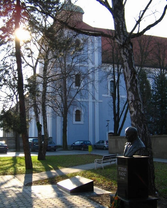
The city's Franciscan monastery dates from the 18th century, and is also Baroque in style, with exceptional architecture, especially of the church yard, and monastery church interior, with its beautiful altar and paintings. In 1720, a faculty of philosophy was opened here.
The most important annual cultural event in the town is the children's festival 'In the World of the Fairy Tales of Writer Ivana Brlić-Mažuranić', in April and May. The Brod Circle Dance, an annual show of original folklore, is held in mid-June, while the Festival of Patriotic Folk Songs takes place in May. The artistic 'Sava' colony\[1] cherishes the tradition of watercolour painting.
One of the attractions of Slavonski Brod is a beautiful central town square, one of the two or three biggest in all of Croatia, Ivana Brlić-Mažuranić square, named after a popular children's writer, whose house is on the square. This square is also home to numerous cultural events and has a perfect view of the beautiful Sava river. The square is also dotted with galleries, book stores, cafes, night clubs, shops etc., which make it perfect place for entertainment. Close to the square, another attraction is the romantic promenade next to the Sava river - 'Kej' as it is called by citizens of town.
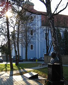
Slavonski Brod is home to monuments to bishop Josip Stadler and Croatia's first president Franjo Tuđman.[6][7]
Education
Slavonski Brod has very developed educational institutions in pre-school, primary, secondary and high education.
The city also hosts the Faculty of Mechanical Engineering of Osijek University, and the Primary School Teacher Training College. Some other faculties are expected to be opened soon. In October 2006. associate-degree college has been founded with several other faculties.
Surroundings
In the immediate surroundings of the town there are interesting hunting grounds (Migalovci), fishponds (Jelas Polje), and a lake (Petnja). There are pleasant orchards and vineyards, Dilj mountain (or 'Dilj Gora'), and swimming opportunities.
See also
- List of people from Slavonski Brod
- Petnja
References
Bibliography
- Cresswell, Peterjon; Atkins, Ismay; Dunn, Lily (10 July 2006). Time Out Croatia (First ed.). London, Berkeley & Toronto: Time Out Group Ltd & Ebury Publishing, Random House Ltd. 20 Vauxhall Bridge Road, London SV1V 2SA. ISBN 978-1-904978-70-1. http://books.google.com/books?id=VZweAAAACAAJ. Retrieved 10 March 2010.
Notes
- ^ a b c "Census of Population, Households and Dwellings 2011, First Results by Settlements" (in Croatian and English) (HTML). Statistical Reports (Zagreb: Croatian Bureau of Statistics) (1441). June 2011. ISSN 1332-0297. http://www.dzs.hr/Eng/censuses/census2011/htm/E11_Zup24_3964.html. Retrieved 2011-08-26.
- ^ Slobodna Dalmacija - Hrvatska turistička zajednica: Slavonski Brod - najljepši grad u Hrvatskoj, Aleksandra Primorac/EPEHA, Danijel Soldo/CROPIX, objavljeno 25. rujna 2009. god. (in Croatian)
- ^ Ne može se utvrditi koliko su Hrvata ubili saveznici, Nacional
- ^ a b Saveznička bombardiranja Slavonskog i Bosanskog Broda i okolnih mjesta tijekom Drugog svjetskog rata
- ^ Demokratske promjene u općini Slavonski Brod (1990.)
- ^ Memorial to Josip Stadler unveiled
- ^ Monument to Franjo Tuđman in the centre of Slavonski Brod unveiled
External links
- Slavonski Brod online, city portal
- Slavonski Brod, city web directory
- Slavonski Brod, city government
- Slavonski Brod Photo Guide
- Roman Military Diploma from Slavonski Brod
- SlavonskiBrod.Info - new site in English
- Festung Brod (Fortress Brod)
- Slavonski-Brod @ Net
- Cravatten Statt
- Pictures of Slavonski Brod
- Brlog Predstavlja, Music Record Label from Slavonski Brod
Cities and major settlements of Croatia by population 100,000+ 
35,000+ 10,000+ Beli Manastir · Belišće · Benkovac · Čakovec · Crikvenica · Đakovo · Daruvar · Duga Resa · Dugo Selo · Garešnica · Gospić · Imotski · Ivanec · Ivanić-Grad · Jastrebarsko · Kastav · Knin · Koprivnica · Krapina · Križevci · Kutina · Labin · Makarska · Metković · Našice · Nova Gradiška · Novi Marof · Novska · Ogulin · Omiš · Opatija · Petrinja · Pleternica · Ploče · Poreč · Požega · Rovinj · Sinj · Slatina · Solin · Sveta Nedelja · Sveti Ivan Zelina · Trogir · Umag · Valpovo · Virovitica · Vrbovec · Vukovar · Zaprešić · ŽupanjaSubdivisions of Brod-Posavina County Cities and towns Nova Gradiška · Slavonski Brod (seat)
Municipalities Bebrina · Brodski Stupnik · Bukovlje · Cernik · Davor · Donji Andrijevci · Dragalić · Garčin · Gornja Vrba · Gornji Bogićevci · Gundinci · Klakar · Nova Kapela · Okučani · Oprisavci · Oriovac · Podcrkavlje · Rešetari · Sibinj · Sikirevci · Slavonski Šamac · Stara Gradiška · Staro Petrovo Selo · Velika Kopanica · Vrbje · VrpoljeCategories:- Cities and towns in Croatia
- Slavonia
- Slavonski Brod
- Bosnia and Herzegovina – Croatia border crossings
- Populated places in Brod-Posavina County


Wikimedia Foundation. 2010.