- Ogulin
-
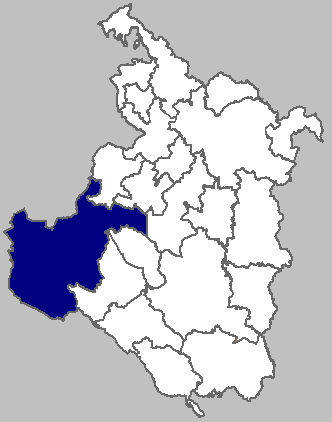
Ogulin Map of Ogulin municipality within Karlovac County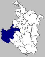 Location of Ogulin in Croatia
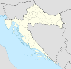
 Ogulin
Coordinates: 45°16′01″N 15°13′30″E / 45.26686°N 15.225076°E County Karlovac county Government - Mayor Nikola Magdić (HDZ) Area - Total 542 km2 (209.3 sq mi) Population (2001)[1] - Total 15,054 (municipality) Time zone Central European Time (UTC+1) Ogulin (pronounced [ɔ̂guliːn]) is a town in north-western Croatia, in Karlovac County. It has a population of 8,712 (2001), and a total municipal population of 15,054 (2001).[1] Ogulin is known for its historic stone castle Kula, and the nearby mountain of Klek.
Contents
History
Ogulin's history dates back to the 15th century, where it struggled against the Ottoman Turks.The exact timing of the building of the Ogulin tower has not been established. However, a document issued by Bernardin Frankopan in his town of Modruš at around 1500 A.D. mentioned the borders between Modruš and Vitunj, and this is, at the same time, the first historical mention of Ogulin. Ogulin was named Julija's town on the first geographical map of Croatia, made by the Jesuit cartographer Stjepan Glavač in 1673. Julija's Town is known for the legend of Đula who threw herself into the abyss of the River Dobra because of an unhappy love affair. There is also an explanation for the name of Ogulin. The surrounding woods needed to be cleared for the better defence of the town, so Ogulin received its name because of the resulting bare area ("ogolio" in Croatian) around it. Another explanation speaks also about the name of Ogulin. There were a lot of lime-trees along the road from Ogulin towards Oštarije, and the people used to peel the bark. in order to get bass. Ogulin this time got its name from the verb to peel ("guliti" in Croatian). However, none of these is scientifically confirmed. In the 16th century, it became a military stronghold against the Ottomans.
Geography
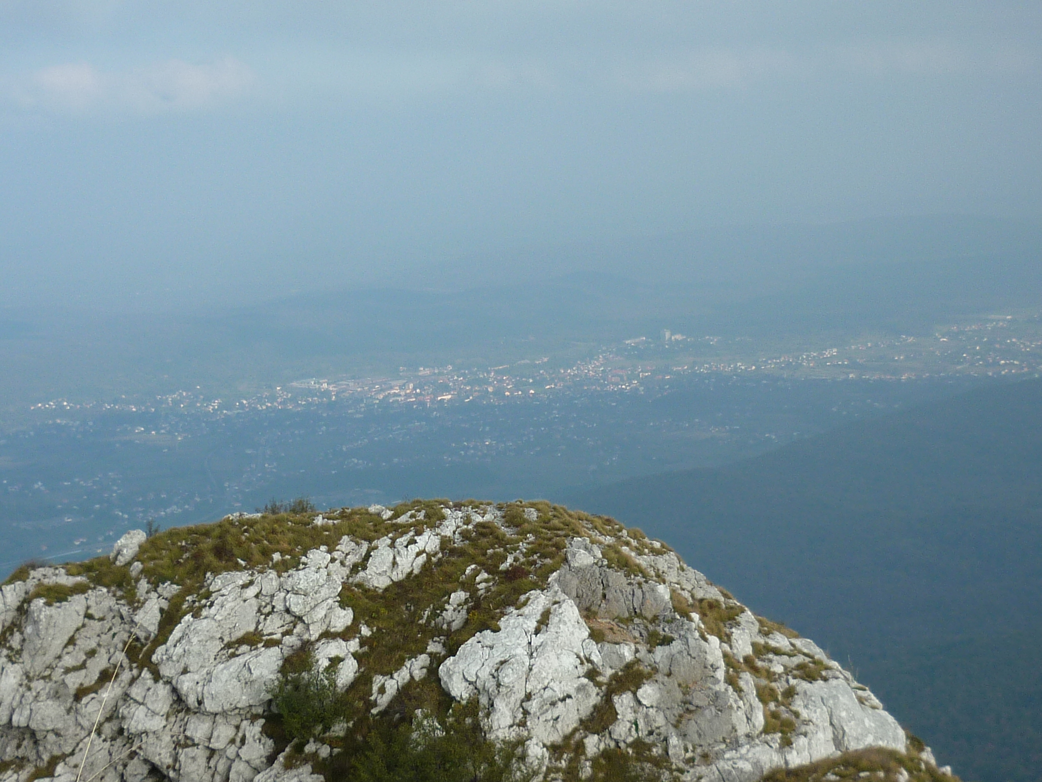
 Ogulin seen from the peak of the Klek mountain
The town of Ogulin is situated in the very center of mainland Croatia, between Zagreb and Rijeka. It was founded in a large valley formed by two rivers: the Dobra and Zagorska Mrežnica. The administrative constitution of the town of Ogulin covers the area of 543.32 km2, and has about 15000 inhabitants according to 2001 census.
This is a kind of transitional micro-region neighbouring the larger regions of Croatia - Gorski Kotar, Lika, Kordun and Gornje Pokuplje. The Ogulin-Modruš valley finishes towards the south where the Modruš hills pass into the second largest field of the area under Kapela-Plaški Polje. This comprises a completed geographical whole border on the western side by the mountain massif of Velika Kapela dominated by Klek (1181 m). Its eastern edges are bordered by the mounts of Krpel (511 m), Brezovica (565 m) and Hum (863 m). The valley then passes to the hilly are dominated by Klekinja (504 m) and Trojvrh (599 m). This valley is also called Ogulin's Field (in Croatian: Ogulinsko Polje). This is the fifth largest karst valley in Croatia (60 km2), and it lies 320 meters above sea level. Its elongated form lies in the direction northwest-southeast, and it is 16 km long (Ogulin-Trojvrh) and 9 km wide (Desmerice-Skradnik).
According to the territorial divide laid down by the Roman Catholic Church, the Ogulin-Modruš valley is part of the Ogulin's Deanery, within the Diocese of Gospić-Senj. The area of Ogulin - Modruš valley belongs to the Karlovac county.
The Dobra River runs through town.
- Elevation: 323 m (1060 ft) above sea level
- Latitude: 45° 15' 59"
- Longitude: 15° 13' 44"
Population
According to the 2001 census, Croats compromise 75.7% and Serbs 20.7% of the municipality population. Serbs form a majority in the villages of Drežnica, Jasenak, Potok Musulinski and some others.
The settlements in the municipality are:[1]
- Desmerice, population 278
- Donje Dubrave, population 249
- Donje Zagorje, population 252
- Drežnica, population 729
- Dujmić Selo, population 126
- Gornje Dubrave, population 119
- Gornje Zagorje, population 325
- Hreljin Ogulinski, population 595
- Jasenak, population 301
- Marković Selo, population 58
- Ogulin, population 8,712
- Otok Oštarijski, population 446
- Ponikve, population 159
- Popovo Selo, population 58
- Potok Musulinski, population 126
- Puškarići, population 392
- Ribarići, population 312
- Sabljak Selo, population 241
- Salopek Selo, population 290
- Sveti Petar, population 633
- Trošmarija, population 130
- Turkovići Ogulinski, population 255
- Vitunj, population 141
- Zagorje, population 127
Culture
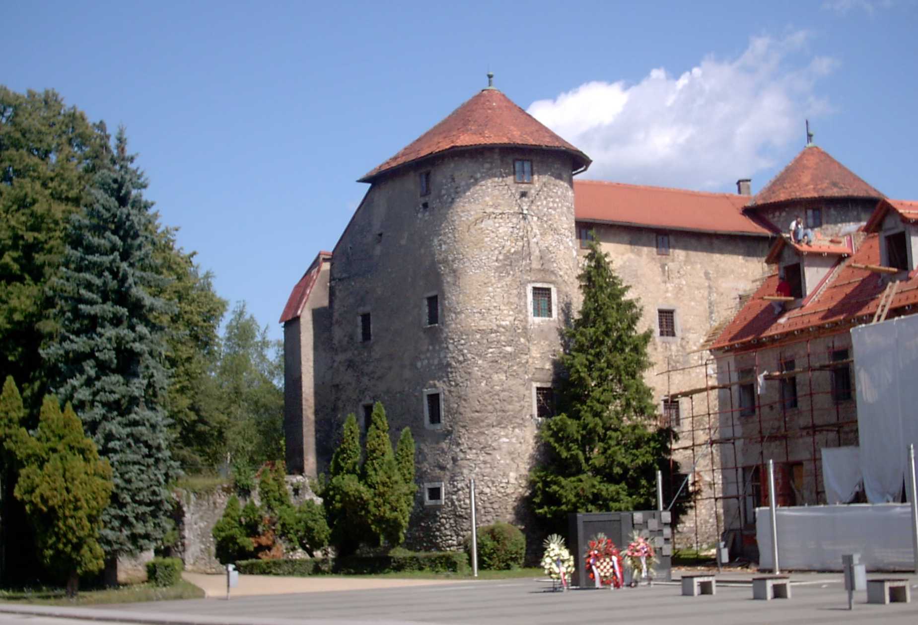
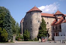 Ogulin castle
THE PARISH CHURCH OF THE EXTOLLING OF SAINT CROSS - This church was built in 1781 in the middle of the town, in the Park of King Tomislav. Consecrated on June 1, 179, it reflects the spirit of the time with its pleasing external appearance and the richness of various sculptural decorations. The town of Ogulin celebrates June 14th as the fest day of its patron Saint of Extolling of the Cross.
THE CHAPEL OF ST BERNARDIN - Bernardin Frankopn, the son of Stjepan, and the founder of the town of Ogulin, erected a chapel in 16th century both for nobleman and ordinary people within the castle. It is devoted to St Bernardin. This chapel was the parish church from 1521 until the building of the church of St Cross in 1781. Today, only the altar has been preserved.
THE CHAPEL OF SAINT ROCCO - This chapel was built at the entrance to the town in the first half of 19th century as a votive church against cholera.
THE FRANKOPAN CASTLE - The Castle was built around 1500 above the gorge of the River Dobra - Đula's abyss. The founder of the town was Bernardin Frankopan, one of the mightiest people of his time, and the feudal master of Modruš, Plaški, Vitunj, Tounj, Zvečaj, Bosiljevo, Novigrad and Dubovac. It belongs to the period of Renaissance castles. The town walls surrounded the courtyard area on three sides, while on the fourth there was a three-storey building with towers at the sides. Today,in the Castle houses,is The County Museum which was opened in 1967. It owns a several collections showing exhibits of various kinds: archaeology, ethnology, old armaments, the memorial room of Ivana Brlić-Mažuranić (a renowned Croatian fairy-tale author), mountaineering, and an exhibition of the academic painter Stjepan Galetić born in Ogulin.
THE MONUMENT TO KING TOMISLAV - was erected for the 1000th anniversary of the founding of the Croatian kingdom. It stands in the Park of King Tomislav which was planned and arranged in the 18th century. The monument was made according to the design of the Slovenian architect Vitburg Meck, and was repaired in 1990.
THE FOUNTAIN OF CESAROVAC - This classic building is also erected in the Park. It represents a memorial to the Ogulin aqueduct and was built by colonel Štefan Šuplikac from Ogulin in 1847. Water flowed from the spring through wooden tubes which were lately replaced by the clay, and in 1882 by the iron tubes. For Cesarovac source is connected and a legend. Water flows into the source, comes from a source located at the foot of the mountain Klek. And as on the mountain Klek lived a witch, so the water is magical. Legend says, that women who drink the water from the springs, will remain forever young. And men who drink water from springs, water will be captured to forever remain in this city, who you will fall in love with a woman from Ogulin, and by the end of life remain to live in Ogulin.
Notable people
- Ivana Brlić-Mažuranić - famous writer
- Ema Pukšec - also known as Ilma De Murska, famous opera singer
- Petar Stipetić - Croatian general
- Barbara Radulović - Famous anchor host
- Josip Kregar - Croatian lawyer and politician
References
External links
- Ogulin official site
- Ogulin portal
- Blog site about Ogulin
- Another blog site about Ogulin
- Blog site about Handball school Ogulin
- Blog site about Ogulin wireless network
- The "Domaći" Tourist agency, Ogulin
Subdivisions of Karlovac County Cities and towns 
Municipalities Categories:- Populated places in Karlovac County
- Cities and towns in Croatia

Wikimedia Foundation. 2010.