- Mira Mesa, San Diego
-
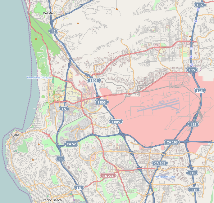
Mira Mesa — Community of San Diego — Location within Northwestern San Diego
 Mira Mesa
Coordinates: 32°54′59″N 117°08′39″W / 32.916389°N 117.144167°W Country United States State California County County of San Diego City City of San Diego Mira Mesa is a large suburb that is part of the city of San Diego, California.
Mira Mesa is bordered by Interstate 15 to the east, Interstate 805 to the west, the Los Peñasquitos Canyon to the north and Marine Corps Air Station Miramar, to the south. The west end of Mira Mesa is a business and technology park, often referred to as "Sorrento Mesa". This area is a major employment area for San Diego.
Contents
History
Further information: Kumeyaay and Rancho Santa Maria de Los PeñasquitosAround the time of World War II the area now called Mira Mesa was used by the United States Army as a test area. Just west of U.S. Route 395 (now Interstate 15) was a Navy auxiliary landing field that was known locally as Hourglass Field because the layout of the runways was a single piece of asphalt in the shape of an hourglass. The Navy also used the surrounding area as a bombing range.
Starting in 1969 there was a housing boom in the area that now extends from the I-15 freeway in the East to I-805 in the West and is approximately 10,500 acres (42 km²). It was one of the earliest areas of urban sprawl along the I-15 Corridor. Hourglass field became the site of San Diego Miramar College and Hourglass Field Community Park. The area was built so quickly that it was lacking schools, shopping centers, or other services for its thousands of residents. In 1971 Pete Wilson started his political career running for mayor with the slogan "No more Mira Mesas!" as a promise to stop quick, unplanned growth in San Diego.
Since its inception, Mira Mesa was largely influenced by the military located at adjacent NAS Miramar. Mira Mesa was the northernmost "real community" of San Diego, and was separated from the rest of the city by NAS Miramar for many years. For nearly 30 years the Navy's Top Gun School was located here and most of the pilots made their homes in Mira Mesa.
As of the late 1990s, the Mira Mesa area has undergone extensive expansion to accommodate the thousands of new residents attracted by its close proximity to major employers like UC San Diego, MCAS Miramar, Qualcomm, and dozens of biotech and pharmaceutical companies[1]. Several commercial and industrial centers have been built within the Mira Mesa area.
Mira Mesa has a significant concentration of Asian-American residents. Their presence has added to the diverse shopping available in Mira Mesa, including groceries and shops offering Filipino, Vietnamese, and Indian goods.
Economy
Established in the 1950s as a residential area to support Naval Air Station, Miramar, Mira Mesa has grown into the largest community in San Diego.
The community has business and residential zoned areas, providing shopping and recreational opportunities as well as business buildings with technology facilities and office space. There are a variety of ethnic cuisines and restaurants, as well as more traditional dining. There are eight community parks, teen and senior centers, an ice arena, an aquatic complex, multiple shopping centers, and a state-of-the-art movie theater.
Personal income
The community has a median income of approximately $63,000/year.[2]
Geography
The area is situated on the southern edge of the Los Peñasquitos Canyon Preserve and the northern boundary of MCAS Miramar.[2]
Demographics
The community has approximately 80,000 residents, including students, hi-tech employees, families, and single people alike.[2] There are over 23,000 homes in the community, averaging 3.09 people per household. The median age is 32.4 years old.[2]
The 2000 census counted: White (Not Hispanic or Latino) 40.8%, Asian 37.6% (including 20.7% Filipino and 7.8% Vietnamese), Hispanic or Latino (of any race) 11.1%, African American/Black 5.4%, Native Hawaiian and Other Pacific Islander 0.6%, Native American 0.5%[3].
Transportation
Public transportation is provided by the San Diego Transit and the Metropolitan Transit System, through buses and DART (Direct Access to Regional Transit) shuttles.
A train station serves Mira Mesa in Sorrento Valley and is served by the Coaster commuter train, of the North County transit district. The Coaster links Mira Mesa to Downtown San Diego, and north to coastal communities like Solana Beach and Oceanside.
Main highways include: Interstates 805 and 15.
Main thoroughfares
- Mira Mesa Boulevard runs east to west, and is the main road in Mira Mesa, and is an important link between Interstates 15 and 805. In the year 2000 this main artery was estimated by the city government to carry over 80,000 vehicles/day.[citation needed] During the normal work week it has arguably the worst traffic in the county due to the excessive amount of commuters traveling in and out of the high density employment area of Sorrento Valley, and from cut-through traffic between Interstates 15 and 805/5 corridors.[citation needed] There has been such a high traffic volume, that the majority of residential roads running in all directions from Mira Mesa Boulevard became backed up. By 1997, in an effort to control the problem, the city had installed additional traffic controls, such as turn prohibitions at various intersections, and speed humps on certain streets, to reduce the cut-through traffic from other neighborhoods, such as Scripps Ranch and Rancho Peñasquitos.[citation needed]
According to the City of San Diego Council Minutes - Sept. 9, 1997, faith in alleviating the Mira Mesa Blvd. traffic problem was put in the completion of east-west running State Route 56 to the north of Mira Mesa Blvd. The minutes state, "(SR 56) is expected to substantially reduce the non-neighborhood cut-through traffic demand on (Mira Mesa residential streets)." SR 56 construction started in 1999 and was scheduled to be completed by the summer of 2004. This was delayed, and with the opening of SR 56 north of Mira Mesa complete in early 2006, there has been a noticeable drop in residential traffic, especially on Calle Cristobal.
- Camino Ruiz is a north-south four lane thoroughfare that runs the whole length of the Mira Mesa area, and links Miramar Road to Mira Mesa Boulevard, to Calle Cristobal. It is a main thoroughfare for military personnel traveling to and from MCAS Miramar and the surrounding area.
- Black Mountain Road is a north-south thoroughfare that connects San Diego to Mira Mesa, and continues to Rancho Peñasquitos, and Del Mar.
- Calle Cristobal runs east to west, along the northern perimeter of Mira Mesa, through the Los Peñasquitos Canyon. It is mainly used by residents to get to the subdivisions of Sorrento Valley, and by commuter cut-through traffic via Interstates 805 or 5.
- Sorrento Valley Boulevard becomes Calle Cristobal between Sorrento Valley and Mira Mesa.
Major companies
Medical, Biotechnology and Pharmaceutical
- Abgent
- Gen-Probe, a global leader in the development, manufacture and marketing of molecular diagnostics products
- Quintiles
- Scripps Health Proton Therapy Center
Technology
- Atego
- Qualcomm corporate headquarters
- Sony Online Entertainment
- Texas Instruments
Construction
- Vulcan Materials Company, the largest producer of construction materials
Commercial and Retail
- Skinit, Phone, Laptop, Mp3 & Game Skins
Sports
Mira Mesa girls softball, 12 and under, won the state championship 1999, 2005 and 2006.[4]
Community events
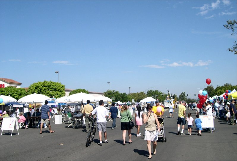
 Mira Mesa Street Fair
- The Mira Mesa Street Fair is held the third Saturday in September on Camino Ruiz just west of Mira Mesa Community Park. The fair is sponsored by the Mira Mesa Town Council.[5]
- On the Fourth of July, a parade runs through town on Mira Mesa Boulevard, then turns on Camino Ruiz. In the evening a fireworks display is accompanied by music from the radio station KyXy 96.5. The fireworks are located at Mira Mesa Senior High School
- Halloween is celebrated at Mira Mesa Recreation Center.
- There is a Monster Manor,[6] a "haunted house" located in the Target parking lot.
- This event celebrates the anniversary of Philippine Independence from Spain. The festivities include a day of music, cultural shows, dance performances, talent competition, exhibits, food, guest speakers and rides for kids. It takes place every summer at the Mira Mesa Community Park and is hosted by the Emilio Aguinaldo Foundation.
- Every Thursday night, groups of motorcycle riders gather just off of Mira Mesa Blvd (Albertson's/Home Depot shopping center). This is known as "Mira Mesa Bike Night" (MMBN) and is typically a fairly large gathering, attracting over 100 bikers during the warm-weather months.
- "Mira Mesa Living,"[7] a community newspaper publishing local news and events, started publication bimonthly in July 2010. The previous community newspaper, the Mira Mesa Scripps Ranch Sentinel, stopped publication in July 2009.
- The Epicentre[8] teen center is a music venue by night. There are often concerts each week.
Schools in Mira Mesa
Private schools
- Good Shepherd Catholic School[9]
- Christ the Cornerstone Academy[10]
- Rainbow Kids Integral Preschool[11]
- Mira Mesa Christian School[12]
Elementary schools
- Ericson Elementary School
- Hage Elementary School
- Hickman Elementary School
- Mason Elementary School
- Sandburg Elementary School
- Walker Elementary School
Middle schools
High schools
- Mira Mesa High School[13]
- Scripps Ranch High School
- Mark Twain High School[14]
Junior colleges
Public safety
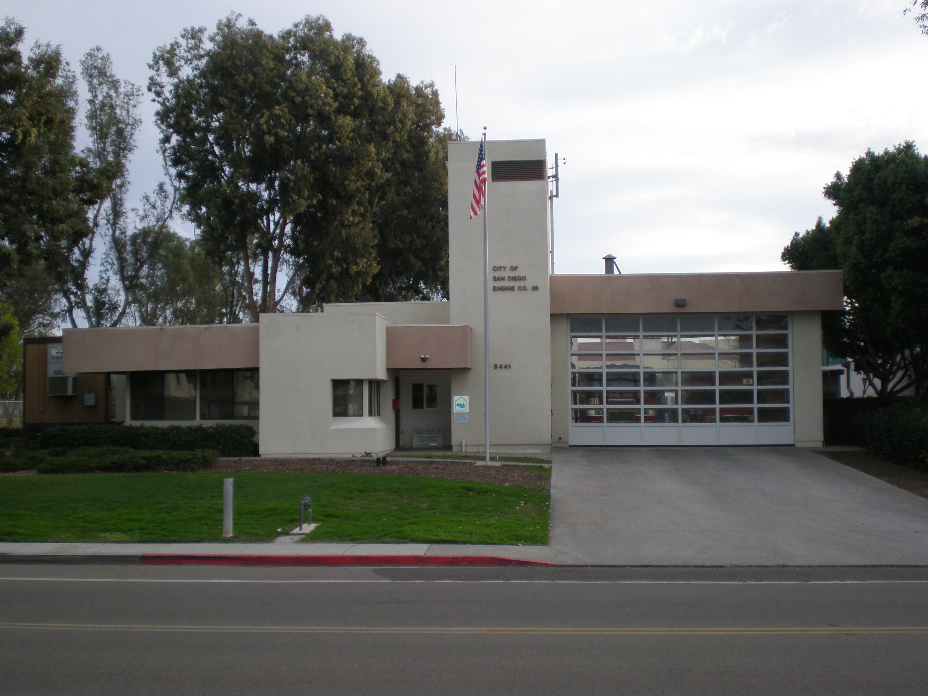
Mira Mesa has two fire stations and is served by the San Diego Police Department Northeastern Division.[16]
Fire service is provided by the San Diego Fire-Rescue Department Fire Station 38 which is located in the Mira Mesa area. The station is in the 5th Battalion district.
Notable people from Mira Mesa
- Adam Brody (television actor) went to Wangenheim Middle School in Mira Mesa then to Scripps Ranch High School.
- Chris Chelios (former National Hockey League player and alternate captain of USA Hockey team) attended Mira Mesa High School, and Mt. Carmel High School.
- Teyo Johnson (National Football League player) went to Mira Mesa High School.
- Jamie Kime (Grammy Award winning guitarist and member of Zappa Plays Zappa) went to Mira Mesa High School.
- Michael Pittman (National Football League player) went to Mira Mesa High School.
- Ray Rowe (National Football League player) went to Mira Mesa High School.
- Willy Santos (Professional Skateboarder) went to Mira Mesa High School.
- J. R. Tolver (National Football League player) went to Mira Mesa High School.
- Kellen Winslow II (National Football League Player) attended Scripps Ranch High School.
References
- ^ "Biotechs near 92126". http://maps.google.com/maps?hq=biotech&q=biotech&hnear=92126. Retrieved May 22nd, 2011.
- ^ a b c d Mira Mesa Dot Com | Mira Mesa History
- ^ "Profile of General Demographic Characteristics: Census 2000 Summary File 1, 92126 5-Digit ZCTA". http://factfinder.census.gov/servlet/QTTable?_bm=y&-geo_id=86000US92126&-qr_name=DEC_2000_SF1_U_DP1&-ds_name=DEC_2000_SF1_U&-_lang=en&-redoLog=false&-_sse=on. Retrieved May 22nd, 2011.
- ^ California District 32 Hall of Championsa
- ^ MMTC
- ^ Monster Manor
- ^ Mira Mesa Living
- ^ Epicentre
- ^ Good Shepherd Catholic School
- ^ Christ the Cornerstone Academy
- ^ Rainbow Kids Integral Preschool
- ^ Mira Mesa Christian School
- ^ (Website)
- ^ Mark Twain High School
- ^ (Website)
- ^ http://www.sandiego.gov/police/neighborhood/northeastern.shtml
External links
- Mira Mesa Town Council
- Mira Mesa Google Local Map
- The Mira Mesa branch public library
- Mira Mesa Transit Center
- Mira Mesa community profile, planning and demographics from the City of San Diego
- The Kiwanis Club of Scripps-Mira Mesa
- Mira Mesa HEROES
Neighborhoods of San Diego Northern Bay Ho · Bay Park · Carmel Valley · Clairemont · Del Mar Heights · Del Mar Mesa · La Jolla · La Jolla Village · Mission Beach · North City · Pacific Beach · Pacific Highlands Ranch · Torrey Hills · Torrey Pines · University City · Village of La JollaNortheastern Black Mountain Ranch · Carmel Mountain Ranch · Mira Mesa · Miramar · Rancho Bernardo · Rancho Encantada · Rancho Peñasquitos · Sabre Springs · San Pasqual Valley · Scripps Ranch · Sorrento Valley · Sorrento Mesa · Torrey HighlandsEastern Birdland · Kearny Mesa · Mission Valley East · Navajo (Allied Gardens · Del Cerro · Grantville · San Carlos) · Serra Mesa · TierrasantaWestern Burlingame · Hillcrest · Linda Vista · Midtown · Mission Hills · Mission Valley West · Morena · North Park · Ocean Beach · Old Town · Point Loma (La Playa · Liberty Station · Loma Portal · Midway · Point Loma Heights · Roseville-Fleetridge · Sunset Cliffs · Wooded Area) · University HeightsCentral Downtown (Columbia · Core · Cortez Hill · East Village · Gaslamp Quarter · Harborview · Little Italy · Marina) · Balboa Park · Bankers Hill · Barrio Logan · Golden Hill · Grant Hill · Logan Heights · Middletown · Sherman Heights · South Park · StocktonMid-City Adams North · Azalea/Hollywood Park · Castle · Cherokee Point · Chollas Creek · City Heights · Colina del Sol · College Area · Corridor · Darnall · El Cerrito · Fairmont Park · Fox Canyon · Gateway · Islenair · Kensington · Normal Heights · Oak Park · Ridgeview · Redwood Village · Rolando · Swan Canyon · Talmadge · Teralta · WebsterSoutheastern Alta Vista · Bay Terraces · Broadway Heights · Chollas View · Emerald Hills · Encanto · Jamacha-Lomita · Lincoln Park · Mountain View · Mount Hope · Paradise Hills · Shelltown · Skyline · Southcrest · Valencia ParkSouthern Border · Egger Highlands · Nestor · Ocean View Hills · Otay Mesa · Otay Mesa West · Palm City · San Ysidro · Tijuana River ValleyCoordinates: 32°54′59″N 117°8′39″W / 32.91639°N 117.14417°W
Categories:- Neighborhoods in San Diego, California
Wikimedia Foundation. 2010.