- College Area, San Diego
-
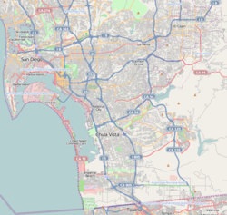
College Area — Community of San Diego — Location within San Diego Coordinates: 32°46′19″N 117°04′08″W / 32.771831°N 117.068939°W Country United States State California County County of San Diego City City of San Diego The College Area is a neighborhood of the Mid-City region of San Diego, California. The College Area is dominated by San Diego State University (SDSU), which was formerly San Diego State College and previous to that San Diego State Teachers College, which the area is still named after. The College Area is in the mid-city, and has many new stores and restaurants, as well as many canyons.
There is also an Orthodox Jewish neighborhood in the area near Congregation Beth Jacob Orthodox Temple on College Avenue.
Contents
Geography
The college area lies on a plateau which overlooks Interstate 8. The neighborhood's borders are defined by Fairmount Avenue/Montezuma Road/Collwood Boulevard to the Southwest, Interstate 8 to the North, 70th Street/Keeney Street to the East, and El Cajon Boulevard to the South.
Transportation
MTS (Metropolitan Transit System) operates the San Diego Trolley[1] to SDSU Transit Center and the Alvarado Medical Center trolley station, both of which are in the College Area. The trolley station at SDSU, as well as a bus plaza, make up the SDSU Transit Center. Bus routes 11, 11A, 14, 936, 115 go to the Transit Center, to name a few. Transfers are made from the SDSU trolley subway station located at the Transit Center, underneath the bus plaza. Riders can go up to the bus plaza via elevator or stairs.
Traffic
Congested traffic is a consistent nuisance on College Avenue, a main street in the area. During the school year at SDSU, freeway ramps are heavily backed up. Since the July 2005 connection of the San Diego Trolley to the SDSU on-campus underground station, congestion has subsided only marginally. The Interstate 8 freeway that runs past the area to the north often gets congested during the week because of students and commuters.
Education
The college area is home to one traditional elementary school, two alternative K-8 schools, and SDSU.
Elementary schools
K through 12
- San Diego Unified School District
- Language Academy
- Tubman Village Charter
Colleges and universities
References
External links
- Rolando Village, Located in San Diego's college area, 92115
- Rolando Community Council
- College Neighborhoods Foundation
- Mission Times Courier, community newspaper
Neighborhoods of San Diego Northern Bay Ho · Bay Park · Carmel Valley · Clairemont · Del Mar Heights · Del Mar Mesa · La Jolla · La Jolla Village · Mission Beach · North City · Pacific Beach · Pacific Highlands Ranch · Torrey Hills · Torrey Pines · University City · Village of La JollaNortheastern Black Mountain Ranch · Carmel Mountain Ranch · Mira Mesa · Miramar · Rancho Bernardo · Rancho Encantada · Rancho Peñasquitos · Sabre Springs · San Pasqual Valley · Scripps Ranch · Sorrento Valley · Sorrento Mesa · Torrey HighlandsEastern Birdland · Kearny Mesa · Mission Valley East · Navajo (Allied Gardens · Del Cerro · Grantville · San Carlos) · Serra Mesa · TierrasantaWestern Burlingame · Hillcrest · Linda Vista · Midtown · Mission Hills · Mission Valley West · Morena · North Park · Ocean Beach · Old Town · Point Loma (La Playa · Liberty Station · Loma Portal · Midway · Point Loma Heights · Roseville-Fleetridge · Sunset Cliffs · Wooded Area) · University HeightsCentral Downtown (Columbia · Core · Cortez Hill · East Village · Gaslamp Quarter · Harborview · Little Italy · Marina) · Balboa Park · Bankers Hill · Barrio Logan · Golden Hill · Grant Hill · Logan Heights · Middletown · Sherman Heights · South Park · StocktonMid-City Adams North · Azalea/Hollywood Park · Castle · Cherokee Point · Chollas Creek · City Heights · Colina del Sol · College Area · Corridor · Darnall · El Cerrito · Fairmont Park · Fox Canyon · Gateway · Islenair · Kensington · Normal Heights · Oak Park · Ridgeview · Redwood Village · Rolando · Swan Canyon · Talmadge · Teralta · WebsterSoutheastern Alta Vista · Bay Terraces · Broadway Heights · Chollas View · Emerald Hills · Encanto · Jamacha-Lomita · Lincoln Park · Mountain View · Mount Hope · Paradise Hills · Shelltown · Skyline · Southcrest · Valencia ParkSouthern Border · Egger Highlands · Nestor · Ocean View Hills · Otay Mesa · Otay Mesa West · Palm City · San Ysidro · Tijuana River ValleyCoordinates: 32°46′18.59″N 117°4′8.18″W / 32.7718306°N 117.0689389°W
Categories:- Neighborhoods in San Diego, California
- Urban communities in San Diego, California
- San Diego State University
- San Diego Unified School District
Wikimedia Foundation. 2010.

